
Area guide
Buying Land in Dharuhera
Land at the edge of the Dharuhera industrial belt on NH-48: zoning and CLU checks, PLPA status, an estimated price band* and what the RRTS plan does not yet deliver.
30,344
Population (Census 2011)
~19 km
From Rewari
~40 km
From Gurgaon
₹1–3.5 crore per acre*
Estimated price*
*Indicative range across districts and land types. Stamp duty, registration and conversion charges are additional. Local measurement units vary — every listing states the unit it is priced in. Not a valuation or an offer.
Micro-market record — Dharuhera
Rev. 2026 · Farmland India desk
District
Rewari
Status
Municipal committee and census town (as reported)
Population
30,344 (Census of India 2011, as reported)
Distance
About 19 km from Rewari, 40 km from Gurgaon (approximate)
Anchor
Dharuhera industrial area on both sides of NH-48
Zoning to check
Dharuhera final development plan, industrial zone, CLU and agricultural zone
Estimated land price*
₹1–3.5 crore per acre*
Sub-area overview
Dharuhera — an NH-48 industrial and residential belt south of Manesar
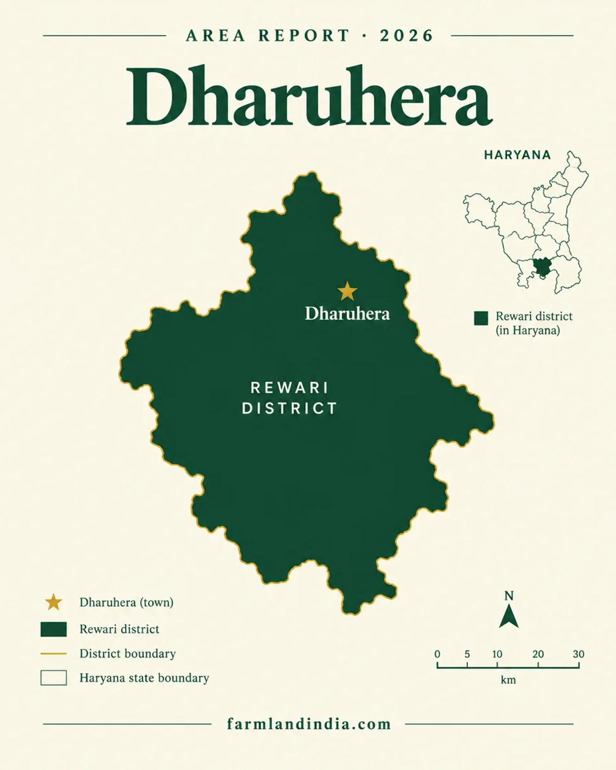
Agricultural land in Dharuhera is land at the edge of an industrial town, and the useful question is what it can legally become. Dharuhera, in Rewari district, is a census town and municipal committee with 30,344 people at the 2011 Census (Census of India, as reported). It lies about 19 km from Rewari and 40 km from Gurgaon, with an industrial area on both sides of National Highway 48. The 2010-11 industrial profile quoted on the Rewari page lists the Dharuhera industrial area at 550 acres with 323 operating units; those figures are dated.
Farmland India's estimate* for farm land at the edge of the belt is ₹1–3.5 crore per acre*; ask the Sub-Registrar for the current Collector rate and for registered comparables before you form a price view. A secondary map source says Dharuhera has its own final development plan tied to the Rewari Master Plan 2031 and sits in a Gurugram-Manesar-Bawal-Dharuhera-Rewari highway corridor zone in the NCR plan for 2041; read the DTCP plan documents, not a summary.
Read the Rewari district page for district-wide rules, then the Haryana agricultural land rules guide. Before any token payment, check whether the khasra lies inside the municipal limit or a controlled area, whether CLU has been granted, and whether the land is in the Aravali or PLPA belt.
- NH-48 industrial belt
- Municipal committee
- Final development plan
- PLPA district
- NRI barred
Connectivity
How Dharuhera connects
Dharuhera is on NH-48 between Manesar and Rewari. Distances are approximate and are not route-checked.
By road and rail
Read this before relying on distances
The 'about one hour' to the airport and 40 km to Gurgaon are approximate, single-source figures and will vary with traffic on NH-48. We have not route-checked any distance. Reports also note gaps in healthcare, education and drainage in the town, so ask what services reach the specific village, not just the town.
Growth catalysts
Upcoming infrastructure & developments
Status labels reflect sources read in October 2026. Government-announced timelines are not guaranteed; items marked confirm have single or conflicting sources.
01Operational
03In progress, pending or policy
Agriculture & terrain
Soil, crops & water in Dharuhera
Dharuhera is on the Rewari alluvial plain, but the farm parcels on its edge sit beside an industrial area and are priced for what they could become.
Soil & crops
CGWB describes Rewari district as Indo-Gangetic alluvial plain with calcareous, loamy sand soils and a moderate to high salinity hazard. The district grows bajra, wheat and mustard (HSAC Krishi decision-support document). We found no crop data specific to Dharuhera, and land on the NH-48 frontage is bought for industrial, logistics or residential reasons rather than for crops. Data: Soil Health Card portal.
- Alluvial plain
- Bajra, wheat, mustard
- Salinity hazard
- Industrial edge
Water
Six of seven blocks in Rewari district are over-exploited and Dahina is critical (HWRA, as on 31 March 2024); we did not match Dharuhera's block to a category, so read the HWRA notice. CGWB's 2011 balance shows gross draft above net availability for the district, with depth to water from about 11 to 63 m in May 2015. Reports note drainage gaps in the town. Ask for a borewell yield and quality report and for drainage history.
Mandi price reference
Dharuhera land values follow industry, not crops. Mustard and bajra prices for Rewari markets are on Agmarknet; we have not matched a mandi to this town.

Farmland India view
Why buyers look at Dharuhera
Reasons buyers look at this micro-market, stated with the evidence we have. Not a price forecast.
An employment base already exists
The industrial area has operated for years on both sides of NH-48, and the 2010-11 profile counted 323 operating units in the 550-acre estate.
Closest Rewari belt to Gurugram
At about 40 km from Gurgaon, Dharuhera is the part of Rewari district nearest the Gurugram land market, a point the Rewari page also makes.
Freight corridor and a planned RRTS stop
The freight corridor is complete and an RRTS station is planned at Dharuhera, though the rail timing is disputed.
Municipal status
Being a municipal committee means a development plan and municipal services exist on paper, which gives buyers documents to check.
Listing data is not legal advice. Confirm title, land use and zoning with the District Town Planner and the Sub-Registrar.
STRAIGHT TALK
Risks & challenges specific to Dharuhera
Specific to this micro-market, beyond the Rewari and Haryana-wide points.
Prices can vary widely in one belt
Quoted prices within the same belt can differ widely depending on frontage, zoning and CLU. Our estimate* of ₹1–3.5 crore per acre* is a band, not a rate. Ask the Sub-Registrar for recent deeds.
Municipal limit and plan zone
Land inside the municipal limit or a controlled area follows the development plan and may need CLU or a licence for any non-farm use. Check the zone with the District Town Planner before any payment.
PLPA and Aravali status
Rewari is a PLPA district, and the Supreme Court's definition of the Aravalli hills is still being worked out. Ask for PLPA, forest and mining-lease status in writing.
Infrastructure gaps
Reports note gaps in healthcare, education and drainage in the town. A cheaper parcel may lack drainage or a road above 12 feet.
Groundwater is stressed
Six of seven Rewari blocks are over-exploited. Test borewell yield and ask whether a new borewell needs permission.
Plots need a licence
Under section 3 of the Haryana Development and Regulation of Urban Areas Act, 1975, a colony needs a licence from the Director, Town and Country Planning, and the Act bars transferring or advertising plots in an unlicensed colony. Ask for the licence number and check it with DTCP before paying any booking amount.
NRIs and OCIs cannot buy agricultural land
FEMA bars NRIs and OCIs from buying agricultural land, plantation land or a farmhouse anywhere in India. Residential or commercial plots in licensed areas are a separate question for a lawyer, so take advice before paying any token amount.
Stamp duty and Collector rate
The Haryana government statement reported by The Tribune on 28 August 2025 put sale-deed duty for urban areas at 7% for men (including a 2% development fee) and 5% for women. The rural rates of 5% and 3%, and the 1% registration fee, are not confirmed from an official notification here, so confirm them with the Sub-Registrar. Duty is charged on the higher of the deal value and the Collector rate. Parcels inside the Dharuhera municipal limit take the urban rate. No Dharuhera Collector rate was read.
KEEP EXPLORING
Explore more areas
Other areas in Rewari
Guides & research
- Stamp Duty Calculator Haryana: Land Cost Method (2026)Wiki · P11 Taxation, Stamp Duty & Registration
- Circle Rate Gurgaon: Collector Rate Lookup (2026)Wiki · P11 Taxation, Stamp Duty & Registration
- Circle Rate Faridabad: Collector Rate Lookup (2026)Wiki · P11 Taxation, Stamp Duty & Registration
- Land Ceiling in Haryana: 1972 Act Explained (2026)Wiki · P05 Agricultural Land Rules
- Stamp Duty Haryana: Land Registry Charges (2026)Wiki · P11 Taxation, Stamp Duty & Registration
- Mutation Status Haryana: How to Check Online (2026)Wiki · P02 Land Records & Documentation
- Fard Haryana: What It Is and How to Get One (2026)Wiki · P02 Land Records & Documentation
- Bhu Naksha Haryana: View Land Map Online (2026 Guide)Wiki · P02 Land Records & Documentation
COMMON QUESTIONS
Frequently asked questions
Everything buyers, NRIs and investors ask before their first reviewed farmland purchase in Dharuhera.
Visit full wiki01 of 04
Is land in Dharuhera agricultural or industrial?
Both. The industrial area lies on both sides of NH-48, and farm parcels sit around it. Check the khasra's recorded use, the development plan zone and whether CLU has been granted.
02 of 04
What are land prices in Dharuhera?
Farmland India's estimate* for farm and agricultural land in Dharuhera is about ₹1–3.5 crore per acre*; quoted prices on the same belt can differ widely with frontage, zoning and CLU. *Indicative only, not a valuation; check registered sale deeds and the collector rate with the Sub-Registrar.
03 of 04
Is an RRTS station coming to Dharuhera?
Haryana approved a corridor in May 2023 with a station planned at Dharuhera. Reports differ on timing, from 2028 to a Bawal stage first with the rest later, so confirm with NCRTC.
04 of 04
Can an NRI buy land in Dharuhera?
Not agricultural land, plantation land or a farmhouse, under FEMA. Licensed residential or commercial plots are a separate question for a lawyer.
Ready to look at what is available?
Browse reviewed listingsTransparency
Sources for this page
- Population, status — Census of India 2011, as reported (not re-fetched); distances and employers' presence approximate, reported
- Industrial area 550 acres and 323 units — 2010-11 MSME-DI industrial profile, as read on the Rewari page (dated)
- Prices — Farmland India estimate*; collector rate to be obtained from the Sub-Registrar
- Western Dedicated Freight Corridor — Indian Infrastructure, 2 Apr 2026; RRTS — Patrika, 27 Jul 2026, Swarajya, May 2023
- Nangal Chaudhary hub — India Shipping News, 2 May 2026
- Development plan and NCR corridor zone — secondary map source (single); confirm with DTCP Haryana
- Groundwater blocks — HWRA notice, 31 Mar 2024; crops — HSAC Krishi DSS; soils and water balance — CGWB Rewari brochure (2011)
- Rural stamp duty rates — to be confirmed with the Sub-Registrar; urban rate — The Tribune, 28 Aug 2025
- District context — see the Rewari district page. Sources read October 2026.
General information, not legal advice. Report inaccuracies to wiki@farmlandindia.com.
For developers
Ready to explore Dharuhera farmland?
Browse reviewed projects and individual land parcels across Dharuhera — or if you own land here, list it with platform review and reach serious buyers.