

Owner listed
Rasa Enclave Industrial Plots Palwal
Palwal, Haryana
₹2.01Cr17.92 AcreView

District guide
A district on the KMP and Eastern Peripheral expressways with an NH-19 acquisition notice from May 2026, a Ballabhgarh–Palwal metro DPR, groundwater at 94.48% extraction, PLPA-listed status and no sourced per-acre price series.
1,368 sq km
Area (CGWB, 2013)
10.40 lakh
Population (Census 2011)
94.48%
Groundwater extraction (2024)
8 May 2026
NH-19 acquisition notice
*Indicative range across districts and land types. Stamp duty, registration and conversion charges are additional. Local measurement units vary — every listing states the unit it is priced in. Not a valuation or an offer.
District land record — Palwal
Rev. 2026 · Farmland India desk
State
Haryana
Formed
13 August 2008 (DCMSME district profile)
Sub-divisions
3 tehsils with Tehsildars listed: Palwal, Hodal, Hathin (Palwal district portal directory); the portal's collector-rate page also lists files for Bahin and Hassanpur
Key markets
Palwal · Hodal · Hathin · Hassanpur · Prithla
Demand anchors
KMP and Eastern Peripheral expressways · NH-19 six-laning notice (May 2026) · Prithla industrial belt · orbital rail and Ballabhgarh–Palwal metro proposals
Rail
Palwal station, local trains extended to Mathura and Kosi Kalan (News On AIR, May 2026)
Size and population
About 1,368 sq km · 10,40,493 people, Census 2011 (CGWB district booklet, 2013; DCMSME profile)
PLPA status
District is on the Forest Department's list; confirm the parcel
Pricing unit
₹/acre (farmland) · ₹/sq yd (plots)
Local units
Killa = 1 acre · Kanal = 605 sq yd · Marla = 30.25 sq yd
Land records portal
jamabandi.nic.in (not opened for this page; check records there)
The Haryana state page applies to Palwal in full. The notes below are specific to this district and are not repeated from the state page. Law was read from Act texts on India Code and PRS, one Supreme Court judgment and Forest Department documents; where an official page did not open, the note says so.
⚠ Palwal is one of the ten Haryana districts on the Forest Department's Punjab Land Preservation Act list (Haryana Forest Department). The Department's compilation of section 4 and 5 notifications, with status at 31 December 2009, shows one Palwal entry: Dighot village, 63 acres, notified 14 July 1978 for 15 years and shown as expired (Forest Department compilation of PLPA notifications (status at 31 Dec 2009), read through a text extraction). The compilation's preface says expiry does not change the forest-law status of the land. Under section 4 the State may regulate or prohibit clearing, quarrying, tree-felling and building permits in a notified area (Land Preservation Act, 1900 (India Code)), and the Supreme Court has held that notified land must be treated as forest (Supreme Court, M.C. Mehta v. Union of India, 11 Sep 2018). The State's reply to the National Green Tribunal in OA 680 of 2024 does not name Palwal, Hodal or Hathin among the areas it lists (NGT reply, OA 680 of 2024; scanned annexures, partly legible). The list is 16 years old, so ask the Forest Department or the District Revenue Officer for the khasra's current status in writing.
⚠ A farmhouse or any other non-agricultural use needs Change of Land Use (CLU) from the Directorate of Town and Country Planning, and the Haryana Development and Regulation of Urban Areas Act, 1975 requires a licence for a colony (section 3) and bars non-agricultural buildings on land sub-divided for agriculture (section 7) (Urban Areas Act, 1975 (PRS text)). The Tribune reported the state's eco-friendly farmhouse policy on 21 September 2021: agriculture zone, beyond 500 metres of the urbanisable zone, at least one acre, with CLU (The Tribune, September 2021); we did not open the notification. Palwal adds two local layers: 19 villages of the Yamuna Khadar belt were reported as declared a controlled area in November 2023, and notices went to unauthorised colonies in controlled areas, with a 2022-23 survey reported to have found over 300 unauthorised colonies in the district (The Tribune, December 2024). Ask DTCP for the parcel's zoning and the colony's licence in writing.
⚠ Roadside structures along the two expressways are a known problem. The Tribune reported in November 2023 that residents saw unauthorised stops and eateries spring up along the KMP and that the authorities had not curbed them (The Tribune, November 2023). Before buying land next to either expressway, ask the District Town Planner whether the parcel has road access and clearance for the intended use.
⚠ Section 4 of the Haryana Ceiling on Land Holdings Act, 1972 sets the limit at 7.25 hectares where assured irrigation gives two crops a year, 10.9 hectares for one crop and 21.8 hectares for other land, with extra family members adding a fifth each (Haryana Ceiling on Land Holdings Act, 1972). Most Palwal land is irrigated, so a buyer assembling a large holding should check the family's total holding. NRIs and OCIs cannot buy agricultural land (RBI 2018 regulations).
Read the full Haryana land buying guide for buyer eligibility, stamp duty and NRI rules.
District overview
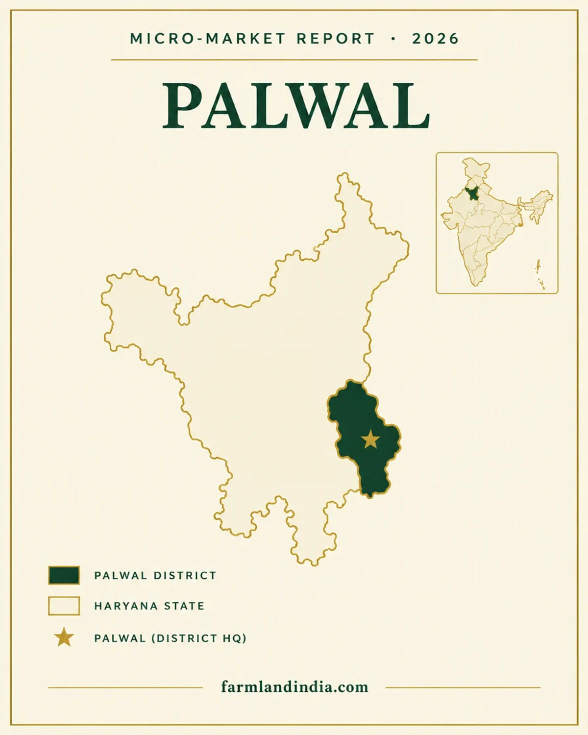
Palwal became a district on 13 August 2008 (DCMSME profile) and covers about 1,368 sq km with 10,40,493 people at the 2011 Census (CGWB district booklet). The district portal directory lists Tehsildars for Palwal, Hodal and Hathin (Palwal district portal), and the CGWB booklet names four blocks: Palwal, Hathin, Hodal and Hassanpur. The Haryana Water Resources Authority's 2024 table lists six assessment units for Palwal, adding Badoli and Prithla (HWRA table, March 2024). The district sits between Faridabad to the north, Nuh (then Mewat) to the west and Uttar Pradesh across the Yamuna to the east (CGWB).
Road access is the draw. The Kundli–Manesar–Palwal (KMP) Expressway was completed with its final section on 19 November 2018 (PMO), after the 52.33 km Manesar–Palwal section opened around 1 April 2016 (Indian Infrastructure, April 2016). The Eastern Peripheral Expressway, known locally as KGP, was dedicated on 27 May 2018 (PMO). A Gazette notification of 8 May 2026 declares an intention to acquire land for six-laning NH-19 between km 44.400 and km 94.000, though the plots listed are small: 15 plots, about 0.27 hectare, in nine villages (Gazette of India, 8 May 2026).
We publish no per-acre price band for Palwal. Listing-site asking prices could not be traced to registered deals, and we could not read a Palwal collector-rate figure: the district portal lists tehsil-wise rate files but the rates did not extract (Palwal district portal, collector rates). Groundwater extraction was 94.48% in the 2024 assessment (The Tribune, January 2025), the Yamuna Khadar belt floods, and the district is on the Forest Department's PLPA list. Land here is a parcel-by-parcel decision.
Market bands
No sourced per-acre price series exists for Palwal, and no Palwal collector-rate figure was read. No listing-site asking prices are used. Treat any row as a dated reference point, not a valuation.
* Indicative market range compiled from listed inventory and public circle-rate references. Not a valuation, an offer, or a guarantee of transaction price. Verify current DLC / circle rates with the sub-registrar before transacting.
Trend describes a historical movement over the stated period. It is not a projection or a forecast of future prices.
Transaction costs
7%
Stamp duty — male buyer
rate stated for sale deeds, incl. 2% development fee; rural schedule not opened
5%
Stamp duty — female buyer
rate stated for sale deeds; rural schedule not opened
Not sourced
Registration fee and rural rates
no government schedule opened; confirm with the Sub-Registrar
Duty is assessed on the higher of the deal value and the collector rate; we did not open an official schedule to confirm that rule. On 28 August 2025 the Chief Minister said sale-deed duty had been 7% (including a 2% development fee) for men and 5% for women since 2008, with no new registration tax, and that residential plots of up to 50 sq yd in urban areas and 100 sq yd in rural areas allotted under housing schemes pay no stamp duty (The Tribune, August 2025). We found no government page giving a rural rate or the registration fee, so we quote neither; ask the Sub-Registrar. A 2020 state audit report records an instruction of November 2000 that agricultural land inside municipal limits and under 1,000 sq yd is valued at the residential rate of the locality, and that registering officers sometimes applied ordinary agricultural rates to prime khasra land (CAG audit report, Haryana revenue sector, 2020); we have not confirmed that these instructions still apply. On rates themselves, The Tribune reported on 29 March 2026 that collector rates would rise by up to 75% from 1 April but the report does not name Palwal; its Faridabad coverage is limited to Faridabad and Ballabhgarh tehsils (The Tribune, March 2026). The Palwal district portal lists collector-rate files for Palwal, Hodal, Hathin, Bahin and Hassanpur (district portal) and a 2025 predictive-rates page (district portal, predictive rates 2025, not opened); we could not read the rates from either.
Know the belt
Palwal has no sourced price series. What exists is news on demand and planning, plus one neighbouring-district rate. No listing-site prices are used.
Rate files exist; figures not extracted
The district portal lists collector-rate files for five locations: Palwal, Hodal, Hathin, Bahin and Hassanpur, under the heading "Collector Rates Year 2023-2024" (district portal). A separate page carries the 2025 predictive rates (district portal, not opened). The state-wide hike reported for 1 April 2026 does not mention Palwal (The Tribune, March 2026). We quote no Palwal rate.
Check: the village rate in force on the sale-deed date, from the Tehsil or the portal.
Tajupur ₹1.30–2.28 crore per acre (proposed)
Next door, The Tribune reported on 29 March 2026 that the Faridabad tehsil agricultural rate at Tajupur was being raised from ₹1.30 crore to ₹2.28 crore per acre (+75%) (The Tribune, March 2026). That is a Faridabad figure, shown only as the neighbour's reference point; it says nothing about Palwal villages.
Check: whether the proposal was notified; the report does not say.
43 CLU permissions in 2023 (reported)
The Tribune reported on 10 November 2023 that 43 change-of-land-use permissions for industrial and commercial units had been issued in Palwal since 1 January 2023, over 90% for industry, with buyers acquiring land at Prithla, Tatarpur, Dudhola, Bhagola, Gadpuri and Aurangabad and the Haryana State Industrial and Infrastructure Development Corporation reportedly surveying for a dry port near Prithla (The Tribune, November 2023). Older data: the Hathin Industrial Area had 68.91 acres in 111 plots, all allotted (DCMSME profile).
Check: that industrial CLU near a farm plot does not turn the plot industrial; each parcel needs its own permission.
300+ unauthorised colonies (2022-23 survey, reported)
District officials told The Tribune in December 2024 that agricultural land rates had risen sharply over two to three years and that this had driven colonisation; notices went to colonies built after controlled-area limits were notified, and 19 Khadar villages along the Yamuna were categorised as controlled area in November 2023 (The Tribune, December 2024). The state announced the controlled-area plan for the Yamuna belt in September 2023 (National Herald, September 2023). A Palwal–Prithla Final Development Plan 2041 was reported notified on 24 August 2026 (UNI, August 2026).
Check: the plot's licence and zoning with the District Town Planner before paying a token amount.
No sourced price series
Listing-site asking prices for Palwal could not be traced to registered deals, so none are shown. The collector rate is the only official reference and it is a floor for registration, not what a seller will accept.
Check: registered sale deeds in the same revenue estate before negotiating.
Haryana land is sold by the killa (1 acre), kanal (605 sq yd) and marla (30.25 sq yd). Jamabandi records use kanal-marla, so convert any quote to acres and confirm the share of the khewat or khasra being sold. We did not open a revenue manual for these unit definitions, so confirm them with the patwari.
Connectivity
Distances to Delhi, Faridabad and the airport are not given because no official or news source was found. Journey times vary with traffic and road works.
Sources for this section: PMO, KMP, Indian Infrastructure, PMO, Eastern Peripheral, Gazette of India, DCMSME, ETV Bharat, News On AIR, Swarajya, Swarajya, October 2026 and The Tribune, August 2023. The practical question is the last leg from the highway to the parcel; ask for the access road in the revenue record. Full Haryana rules for buyers from outside the state: Haryana agricultural land rules.
Growth catalysts
Status labels reflect sources read in October 2026. Government-announced timelines are not guaranteed; items marked confirm have a single or an older source.
03Open or inaugurated
04In progress or pending
Agriculture & terrain
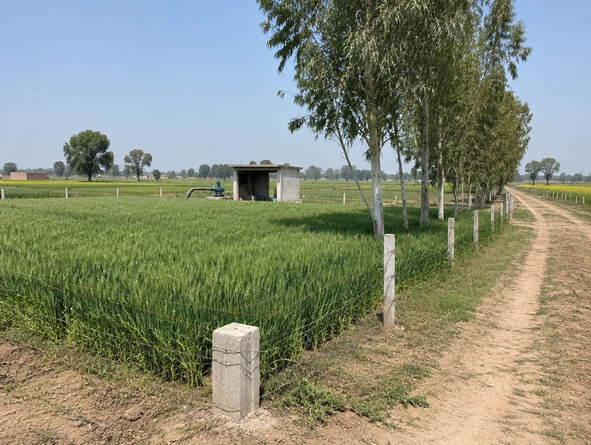
A wheat-led plain on sandy-loam soil with tubewell and canal irrigation, a Yamuna floodplain on the east and groundwater that is saline in places.
The ICAR-CRIDA contingency plan (crop data for 2008-09, so dated) gives sandy-loam soil across the district, with wheat on 104,800 hectares, rice on 27,400, pearl millet on 8,900 and rapeseed-mustard on 4,200, vegetables led by radish, cauliflower, carrot and tomato, and a cropping intensity of 187% (ICAR-CRIDA Palwal plan). Its land-use hectares rest on an older district area, so use the crop mix rather than the totals; the CGWB booklet gives net sown area as 1,070 sq km (CGWB booklet). The Tribune reported about 20,000 tonnes of paddy and 8,000 tonnes of bajra procured by 31 October 2024 (The Tribune, November 2024). Village soil data: Soil Health Card portal (not opened for this page).
The Yamuna runs along the eastern side of the district, with the Agra Canal to the west and the Gurgaon Canal through the centre (CGWB). In August 2019 villages near the river were put on alert after 8.14 lakh cusecs were released at Hathnikund, with the SDMs of Palwal and Hodal surveying flood-prone areas (The Tribune, August 2019). In July 2024 the irrigation department said 40 to 50 villages in Faridabad and Palwal were flood-sensitive and that it had cleaned 22 drains in Palwal (The Tribune, July 2024). Ask the seller for flood history on any riverside parcel.
The CGWB booklet records soil pH of 6.5 to 8.7, low organic content outside Hathin block, shallow groundwater described as moderately to highly saline (electrical conductivity 693 to 3,600) and fluoride above the 1.5 mg/l drinking limit in a large share of samples; salinity, waterlogging and fluoride are its listed problems (CGWB booklet, 2013). The 2024 CGWB state report still lists Palwal for sporadic anomalies in electrical conductivity, fluoride, nitrate and uranium (CGWB, Haryana 2024). A borewell test matters more here than the soil label.
Normal annual rainfall is 542 mm in the CGWB booklet and 595.6 mm in the ICAR-CRIDA plan; the two do not agree, so we give both. The booklet records net irrigated area of 1,050 sq km, of which tubewells 770 and canals 270 (CGWB booklet). On 2009-11 data it rated Palwal block over-exploited at 113% and showed Hodal and Hassanpur at 103% and Hathin at 89%. District extraction was 94.48% in the 2024 assessment (The Tribune, January 2025), against a state figure of 135.96% with 88 of 143 units over-exploited (CGWB, Haryana 2024). The HWRA block table as on 31 March 2024 lists Badoli, Prithla, Hasanpur, Hodal, Hathin and Palwal, but the text extraction did not separate its category columns, so we give no per-block category (HWRA table; HWRA notice). Check the borewell yield and permission for any parcel.
Haryana land units: killa = 1 acre; kanal = 605 sq yd; marla = 30.25 sq yd. Convert every quote to acres or sq yd before comparing two offers. Live wholesale mandi prices are on Agmarknet (not opened for this page); crop income is modest next to land values near the expressways, so price a parcel on its location and permitted use, not on wheat yield.
At a glance
| District / belt | Price band* (per acre) | Evidence |
|---|---|---|
| Palwal | No sourced price series | No Palwal collector rate read; PLPA-listed district; district extraction 94.48% (2024) |
| Faridabad — Tajupur (Faridabad tehsil) | ₹1.30–2.28 crore | Proposed agricultural rate, The Tribune, 29 Mar 2026; notification not seen; district extraction 180.89% |
| Nuh | No sourced price series | No figure used on this page; also on the PLPA list (as Mewat) |
| Gurugram | No sourced agricultural series | No agricultural figure used; all five blocks over-exploited (HWRA, March 2024) |
| Uttar Pradesh edge (Mathura, Gautam Buddh Nagar) | No sourced price series | Different state rules; Noida International Airport flights from 15 Jun 2026 |
*Collector rates are registration floors, not market prices, and draft or proposed figures can change before notification. Sources: The Tribune, March 2026, The Tribune, January 2025, HWRA, March 2024, Forest Department PLPA list and the district profile. See the Faridabad page for the northern neighbour and the Nuh page for the western one.
Farmland India view
Five reasoned points, with an honest note that the price evidence is thin and several catalysts are still pending.
The KMP and Eastern Peripheral expressways both serve Palwal, though maintenance on both has drawn complaints. A buyer from Faridabad, Gurugram or Delhi should time the actual drive to the parcel.
News reports of 43 industrial and commercial CLU permissions in 2023 point to demand around Prithla and the NH-19 belt. That supports land beside it, not every farm plot in the district.
A Final Development Plan 2041 for Palwal and Prithla was reported notified in August 2026, and the Khadar belt is a controlled area. Zoning now matters as much as location.
The orbital rail line starts at Palwal but only 10 km of it (Manesar–Patli) is open, and the Ballabhgarh–Palwal metro has reached the DPR stage. This desk reads both as optionality, not as a reason to pay a premium.
With PLPA, controlled-area, unauthorised-colony, flood and groundwater questions all parcel-specific, a buyer who documents each one is better placed than one relying on a broker summary.
Confirm PLPA, CLU, zoning, flood and collector-rate status directly; these are not certified by Farmland India’s review.
Read these before shortlisting in Palwal specifically.
Palwal is on the Forest Department's list of ten covered districts, and its 2009 compilation shows one expired Palwal notification (Dighot, 63 acres). Expiry does not settle forest status, so ask for the khasra's current status in writing.
Nineteen Khadar villages were reported as controlled area in November 2023, and a 2022-23 survey reportedly found over 300 unauthorised colonies. Ask for the colony licence and the zoning before paying any token.
Villages near the river were put on alert in August 2019, and 40 to 50 villages in Faridabad and Palwal were called flood-sensitive in July 2024. Ask for flood history on any parcel east of the canals.
District extraction was 94.48% in 2024, Palwal block was over-exploited on 2009-11 data, and the older CGWB booklet records saline water and high fluoride. Test the borewell before assuming irrigation or a farmhouse supply.
The Tribune reported in May 2024 that a 23-acre mutation in Shekhpur village, entered in 2022, was in violation of rules, with a kanungo and a patwari suspended. Check the mutation history, not just the latest jamabandi.
Unauthorised stops and eateries along the KMP were reported in November 2023. Do not assume a roadside structure is cleared; ask the District Town Planner.
A parcel marketed as farmhouse-ready may not hold CLU, and industrial CLU nearby does not carry over. Ask for the CLU order and zoning, and for the current text of the 2021 eco-friendly farmhouse policy.
NH-19 is at the acquisition-notice stage, the orbital rail line has 10 km open, and the metro has reached the DPR stage. Price on today's roads and zoning.
We use no listing-site prices for Palwal, we read no Palwal collector rate, and collector rates are only a floor. Collect registered comparables before negotiating.
Who to contact
Mutation and revenue-record matters go through the Tehsildar of the relevant tehsil; the district portal directory lists Tehsildars for Palwal, Hodal and Hathin and an SDM for Palwal, and has no entries for Sub-Registrar or District Town Planner offices (Palwal district portal directory). The portal's collector-rate page also lists Bahin and Hassanpur, so ask the Tehsil which office holds the revenue estate. CLU applications go to the Directorate of Town and Country Planning (DTCP Haryana) through the District Town Planner, and the Forest Department (Forest Department PLPA page) confirms whether a khasra falls under a PLPA notification. Sale-deed registration is handled by the local Sub-Registrar. Collector rates are on the Palwal district portal and the ULB Haryana portal, records on jamabandi.nic.in and office details on the Haryana Revenue Department portal. We could not open the revenue, jamabandi, DTCP and ULB home pages, so check them directly.
DEVELOPER PROJECTS · TRUST SCORE
Developer projects carry the platform Trust Score and a reviewed document set.
Reviewed projects have completed Farmland India's document and site review. Individual land parcels are listed by their owners and are not reviewed to the same standard. Always complete your own legal due diligence.
KEEP EXPLORING
Micro-markets in Palwal
Other districts in Haryana
Guides & research
COMMON QUESTIONS
Everything buyers, NRIs and investors ask before their first reviewed farmland purchase in Palwal.
Visit full wiki01 of 04
We know of no residence bar for Indian buyers in Haryana, but we did not open an official page that says so, so confirm with a Haryana revenue lawyer. The Ceiling on Land Holdings Act, 1972 caps a family's holding. NRIs and OCIs cannot buy agricultural land under the RBI's 2018 regulations.
02 of 04
We publish no per-acre band, because listing-site asking prices could not be traced to registered deals. The district portal lists collector-rate files for Palwal, Hodal, Hathin, Bahin and Hassanpur, but we could not read a village rate from them. Check the village rate at the Tehsil and ask for registered sale deeds of nearby parcels.
03 of 04
Palwal is one of the ten districts on the Haryana Forest Department's list. Its compilation of section 4 and 5 notifications (status at 31 December 2009) shows one Palwal entry, Dighot village, 63 acres, shown as expired, and its preface says expiry does not change forest status. The Supreme Court has treated notified land as forest (Kant Enclave, 2018), so ask the Forest Department about the specific khasra in writing.
04 of 04
A Gazette notification of 8 May 2026 (S.O. 2369(E)) declares an intention to acquire land for six-laning between km 44.400 and km 94.000, about 49.6 km, naming nine villages and 15 plots of about 0.27 hectare in total. It carries a 21-day objection window, and we found no construction status.
Ready to look at what is available?
Browse reviewed listingsTransparency
Law and courts
Government
News
Further reading
Data-currency note: area and population are Census 2011 figures from the CGWB and DCMSME profiles; crop and groundwater data come from documents dated 2008 to 2013 and the March 2024 and Dec 2024 assessments; infrastructure statuses were read in October 2026 and change quickly; no Palwal collector rate was read. Pages marked "not opened" are named only as places to check. This is a general guide, not legal advice. Report inaccuracies to wiki@farmlandindia.com. Last reviewed 13 October 2026.
For developers
Browse reviewed projects and individual land parcels across Palwal — or if you own land here, list it with platform review and reach serious buyers.
Farmland India ("the Platform"), operated by Bulk Procure Private Limited, is a digital marketplace for listing agricultural land, farmhouse and plotted development projects. The Platform is not a real estate broker, agent or intermediary under RERA or any other applicable law, and does not act for either party to a transaction.
Listings are submitted by developers, owners and their authorised representatives. Before publication, the Platform carries out a documentary review of the material supplied and records what was sighted. That review is limited to the documents made available to us at that time. It is not a title investigation, not a legal opinion, and not a warranty of title, approvals, or the accuracy of any information supplied by a lister. The Trust Score is an internal assessment produced from that review and is intended as a research aid, not as a guarantee of outcome.
Every buyer must carry out independent due diligence before any transaction — including verification of land records, encumbrance searches, approvals and regulatory compliance — through their own advocate and chartered accountant. Any legal or advisory professional introduced through the Platform is engaged directly by the user, on that professional's own terms; the Platform does not employ, supervise or accept responsibility for their work.
Nothing on the Platform is investment advice. Land values can fall as well as rise. The Platform is not liable for any loss, dispute or damage arising from a transaction between parties.
