
Owner listed
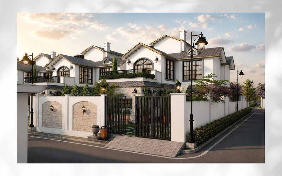
Willow Estates Rishikesh
Pauri Garhwal, Uttarakhand
₹50.4L8.60 AcreView
State guide
Garhwal and Kumaon across 13 districts: the 2025 land law, hill versus Terai land, eco-sensitive zone and disaster checks, the Delhi–Dehradun Expressway and the only districts where outside buyers can seek sanction.
13 (Garhwal 7, Kumaon 6)
Districts
About 210 km, opened 14 Apr 2026
Delhi–Dehradun Expressway
1.01 crore
Population (Census 2011)
5% (3.75% women to ₹25 lakh) + 2% registration
Stamp duty
*Indicative range across districts and land types. Stamp duty, registration and conversion charges are additional. Local measurement units vary — every listing states the unit it is priced in. Not a valuation or an offer.
Bhulekh UK — Uttarakhand Land Records PortalState land record — Uttarakhand
Rev. 2026 · Farmland India desk
Divisions
2 (Garhwal 7 districts · Kumaon 6 districts)
Total districts
13
State area
~53,483 sq km
Forest cover
About 45% of state area (ISFR 2023, reported)
Assent and effect
Assent 30 April 2025 · in force 1 May 2025
Land records portal
Bhulekh UK (state land-records portal); Tehsildar office for certified copies
Governing law
UP Zamindari Abolition & Land Reforms Act 1950 as applied here · Uttarakhand Act 11 of 2025
Non-resident agri land
Only in Haridwar & Udham Singh Nagar, with prior state sanction
Stamp duty (sale deed)
5% general · 3.75% women to ₹25 lakh, then 5% · registration 2% (cap to be confirmed) · fee sheet
⚠ Uttarakhand limits who can buy agricultural and horticultural land. Check who you are, which district the land is in, and how it is recorded before anything else.
Who can buy agricultural land? Since 1 May 2025, a person who does not already hold land in Uttarakhand can buy agricultural or horticultural land only in Haridwar and Udham Singh Nagar, and only with prior sanction from the state government (Uttarakhand Act 11 of 2025). Press coverage describes this as a bar in 11 of the 13 districts (Scroll, February 2025); the Act names the two districts and does not count the rest. Buying through a nominee is a compliance risk, and a transfer made on a false affidavit is void under the Act.
The 2025 land law amendment: The Assembly passed the bill on 21 February 2025 (Scroll, February 2025). The Governor gave assent on 30 April 2025, and the Act was notified and took effect on 1 May 2025 (Act text; PTI via The Week, May 2025). The power to allow purchases moved from the District Magistrate to the state government (Business Standard, February 2025). The Chief Minister said land bought on false declarations can vest in the state, and cited 1,883 approvals since 2018 with 599 violations found (Scroll, February 2025).
Haridwar and Udham Singh Nagar: These are the only districts where sanction for such a purchase is possible, and sanction is not automatic. The buyer gives an affidavit that the land will be used only for the stated agricultural or horticultural purpose and must put it to that use within three years or an extended period; a change of use makes the transfer void (Act text). The general power to allow transfers above the ceiling, earlier reported as 12.5 acres, is now confined to these two districts and sits with the state government, which acts on an essentiality certificate (Act text; Business Standard, February 2025). Ask the revenue department which office takes sanction applications before paying a token amount.
Residential land for non-residents: The Act lets a buyer file an affidavit that neither he nor his family has bought more than 250 sq m of land elsewhere in the state for residential use; a false affidavit voids the transfer (Act text; Scroll, February 2025). The text we read does not settle whether 250 sq m is a lifetime count across the family, or how the rule works inside municipal limits, which the Act's extent clause excludes, so take both questions to the Sub-Registrar in writing.
Land-use declaration (Section 143): Section 143 of the parent Act (UP Zamindari Abolition and Land Reforms Act, 1950) deals with declaring agricultural land for other uses, such as a house or farmhouse. We have not re-read the section for this edition, so ask the Sub-Divisional Magistrate which declaration applies before building. Check the land's classification in the khatauni, not in the seller's brochure.
Forest, van panchayat and eco-sensitive land: Land recorded as forest cannot be freely sold or converted, and land near Corbett, Rajaji and other protected areas can fall inside an eco-sensitive zone with construction limits. In November 2025 the Supreme Court directed that zones around tiger reserves be notified within a year (The Week/PTI, November 2025). A plot that looks like farmland can be recorded differently, so ask for the revenue record and the forest position in writing.
NRI & OCI buyers: FEMA 1999 bars NRIs and OCIs from buying agricultural land, plantation land or farmhouse land anywhere in India, Uttarakhand included. That is a central rule, not a state one, and the state Act adds its own conditions on top; read the current RBI notification for the exact wording.
State overview
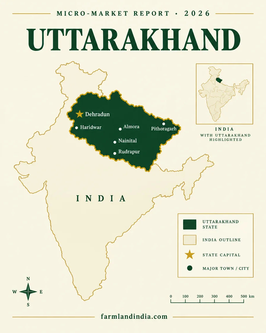
Agricultural land in Uttarakhand sits in a state of 13 districts split between Garhwal (Chamoli, Dehradun, Haridwar, Pauri Garhwal, Rudraprayag, Tehri Garhwal, Uttarkashi) and Kumaon (Almora, Bageshwar, Champawat, Nainital, Pithoragarh, Udham Singh Nagar). It became a state on 9 November 2000, covers about 53,483 sq km and had 10.09 million people at the 2011 Census, about 70% of them rural. The India State of Forest Report 2023 put forest cover at about 45% of the state area (AIR, ISFR 2023 release). The area, population and district figures were not re-checked against the Census tables for this edition. Much of the remaining area is hill terrain, so farmland is limited and unevenly spread.
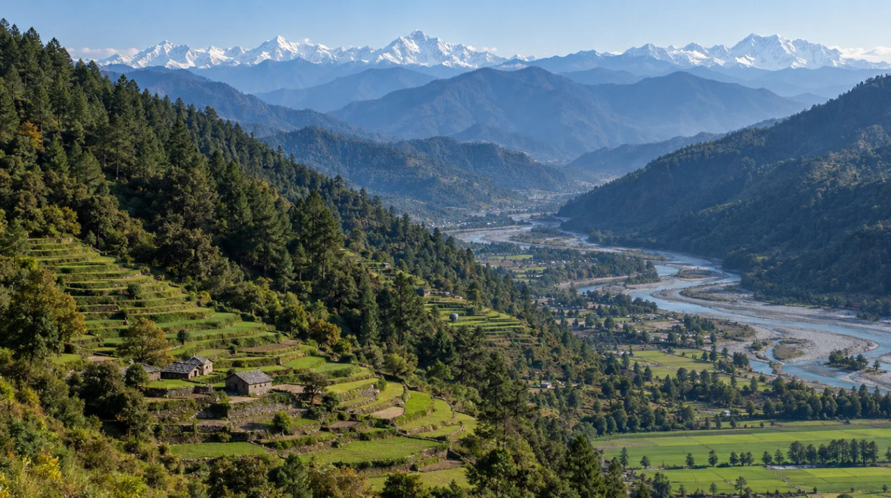
Buyers face three different land markets. The Terai and Bhabar plains (Haridwar, Udham Singh Nagar and the southern edge of Nainital) are flat and irrigated, with rice, wheat and sugarcane. The Doon Valley and Shivalik foothills (Dehradun, the Corbett belt, Kotdwar) carry farmhouse and lifestyle demand from Delhi NCR. The mid and high Himalaya (Almora, Tehri, Chamoli, Pithoragarh and others) is terraced hill land, quoted in nali, where slope, water, access roads and disaster exposure matter more than the headline price.
The 2025 land law applies across all three. A person who does not already hold land in the state can buy agricultural land only in Haridwar and Udham Singh Nagar, with prior state sanction (Act text), so the district decides whether a purchase is possible at all. The Delhi–Dehradun Expressway opened on 14 April 2026 (PIB, April 2026) and is reported to cut the drive to the Doon Valley to about 2.5 hours (Construction World, April 2026), which is where farmhouse-land interest is concentrated.
Micro-markets by district:
Dehradun: Rishikesh, Mussoorie, Doiwala, Vikasnagar, Sahaspur, Premnagar, Raipur, Selaqui, Chakrata, Kalsi, Delhi–Dehradun Expressway belt
Haridwar: Roorkee, Laksar, Bahadrabad
Nainital: Ramnagar (Jim Corbett), Haldwani, Kaladhungi, Bhimtal, Sattal, Bhowali, Mukteshwar
Almora: Ranikhet, Binsar
Bageshwar: Kausani
Pauri Garhwal: Kotdwar, Lansdowne
Tehri Garhwal: New Tehri, Narendra Nagar, Dhanaulti, Kanatal
Udham Singh Nagar: Rudrapur, Kashipur
Rishikesh town is administratively in Dehradun district; parts of the wider Rishikesh belt fall in Tehri Garhwal and Pauri Garhwal. Mussoorie is in Dehradun district.
District guide
No dated per-acre asking-price series was sourced for this state page, so it shows none. Each district page lists the asking prices and circle-rate evidence it could source, with dates.
| District | Region | Land character | Non-resident agricultural land* |
|---|---|---|---|
| Almora | Kumaon | Hill district: Ranikhet, Binsar, terraced orchard and farmhouse land | Barred for non-holders |
| Bageshwar | Kumaon | Remote hills around Kausani; thin land market | Barred for non-holders |
| Chamoli | Garhwal | Char Dham district (Badrinath, Joshimath); high-altitude, slope-risk land | Barred for non-holders |
| Champawat | Kumaon | Nepal-border hill district; small land market | Barred for non-holders |
| Dehradun | Garhwal | Doon Valley, Mussoorie, Rishikesh belt; farmhouse and lifestyle demand | Barred for non-holders |
| Haridwar | Garhwal | Gangetic plain: Roorkee, Laksar; rice, wheat, sugarcane land | Only district route, with prior state sanction |
| Nainital | Kumaon | Jim Corbett belt (Ramnagar), Haldwani, Bhimtal, Mukteshwar | Barred for non-holders |
| Pauri Garhwal | Garhwal | Kotdwar foothills gateway, Lansdowne hills | Barred for non-holders |
| Pithoragarh | Kumaon | Far-east border district with Naini Saini airport | Barred for non-holders |
| Rudraprayag | Garhwal | Kedarnath route; pilgrim-town land, flood-zone checks | Barred for non-holders |
| Tehri Garhwal | Garhwal | Tehri lake, New Tehri, Dhanaulti, Kanatal | Barred for non-holders |
| Udham Singh Nagar | Kumaon | Terai plain: Rudrapur, Kashipur, Pantnagar; rice, wheat, sugarcane | Only district route, with prior state sanction |
| Uttarkashi | Garhwal | Gangotri and Yamunotri route; Bhagirathi valley flood risk | Barred for non-holders |
*Status under Uttarakhand Act 11 of 2025. The Act names Haridwar and Udham Singh Nagar as the only districts for sanctioned purchase; "Barred" is the press count for the other 11 (Scroll, February 2025). Hill land is quoted per nali, and the size of a nali varies locally; Farmland India uses 240 sq yd (about 200 sq m) as a working figure. Circle rates for a specific village come from the Stamps and Registration Department. Past movement is historical, not a projection.
Transaction costs
5%
Stamp duty — general rate
on the sale-deed value
3.75%
Stamp duty — women buyers
up to ₹25 lakh; 5% above that
2%
Registration fee
cap under revision, see note
Source: the Stamps and Registration Department fee sheet (undated) and the department's notification index (updated 18 November 2025). The index records a 16 November 2025 amendment to the registration fee table that replaced a figure of twenty-five thousand with fifty thousand, so the cap on the 2% fee may now be ₹50,000; get the current cap from the Sub-Registrar. Whether duty is charged on the higher of deal value and circle rate has not been confirmed from these documents. The fee sheet also lists a 100% rebate for qualified disaster-affected beneficiaries in Uttarkashi, Chamoli, Pithoragarh, Rudraprayag and Bageshwar.
Connectivity
The Delhi–Dehradun Expressway has reset the Doon Valley's distance from Delhi; the rest of the state still depends on national highways, hill roads and three small airports. Journey times vary with traffic, weather and road works.
The expressway opened on 14 April 2026, and PIB describes a nearly 12 km elevated wildlife corridor on it (PIB, April 2026). Construction World, citing MoRTH and NHAI, reports a length of about 210 km and a spur to Haridwar (Construction World, April 2026). Land near the corridor can sit close to forest and eco-sensitive limits, so read the route and land-impact analysis in our Delhi–Dehradun Expressway wiki guide.
Growth catalysts
Status as of October 2026, maintained by the Farmland India research desk. Government-announced timelines are not guaranteed.
03Airports
Dehradun, Pantnagar, Pithoragarh
06Catalysts
Agriculture & terrain
Farmland in Uttarakhand changes completely with altitude: assured-irrigation commodity farming on the plains, spring-fed terraces and orchards in the hills.
Flat alluvial plain with canal and tubewell irrigation, farmed mainly for rice, wheat and sugarcane. This is the belt where crop income is a real part of the case.
Well-drained, coarse foothill soils at the base of the hills, mixing cropland, orchards and forest edge. Value is driven more by farmhouse demand and access than by crop yield. Rivers, seasonal streams and borewells are the water sources; yield varies by parcel.
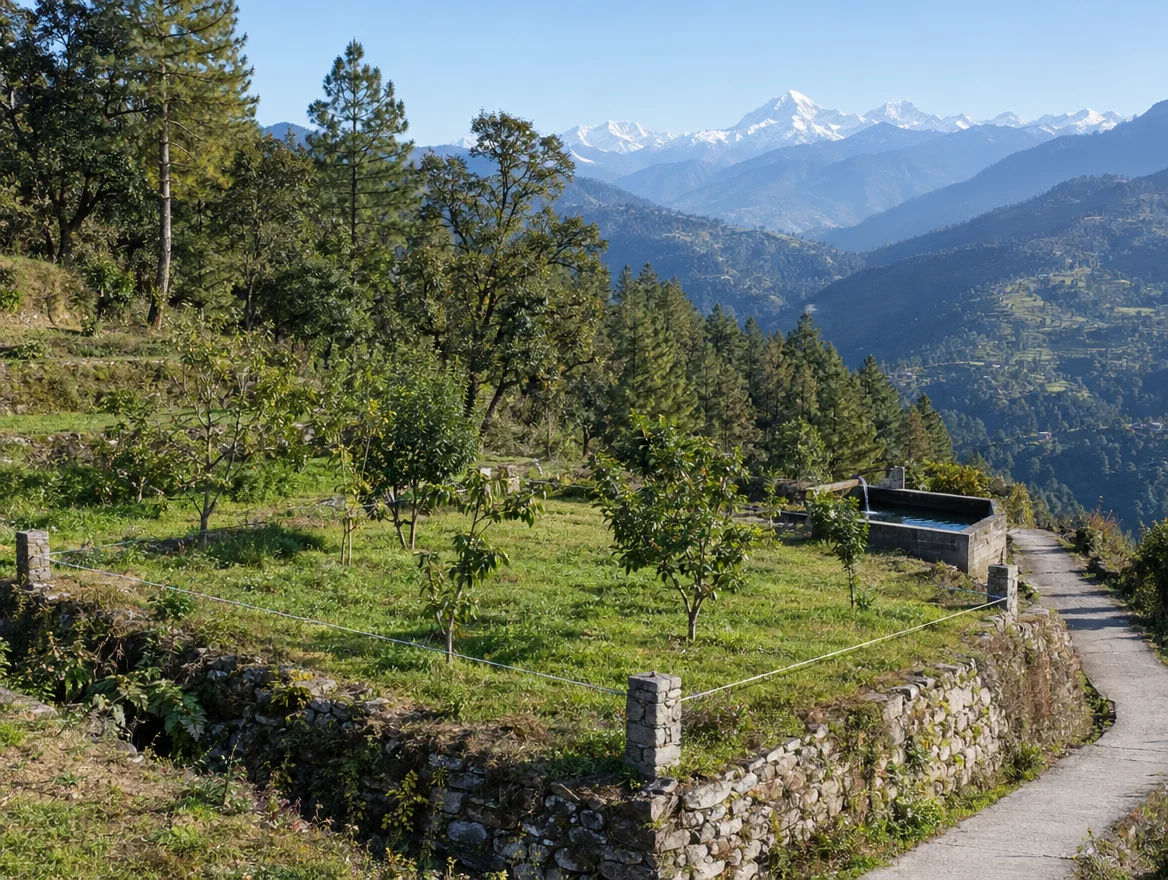
Terraced, small holdings on slopes, with fruit orchards, vegetables, potato and spices, and cereals such as mandua. Irrigation is largely spring-fed and holdings are small and fragmented.
Wheat, rice and sugarcane dominate on the plains; mandua and horticulture dominate in the hills. This page gives no crop-share figures because the state planning data available is from an older period. For current prices, check Agmarknet mandi rates for the Dehradun, Haldwani and Rudrapur markets.
Rainfall and water access vary sharply between the Doon Valley, the Terai and the high hills; see the India Meteorological Department's district normals. Hill farmland usually depends on springs, so ask for the spring or other water source and its flow across seasons, and check CGWB block status for plain-side borewell plans.
Hill land is quoted in nali, and the size of a nali varies by locality. Farmland India uses 240 sq yd (about 200 sq m) as a working figure, which makes an acre roughly 20 nali; take the area in sq m or acres from the khatauni. Terai listings use other local units, so always convert to acres or sq m before comparing prices across districts.
At a glance
| District | Terrain | Delhi access | Nearest airport | Non-resident agri land* |
|---|---|---|---|---|
| Dehradun | Doon Valley, hills (Mussoorie) | Expressway: ~210 km, ~2.5 hr (reported) | Jolly Grant | Barred for non-holders |
| Haridwar | Gangetic plain | Expressway-side network; confirm | Jolly Grant | Only district route, with prior state sanction |
| Nainital | Foothills, Corbett belt, hills | Moradabad-side highways; confirm | Pantnagar | Barred for non-holders |
| Udham Singh Nagar | Terai plain | Moradabad-side highways; confirm | Pantnagar | Only district route, with prior state sanction |
*Status as explained under the district guide above. Pantnagar lies in Udham Singh Nagar.
Farmland India view
Five structural reasons this desk looks at Uttarakhand, and the checks that go with them.
A person who does not already hold land in the state can buy agricultural land only in Haridwar and Udham Singh Nagar, with state sanction, so supply to outside buyers is narrow and rules-driven.
The Delhi–Dehradun Expressway opened on 14 April 2026 and is the main new fact behind Doon Valley farmhouse-land interest.
Haridwar and Udham Singh Nagar are also the two districts open to sanctioned purchase, and their rice, wheat and sugarcane land is a different case from hill land.
Corbett, Rishikesh, Mussoorie, Nainital and the Char Dham routes support farmhouse and stay-led land interest, subject to eco-sensitive zone and flood limits.
Orchard and vegetable land in the hills gives land an income use, and the Rishikesh–Karnaprayag line (reported first train Dec 2028) is a long-term access story.
Confirm your buyer eligibility, land-use class and ESZ status directly; these are not certified by Farmland India's review.
STRAIGHT TALK
Read these before shortlisting. Uttarakhand's risks are legal, environmental and physical, and they stack.
The 2025 amendment moved sanction from the District Magistrate to the state government, requires affidavits of use, and makes a transfer on a false declaration void (Act text; Business Standard, February 2025). Chief Minister Dhami cited 1,883 approvals since 2018, with 599 violations found (Scroll, February 2025). Settle eligibility before any token payment.
These two districts are the only ones where a person without land in the state can be sanctioned to buy agricultural land, and the state government decides each case (Act text). Some early coverage called them open to outside buyers, which the Act text does not support. Do not rely on a seller or a portal listing for the approval path.
Forest-recorded land cannot be freely sold or converted. On 17 November 2025 the Supreme Court directed that eco-sensitive zones around tiger reserves be notified within a year, ordered demolition of unauthorised construction in Corbett Tiger Reserve within three months and barred mining within 1 km of tiger habitat or an eco-sensitive zone (The Week/PTI, November 2025). Check the zone position for any parcel near Corbett or Rajaji.
A cloudburst and flash flood hit Dharali in Uttarkashi district on 5 August 2025, with deaths and many people missing (Deccan Herald, August 2025). Hill buyers should check slope, drainage and distance from streams, not just the road.
Subsidence began in Joshimath in January 2023. On 4 May 2025 Chief Minister Dhami announced that the Centre had approved ₹1,700 crore for rehabilitation, with a first instalment of ₹292 crore (Business Standard, May 2025). Slope-stability and geological reports matter for any construction on weak ground.
The state lies in the Himalayan seismic belt. A 2025 BIS seismic code that proposed a new Zone VI was withdrawn in March 2026, as reported by ETV Bharat, March 2026, so the 2016 map stays in force. Treat structural design as a cost, not an extra, and take the zone from a structural engineer.
The Rishikesh–Karnaprayag deadline has already been pushed back once (Swarajya, 2025), and the first-train target now stands at December 2028 (Swarajya, March 2026). Price a parcel on today's access, not an announcement.
Who to contact
Land records (khatauni, khasra, mutation) sit with the Tehsildar office, and the state's Bhulekh UK portal is its online records service. Land-use declarations and conversion questions go to the Sub-Divisional Magistrate (SDM), and sanction for purchases by people without land in the state rests with the state government (Act text). Sale deeds are registered at the local Sub-Registrar; the Stamps and Registration Department publishes its fee sheet and notification index. Confirm the exact office for each tehsil before applying.
DEVELOPER PROJECTS · TRUST SCORE
Developer projects carry the platform Trust Score and a reviewed document set.
Pauri Garhwal, Uttarakhand
Nainital, Uttarakhand
Haridwar, Uttarakhand
Ramnagar (jim Corbett), Nainital, Uttarakhand
Kashipur, Udham Singh Nagar, Uttarakhand
Kaladhungi, Nainital, Uttarakhand
Narendra Nagar, Tehri Garhwal, Uttarakhand
Reviewed projects have completed Farmland India's document and site review. Individual land parcels are listed by their owners and are not reviewed to the same standard. Always complete your own legal due diligence.
KEEP EXPLORING
Districts
Guides & research
COMMON QUESTIONS
Everything buyers, NRIs and investors ask before their first reviewed farmland purchase in Uttarakhand.
Visit full wiki01 of 04
Only in Haridwar and Udham Singh Nagar, and only with prior sanction from the state government. Uttarakhand Act 11 of 2025, which amended the UP Zamindari Abolition and Land Reforms Act, 1950, took effect on 1 May 2025 and allows a person who does not already hold land in the state to buy agricultural or horticultural land only in those two districts. The buyer files an affidavit that the land will be used only for that purpose, and a change of use makes the transfer void. Press reports describe this as a bar in 11 of the 13 districts.
02 of 04
The Act asks the buyer to file an affidavit that neither he nor his family has bought more than 250 sq m of land elsewhere in the state for residential use, and a false affidavit voids the transfer. The text we read does not settle whether this is a lifetime count or how it applies inside municipal limits, so ask the Sub-Registrar for the position in writing.
03 of 04
The Stamps and Registration Department fee sheet lists 5% stamp duty on a sale deed, 3.75% for women buyers up to ₹25 lakh and 5% above that, and a 2% registration fee. The department's notification index records a 16 November 2025 amendment to the registration fee table, so the cap on that fee may have moved from ₹25,000 to ₹50,000; get the current figure from the Sub-Registrar.
04 of 04
NRIs and OCIs cannot buy agricultural land, plantation land or farmhouse land anywhere in India under FEMA 1999, and Uttarakhand has no exception. They can buy land recorded as non-agricultural. This is a central rule, so read the current RBI notification for the exact wording.
Ready to look at what is available?
Browse reviewed listingsTransparency
Where a claim is marked as reported, the outlet named in the link is the only source we reached for it.
Law and courts
Government
News
Further reading
Data-currency note: sources were read in October 2026, and Census figures reflect 2011. The land-law summary follows the Act text; infrastructure figures and some court and disaster details rest on press reports and are labelled as reported. Report inaccuracies to wiki@farmlandindia.com.
For developers
Browse reviewed projects and individual land parcels across Uttarakhand — or if you own land here, list it with platform review and reach serious buyers.
Farmland India ("the Platform"), operated by Bulk Procure Private Limited, is a digital marketplace for listing agricultural land, farmhouse and plotted development projects. The Platform is not a real estate broker, agent or intermediary under RERA or any other applicable law, and does not act for either party to a transaction.
Listings are submitted by developers, owners and their authorised representatives. Before publication, the Platform carries out a documentary review of the material supplied and records what was sighted. That review is limited to the documents made available to us at that time. It is not a title investigation, not a legal opinion, and not a warranty of title, approvals, or the accuracy of any information supplied by a lister. The Trust Score is an internal assessment produced from that review and is intended as a research aid, not as a guarantee of outcome.
Every buyer must carry out independent due diligence before any transaction — including verification of land records, encumbrance searches, approvals and regulatory compliance — through their own advocate and chartered accountant. Any legal or advisory professional introduced through the Platform is engaged directly by the user, on that professional's own terms; the Platform does not employ, supervise or accept responsibility for their work.
Nothing on the Platform is investment advice. Land values can fall as well as rise. The Platform is not liable for any loss, dispute or damage arising from a transaction between parties.