

Owner listed
Willow Estates Rishikesh
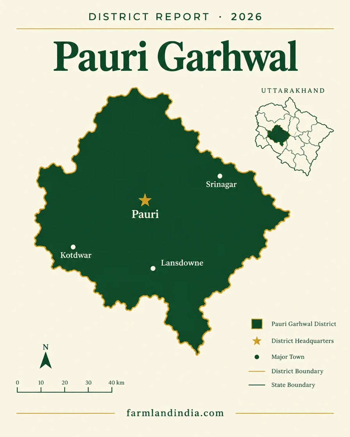
Pauri Garhwal, Uttarakhand
₹50.4L8.60 AcreView
District guide
A Garhwal hill district with a plains gateway at Kotdwar: no outsider purchase of agricultural land under the 2025 Act, Corbett and Rajaji zones still to be notified, Lansdowne cantonment, a rail line targeted for December 2029 and outmigration title checks.
~200 km
Delhi to Corbett's Pakhro gate (Kotdwar)
−1.51%
Population change 2001-11
None sourced
Price series
~125 km, 78% done (Aug 2026)
Rishikesh–Karnaprayag rail
District land record — Pauri Garhwal
Rev. 2026 · Farmland India desk
State
Uttarakhand
Administrative units
9 tehsils and 15 development blocks (district portal, October 2026)
Key markets
Kotdwar · Lansdowne · Srinagar · Pauri
Demand anchors
Kotdwar plains gateway and Corbett access · Lansdowne cantonment · Srinagar university town · Rishikesh–Karnaprayag rail line
Rail
Kotdwar, the district's only railway station (MSME-DI profile); Rishikesh–Karnaprayag line under construction
Size and population
5,230 sq km at the district portal (the ICAR plan implies 6,729 sq km) · about 6.87 lakh people at the 2011 Census, down 1.51% since 2001 (MSME-DI profile)
Pricing unit
₹/acre (farmland) · ₹/sq yd (plots)
Local units
Nali: Farmland India uses 240 sq yd (about 200 sq m) as a working figure, but a nali varies by locality, so take the area from the khatauni · Acre = 4,840 sq yd
Land records portal
Bhulekh Uttarakhand (state land-records portal); Tehsildar office for certified copies
Land law is state law. These rules are maintained on the Uttarakhand page and apply to every district within it.
⚠ Uttarakhand limits who can buy agricultural and horticultural land. Check who you are, which district the land is in, and how it is recorded before anything else.
Who can buy agricultural land? Since 1 May 2025, a person who does not already hold land in Uttarakhand can buy agricultural or horticultural land only in Haridwar and Udham Singh Nagar, and only with prior sanction from the state government (Uttarakhand Act 11 of 2025). Press coverage describes this as a bar in 11 of the 13 districts (Scroll, February 2025); the Act names the two districts and does not count the rest. Buying through a nominee is a compliance risk, and a transfer made on a false affidavit is void under the Act.
The 2025 land law amendment: The Assembly passed the bill on 21 February 2025 (Scroll, February 2025). The Governor gave assent on 30 April 2025, and the Act was notified and took effect on 1 May 2025 (Act text; PTI via The Week, May 2025). The power to allow purchases moved from the District Magistrate to the state government (Business Standard, February 2025). The Chief Minister said land bought on false declarations can vest in the state, and cited 1,883 approvals since 2018 with 599 violations found (Scroll, February 2025).
Haridwar and Udham Singh Nagar: These are the only districts where sanction for such a purchase is possible, and sanction is not automatic. The buyer gives an affidavit that the land will be used only for the stated agricultural or horticultural purpose and must put it to that use within three years or an extended period; a change of use makes the transfer void (Act text). The general power to allow transfers above the ceiling, earlier reported as 12.5 acres, is now confined to these two districts and sits with the state government, which acts on an essentiality certificate (Act text; Business Standard, February 2025). Ask the revenue department which office takes sanction applications before paying a token amount.
Residential land for non-residents: The Act lets a buyer file an affidavit that neither he nor his family has bought more than 250 sq m of land elsewhere in the state for residential use; a false affidavit voids the transfer (Act text; Scroll, February 2025). The text we read does not settle whether 250 sq m is a lifetime count across the family, or how the rule works inside municipal limits, which the Act's extent clause excludes, so take both questions to the Sub-Registrar in writing.
Land-use declaration (Section 143): Section 143 of the parent Act (UP Zamindari Abolition and Land Reforms Act, 1950) deals with declaring agricultural land for other uses, such as a house or farmhouse. We have not re-read the section for this edition, so ask the Sub-Divisional Magistrate which declaration applies before building. Check the land's classification in the khatauni, not in the seller's brochure.
Forest, van panchayat and eco-sensitive land: Land recorded as forest cannot be freely sold or converted, and land near Corbett, Rajaji and other protected areas can fall inside an eco-sensitive zone with construction limits. In November 2025 the Supreme Court directed that zones around tiger reserves be notified within a year (The Week/PTI, November 2025). A plot that looks like farmland can be recorded differently, so ask for the revenue record and the forest position in writing.
NRI & OCI buyers: FEMA 1999 bars NRIs and OCIs from buying agricultural land, plantation land or farmhouse land anywhere in India, Uttarakhand included. That is a central rule, not a state one, and the state Act adds its own conditions on top; read the current RBI notification for the exact wording.
The full Uttarakhand legal framework above applies to Pauri Garhwal in full. The notes below are specific to this district and are not repeated from the state page.
⚠ Pauri Garhwal is one of the 11 districts where a person who does not already hold land in Uttarakhand cannot buy agricultural or horticultural land. Since 1 May 2025 the Act allows such a purchase only in Haridwar and Udham Singh Nagar, with prior state sanction (Uttarakhand Act 11 of 2025). Press coverage describes this as a bar in 11 of 13 districts (Scroll, February 2025).
⚠ For residential use, the Act lets a buyer file an affidavit that neither he nor his family has bought more than 250 sq m of land elsewhere in the state; a false affidavit voids the transfer (Act text; Scroll, February 2025). The general power to allow transfers above the ceiling, earlier reported as 12.5 acres, is now confined to Haridwar and Udham Singh Nagar (Business Standard, February 2025). The text we read does not settle whether the 250 sq m is a lifetime count or how it works inside municipal limits, so put both questions to the Sub-Registrar in writing. NRIs and OCIs cannot buy agricultural land, plantation land or a farm house under RBI rules (RBI Master Direction; FEMA 21(R)/2018-RB).
⚠ The southern foothills border the Corbett and Rajaji conservation landscapes. On 5 March 2025 the Supreme Court criticised the state for failing to declare eco-sensitive zones around both (The Tribune, April 2025), and on 19 March 2025 it asked the Environment Ministry to consider the state's revised proposal, sent on 11 March, and publish the final notification (The Week/PTI, March 2025). On 17 November 2025 it directed states to notify zones around all tiger reserves within a year and ordered a restoration plan for Corbett (The Week/PTI, November 2025). We found no final notification for either park, so ask the Divisional Forest Officer for the forest boundary and the draft or final zone for any parcel in the Kotdwar and Lansdowne belt.
⚠ Lansdowne is a cantonment town and the Garhwal Rifles regimental centre; the Army limits the activities allowed there and the Cantonment Board manages the town (Incredible India). Land inside the cantonment follows cantonment and defence-land rules. We found no Pauri-specific notification on nearby plots, so ask whether a parcel is inside the boundary and for any clearance in writing.
⚠ Outmigration has left empty houses and fields, but 'abandoned' is not a legal status. The migration commission's second interim report counts 1,792 uninhabited villages in the state (1,034 at the 2011 Census, 734 more by 2018 and 24 more by 2022) and puts Pauri third among districts for permanent migrants, with 5,474 between January 2018 and September 2022 (The Tribune, March 2023). Such land still has owners, often several heirs or absentee holders. A sale needs every co-owner, so check the khatauni history, pending mutations and any power of attorney in the chain, and avoid power-of-attorney sales.
Read the full Uttarakhand land buying guide for buyer eligibility, stamp duty and NRI rules.
District overview
Pauri Garhwal is a Garhwal hill district that reaches down to the plains at Kotdwar, and its agricultural land is terraced hill farmland with forest on much of the rest. The district portal gives it 5,230 sq km, nine tehsils and 15 blocks, with Pauri town at 1,650 m, Dudatoli at 3,116 m and a low point of 295 m near Chilla (Geography, Pauri Garhwal district portal, October 2026). The MSME-DI profile records 6,86,527 people at the 2011 Census, a 1.51% fall since 2001 (MSME-DI profile). The ICAR plan reports 672,900 hectares, of which 385,100 are forest and 78,486 net sown, so the total area differs by source (ICAR-CRIDA plan).
Kotdwar holds the district's only railway station, built in 1889, and the Sitabpur industrial estate (MSME-DI profile). A route into Corbett through the Pakhro gate near Kotdwar was announced in 2019 and puts Delhi about 200 km away, against about 280 km via Ramnagar (Down To Earth, February 2019). Srinagar hosts HNB Garhwal University, a central university since 2009 (About the university, HNB Garhwal University), and the temporary campus of NIT Uttarakhand (About NIT Uttarakhand). Lansdowne is the Garhwal Rifles cantonment. We found no sourced price series for the district.
Outmigration makes the district unusual: land and houses are available from absentee families, but the supply comes with fragmented heirs and unclear title. Pauri is not one of the two districts where sanctioned purchase of agricultural land is possible, so a buyer who holds no land in Uttarakhand is limited to a small residential plot on an affidavit. We have no sourced breakdown of buyer origin. Read the legal notes above before any price.
Transaction costs
5%
Stamp duty — male buyer
sale or conveyance deed; the fee sheet has no rural or urban split
3.75% / 5%
Stamp duty — female buyer
3.75% up to ₹25 lakh, 5% above ₹25 lakh
2%
Registration fee
fee sheet cap ₹25,000; may now be ₹50,000, see note
The rates above come from the Stamps and Registration Department fee sheet, an undated PDF, and the department's notification index (updated 18 November 2025), which records 5% duty since 31 May 2011. The index also records a 16 November 2025 amendment to the registration fee table that replaced a figure of twenty-five thousand with fifty thousand, so the cap on the 2% fee may now be ₹50,000; get the current cap from the Sub-Registrar. Whether duty is charged on the higher of the deal value and the circle rate has not been confirmed from these documents. Circle rates were revised from 5 October 2025, reported at 9% to 22% for Dehradun (ETV Bharat, October 2025); we found no Pauri Garhwal circle-rate list.
Know the belt
A plains gateway, a cantonment hill and a river valley in one district, with no sourced price series. The notes below give official and dated figures only.
No Pauri list found
We found no Pauri Garhwal circle-rate list on the Stamps and Registration Department's pages or in search. The October 2025 revision is reported only for Dehradun, at 9% to 22% (ETV Bharat, October 2025).
Check: the rate list for the exact village at the Sub-Registrar's office.
No sourced price
The MSME-DI profile records the Sitabpur industrial estate at Kotdwar with 29 plots, 24 allotted and 23 units in production, at a prevailing rate of ₹560 per sq m (undated profile) (District industrial profile, Pauri Garhwal, MSME-DI (undated, data to 2010-11)). That is an allotment rate for industrial plots, not a farmland benchmark.
Check: whether a parcel near the estate is farmland or industrial-use land.
No sourced price
We found no registered-deal or compensation figure for land on the Kotdwar–Lansdowne road. The Kotdwar bypass and the Pakhro gate shape interest on this side, but neither has produced a sourced land price.
Check: mutation status, land classification in the khatauni and road access before shortlisting.
5,474 permanent migrants, 2018 to 2022
Pauri recorded the third-highest number of permanent migrants of any district between January 2018 and September 2022, according to the migration commission's second interim report (The Tribune, March 2023). That widens the supply of land from absentee families, not the demand for it.
Check: every co-owner's consent and any pending mutation.
Hill land is often quoted in nali, and the size of a nali varies by locality. Farmland India uses 240 sq yd (about 200 sq m) as a working figure, which makes an acre roughly 20 nali; take the area from the khatauni. One acre is 4,840 sq yd or 43,560 sq ft. Convert every quote before comparing two parcels.
Connectivity
Kotdwar is the plains gateway and the district then climbs into hill roads. Distances come from the district portal, the MSME-DI profile and one news report, and vary by route.
Kotdwar, the plains end of the district, is the practical gateway; the further a parcel is up the hills, the more the question becomes the last kilometre of road. Full Uttarakhand rules for buyers from outside the state: Uttarakhand agricultural land rules.
Growth catalysts
Status labels reflect sources read in October 2026. Government-announced timelines are not guaranteed; items marked reported or not found have single or conflicting sources.
02Construction or tender
01Regulatory, pending
Agriculture & terrain
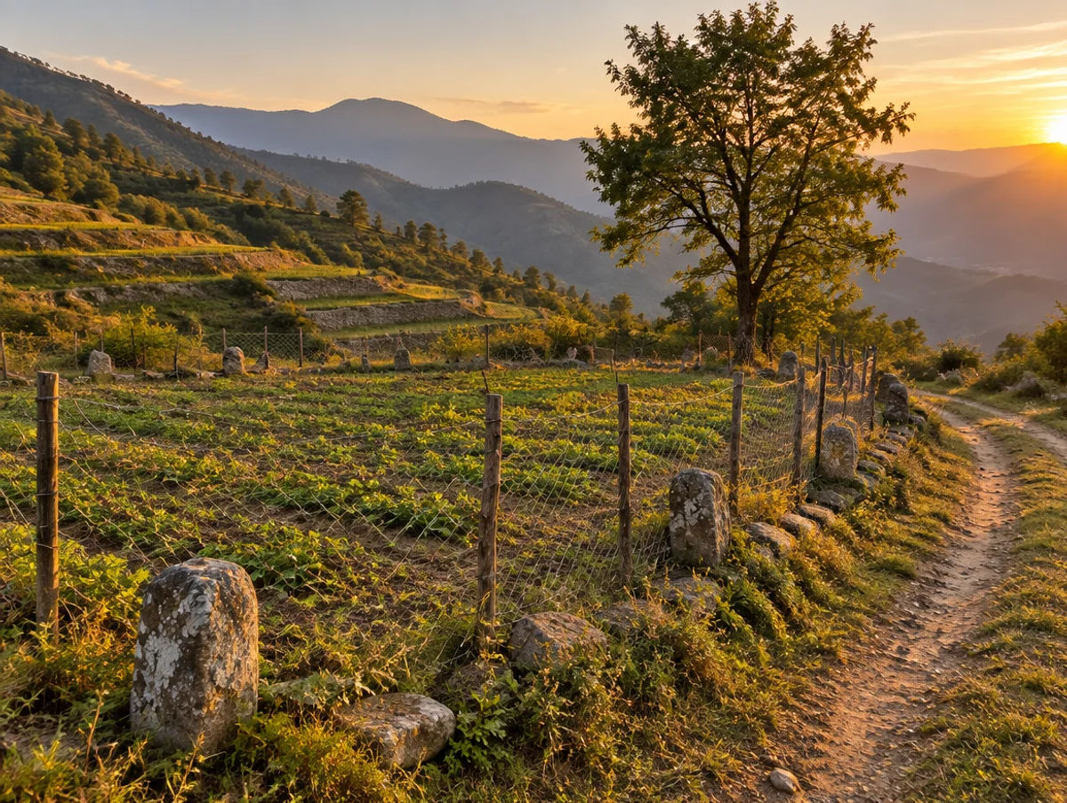
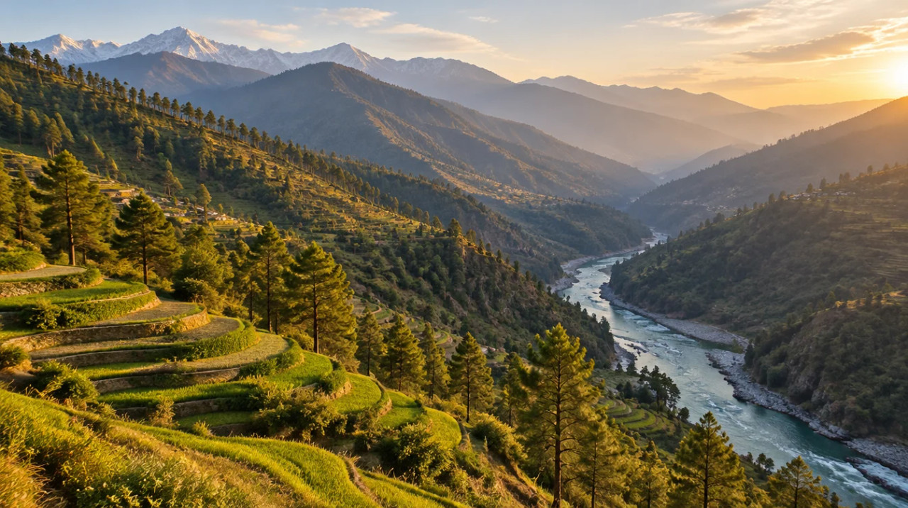
Terraced hill farms, a small fruit belt and a great deal of forest, with the plains at Kotdwar and the Alaknanda river valley around Srinagar; figures come from an undated ICAR plan.
The ICAR-CRIDA district plan (undated, using 2012-13 production data) gives a net sown area of 78,486 hectares, a gross cropped area of 110,875 hectares and a cropping intensity of 141.26%. The crops it lists include finger millet, barnyard millet, wheat, rice, barley, maize and pulses such as black gram, horse gram, lentil and arhar. It describes sub-temperate to temperate conditions at elevations of 1,000 to 2,500 m, though the district portal puts the lowest point at 295 m, so the plan's range does not cover the plains edge (ICAR-CRIDA Pauri Garhwal plan; district portal).
The plan lists apple on about 100 hectares and walnut on about 178 hectares (District agriculture contingency plan, Pauri Garhwal, ICAR-CRIDA). These are district totals, and a single parcel's suitability depends on altitude, aspect and water.
Forest covers about 385,100 hectares in the ICAR plan, roughly 57% of the 672,900 hectares it reports. The Kotdwar and Lansdowne belt adjoins Corbett and Rajaji, so forest boundaries and the pending eco-sensitive zones matter more than soil here. Ask the Divisional Forest Officer for written status on any foothill parcel.
The district portal gives annual rainfall of about 218 cm, roughly 90% of it in the monsoon from mid-June to mid-September (Geography, Pauri Garhwal district portal, October 2026), while the ICAR plan gives a normal of 1,232 mm; the two differ by station and period. The Alaknanda is the district's major river and the Nayar its main tributary. Hill farming here is mostly rainfed, so ask where a parcel's water comes from and who holds the right to it.
Hill land is quoted in nali, acres or sq yd. Farmland India uses 240 sq yd per nali as a working figure, but a nali varies by locality. Price a parcel on its location, access, title and permitted use, not on crop yield.
At a glance
| District / belt | Price evidence* | Evidence |
|---|---|---|
| Pauri Garhwal — district | No sourced price series | No Pauri circle-rate list found |
| Pauri Garhwal — Kotdwar industrial belt | Not a farmland benchmark | Sitabpur estate allotment rate ₹560 per sq m (undated) |
| Tehri Garhwal | Not sourced | See the Tehri Garhwal page |
| Dehradun | Not sourced | See the Dehradun page |
*No listing-site asking prices are used. See the Tehri Garhwal page, the Dehradun page and the Haridwar page for the plains side.
Farmland India view
Five reasoned points, with an honest note that outmigration makes land easy to find and hard to title cleanly.
Kotdwar has the district's only railway station and is the way into Corbett's Pakhro gate, about 200 km from Delhi on that route (MSME-DI profile; Down To Earth, February 2019). For a resident buyer that is the most accessible edge of the Garhwal hills.
The Rishikesh–Karnaprayag line is reported 78% complete and connects towns including Srinagar, but its target has moved from December 2028 to December 2029 between March and August 2026 (Swarajya, August 2026). It is optionality, not a basis for a premium.
HNB Garhwal University (central since 2009) and NIT Uttarakhand's campus in the Srinagar valley, and Lansdowne's cantonment, give those towns a standing population that most remote hill areas lack (About the university, HNB Garhwal University; About NIT Uttarakhand). The link to rental and small-plot demand is our inference, not a sourced figure.
The district's population fell 1.51% between 2001 and 2011, and statewide 1,792 villages are uninhabited (The Tribune, March 2023). That is supply, not demand, and it comes with fragmented heirs and pending mutations.
With eligibility under the 2025 law, pending forest zones, cantonment boundaries and title fragmentation all parcel-specific, a buyer who documents each point is better placed than one relying on a broker summary.
Confirm eligibility, forest-zone, cantonment and title status directly; these are not certified by Farmland India's review.
STRAIGHT TALK
Read these before shortlisting in Pauri Garhwal specifically.
A person who holds no land in Uttarakhand cannot buy agricultural or horticultural land in Pauri Garhwal under the 2025 Act (Act text). Residential purchase works through the 250 sq m affidavit. Confirm eligibility before paying an advance.
No final eco-sensitive-zone notification was found for Corbett or Rajaji, and the Supreme Court pressed the state and the ministry in March and November 2025. Get the forest boundary and the zone status in writing.
Empty houses and fields still have owners, often several heirs. A sale needs every co-owner, so check the khatauni, pending mutations and any power of attorney in the chain.
The ICAR plan covers drought, flood and hailstorm among the district's contingencies, and the Alaknanda and Nayar valleys carry river risk. Ask for flood and landslide history for any slope or river-side parcel.
Land inside the cantonment follows Cantonment Board and defence rules, and the Army limits activities in the town (Lansdowne, Incredible India (Ministry of Tourism)). We found no Pauri-specific notification on nearby plots.
We found no price series and no Pauri circle-rate list. Collect registered sale deeds from the same village before negotiating.
The rail line's target moved to December 2029, the Kotdwar bypass has a sanction and a tender but no award found, and the eco-sensitive zones are not notified. Price on today's roads.
Who to contact
Mutation and revenue-record matters go through the Tehsildar of the relevant tehsil, such as Kotdwar, Pauri, Srinagar or Lansdowne (the district portal lists nine tehsils, Geography, Pauri Garhwal district portal, October 2026), and the SDM and District Magistrate handle land-revenue matters. Sale-deed registration is handled by the local Sub-Registrar, and the Stamps and Registration Department publishes its fee sheet and notification index. The Divisional Forest Officer confirms forest and eco-sensitive-zone status, and the Cantonment Board at Lansdowne confirms boundary and defence conditions. Land records are on Bhulekh Uttarakhand, so ask the tehsil for a certified copy.
DEVELOPER PROJECTS · TRUST SCORE
Developer projects carry the platform Trust Score and a reviewed document set.
Reviewed projects have completed Farmland India's document and site review. Individual land parcels are listed by their owners and are not reviewed to the same standard. Always complete your own legal due diligence.
COMMON QUESTIONS
Everything buyers, NRIs and investors ask before their first reviewed farmland purchase in Pauri Garhwal.
Visit full wiki01 of 04
Not if you hold no land in Uttarakhand. Since 1 May 2025 the Act allows such a purchase only in Haridwar and Udham Singh Nagar, with state sanction, and Pauri Garhwal is one of the other 11 districts. Residential land works through an affidavit that neither the buyer nor family has bought more than 250 sq m elsewhere in the state; confirm the details with the Sub-Registrar.
02 of 04
We have no sourced price series and found no circle-rate list for the district. The one dated figure is an allotment rate of ₹560 per sq m at the Sitabpur industrial estate in Kotdwar, in an undated MSME-DI profile, which is not a farmland benchmark. Ask the Sub-Registrar for the village rate and collect registered sale deeds.
03 of 04
Abandoned land still has legal owners, often several heirs or absentee holders. The migration commission counts 1,792 uninhabited villages in the state, and Pauri had 5,474 permanent migrants between January 2018 and September 2022, the third-highest of any district. Check the khatauni history, pending mutations and every co-owner's consent, and avoid power-of-attorney sales.
04 of 04
The Rishikesh–Karnaprayag rail line is reported 78% complete with a December 2029 target. The Kotdwar bypass has a sanction and a 2026 tender but no award found. We found no final eco-sensitive-zone notification for Corbett or Rajaji, so ask the Divisional Forest Officer for the boundary near Kotdwar and Lansdowne.
Ready to look at what is available?
Browse reviewed listingsTransparency
Law and courts
Government
News
Further reading
Data-currency note: census figures reflect 2011, and the population is from an undated MSME-DI profile. The ICAR plan is undated and uses 2012-13 production data. Rainfall differs between the district portal and the ICAR plan. Rail, bypass and eco-sensitive-zone items were read in October 2026 and change quickly. We found no Pauri Garhwal circle-rate list and no sourced price series. This is a general guide, not legal advice. Report inaccuracies to wiki@farmlandindia.com.
For developers
Browse reviewed projects and individual land parcels across Pauri Garhwal — or if you own land here, list it with platform review and reach serious buyers.
Farmland India ("the Platform"), operated by Bulk Procure Private Limited, is a digital marketplace for listing agricultural land, farmhouse and plotted development projects. The Platform is not a real estate broker, agent or intermediary under RERA or any other applicable law, and does not act for either party to a transaction.
Listings are submitted by developers, owners and their authorised representatives. Before publication, the Platform carries out a documentary review of the material supplied and records what was sighted. That review is limited to the documents made available to us at that time. It is not a title investigation, not a legal opinion, and not a warranty of title, approvals, or the accuracy of any information supplied by a lister. The Trust Score is an internal assessment produced from that review and is intended as a research aid, not as a guarantee of outcome.
Every buyer must carry out independent due diligence before any transaction — including verification of land records, encumbrance searches, approvals and regulatory compliance — through their own advocate and chartered accountant. Any legal or advisory professional introduced through the Platform is engaged directly by the user, on that professional's own terms; the Platform does not employ, supervise or accept responsibility for their work.
Nothing on the Platform is investment advice. Land values can fall as well as rise. The Platform is not liable for any loss, dispute or damage arising from a transaction between parties.