
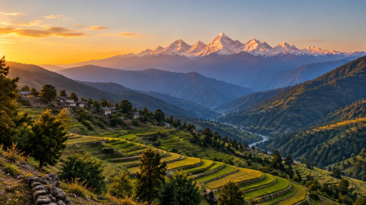
District guide
Buying Land in Pithoragarh
A Nepal and Tibet border district with Munsiyari, Dharchula and the Kailash route: outside buyers kept off agricultural land, border and forest checks, and no sourced prices.
Nepal (east), Tibet (north)
Borders
4.83 lakh
Population (Census 2011)
None found
Sourced price series
Alliance Air to Dehradun, Mar 2026
Naini Saini airport
*Indicative range across districts and land types. Stamp duty, registration and conversion charges are additional. Local measurement units vary — every listing states the unit it is priced in. Not a valuation or an offer.
Bhulekh UK — Uttarakhand Land Records PortalDistrict land record — Pithoragarh
Rev. 2026 · Farmland India desk
State
Uttarakhand (Kumaon division)
District headquarters
Pithoragarh
Tehsils (reported)
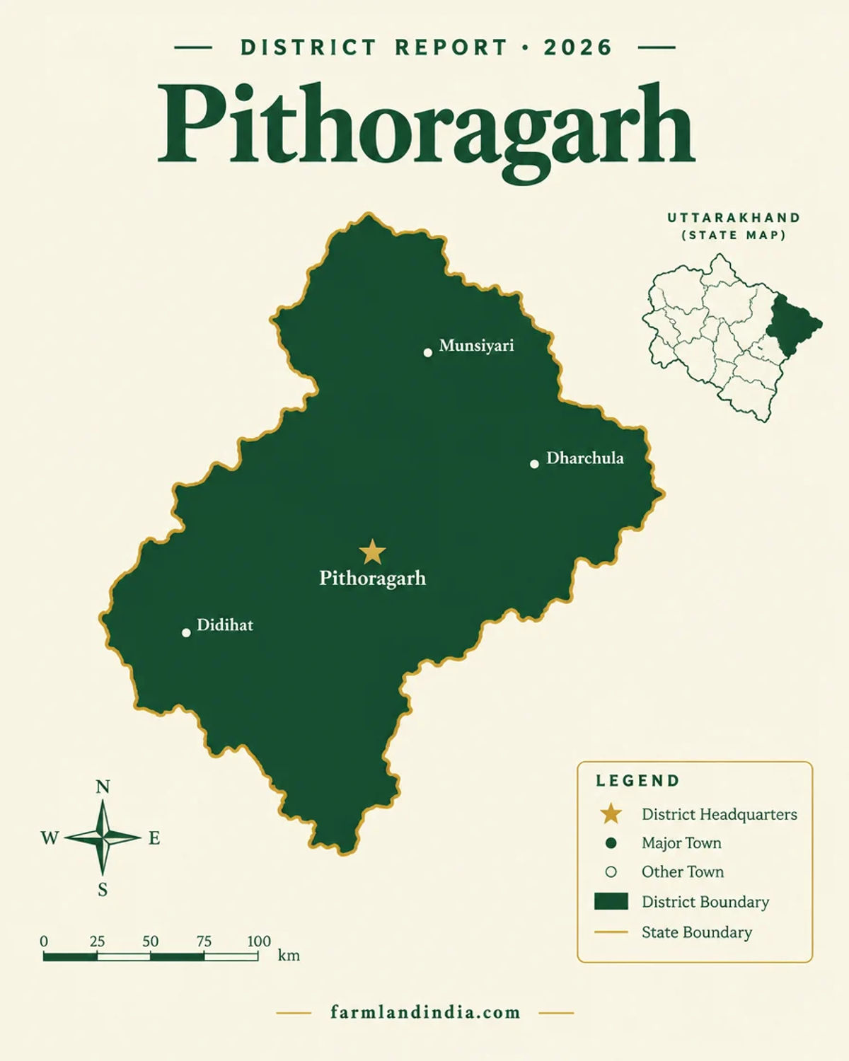
Pithoragarh · Munsyari · Dharchula · Didihat · Berinag · Gangolihat · Ganai Gangoli · Bangapani (as listed on the district portal)
Key places
Pithoragarh · Munsiyari · Dharchula · Didihat · Berinag · Jauljibi · Gangolihat (places named on the district portal)
Buyer access
Agricultural land: a person not already holding land in Uttarakhand can buy only in Haridwar and Udham Singh Nagar, with state sanction (Act 11 of 2025); residential land carries a 250 sq m affidavit condition
Borders
Nepal to the east (Kali river) and Tibet to the north (district portal)
Demand anchors
Kailash Mansarovar and Adi Kailash routes · Munsiyari and Panchachuli tourism · Naini Saini airport
Size and population
About 7,218 sq km (district portal; other documents give 7,090 to 7,110) · 4.83 lakh people (Census 2011, Chief Electoral Officer, Uttarakhand)
Pricing unit
Rs per nali or per sq yd when a quote gives one; no sourced price on this page
Local units
Nali: Farmland India working value of 240 sq yd (about 200 sq m), with no official conversion found; check the area in the khatauni and the deed
Land records portal
Bhulekh Uttarakhand (state land-records portal; it did not open for us, so ask the tehsil for a certified copy)
Land law is state law. These rules are maintained on the Uttarakhand page and apply to every district within it.
Pithoragarh — land purchase legal rules
⚠ Uttarakhand limits who can buy agricultural and horticultural land. Check who you are, which district the land is in, and how it is recorded before anything else.
Who can buy agricultural land? Since 1 May 2025, a person who does not already hold land in Uttarakhand can buy agricultural or horticultural land only in Haridwar and Udham Singh Nagar, and only with prior sanction from the state government (Uttarakhand Act 11 of 2025). Press coverage describes this as a bar in 11 of the 13 districts (Scroll, February 2025); the Act names the two districts and does not count the rest. Buying through a nominee is a compliance risk, and a transfer made on a false affidavit is void under the Act.
The 2025 land law amendment: The Assembly passed the bill on 21 February 2025 (Scroll, February 2025). The Governor gave assent on 30 April 2025, and the Act was notified and took effect on 1 May 2025 (Act text; PTI via The Week, May 2025). The power to allow purchases moved from the District Magistrate to the state government (Business Standard, February 2025). The Chief Minister said land bought on false declarations can vest in the state, and cited 1,883 approvals since 2018 with 599 violations found (Scroll, February 2025).
Haridwar and Udham Singh Nagar: These are the only districts where sanction for such a purchase is possible, and sanction is not automatic. The buyer gives an affidavit that the land will be used only for the stated agricultural or horticultural purpose and must put it to that use within three years or an extended period; a change of use makes the transfer void (Act text). The general power to allow transfers above the ceiling, earlier reported as 12.5 acres, is now confined to these two districts and sits with the state government, which acts on an essentiality certificate (Act text; Business Standard, February 2025). Ask the revenue department which office takes sanction applications before paying a token amount.
Residential land for non-residents: The Act lets a buyer file an affidavit that neither he nor his family has bought more than 250 sq m of land elsewhere in the state for residential use; a false affidavit voids the transfer (Act text; Scroll, February 2025). The text we read does not settle whether 250 sq m is a lifetime count across the family, or how the rule works inside municipal limits, which the Act's extent clause excludes, so take both questions to the Sub-Registrar in writing.
Land-use declaration (Section 143): Section 143 of the parent Act (UP Zamindari Abolition and Land Reforms Act, 1950) deals with declaring agricultural land for other uses, such as a house or farmhouse. We have not re-read the section for this edition, so ask the Sub-Divisional Magistrate which declaration applies before building. Check the land's classification in the khatauni, not in the seller's brochure.
Forest, van panchayat and eco-sensitive land: Land recorded as forest cannot be freely sold or converted, and land near Corbett, Rajaji and other protected areas can fall inside an eco-sensitive zone with construction limits. In November 2025 the Supreme Court directed that zones around tiger reserves be notified within a year (The Week/PTI, November 2025). A plot that looks like farmland can be recorded differently, so ask for the revenue record and the forest position in writing.
NRI & OCI buyers: FEMA 1999 bars NRIs and OCIs from buying agricultural land, plantation land or farmhouse land anywhere in India, Uttarakhand included. That is a central rule, not a state one, and the state Act adds its own conditions on top; read the current RBI notification for the exact wording.
- Purchase: Haridwar & USN only
- State sanction required
- Residential: 250 sq m affidavit
- Section 143 land use
- ESZ & forest checks
- NRI agri: barred (FEMA)
- Act 11 of 2025
Pithoragarh — district-specific notes
The statewide Uttarakhand framework (2025 Act, Section 143 land use, forest and eco-sensitive land, NRI limits) applies to Pithoragarh in full. The notes below are specific to this Nepal and Tibet border district and are not repeated from the state page.
⚠ Since 1 May 2025 a person who does not already hold land in Uttarakhand can buy agricultural or horticultural land only in Haridwar and Udham Singh Nagar, and only with prior sanction from the state government (Uttarakhand Act 11 of 2025). Pithoragarh is not one of the two; press coverage describes the bar as covering 11 of the 13 districts (Scroll, February 2025). The Governor assented on 30 April 2025 and the law took effect on 1 May 2025 (PTI via The Week, May 2025). For residential use the buyer files an affidavit that neither he nor his family has bought more than 250 sq m of land elsewhere in the state, and a false affidavit voids the transfer. The text we read does not define a resident, settle whether the 250 sq m count is lifetime and family-wide, or say how the rule works inside municipal limits, so take all three to a local advocate in writing before paying a deposit.
⚠ NRIs and OCIs cannot buy agricultural land, plantation land or a farmhouse, and citizens of Nepal and Bhutan need the Reserve Bank's prior permission to acquire or transfer immovable land in India, with an exception for OCIs and for leases of up to five years (RBI FAQ on immovable property, opened October 2026). These are central-law bars that apply on top of the state Act.
⚠ Pithoragarh is the easternmost Himalayan district of Uttarakhand, with Tibet to the north and Nepal to the east along the Kali river, and its portal lists strategic passes to Tibet including Lipulekh (district portal). We found no central law creating a purchase ban or construction belt along the Indo-Nepal border and no Nepal-specific land rule from the Uttarakhand government; absence of a source is not proof, so ask the District Magistrate about any local order. Permit rules for visiting Dharchula, Munsiyari and the high border valleys were not researched, so check them before planning any visit that is tied to a purchase.
⚠ The Daily Pioneer (URL dated 2021) reports that the Union Environment Ministry notified an eco-sensitive zone for Askot Wildlife Sanctuary on 3 December, keeping more than 111 villages (about 146 sq km) out of the zone; the article gives no year and no total zone area (Daily Pioneer). The Ministry's expert committee had deferred the proposal at the state's request on 3 June 2019 (MoEFCC minutes, June 2019). We have not read the notification, so ask the Divisional Forest Officer to place the khasra relative to the zone.
⚠ The district industrial profile lists 205,239 hectares of forest in a total area of 410,638 hectares (2006-07), with permanent pasture of about 54,000 hectares in its undated table (DIPSR, Pithoragarh). Land classified as forest cannot be bought or converted, and community land such as pasture and van panchayat areas needs a record check we did not carry out.
⚠ The proposed 5,040 MW Pancheshwar dam on the Mahakali at the Uttarakhand-Nepal border would submerge about 11,600 hectares, around 7,600 of them in Uttarakhand, and affect about 30,000 families in 62 villages; public hearings were held in Pithoragarh on 11 August 2017 (Dialogue Earth, August 2017). Which villages fall inside the acquisition or submergence zone is not confirmed, so check any parcel near the Kali or Saryu valleys against acquisition notices before paying.
Read the Uttarakhand land buying guide, the Bhu Kanoon 2025 explainer and the Section 143 conversion note for buyer eligibility, conversion and NRI rules. For the Nepal-border points see the Champawat page.
- 2025 Act: Haridwar & USN only
- Nepal and Tibet border
- Askot eco-sensitive zone
- Forest and pasture land
District overview
Pithoragarh — India’s Nepal and Tibet border district in the Kumaon Himalaya
Pithoragarh is the easternmost Himalayan district of Uttarakhand, in the Kumaon division. The district portal gives an area of 7,217.7 sq km, eight tehsils (Munsyari, Dharchula, Didihat, Gangolihat, Pithoragarh, Berinag, Ganai Gangoli and Bangapani) and ten development blocks (district portal); the 2011 Census population was 483,439 (Chief Electoral Officer, Uttarakhand). The older industrial profile lists six tehsils, eight blocks and 1,672 villages (DIPSR, Pithoragarh), so counts differ by source. The northern and eastern boundaries are international.
The district is known for tourism and pilgrimage rather than farming. Munsiyari and the Milam Glacier trail draw trekkers, Dharchula is the gateway for the Kailash Mansarovar route via Lipulekh Pass, and Adi Kailash is a tourism draw that a planned border road would bring closer (ETV Bharat, December 2025). Border tourism, including homestays and treks, is being pushed under the Vibrant Villages Programme (ETV Bharat, April 2026). Naini Saini airport near the town is back in the news: Alliance Air flagged off a Dehradun flight on 26 March 2026 (All India Radio, March 2026).
For a land buyer this is a legally narrow and thinly documented market. A buyer who does not already hold land in the state cannot buy agricultural land here under the 2025 Act, most of the area is forest or high pasture, and we found no price that could be traced to a registered sale. The price section is therefore empty on purpose, and the page spends its words on the border, the law and the airport and road projects that are still partly plans.
- Pithoragarh town
- Munsiyari
- Dharchula
- Didihat
- Berinag
- Nepal and Tibet border
Transaction costs
Stamp duty & registration in Pithoragarh
5%
Stamp duty — sale deed (general)
state e-registration fee schedule; confirm for the village
3.75%
Stamp duty — female buyer
up to ₹25 lakh, 5% above; confirm
2%
Registration fee
cap under revision, see note
The general sale-deed duty is 5%, with 3.75% for a female buyer up to ₹25 lakh and 5% above that, and the registration fee is 2% of the value (Stamps and Registration Department fee sheet, undated). The department's notification index (updated 18 November 2025) records a 16 November 2025 amendment replacing twenty-five thousand with fifty thousand in the registration fee table, so the ₹25,000 cap on the fee sheet may now be ₹50,000; get the current cap from the Sub-Registrar. We have not confirmed whether duty is charged on the higher of the deal value and the circle rate. The fee sheet also lists a 100% rebate for qualified disaster-affected beneficiaries in five districts, Pithoragarh among them; it is not a general-buyer concession, and the schedule does not state the conditions. The state directed district magistrates to revise circle rates from 5 October 2025; ETV Bharat, October 2025 gives 9% to 22% for Dehradun only, and we found no published Pithoragarh rate.
Know the belt
What is moving prices in Pithoragarh
Thin or no price evidence. Nothing below is a price; these are the market signals and checks we could source in October 2026.
No usable price series found
No sourced per-nali or per-acre figure
We found no price for Pithoragarh land that could be traced to a registered sale, so we publish none.
Check: the registered deed of a comparable plot in the same village before accepting any asking price.
Pithoragarh town and the airport side
No sourced band
The Airports Authority of India and the state signed a takeover memorandum on 9 November 2025 for the airport, a site of about 70 acres whose terminal handles 40 passengers at peak (ETV Bharat, November 2025). A scheduled flight is a demand signal for visitors, not evidence of a land price.
Check: whether the parcel falls inside any airport height or approach restriction, and the town's municipal status.
Munsiyari and the Panchachuli belt
No sourced band
Munsiyari and Dharchula have hotels, guest houses and homestays, and Panchachuli base camp and the Milam Glacier trail are promoted under the Vibrant Villages Programme (ETV Bharat, April 2026). PTI reported in August 2025 that a UDAN helicopter service to Munsyari was expected by 30 September and that Dharchula still needed land for a helipad (The Week/PTI, August 2025). Demand is seasonal and sites are remote.
Check: road access in monsoon, slope stability, and distance to any sanctuary or forest boundary.
Dharchula and the Kailash route
No sourced band
The Border Roads Organisation says the Lipulekh route is now largely vehicle-based (Asianet Newsable, July 2026), and the first 2026 batch had 49 pilgrims (IANS, July 2026). Pilgrim flows are seasonal, state-organised and small. A hill collapse near Tawaghat shut the Dharchula road in December 2024 (ETV Bharat, December 2024).
Check: permits, any defence or border-force notice, and flood and slide history along the Kali river.
Circle rates
Not found
We did not find a published Pithoragarh circle-rate list. The state directed district magistrates to revise circle rates from 5 October 2025, but the report we found gives Dehradun figures only.
Check: the rate in force for the village from the Sub-Registrar.
Units: nali and acre
Hill land in Kumaon is quoted in nali. Farmland India works with 1 nali = 240 sq yd (about 200 sq m), a working value with no official source, and other values circulate. Ask for the area in sq m or acres from the khatauni and convert every quote before comparing offers. See the nali to acre note.
Connectivity
How Pithoragarh connects — road, rail and air
Pithoragarh is reached by mountain road from the plains at Tanakpur, with a small airport at the district town. Distances and journey times were not sourced, so none are shown; check them on a current map and allow for landslide closures.
By road
By air
By rail
Every route into Pithoragarh and up to Munsiyari or Dharchula runs along slopes and rivers, so a plot that looks close on the map can be hours away in monsoon. Ask local people which road closes first. The full rules for buyers from outside the state are in the Uttarakhand land buying guide.
Growth catalysts
Upcoming infrastructure & developments
Status labels reflect sources opened in October 2026. Announced timelines are not guaranteed, and an item described as reported rests on one outlet.
02Operating or active
03Proposed or pending
Agriculture & terrain
Soil, crops & water in Pithoragarh
A high, steep and mostly forested district: small cultivated area, orchards in the mid-hills, mineral deposits and a dated evidence base.
🌾 Cultivated land and crops
The district industrial profile shows a net area sown of about 50,000 hectares, a total cropped area of about 79,300 hectares and only about 5,000 hectares irrigated, so most farming is rainfed on terraces (District industrial profile; year of land-use data not stated). We found no crop-area table, so we cannot rank crops.
- Rainfed terraces
- ~5,000 ha irrigated
- No crop table
- Dated data
🌲 Forest, pasture and minerals
The same profile shows about 215,000 hectares of forest and about 54,000 hectares of permanent pasture in its undated table, and lists limestone (950 million tonnes), dolomite (200), magnetite (180) and soapstone (160) among mineral resources. Mining leases and quarries can sit close to farmland, so ask whether a parcel borders a lease or a forest boundary.
- Forest
- Pasture
- Limestone
- Magnetite
🏔️ Rivers, glaciers and hazards
The Kali river forms the Nepal boundary, and the Milam Glacier trail runs about 60 km from Munsiyari (ETV Bharat, April 2026). A hill collapse near Tawaghat shut the Dharchula road in December 2024 (ETV Bharat), and heavy rain in August 2025 closed 28 roads and cut off the whole Munsiyari tehsil (Dynamite News). Ask for the history and the slope condition of every plot, and avoid river-edge and drain-side sites.
- Kali river
- Milam glacier
- Landslide
- Border valleys
💧 Water & rainfall
We did not find a rainfall or groundwater figure for Pithoragarh in the sources opened; the industrial profile gives no rainfall and a CGWB district brochure was not retrieved. Hill supply is usually springs and pipe schemes, so check the water source and any shared-spring rights for a plot.
📐 Measurement units & markets
Hill land is quoted in nali; Farmland India works with 1 nali = 240 sq yd as an unofficial working value. Wholesale prices for nearby markets are published on the Agmarknet portal. Crop income on small terraces is modest, so a buyer is paying for location, access and permitted use, and the permitted-use question is the hard one.
At a glance
Pithoragarh vs. its neighbours
| District / belt | Price band (per acre or nali) | Evidence |
|---|---|---|
| Pithoragarh | No sourced band | No price evidence found; outside buyers limited to Haridwar and Udham Singh Nagar for agricultural land |
| Champawat | No sourced band | Not priced here; same position under the Act |
| Bageshwar | No sourced band | Not priced here; same position under the Act |
| Almora | No sourced band | Not priced here; same position under the Act |
Under the Act text only Haridwar and Udham Singh Nagar allow sanctioned purchase of agricultural land by a person not already holding land in the state; press describes the rest as 11 districts (Scroll, February 2025). None of the districts above has a sourced price on this page, so the table compares legal access only. See the Champawat page for the Tanakpur side and the Almora page for the mid-hills.
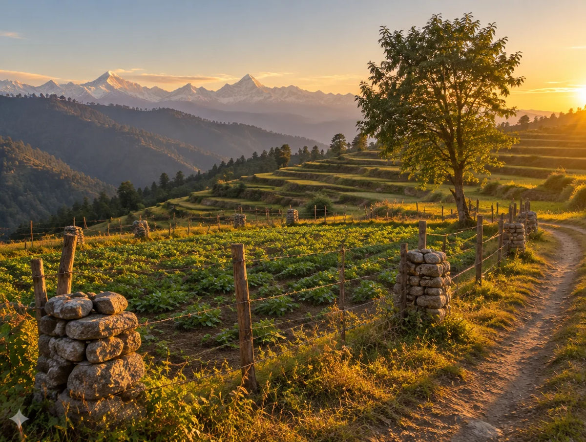
Farmland India view
Why investors look at Pithoragarh
Five reasoned points, with an honest note that price evidence is missing and that eligibility and access decide most outcomes.
A border district with national attention
Border roads, the Kailash route and the Vibrant Villages Programme are bringing infrastructure and tourism attention to Munsiyari and Dharchula. That can support homestay demand, but it is seasonal, permit-linked and remote, and we have no price evidence for it.
A small airport that is working again
Operational responsibility for Naini Saini has been assigned to the Airports Authority of India and Alliance Air flagged off a Dehradun flight in March 2026. Past suspensions mean this desk treats it as access that may improve, not as a basis for paying a premium.
Projects are real but unscheduled
The Tanakpur highway has an unconfirmed completion status, the border road awaits Home Ministry approval and Pancheshwar is unresolved. Price on today's roads.
Eligibility is narrow, so be clear who you are
A person who does not already hold land in the state can buy agricultural land only in Haridwar and Udham Singh Nagar, so not in Pithoragarh; residential land carries a 250 sq m affidavit condition, and NRIs cannot buy agricultural or farmhouse land. Citizens of Nepal need RBI permission. A buyer outside these categories should not proceed on a broker's assurance.
A market that rewards paperwork
Forest and eco-sensitive status, slope and flood history, water source, border position and permitted use are all parcel-specific. A buyer who documents each one is better placed than one relying on a summary. The case is long-term and location-led, not a yield story.
Check eligibility under the 2025 Act, forest and eco-sensitive status and the border position directly; these are not certified by Farmland India's review.
STRAIGHT TALK
Risks & challenges in Pithoragarh
Read these before shortlisting in Pithoragarh specifically.
Outsider bar on agricultural land
The 2025 Act allows a person not already holding land in the state to buy agricultural land only in Haridwar and Udham Singh Nagar (Act text). Pithoragarh is not one of the two. Settle the buyer's category before any advance.
Border position and permits
The district borders Nepal and Tibet. We found no purchase ban, but permit rules for Dharchula and Munsiyari were not researched and defence or border-force notices may exist. Ask the District Magistrate before paying for a border-side plot.
Eco-sensitive and forest land
A zone for Askot sanctuary was reported as notified with over 111 villages kept out, and the industrial profile lists forest on about half of the district's area. Forest land cannot be bought or converted, so ask the Divisional Forest Officer to place the khasra.
Landslides and remote access
Every route runs along slopes and rivers: a hill collapse shut the Dharchula road near Tawaghat in December 2024, and heavy rain closed 28 roads in August 2025. Ask for slide history on every plot and get road access in writing.
Pancheshwar acquisition zone
Land-acquisition plans for the dam are long-standing, and which Pithoragarh villages are affected is not confirmed. Ask for any acquisition notice before paying near the Kali or Saryu valleys.
Thin market and no price evidence
We found no price that could be traced to a registered sale. Collect registered comparables before negotiating, and treat any quote as an asking price.
Announced is not delivered
The airport has stopped and restarted before, the helicopter routes are single-source, and the highway and border road are unconfirmed or awaiting approval. Price on today's access.
Who to contact
Local revenue, planning & forest offices
Mutation and revenue-record matters go through the Tehsildar of the relevant tehsil (Pithoragarh, Munsyari, Dharchula, Didihat, Gangolihat, Berinag, Ganai Gangoli or Bangapani, as listed by the district portal), and the District Magistrate's office at Pithoragarh handles revenue orders and any border-area notices. Sale-deed registration is handled by the local Sub-Registrar, who can state the circle rate and stamp duty for a village. The Divisional Forest Officer confirms forest, sanctuary and eco-sensitive status. Check the record on Bhulekh Uttarakhand (see our Bhulekh guide). Office addresses were not checked for this page.
COMMON QUESTIONS
Frequently asked questions
Everything buyers, NRIs and investors ask before their first reviewed farmland purchase in Pithoragarh.
Visit full wiki01 of 04
Can an outsider buy agricultural land in Pithoragarh?
No, on the Act text we read. Since 1 May 2025 a person who does not already hold land in Uttarakhand can buy agricultural or horticultural land only in Haridwar and Udham Singh Nagar, with prior state sanction (Uttarakhand Act 11 of 2025). Pithoragarh is not one of the two. NRIs and OCIs cannot buy agricultural land, and citizens of Nepal and Bhutan need the Reserve Bank's prior permission for immovable land in India.
02 of 04
Are there extra rules near the Nepal and Tibet borders?
We found no central law or Uttarakhand rule that bans purchase or sets a construction belt along the Nepal border, but absence of a source is not proof. Visits to the high passes toward Tibet are a permit matter, not a land rule, and we did not research those permits. Ask the District Magistrate about any local order before paying for a border-side plot.
03 of 04
What are stamp duty and registration charges in Pithoragarh?
The Stamps and Registration Department's fee sheet gives 5% stamp duty on a sale deed, 3.75% for a female buyer up to ₹25 lakh and 5% above that, and a 2% registration fee. It also lists a rebate for disaster-affected individuals in Pithoragarh and four other districts. The fee cap was changed by a 16 November 2025 amendment, so get the current figure from the Sub-Registrar.
04 of 04
Is there a working airport in Pithoragarh?
Naini Saini airport is run by the Airports Authority of India, and an Alliance Air flight to Dehradun was flagged off on 26 March 2026 (All India Radio). Service has stopped and restarted before, so check the current schedule before relying on it. The Rs 450 crore expansion figure comes from a single report and is not confirmed.
Ready to look at what is available?
Browse reviewed listingsTransparency
Sources and references
Law and courts
Government
- Stamp duty and registration fee sheet, Stamps and Registration Department (undated), opened October 2026
- Stamp duty and registration fee notifications, Stamps and Registration Department, page updated 18 Nov 2025
- FAQs on immovable property (NRIs, OCIs, citizens of Nepal and Bhutan), Reserve Bank of India, opened October 2026
- Pithoragarh district portal (area, tehsils, blocks, borders, places), opened October 2026
- Statistical data for Pithoragarh (2011 Census total), Chief Electoral Officer, Uttarakhand
- District Industrial Profile, Pithoragarh (land use, minerals, rail), MSME Development Institute
- Minutes of the 35th ESZ Expert Committee, 3 Jun 2019 (Askot deferred), MoEFCC
News
- Uttarakhand Assembly clears bill to restrict outsiders from buying agricultural land, Scroll, Feb 2025
- Strict land law comes into force in Uttarakhand, PTI via The Week, 1 May 2025
- Uttarakhand revises circle rates, ETV Bharat, 6 Oct 2025
- Askot Wildlife Sanctuary declared eco-sensitive zone, Daily Pioneer (URL dated 2021)
- Minister flags off Alliance Air flight connecting Pithoragarh and Dehradun, All India Radio, 26 Mar 2026
- AAI to take over Naini Saini airport, ETV Bharat, 9 Nov 2025
- Uttarakhand airstrips and expansion plans, The Week/PTI, 26 Aug 2025
- Naini-Saini airport resumes flight operations, Indian Infrastructure, 1 Feb 2024
- Vibrant Villages scheme to boost border tourism in Uttarakhand, ETV Bharat, 22 Apr 2026
- Dhami flags off first batch of Kailash Mansarovar Yatra pilgrims from Tanakpur, IANS, 5 Jul 2026
- BRO upgrades Kailash Mansarovar route, Asianet Newsable, 5 Jul 2026
- Kailash Manasarovar Yatra set to resume in June 2025, The Tribune, 26 Apr 2025
- Centre sanctions Rs 15.57 billion for Tanakpur–Pithoragarh national highway, Indian Infrastructure, 7 Jun 2017
- Centre sanctions Rs 1,557 crore for NH 125 in Kumaon, Millennium Post, 1 Jun 2017
- MoRTH clears Rs 318 crore for NH project in Uttarakhand, NBM&CW, 27 Mar 2023
- Landslide on Dharchula–Tawaghat road, ETV Bharat, 21 Dec 2024
- Heavy rain leads to landslide in Pithoragarh; 28 roads closed, Dynamite News, 3 Aug 2025
- SSB approves alignment of strategic Tanakpur–Jauljibi road, ETV Bharat, 28 Dec 2025
- Uttarakhand is building a dam over an area larger than Chandigarh, Dialogue Earth, 28 Aug 2017
- Nepal–India joint water resources committee meeting in September, Kantipur, 7 Aug 2026
Further reading
- Uttarakhand Act 11 of 2025, the full amendment text
- Stamp duty and registration fee sheet, Stamps and Registration Department
- Stamps and Registration Department, notification index
- Reserve Bank of India, FAQs on immovable property
- Pithoragarh district portal
- MSME-DI district industrial profile, Pithoragarh
- Land, livelihood and the future of Uttarakhand's hills, The Wire, 3 Mar 2025
- Tanakpur–Jauljibi border road alignment, ETV Bharat
- Vibrant Villages Programme in Uttarakhand, ETV Bharat
- Pancheshwar dam and the Uttarakhand hearings, Dialogue Earth
- Tanakpur–Bageshwar rail DPR, NBM&CW
- Supreme Court on eco-sensitive zones around tiger reserves, The Week/PTI, 17 Nov 2025
Data-currency note: the 2011 Census total comes from an election-office statistics file, and area and block counts differ between the district portal and the older industrial profile. Land-use and mineral figures come from that profile, with a 2006-07 reference year for part of it. Land-law points rest on the Act text, which is a scanned copy and should be checked against the Gazette. The Askot zone report gives no year in its text, and airport, road and dam items are reported by the outlets named and change quickly. The Sub-Registrar must confirm the registration fee cap and the Bhulekh record for any parcel. No price figures are given because none could be sourced. This is a general guide, not legal advice. Report inaccuracies to wiki@farmlandindia.com.
For developers
Ready to explore Pithoragarh farmland?
Browse reviewed projects and individual land parcels across Pithoragarh — or if you own land here, list it with platform review and reach serious buyers.