
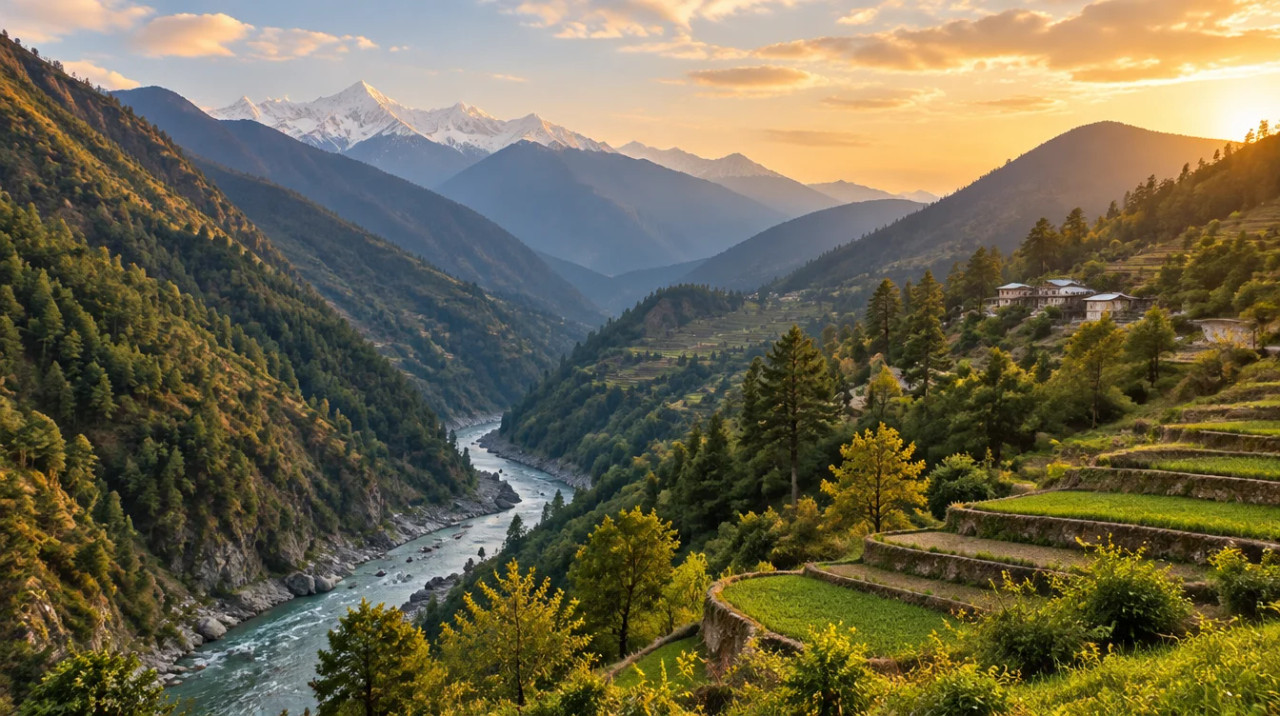
District guide
Buying Land in Rudraprayag
Kedarnath district at the Alaknanda–Mandakini confluence: the 2025 Act's farmland rule, sanctuary and river-setback checks, 2013-type flood and landslide risk, and no sourced prices.
~2,430 sq km (sources differ)
Area
2.42 lakh
Population (Census 2011)
12.9 km, approved Mar 2025
Kedarnath ropeway
None found
Sourced prices
*Indicative range across districts and land types. Stamp duty, registration and conversion charges are additional. Local measurement units vary — every listing states the unit it is priced in. Not a valuation or an offer.
Bhulekh UK — Uttarakhand Land Records PortalDistrict land record — Rudraprayag
Rev. 2026 · Farmland India desk
State
Uttarakhand
Administration
Rudraprayag (headquarters); district formed 16 September 1997 from parts of Chamoli, Tehri and Pauri (district court portal)
Key markets
Rudraprayag town · Agastyamuni · Ukhimath · Guptkashi · Sonprayag · Chopta
Demand anchors
Kedarnath pilgrimage · Madhyamaheshwar and Tungnath circuits · Chopta trekking · Alaknanda–Mandakini confluence
Rail
No station yet; Rudraprayag town is among those the Rishikesh–Karnaprayag line (under construction) is to connect
Size and population
~2,430 sq km (CGWB 2,439; IndiaStat lists 1,984) · 2.42 lakh people (Census 2011)
Pricing unit
No sourced price series; hill plots are normally quoted per nali or sq yd
Local units
1 nali = 240 sq yd (Farmland India working figure; local usage varies, read the khatauni)
Land records portal
Bhulekh Uttarakhand (state land records; portal not opened for this page)
Land law is state law. These rules are maintained on the Uttarakhand page and apply to every district within it.
Rudraprayag — land purchase legal rules
⚠ Uttarakhand limits who can buy agricultural and horticultural land. Check who you are, which district the land is in, and how it is recorded before anything else.
Who can buy agricultural land? Since 1 May 2025, a person who does not already hold land in Uttarakhand can buy agricultural or horticultural land only in Haridwar and Udham Singh Nagar, and only with prior sanction from the state government (Uttarakhand Act 11 of 2025). Press coverage describes this as a bar in 11 of the 13 districts (Scroll, February 2025); the Act names the two districts and does not count the rest. Buying through a nominee is a compliance risk, and a transfer made on a false affidavit is void under the Act.
The 2025 land law amendment: The Assembly passed the bill on 21 February 2025 (Scroll, February 2025). The Governor gave assent on 30 April 2025, and the Act was notified and took effect on 1 May 2025 (Act text; PTI via The Week, May 2025). The power to allow purchases moved from the District Magistrate to the state government (Business Standard, February 2025). The Chief Minister said land bought on false declarations can vest in the state, and cited 1,883 approvals since 2018 with 599 violations found (Scroll, February 2025).
Haridwar and Udham Singh Nagar: These are the only districts where sanction for such a purchase is possible, and sanction is not automatic. The buyer gives an affidavit that the land will be used only for the stated agricultural or horticultural purpose and must put it to that use within three years or an extended period; a change of use makes the transfer void (Act text). The general power to allow transfers above the ceiling, earlier reported as 12.5 acres, is now confined to these two districts and sits with the state government, which acts on an essentiality certificate (Act text; Business Standard, February 2025). Ask the revenue department which office takes sanction applications before paying a token amount.
Residential land for non-residents: The Act lets a buyer file an affidavit that neither he nor his family has bought more than 250 sq m of land elsewhere in the state for residential use; a false affidavit voids the transfer (Act text; Scroll, February 2025). The text we read does not settle whether 250 sq m is a lifetime count across the family, or how the rule works inside municipal limits, which the Act's extent clause excludes, so take both questions to the Sub-Registrar in writing.
Land-use declaration (Section 143): Section 143 of the parent Act (UP Zamindari Abolition and Land Reforms Act, 1950) deals with declaring agricultural land for other uses, such as a house or farmhouse. We have not re-read the section for this edition, so ask the Sub-Divisional Magistrate which declaration applies before building. Check the land's classification in the khatauni, not in the seller's brochure.
Forest, van panchayat and eco-sensitive land: Land recorded as forest cannot be freely sold or converted, and land near Corbett, Rajaji and other protected areas can fall inside an eco-sensitive zone with construction limits. In November 2025 the Supreme Court directed that zones around tiger reserves be notified within a year (The Week/PTI, November 2025). A plot that looks like farmland can be recorded differently, so ask for the revenue record and the forest position in writing.
NRI & OCI buyers: FEMA 1999 bars NRIs and OCIs from buying agricultural land, plantation land or farmhouse land anywhere in India, Uttarakhand included. That is a central rule, not a state one, and the state Act adds its own conditions on top; read the current RBI notification for the exact wording.
- Purchase: Haridwar & USN only
- State sanction required
- Residential: 250 sq m affidavit
- Section 143 land use
- ESZ & forest checks
- NRI agri: barred (FEMA)
- Act 11 of 2025
Rudraprayag — district-specific notes
The full Uttarakhand legal framework (inherited from the state record) applies to Rudraprayag in full. The notes below are specific to this district and are not repeated from the state page. This is a pilgrimage district with a severe disaster history, so read the risk notes before the price notes.
⚠ Uttarakhand Act No. 11 of 2025 amends the Uttar Pradesh Zamindari Abolition and Land Reforms Act, 1950 as applied in the state. The Governor assented on 30 April 2025 and the Act was notified on 1 May 2025 (Act text, Government of Uttarakhand; The Week/PTI, May 2025). As amended, agricultural and horticultural land can be bought only in Haridwar and Udham Singh Nagar, with prior state government sanction and an affidavit that it will be used for that purpose, so a buyer who does not already hold land in the state has no sanction route for farmland in Rudraprayag. Press coverage counts Rudraprayag among the 11 of 13 districts where the restriction applies (Scroll, February 2025; National Herald, March 2025). For residential land the Act requires an affidavit that neither the buyer nor the family has bought more than 250 sq m of land elsewhere in the state for residential use, and a false affidavit voids the transfer; Scroll reads this as non-residents still being able to buy up to 250 sq m for a home. We read the Government copy of the Act as a scanned PDF with text errors, so have a local advocate check section 154, the position of buyers who already hold land in the state, and whether municipal limits fall outside the Act (its extent clause leaves them out) before you pay a deposit.
⚠ NRIs and OCIs cannot buy agricultural land, plantation land or a farm house under the RBI Master Direction on immovable assets under FEMA, and citizens of Nepal and Bhutan need prior RBI permission to acquire immovable assets in India, apart from leases of up to five years. These are central-law bars that apply on top of the state Act.
⚠ Much of the Kedarnath valley and the Chopta–Tungnath belt sits inside protected forest. The Kedarnath Wildlife Sanctuary covers 975.20 sq km across Chamoli and Rudraprayag, was established in 1972 and rises from 1,160 m to 7,068 m (Wildlife Institute of India). In December 2015 the National Green Tribunal told the state to propose an eco-sensitive-zone notification for the sanctuary (India Environment Portal, December 2015); we did not find a final notification. Ask the Divisional Forest Officer for a written reading of any parcel near Chopta, Ukhimath or the Mandakini valley, including whether it falls inside the sanctuary or a forest or van panchayat area; we did not read the rules that govern sale and building there.
⚠ Twenty days after the June 2013 floods the then chief minister called for a ban on residential and commercial construction in low-lying areas along rivers, and an unnamed official put the setback at 200 m; the order was still verbal (Down To Earth, 2 July 2013). We found no written order, so ask the Revenue and Irrigation departments what setback applies to a Mandakini or Alaknanda parcel. The fee sheet also lists a 100% stamp-duty rebate for qualified disaster-affected beneficiaries in five districts including Rudraprayag (Stamps and Registration Department fee sheet); it is a relief for affected residents, not an investor route.
Read the full Uttarakhand land buying guide for buyer eligibility, stamp duty and NRI rules.
- No farmland sanction route
- Kedarnath Wildlife Sanctuary
- River setback after 2013
- Forest and van panchayat land
District overview
Rudraprayag — the Kedarnath district at the Alaknanda–Mandakini confluence
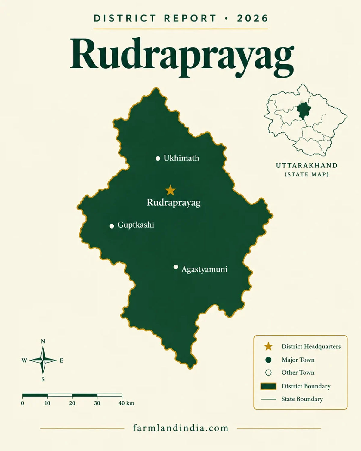
Rudraprayag is a mountain district formed on 16 September 1997 from parts of Chamoli, Tehri and Pauri (Rudraprayag district court portal). Its area is about 2,439 sq km in the Central Ground Water Board profile and 2,429 sq km on the district court portal, while IndiaStat lists 1,984 sq km and 242,285 people at the 2011 Census (CGWB Rudraprayag profile; IndiaStat), so treat the area as approximate. The district takes its name from the confluence of the Alaknanda and Mandakini at Rudraprayag town and contains the Kedarnath temple. For anyone searching for land in Rudraprayag, the first fact is legal: the 2025 Act leaves no sanction route for agricultural land outside Haridwar and Udham Singh Nagar, and large parts of the Kedarnath valley are protected forest.
The district portal gives elevations along the Mandakini valley: Guptkashi at 1,319 m, Sonprayag at 1,829 m, Gaurikund at 1,982 m and Chopta at about 2,900 m, with Gaurikund the last bus stop on the Kedarnath route (Rudraprayag district portal). Kedarnath draws about 20 lakh pilgrims a year, and the temple is open for six to seven months, from Akshaya Tritiya (April or May) to Diwali, according to the Cabinet note on the ropeway (The Tribune, March 2025). That seasonal flow supports homestays, small lodges and shops, and it concentrates demand where the road and the river are.
The same valley is the district’s hazard. The June 2013 floods devastated the Kedarnath area, and builders have been told since to keep back from the river. The Rudraprayag–Gaurikund road (NH-107) is under a ₹357 crore programme to treat 17 landslide and subsidence locations, with newer works running to May 2027 (The Tribune, August 2025). A buyer here is buying a road dependency as much as a plot.
Prices are the gap in this page. We found no sourced registered-rate, collector-rate or sale-deed series for the district, so the price table is empty rather than guessed. The better questions are legal and physical: what the 2025 law allows you to buy, whether the plot is private land or forest land, how far it stands above the river, and who keeps the road open in July. The Rishikesh–Karnaprayag railway and the Kedarnath ropeway are the two public projects that could change access, and neither is complete.
- Rudraprayag
- Agastyamuni
- Ukhimath
- Guptkashi
- Sonprayag
- Chopta
- Kedarnath
Transaction costs
Stamp duty & registration in Rudraprayag
5%
Stamp duty — sale deed (general)
Stamps and Registration Dept fee sheet
3.75% / 5%
Stamp duty — female buyer
up to ₹25 lakh / above ₹25 lakh
2%
Registration fee
fee sheet cap; amended Nov 2025, confirm
The general sale-deed duty is 5%, with 3.75% for a female buyer up to ₹25 lakh and 5% above that, and the registration fee is 2% of the value, per the Stamps and Registration Department's fee sheet (Uttarakhand e-registration fee sheet, undated PDF). The department's notification index records the 5% rate since 31 May 2011 and a 25% discount for a female buyer on land up to ₹25 lakh, twice in a lifetime, since 31 July 2017 (Stamps and Registration Department notification index, updated November 2025). The fee sheet shows the registration fee capped at ₹25,000, but the same index records a 16 November 2025 amendment replacing ₹25,000 with ₹50,000 in the fee table, so the cap needs confirming with the Sub-Registrar. The state revised circle rates in October 2025 (ETV Bharat, October 2025), but the report gives figures only for Dehradun, so we have no Rudraprayag rate. The fee sheet also lists a full rebate for qualified disaster-affected beneficiaries in Rudraprayag and four other districts; it does not say who qualifies, and it is meant for affected residents, not for buyers generally. The Sub-Registrar is the office to confirm the cap, the circle rate and any rebate.
Know the belt
What shapes land value in Rudraprayag
No sourced price evidence for this district. The cards below describe what drives value and what to check, not a price.
Prices: no sourced figure
No sourced asking-price band
We found no collector-rate schedule, registered-deed series or news report giving a Rudraprayag land price in October 2026. We would rather leave the price table empty than quote an unsourced number. Hill plots here are normally quoted per nali or per sq yd; collect registered sale deeds from the same village.
Check: the village circle rate at the sub-registrar and two or three recent registered deeds nearby.
Kedarnath road belt: Guptkashi, Sonprayag, Gaurikund
Seasonal, hazard-exposed
This belt lives on the Kedarnath season of about April to November and on the Rudraprayag–Gaurikund road. The Union Cabinet approved a 12.9 km Sonprayag–Kedarnath ropeway on 5 March 2025 at ₹4,081.28 crore, which could change pilgrim flow (Business Today, March 2025), but we found no construction status. Land near the river is exposed to the type of flood seen in 2013.
Check: distance and height above the Mandakini, and whether the parcel is on a landslide slope.
Chopta, Ukhimath and the sanctuary edge
Forest-edge land
Chopta (about 2,900 m) sits near the Kedarnath Wildlife Sanctuary. Land here is a mix of private plots and forest, and what can be built may depend on forest and eco-zone clearances.
Check: the sanctuary boundary, tree-felling rules and the status of the khasra.
Rudraprayag town and Agastyamuni
Town-edge land
The district headquarters sits at the Alaknanda–Mandakini confluence and is among the towns the Rishikesh–Karnaprayag line is to connect (Swarajya, March 2026). We found no sourced price.
Check: municipal limits, river setback, and the planned station and alignment.
Units: nali and sq yd
Hill land is recorded in nali and sold in sq yd. The Farmland India working figure is 1 nali = 240 sq yd, so an acre is about 20 nali; local usage varies, so convert against the area in the khatauni. The 250 sq m in the residential affidavit rule equals about 299 sq yd, a little over one nali at the working value.
Connectivity
How Rudraprayag connects — road, rail and air
Distances marked below come from the district court portal; journey times vary with landslides and are long in monsoon.
By road
By air
By rail & metro
Rudraprayag is reached from Rishikesh and Dehradun by the Alaknanda valley road, and the last leg to a parcel is often a link road that closes in monsoon. Full rules for buyers from outside the state: Uttarakhand agricultural land rules.
Growth catalysts
Upcoming infrastructure & developments
Status labels reflect sources read in October 2026. Government-announced timelines are not guaranteed; items marked confirm have single or conflicting sources.
00Operational
03In progress or pending
Agriculture & terrain
Terrain, crops & water in Rudraprayag
A steep Alaknanda–Mandakini district of small terraced holdings, sanctuary forest and river valleys, where terrain and hazard decide use before soil does.
🌾 Terraced valley farms
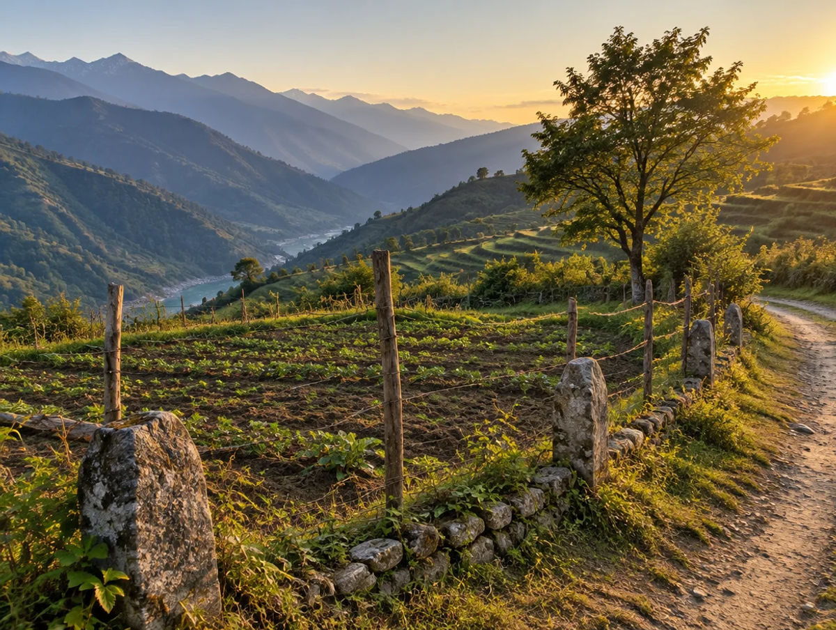
The district’s farming is small-holding hill agriculture on terraces along the Mandakini and Alaknanda. The CGWB profile (data year not stated) lists rice, wheat, maize, jhangora, mandua, potato and pulses, with a net sown area of 114.30 sq km of which 44.13 sq km is irrigated (CGWB Rudraprayag profile).
- Terraced farms
- Small holdings
- Valley floor
🌲 Forest and sanctuary belt
The Kedarnath Wildlife Sanctuary covers 975.20 sq km across Chamoli and Rudraprayag, rising from 1,160 m to 7,068 m (Wildlife Institute of India). Ask the Divisional Forest Officer whether a plot sits inside the sanctuary or a forest or van panchayat area. Chopta and Tungnath are treks in and around this belt.
- Kedarnath Wildlife Sanctuary
- Chopta
- Tungnath
🌊 River belt and flood risk
The Mandakini and Alaknanda meet at Rudraprayag, and the Kedarnath valley was devastated by the June 2013 floods. A verbal 200 m river setback was announced afterwards (Down To Earth, July 2013). Landslides are the reason for the NH-107 treatment programme on the Rudraprayag–Gaurikund road. Ask for flood and slide history for any parcel on a terrace, fan or cut slope.
- Mandakini
- Alaknanda
- 2013 floods
💧 Water & rainfall
The CGWB profile gives average annual rainfall of about 1,485 mm, rising with altitude, and says drinking water draws on 275 springs and 67 hand pumps; no groundwater resource assessment has been done (CGWB). For any parcel, ask for the water source in writing and check the monsoon access to it.
📐 Measurement units
Hill land units: 1 nali = 240 sq yd as the Farmland India working figure (local usage varies); 1 acre = 4,840 sq yd, about 20 nali. The 250 sq m in the residential affidavit rule equals about 299 sq yd, a little over one nali. Always read the area in the khatauni, not the seller’s quote.
At a glance
Rudraprayag vs. its neighbours
| District / belt | Price band* (per acre) | Evidence |
|---|---|---|
| Rudraprayag — all belts | No sourced price | Searched in October 2026; none found |
| Uttarkashi | No sourced price | See the Uttarkashi page; same finding |
| Tehri Garhwal | See the Tehri Garhwal page | See its own page; not compared here |
| Chamoli | See the Chamoli page | Neighbour across the Alaknanda; same 2025 Act |
*No price band is shown for Rudraprayag because none could be sourced. Compare the Tehri Garhwal page for the neighbouring district and the Uttarkashi page for the neighbouring Char Dham district.
Farmland India view
Why investors look at Rudraprayag
Four reasoned points and an honest note: this is a seasonal, high-hazard, rule-heavy district with no sourced prices, and the reasons to look are mostly non-financial.
Kedarnath’s pilgrim traffic
About 20 lakh pilgrims a year visit Kedarnath in a season of roughly April to November (The Tribune, March 2025), which supports homestays and small lodges where building is permitted.
Two public access projects pending
The Rishikesh–Karnaprayag railway is to connect Rudraprayag town and the Sonprayag–Kedarnath ropeway is approved. Neither is confirmed delivered, so price on today’s road.
Treks and quieter circuits
The district portal singles out Chopta for its views of the Himalayan ranges and lists Guptkashi and Sonprayag on the Kedarnath route (Rudraprayag district portal), which gives the district visitors beyond the temple itself.
A buyer-pool that is mostly local
With the 2025 Act allowing sanctioned farmland purchase only in Haridwar and Udham Singh Nagar, the realistic buyer of farmland here is someone already holding land in the state. Anyone else should treat this page as a risk guide.
Confirm eligibility, forest status, flood history and slope stability directly; Farmland India’s review does not certify them.
STRAIGHT TALK
Risks & challenges in Rudraprayag
Read these before shortlisting in Rudraprayag specifically.
Flood and river-setback risk
The June 2013 floods devastated the Kedarnath valley and a verbal 200 m river setback was announced. We found no written order. Ask for flood history and the height of the parcel above the Mandakini or Alaknanda.
Landslide and road-closure risk
NH-107 between Rudraprayag and Gaurikund has 17 landslide and subsidence locations under a ₹357 crore treatment programme, with newer works running to May 2027. A parcel that looks close on a map can be cut off for days.
Agricultural land bar for outsiders
The 2025 Act allows sanctioned purchase of agricultural and horticultural land only in Haridwar and Udham Singh Nagar, so there is no farmland route in Rudraprayag. NRIs cannot buy agricultural land or a farm house under the RBI direction. Check the residential affidavit rule with a local advocate.
Sanctuary and forest land
The 975 sq km Kedarnath Wildlife Sanctuary lies across Chamoli and Rudraprayag. Ask the Divisional Forest Officer about forest and van panchayat boundaries and clearances near them. We did not find a final eco-sensitive-zone notification.
Seasonal demand
Kedarnath runs about April to November, so demand and rental income are seasonal and weather-dependent. A buyer should model a short season.
Announced is not delivered
The rail line has a December 2028 or December 2029 target depending on source, and we found no construction status for the ropeway. Price on today’s fundamentals.
No price evidence
We found no sourced price or circle-rate series. Without registered comparables, any price quoted to you is untested.
Who to contact
Local revenue, planning & forest offices
Mutation and revenue-record matters go through the Tehsildar of the relevant tehsil (the CGWB profile names Okhimath, Rudraprayag and Jakholi) and the District Magistrate’s office at Rudraprayag; the district portal lists places of interest, and office addresses were not checked for this page. Sale-deed registration is handled by the local Sub-Registrar. Forest, sanctuary and tree-felling questions go to the Divisional Forest Officer. Parcel records sit on the Bhulekh Uttarakhand portal, which we did not open for this page.
COMMON QUESTIONS
Frequently asked questions
Everything buyers, NRIs and investors ask before their first reviewed farmland purchase in Rudraprayag.
Visit full wiki01 of 04
Can an outsider buy agricultural land in Rudraprayag?
Not through the sanction route. Under the 2025 amendment, agricultural and horticultural land can be bought only in Haridwar and Udham Singh Nagar, with prior state sanction, and press coverage counts Rudraprayag among the 11 districts where the restriction applies. For residential land the buyer files an affidavit about the 250 sq m limit. Have a local advocate check the Act and your own position.
02 of 04
What does land cost in Rudraprayag?
We found no sourced collector-rate schedule, registered-deed series or news price for Rudraprayag in October 2026, so this page shows no price band rather than an estimate. Collect registered sale deeds for the village and the circle rate from the Sub-Registrar before accepting any figure.
03 of 04
What stamp duty applies in Rudraprayag?
The state fee sheet lists 5% stamp duty on a sale deed, 3.75% for a female buyer on value up to Rs 25 lakh (5% above), and a 2% registration fee shown with a Rs 25,000 cap that a November 2025 amendment may have raised to Rs 50,000. A full rebate exists for qualified disaster-affected beneficiaries in Rudraprayag and four other districts, which is for affected residents, not investors.
04 of 04
Which infrastructure affects Rudraprayag?
The 125 km Rishikesh–Karnaprayag railway is to connect Rudraprayag town, with Swarajya reporting 73% progress and December 2028 in March 2026 and Construction World reporting 78% and December 2029 in September 2026. A 12.9 km Sonprayag–Kedarnath ropeway was approved on 5 March 2025 at ₹4,081.28 crore, and a ₹357 crore slope-treatment programme covers 17 sites on NH-107.
Ready to look at what is available?
Browse reviewed listingsTransparency
Sources and references
Law and courts
- Uttarakhand (Uttar Pradesh Zamindari Abolition and Land Reforms Act, 1950) (Amendment) Act, 2025 (Act 11 of 2025), Government of Uttarakhand, notified 1 May 2025
- Master Direction FED 12/2015-16 on immovable assets under FEMA, Reserve Bank of India
Government
- Stamp duty and registration fee sheet, Stamps and Registration Department, undated
- Stamp duty and registration fee notification index, Stamps and Registration Department, updated 18 Nov 2025
- About the district (area, formation, distances), Rudraprayag district court portal
- Rudraprayag places of interest and elevations, Rudraprayag district portal
- Rudraprayag district groundwater profile, Central Ground Water Board
- Kedarnath Wildlife Sanctuary, Wildlife Institute of India
- Rudraprayag district: area, 2011 population, blocks, IndiaStat
News
- Uttarakhand Assembly clears bill to restrict outsiders from buying agricultural land, Scroll, 22 Feb 2025
- The gaping loopholes in the new land law, National Herald, 1 Mar 2025
- Uttarakhand land law comes into force, The Week/PTI, 1 May 2025
- Uttarakhand revises circle rates, ETV Bharat, 6 Oct 2025
- Uttarakhand chief minister bans construction along riverbanks, Down To Earth, 2 Jul 2013
- Tribunal declines to stop chopper service to Kedarnath, India Environment Portal, 10 Dec 2015
- Cabinet clears Kedarnath ropeway, The Tribune, 5 Mar 2025
- Cabinet approves Kedarnath and Hemkund Sahib ropeway projects, Business Today, 5 Mar 2025
- Landslide and subsidence treatment works on NH under way, Gadkari, The Tribune, 7 Aug 2025
- Rishikesh-Karnaprayag rail project 73% done, Swarajya, 29 Mar 2026
- Rishikesh-Karnaprayag rail project on track for December 2029, Construction World, 2 Sep 2026
Further reading
- Badrinath master plan: development script or disaster manual?, Down To Earth, 14 Jun 2023
- Rishikesh-Karnaprayag railway targets December 2029, Swarajya, 28 Aug 2026
- Rishikesh-Karnaprayag rail line set for 2028 completion, Swarajya, 14 Apr 2026
- Land reform law is a step towards innovation, CM Dhami, Business Standard, 22 Feb 2025
- Char Dham All Weather Road Project, Press Information Bureau, 7 Dec 2022
- Citizens for Green Doon v Union of India: double-lane Char Dham highways, LiveLaw, 14 Dec 2021
- Delhi-Dehradun Economic Corridor inaugurated, Press Information Bureau, 14 Apr 2026
- Rs 1,700 crore approved for Joshimath rehabilitation, Business Standard, 4 May 2025
Data-currency note: population reflects Census 2011 and area differs by source (1,984 to 2,439 sq km). The CGWB profile gives no data year. The fee sheet is undated and the registration-fee cap may have changed in November 2025. Infrastructure statuses were read in October 2026 and change quickly. The Bhulekh portal, Rudraprayag circle rates and any final eco-sensitive-zone notification did not open for us. No price figures are given because none could be sourced. This is a general guide, not legal advice. Report inaccuracies to wiki@farmlandindia.com.
For developers
Ready to explore Rudraprayag farmland?
Browse reviewed projects and individual land parcels across Rudraprayag — or if you own land here, list it with platform review and reach serious buyers.