Buying Land Near the Ganga Expressway: Rules and Parcel Checks (2026)
What the official release confirms, which details are only press-reported, and how to check one parcel.
The Ganga Expressway is a 594 km access-controlled greenfield road in Uttar Pradesh, inaugurated on 29 April 2026 according to the Press Information Bureau. Many land claims about it rest on press lists rather than official pages, so this guide separates the two and shows how to check a parcel.
The Ganga Expressway at a glance
The Ganga Expressway is a greenfield, access-controlled expressway in Uttar Pradesh. The Press Information Bureau (PIB) release of 29 April 2026 on its inauguration at Hardoi gives a headline length of 594 km and says it affects twelve districts. The release does not name the districts, lanes or cost. The authority is the Uttar Pradesh Expressways Industrial Development Authority (UPEIDA).
| Item | Detail | How firm |
|---|---|---|
| Length | 594 km | PIB, 29 April 2026 |
| Inauguration | 29 April 2026, Hardoi | PIB |
| Type | Access-controlled greenfield | PIB |
| Districts | Twelve (PIB). Press lists: Meerut, Hapur, Bulandshahr, Amroha, Sambhal, Budaun, Shahjahanpur, Hardoi, Unnao, Rae Bareli, Pratapgarh, Prayagraj | Count official; names from news |
| Start and end | Near Bijauli, Meerut, to Judapur Dandu, Prayagraj | Press reports |
| Interchanges | 21 planned, per a press list of 28 April 2026 | Press report, not official |
| Toll | We found no official notification and print no rate | Not confirmed |
Other figures circulate, such as 628 km (an early plan), 637 km (a map app measuring city to city) and 1,049 km (a figure that includes extensions that are not built). We use 594 km because it is the official release figure.
Where the road runs
Press reports describe the road as starting at Bijauli village in Meerut, joining NH-334 there, and ending at Judapur Dandu in Soraon tehsil, Prayagraj, at the Prayagraj bypass. It is built in twelve packages, and the western package group was awarded to different contractors than the eastern ones, according to a tracker site. We treat the package table as secondary and do not reproduce it as official.
The road does not pass through every district town. A village "in Hardoi district" may be far from the road. The PIB release names no villages, so the only reliable way to know whether a village is on the line is the acquisition record, covered below.
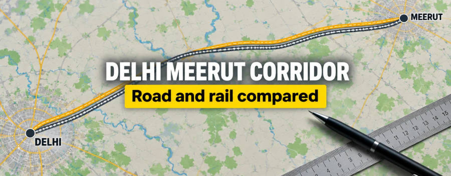
The Meerut end is reachable from Delhi by the Delhi-Meerut Expressway; see our Delhi-Meerut guide. A separate Jewar link, reported as approved by the UP Cabinet on 27 October 2026, is a different road and is not built.
Interchanges: where value is decided
An access-controlled road can be entered and left only at interchanges. A press list of 28 April 2026 describes 21 planned interchanges, including junctions with NH-334 at Meerut, NH-9 near Hapur, NH-509 near Sambhal, several state highways in Budaun, Shahjahanpur and Hardoi, a connection to the Agra-Lucknow Expressway at Unnao, NH-27 at Sonik, NH-31 and NH-30 in Rae Bareli, NH-731A at Pratapgarh and the NH-330A bypass at Prayagraj. We could not confirm the list on a UPEIDA page, and we found no chainage for each interchange.
What this means: a village is not "on the expressway" because it is in the right district. Measure the road distance from the parcel to a named interchange. A village 30 or 50 km from an exit has the same daily access to the road as a village in the next district.
Land acquisition and what the buyer inherits
A tracker site reports that about 6,556 hectares were needed and that acquisition was complete by April 2024. A news report from 2021 says the plan was 120 m of land plus a green belt. We could not confirm the legal route used (mutual consent or the 2013 Act), the compensation multiple, or the right-of-way and construction rules beside the road, and we found no official page that states them.
If land was acquired through the Right to Fair Compensation and Transparency in Land Acquisition, Rehabilitation and Resettlement Act, 2013, our reference library records that after the section 11 preliminary notification no transactions in the land are allowed without the Collector's permission, and that market value under section 26 is the highest of the circle rate, the average of the top half of recent sale deeds nearby, or the consented amount. Read our LARR explainer and how to check government acquisition notices if you suspect your parcel is in a notified list.
Land already bought by UPEIDA cannot be sold by a private owner. A seller's old khatauni can still show the farmer as owner if the mutation has not been updated, which is why a title check matters here.
Industrial and logistics sites
A UPEIDA draft expression of interest dated June 2025 lists proposed industrial and logistics sites along the road, with about 3,700 acres in total by our addition across eleven sites. These are proposals on land UPEIDA controls. They are not private plots, and a broker selling land "inside the industrial cluster" needs to show documents, not a brochure. We did not open the original document in this session, so treat the figure as indicative.
How to check a specific parcel on the Ganga Expressway
- Alignment. Take the village and khasra and compare with the UPEIDA acquisition record. Our KML guide shows how to overlay a line, but the line is indicative.
- Notices. Ask UPEIDA or the district land acquisition office which notification covers the village, and whether any parcel in the khasra remains with the farmer. State-authority notices differ from national highway 3A/3D notices, so ask for the exact notification number and read it.
- Interchange distance. Pick the nearest named interchange from the list above and measure road distance. The press list is not official, so confirm with UPEIDA.
- Master-plan zone. Check the development authority or district plan for the village. Agricultural land still needs a land-use change for non-farm building; see land use conversion in Uttar Pradesh.
- Floodplain and forest overlays. The alignment was reported moved about 10 km from the Ganga bank in 2019, but the road crosses the Ganga basin. Check flood risk with the district office and see green belt and no-development zones.
- Records. Pull the khatauni using UP Bhulekh, see khasra and khatauni in UP, and run an encumbrance search.
Extensions are not the road
The Haridwar and Ballia extensions are not built. A supplementary budget report of August 2026 shows money for them, but we found no confirmed alignment. Do not price an extension as if it were open.
Red flags
- "Next to the interchange" claims without a named interchange village. Names that appear in press lists include Bijauli, Attaullahpur, Mangraula and Sonik, but check each yourself.
- Direct frontage promises on an access-controlled road.
- Airport-link claims. The route to Noida airport is a different, newly approved road.
- Unapproved plotting on agricultural land; see how to spot it.
No price or return claim is made here. For the Meerut-end context, also read the Delhi-Dehradun Expressway page, which shares the Delhi-Meerut approach.
What we could not confirm
On an official page we could not confirm: district names, interchange list, cost, lanes, toll rates, speed limit, the legal route and rate of compensation, setback rules, and the exact length of the road in each district (the Bulandshahr share is unclear in the reports we read). The PIB release itself gives a 600-km span in its body text and 594 km in its headline, so the length varies by a few km depending on how it is described.