
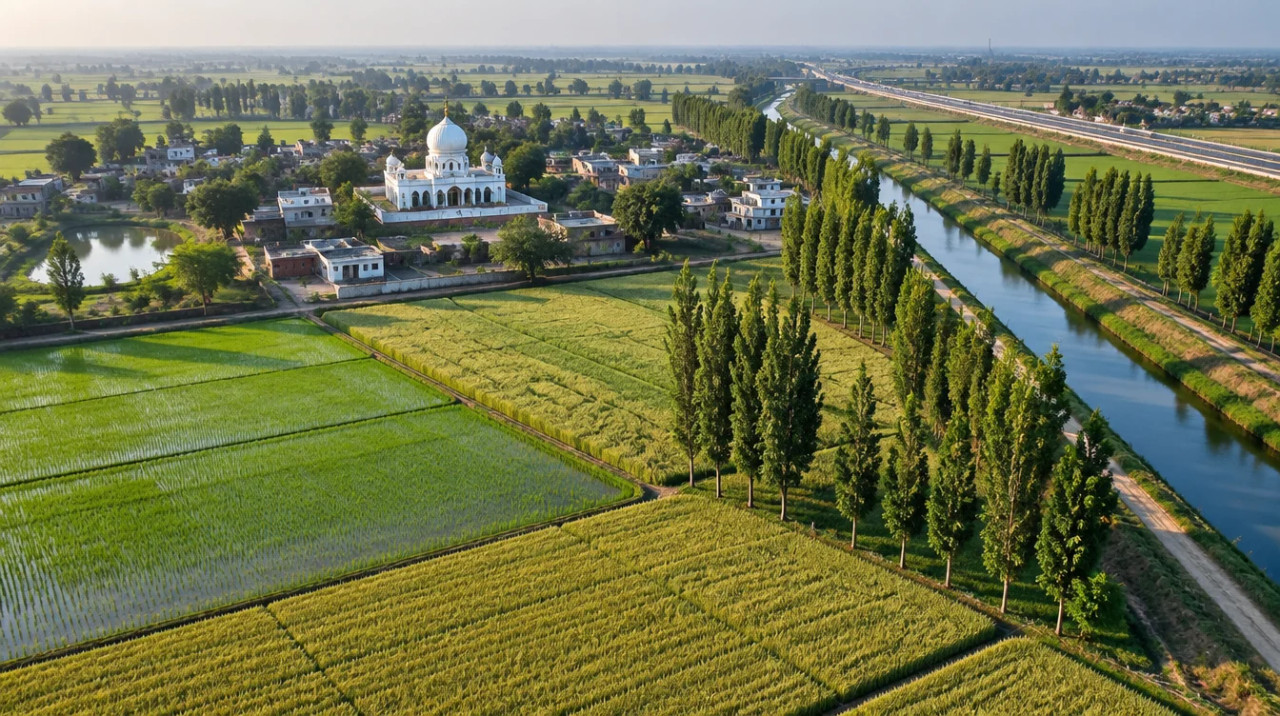
District guide
Buying Land in Gurdaspur
The border district that took the worst of the August 2025 floods: fence-side land, stressed groundwater, an expressway section still unawarded in March 2026 and no sourced per-acre price series.
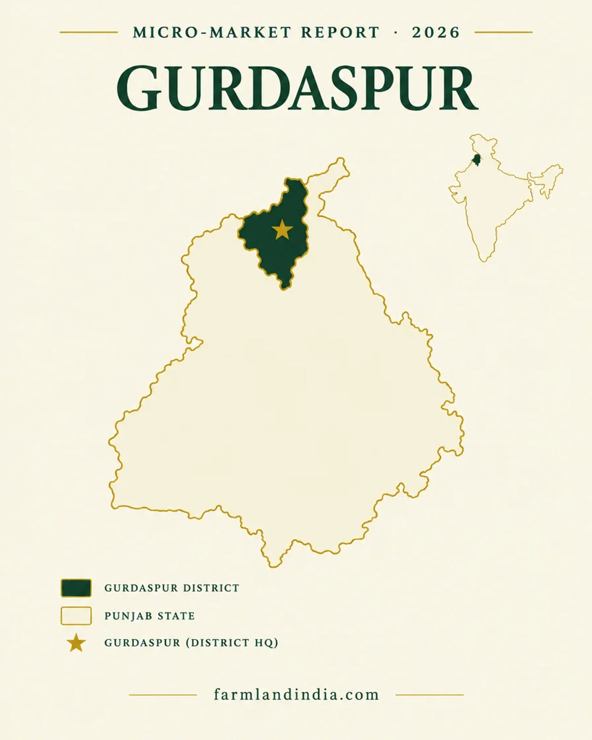
2,610 sq km
Area (district site)
22.99 lakh
Population (Census 2011, district site)
40,169 ha
Crop damage, Sep 2025 (reported)
Open (NRIs barred)
Outsider agricultural land
*Indicative range across districts and land types. Stamp duty, registration and conversion charges are additional. Local measurement units vary — every listing states the unit it is priced in. Not a valuation or an offer.
PLRS — Punjab Land Records SocietyDistrict land record — Gurdaspur
Rev. 2026 · Farmland India desk
State
Punjab
Sub-divisions
11 blocks: Gurdaspur, Dhariwal, Kalanaur, Dorangla, Kahnuwan, Dinanagar, Batala, Qadian, Shri Hargobindpur, Fatehgarh Churian and Dera Baba Nanak (district site). Tehsils and sub-tehsils are on an undated Punjab Land Records Society list whose grouping we inferred: Gurdaspur, Batala and Dera Baba Nanak, with Kalanaur, Dinanagar and Qadian among the sub-tehsils (PLRS list); confirm on the fard
Key markets
Gurdaspur · Batala · Dinanagar · Dera Baba Nanak · Kalanaur · Qadian · Fatehgarh Churian · Sri Hargobindpur
Demand anchors
Border-belt farming · Delhi–Amritsar–Katra Expressway northern branch · Batala and Gurdaspur towns
Rail
Not checked for this page
Size and population
2,610 sq km (district site) · 22,99,026 people at the 2011 Census (district site); the site does not say whether that count includes the area now in Pathankot district
Pricing unit
Acre for farmland · kanal and marla for smaller parcels
Local units
Acre · kanal · marla (1 kanal = 20 marla; 8 kanal = 1 acre)
Land records portal
Punjab Land Records Society (PLRS) · jamabandi and fard
Land law is state law. These rules are maintained on the Punjab page and apply to every district within it.
Gurdaspur — land purchase legal rules
The Act text we read limits how much land a family may hold, not who may buy. The main check is land classification: village common land (Shamlat Deh) vests in the Gram Panchayat, and a private seller cannot pass title to it.
Who can buy agricultural land? Section 4 of the Punjab Land Reforms Act, 1972 (Act No. 10 of 1973) caps what a person or family may hold. We found no clause in the text we read that limits the buyer by domicile or occupation; the copy is a 2005 printout, so a Punjab revenue lawyer should confirm there is no later restriction.
Ceiling limits: under Section 4(2) the permissible area is 7 hectares of two-crop irrigated land, 11 hectares of one-crop irrigated land and 20.5 hectares of barani land, with other classes capped at 21.8 hectares. A family of more than five gets one-fifth extra per additional member, for at most three members. Section 12 makes a transfer beyond the limit void (Act text, Punjab Land Records Society). A 2017 amending Bill took land bought for housing, industry, tourism and institutions outside the Act and asks the buyer to tell the Collector of the change of use within a year (Punjab Vidhan Sabha, Bill 33-PLA-2017).
Shamlat Deh — the parcel that cannot be sold: under the Punjab Village Common Lands (Regulation) Act, 1961 this land vests in the Gram Panchayat, which may dispose of it only for the benefit of villagers and, under the rules, with prior government approval; the Collector decides disputes over its status. A private seller therefore cannot give a buyer title to it. Match every khasra number against the seller's current Jamabandi before paying any advance; the state reported in Tribune, June 2025 that its Easy Jamabandi portal issues free digitally signed copies with a QR code.
NRI Power of Attorney: a power-of-attorney sale does not transfer title; in Suraj Lamp & Industries v State of Haryana (Supreme Court, 2011) the Court held that only a registered deed of conveyance does, though an attorney may sign that registered deed for the owner. If the seller is abroad, read the PoA for an express power to sell and for its registration.
NRI & OCI buyers: the Reserve Bank's Master Direction under FEMA 1999 lets NRIs and OCIs buy immovable property other than agricultural land, plantation property or a farm house. That applies across India, Punjab included.
- Ceiling, not buyer class
- Ceiling: 7 / 11 / 20.5 ha
- Shamlat Deh: Panchayat land
- NRI PoA: registered deed
- NRI agri: barred (FEMA)
- Jamabandi check
Gurdaspur — district-specific notes
The Punjab legal framework on the state page applies to Gurdaspur in full. The notes below are specific to this district and are not repeated from the state page. Law and policy as read in October 2026; confirm with a local advocate.
⚠ Who may buy: the Punjab Land Reforms Act, 1972 limits how much land a family may hold; we found no clause in it limiting who may buy. Section 4(2) of the text hosted by the Punjab Land Records Society sets 7 hectares of assured two-crop irrigated land, 11 hectares of one-crop irrigated land and 20.5 hectares of barani land, with other classes capped at 21.8 hectares, and section 12 makes a transfer beyond the permissible area void (Act text). That copy lists amendments only to 1976, and a November 2017 Assembly bill would take land acquired for housing, industry and similar uses outside the Act (Bill 33-PLA-2017; we did not find the final Act). Ask a Punjab revenue lawyer for the current limit and the family-size adjustment before you sign.
⚠ Border land: Gurdaspur is one of six border districts named in the April 2026 Union Home Ministry letters that start a social impact survey for moving the fence closer to the zero line (News On AIR, April 2026). The Punjab border is 553 km long, farmers cross the fence to farm only in hours set by the BSF, and no acreage, timeline or compensation was stated. A 2021 Tribune report quoted a farmers' society on about 21,600 acres across 220 villages beyond the fence in the border districts together; that figure is not district-specific and not official (The Tribune, December 2021). If a parcel lies beyond the fence, ask for the access hours and gates in writing.
⚠ Buying near the border: in the pages we opened we found no Punjab or central notification that bars an Indian citizen from buying farmland in a border district or requires a purchase NOC. That is an absence of evidence, not a ruling, so put the question to the Deputy Commissioner in writing before paying for land in Dera Baba Nanak or other villages close to the fence.
⚠ Shivalik and the Preservation Act: the Punjab Land Preservation Act, 1900 lets the government restrict clearing, cultivating, tree cutting and building in notified areas (Act text, India Code), and the Supreme Court held on 21 July 2022 (Narinder Singh v. Divesh Bhutani) that land under a section 4 special order has the features of forest land under the Forest (Conservation) Act, 1980 (SCC Online). The Forest Department drone survey of Preservation Act areas reported in October 2022 named Hoshiarpur, Ropar, Nawanshahr, Dasuya, Mohali and Pathankot, not Gurdaspur (The Tribune, October 2022). A December 2025 Tribune report does name Gurdaspur among five districts where about 55,000 hectares were taken off the Act in 2010, and says the Union Environment Ministry wrote in March 2015 that such areas would still be treated as forest under the 1980 Act (The Tribune, December 2025). We found no village-level order for Gurdaspur; ask the Divisional Forest Officer whether any village is under a section 4 or 5 order.
⚠ Eco-sensitive wetlands: the Keshopur-Miani Community Reserve (343.9 hectares) in Gurdaspur was reported to have received Ramsar status in January 2020, and the Beas Conservation Reserve, a 185 km stretch of the Beas from Talwara to Harike, runs through seven districts including Gurdaspur (The Tribune, January 2020). Ask whether a river-edge or wetland-edge parcel sits inside a reserve boundary before you pay.
⚠ Building a farmhouse or any non-agricultural use needs change of land use (CLU) from the Punjab planning authority, and plotted layouts fall under PAPRA, the 1995 plot and apartment regulation Act. We opened no Punjab planning-department page, so the CLU procedure is not confirmed from an official page. An application receipt is not permission: ask for the granted CLU order, the approved layout and, where it applies, the RERA registration.
⚠ Unauthorised colonies: Punjab dropped the NOC requirement for registering land on 6 February 2024 (The Tribune, February 2024), a 2024 amendment then allowed NOC-free registration of plots up to 500 sq yd where a power of attorney or agreement predated 31 July 2024 (The Tribune, 2024), and in May 2025 the government was reported to have halted registrations without an NOC after a High Court direction (The Tribune, May 2025). We have not read the order or the Act text. Do not buy a plot in a layout that lacks authority approval, and ask for the NOC in writing.
⚠ Land pooling: Punjab's Land Pooling Policy was notified in 2025 (reports give 14 May and 4 June), amended on 25 July, stayed by the High Court on 7 August and withdrawn by notification of 14 August 2025 (The Tribune, September 2025). The Tribune later reported an optional revised policy in November 2025 and an enhanced package in April 2026, and places the acquisition in the Greater Mohali (GMADA) belt and New Chandigarh, not in the border districts (The Tribune explainer, June 2026; official text of the later versions not read). We found no pooled-village list for Gurdaspur; ask the development authority whether a survey number is inside any notified scheme before paying a deposit.
⚠ Older district reports such as the Central Ground Water Board's 2016 aquifer report cover Gurdaspur and Pathankot together, so records for northern villages may carry a Gurdaspur reference: confirm the tehsil and Sub-Registrar on the fard. NRIs and OCIs may buy immovable assets in India other than agricultural land, plantation land or a farm house, under the RBI's Master Direction on FEMA, updated 1 September 2022 (RBI). This page is not a route for them; they may inherit it. See the NRI land guide.
Read the Punjab state guide for buyer eligibility, stamp duty and NRI rules, and the state-wise land law guides for how the rules differ across our corridor states.
- Ceiling 7 ha (irrigated, 2 crops)
- Border fence land
- Ravi flood plain
- Ramsar wetlands
- Land pooling (Mohali belt)
District overview
Gurdaspur — the border district that took the worst of the August 2025 floods
Buying land in Gurdaspur means buying in a border district. The district site gives its area as 2,610 sq km, lists 11 blocks and shows Pathankot to the north, Hoshiarpur to the south-east, Kapurthala to the south and Amritsar to the south-west, with Pakistan to the north-west and the Beas to the north-east (Gurdaspur district site). Its Census 2011 count is 22,99,026 people (district site). There is little published price evidence for farmland here, so this page is written for buyers who already have Gurdaspur in mind.
August 2025 is the defining fact. Three floodgates of the 150-year-old Madhopur headworks on the Ravi, upstream of the district, were washed away on 27 August as about 2.12 lakh cusecs arrived, and the Ravi breached embankments and moved several kilometres inland in Gurdaspur and Amritsar (The Tribune, 28 Aug 2025). Siasat reported state figures putting Gurdaspur first for crop damage at 40,169 hectares as of 9 September 2025 (Siasat, September 2025), and a Sphere India situation report of 2 September, citing a government flood bulletin, counted 321 villages and about 1.45 lakh people affected in the district (Sphere India, 2 Sep 2025). The Home Ministry gives only state totals: 40 deaths, 14,065 houses damaged and 1.93 lakh hectares of crop area damaged as of 27 November 2025 (Rajya Sabha reply, 3 Dec 2025). Anyone buying here should treat flood history as the first diligence item.
The land itself is a double-cropped paddy-wheat plain: the ICAR-CRIDA plan (2008-09 reference year, written before Pathankot was split off) gives rice on 201,000 hectares and wheat on 231,000 hectares, with cropping intensity of 176% (ICAR-CRIDA plan). Groundwater is stressed: the CGWB aquifer report puts the district at 124% extraction on 2013 data, with Batala at 151% (CGWB aquifer report). The expressway story is the northern branch of the Delhi–Amritsar–Katra Expressway, which splits near Nakodar and continues toward Gurdaspur, Pathankot and Katra (Business Today, 8 Sep 2026). We found no sourced per-acre price, so the price table is empty: that is a limit of the evidence, not a statement that land is cheap or dear.
- Gurdaspur
- Batala
- Dinanagar
- Dera Baba Nanak
- Kalanaur
- Flood plain
Transaction costs
Stamp duty & registration in Gurdaspur
5%
Stamp duty (2017-18 audit rate)
current rate to confirm with the Sub-Registrar
6% / 4%
Men / women, as reported
press reports, 2018 and 2020
1%
Registration fee
capped at ₹2 lakh (2017-18 audit)
The Comptroller and Auditor General's report on Punjab's revenue sector records stamp duty on a sale deed at 5% of the higher of the deed value and the collector rate, a 1% social infrastructure cess and a 1% registration fee capped at ₹2 lakh, as in force in 2017-18 (CAG report, 2019). Press reports of 2018 and 2020 put the rate at 6% for men and 4% for women, with a 2% rebate for a woman buyer that is reclaimed if the land passes to a male relative within a year (The Statesman, June 2018). We opened no official current schedule and found no report of a change in 2025 or 2026, so confirm the rate with the Sub-Registrar before budgeting. Collector rates were raised by 5% to 50% in 12 districts by August 2025, a list that does not include Gurdaspur, and a further statewide rise was put on hold (The Tribune, August 2025). We did not open a Gurdaspur village-wise rate list, so look up the village before pricing an offer.
Know the belt
What is moving prices in Gurdaspur
No sourced price series for the district. The cards below say what we looked at and what a buyer should collect.
Farmland prices: no sourced series
No per-acre figure sourced
We found no dated per-acre price for Gurdaspur farmland from an official or news source, and we do not use listing-site asking prices. Registered deeds and NHAI compensation awards are the nearest benchmarks, and we found no Gurdaspur award figure.
Check: registered deeds from the same village at the Sub-Registrar.
Flood memory is a price factor
Aug 2025: first for crop damage
Land that went under the Ravi in August 2025 will be priced differently by informed sellers and buyers. We found no report of price changes after the flood.
Check: village flood history, silt deposition and embankment (dhussi bund) condition.
Expressway spur: awarded in parts
Package XIII still “balance for award”
NHAI’s March 2026 balance-for-award list shows the 38.8 km Gurdaspur–Balsua section (Phase-II Package XIII, four lanes, EPC) as not yet awarded (NHAI, March 2026). We found no report of land-price changes along the branch.
Check: whether the khasra number appears in the NHAI acquisition notification and award.
Collector rates to check
Aug 2025: 12 districts raised; Gurdaspur not listed
The Tribune said on 13 August 2025 that rates rose 5–50% in 12 named districts, not including Gurdaspur, and that further proposals were on hold (The Tribune). A Gurdaspur village may carry an older rate or a later notification we did not find.
Check: the current village rate, because stamp duty follows the higher of the deal value and the Collector rate.
Units: acre, kanal, marla
Punjab farmland is sold by the acre and smaller parcels by the kanal or marla: 8 kanal make 1 acre and 1 kanal is 20 marla. The fard and jamabandi show kanal-marla, so convert every quote to acres before comparing two offers.
Connectivity
How Gurdaspur connects — road, rail and air
Gurdaspur sits at the northern end of the Amritsar–Pathankot belt. We found no route-checked distances, so none is given.
By road
By air
By rail & metro
Gurdaspur is a road-first district whose value depends on how a parcel reaches the main roads and, if built, the expressway spur. Ask for the NHAI interchange and service-road plan before paying a premium. Full Punjab rules for buyers from outside the state: Punjab state guide and the state-wise land law guides.
Growth catalysts
Upcoming infrastructure & developments
Status labels reflect sources read in October 2026. Government-announced timelines are not guaranteed; items marked confirm have single or old sources.
00Operational corridors
03Planned, pending or under review
Agriculture & terrain
Soil, crops & water in Gurdaspur
A double-cropped paddy-wheat plain between the Ravi and Beas, with stressed tubewell water and a Siwalik Kandi edge.
🌾 Paddy-wheat plains
The ICAR-CRIDA plan (2008-09 reference year, written before Pathankot was split off, so it covers both districts) gives rice on 201,000 hectares, wheat on 231,000 hectares and maize on 13,000 hectares, with a net sown area of 287,000 hectares and a cropping intensity of 176%. Normal annual rainfall is 996 mm. Source: ICAR-CRIDA plan. The plan says “in general there are no floods”, which the 2025 events contradict.
- Rice
- Wheat
- Maize
- Double cropped
💧 Tubewell water
The plan reports 86,639 bore wells irrigating 178,000 hectares; its canal entry is ambiguous. The CGWB aquifer report (2013 data, published 2016) records declining water levels in most blocks, suggests shifting some paddy area to maize or pulses, and reports arsenic above the 0.01 mg/L limit at four sampled places including Sri Hargobindpur and nitrate above the limit at Batala and Kalanaur. Source: CGWB aquifer report.
- Tubewells
- Canals
- Arsenic and nitrate
- Paddy shift
🌊 Ravi flood plain
The Beas bounds the district on the north-east (district site). On 27–28 August 2025 flows at the Madhopur headworks were reported at about 2.12 lakh cusecs and the Ravi later reached 4.60 lakh cusecs; The Tribune says it breached embankments and advanced several kilometres inland in Gurdaspur and Amritsar. State data reported by Siasat show 40,169 hectares of crop damage here by 9 September, the highest of any district. Ask for the village flood history and the embankment status.
- Ravi
- Aug 2025
- Embankment breach
- Silt
💧 Groundwater
The CGWB aquifer report (dynamic resources as of 31 March 2013, published 2016, covering Gurdaspur and Pathankot) gives the district at 124% and block stages: Batala 151%, Dera Baba Nanak 140%, Fatehgarh Churian 133%, Kalanaur 131%, Qadian 128%, Kahnuwan 124%, Dhariwal 122%, Sri Hargobindpur 116%, Dinanagar 103% and Gurdaspur 85%. The report labels Dinanagar “safe” despite 103%, so category labels are unreliable. The statewide 2024 assessment lists 115 of 153 units as over-exploited (CGWB, December 2024). That report gives no Gurdaspur block categories, so ask for the current block category and borewell depth.
📐 Measurement units
Punjab land units: 8 kanal make 1 acre, and 1 kanal is 20 marla. Convert every quote to acres before comparing two offers. We give no square-yard conversion because we found no official table.
At a glance
Gurdaspur vs. its neighbours
| District / belt | Collector-rate news (Aug 2025) | Evidence |
|---|---|---|
| Gurdaspur | Not in the list of 12 districts with rises | No sourced per-acre price; village rates not opened |
| Pathankot | Listed among the 12 districts with 5–50% rises | See the Pathankot page; The Tribune, 13 Aug 2025 |
| Amritsar | Listed among the 12 districts with 5–50% rises | See the Amritsar page; The Tribune, 13 Aug 2025 |
| Kapurthala, Hoshiarpur | Kapurthala listed; Hoshiarpur not listed | See the Kapurthala page; The Tribune, 13 Aug 2025 |
*Rate movements as reported by The Tribune, 13 Aug 2025; the paper lists Amritsar, Barnala, Fazilka, Faridkot, Jalandhar, Kapurthala, Moga, Malerkotla, Pathankot, Ropar, Sangrur and Nawanshahr. Not valuations and not like-for-like. Gurdaspur has no sourced price. See the Pathankot page for the district carved out of Gurdaspur.
Farmland India view
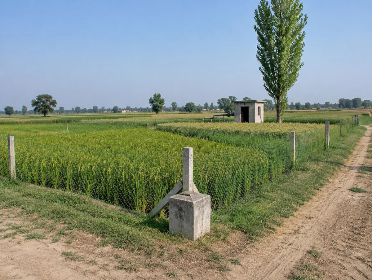
Why investors look at Gurdaspur
Five points that rest on location and projects, and one honest note: there is no sourced price series to test them against.
A planned expressway spur
The northern branch toward Gurdaspur, Pathankot and Katra is a long-dated catalyst. Its Gurdaspur–Balsua section was still unawarded in NHAI’s March 2026 list, so it is a corridor to watch, not to pay for.
Productive double-cropped plains
Cropping intensity of about 176% and tubewell irrigation describe a productive farm district, though falling water tables are a cost.
A flood year that exposes weak parcels
August 2025 showed which villages, embankments and parcels hold. Buyers who do flood diligence can separate higher ground from low ground, which a listing page cannot do.
Border and wetland scarcity
Fence-side and wetland-edge land cannot be freely used, which can limit the supply of clean, usable parcels and also limits resale.
A market that rewards paperwork
With CLU, fence, flood and Collector-rate questions all parcel-specific, and no sourced price band to lean on, a buyer who documents each question is better placed than one relying on a broker.
Confirm CLU, acquisition, flood and Collector-rate status directly; these are not certified by Farmland India’s review.
STRAIGHT TALK
Risks & challenges in Gurdaspur
Read these before shortlisting in Gurdaspur specifically.
Flood exposure
Aug 2025 flooding affected 321 villages in the district by 2 September (government bulletin cited by Sphere India) and 40,169 hectares of crops by 9 September (Siasat). Ask for the village flood history, silt depth and embankment condition.
Ravi headworks risk
The gate failure at the Madhopur headworks upstream is under inquiry and we found no published repair or flood-control upgrade plan. Treat Ravi-side land as higher risk until one is published.
Land beyond the fence
Access is by BSF gates in set hours. Check the khasra against the fence line and the legal status of access before you pay.
Over-exploited groundwater
Eight of the ten blocks CGWB assessed were over-exploited in its 2013 data (published 2016), with arsenic and nitrate above limits at named places. Check borewell depth and water quality.
No price evidence
We found no sourced per-acre price. Without comparables a buyer cannot tell a fair ask from an expectation. Collect registered deeds.
Expressway not yet built
The Gurdaspur–Balsua section was unawarded in March 2026, and The Tribune reported most of the Punjab stretch incomplete in August 2024. Price on what is open today.
CLU and unauthorised colonies
Farmhouse-ready labels do not prove CLU. Ask for the CLU order and for NOC and layout approval on any plot.
Wetland and Preservation Act edges
Keshopur-Miani and the Beas Conservation Reserve are protected, and a December 2025 report names Gurdaspur among districts with delisted Preservation Act land. Ask the forest department.
Who to contact
Local revenue, planning & development offices
Mutation and revenue-record matters go through the Patwari and the Tehsildar of the relevant tehsil or sub-tehsil (see the tehsil and sub-tehsil list above). CLU and layout approval go through the Punjab town and country planning authority, and sale-deed registration is handled by the local Sub-Registrar. The district administration site is gurdaspur.nic.in; its pages give the area and block list but not the tehsils. Fard and jamabandi copies come through the Punjab Land Records Society, and the Punjab Revenue Department site lists e-services; we did not open its rate pages or a Gurdaspur collector-rate page.
KEEP EXPLORING
Explore more areas
Other districts in Punjab
Guides & research
- Kanal and Marla in Haryana and Punjab — Conversion GuideWiki · P01 Land Measurement Units
- Punjab Agricultural Land RulesWiki · P04 State-wise Land Laws
- Marla, Kanal and Killa in Punjab — What They MeanWiki · P01 Land Measurement Units
- Farmhouse Rules in Punjab (2026): Mohali and PAPRAWiki · P17 Farmhouse & Lifestyle Land
- Stamp Duty Calculator Punjab: Land Cost Method (2026)Wiki · P11 Taxation, Stamp Duty & Registration
- Bhu Naksha Punjab: Village Land Map Guide (2026)Wiki · P02 Land Records & Documentation
- Stamp Duty Punjab: Land Registry Charges (2026)Wiki · P11 Taxation, Stamp Duty & Registration
- Punjab CLU: Change of Land Use Explained (2026)Wiki · P06 Land Use, CLU & NA Conversion
COMMON QUESTIONS
Frequently asked questions
Everything buyers, NRIs and investors ask before their first reviewed farmland purchase in Gurdaspur.
Visit full wiki01 of 04
What does agricultural land cost in Gurdaspur?
We publish no per-acre band. We found no dated price for Gurdaspur farmland from an official or news source, and we do not use listing-site asking prices. The nearest benchmarks are registered deeds from the same village at the Sub-Registrar; ask for the village collector rate too, because duty follows the higher of the deal value and that rate.
02 of 04
Did the 2025 floods hit Gurdaspur?
Yes, harder than any other district by crop area. Siasat reported state figures of 40,169 hectares of crop damage as of 9 September 2025, and a 2 September situation report citing a government bulletin counted 321 villages affected. Three floodgates of the Madhopur headworks upstream on the Ravi were washed away on 27 August 2025 (The Tribune).
03 of 04
Does the Land Preservation Act apply in Gurdaspur?
The 2022 Forest Department survey reported by The Tribune named Hoshiarpur, Ropar, Nawanshahr, Dasuya, Mohali and Pathankot, not Gurdaspur, but a December 2025 Tribune report names Gurdaspur among districts with land taken off the Act in 2010. We found no village-level order, so ask the Divisional Forest Officer; the Supreme Court's July 2022 ruling treats section 4 land as forest land.
04 of 04
Who can buy agricultural land in Gurdaspur?
We found no domicile or agriculturist bar in the Punjab Land Reforms Act text we read, so an Indian citizen can buy within its limit (7 hectares of two-crop irrigated land; amendments after 1976 not read). NRIs and OCIs cannot buy agricultural land under the RBI's FEMA Master Direction. Confirm with a Punjab revenue lawyer.
Transparency
Sources and references
Law and courts
- Punjab Land Reforms Act, 1972 (ss. 4, 12), Punjab Land Records Society, text opened October 2026
- Punjab Land Reforms (Amendment) Bill 2017, Punjab Vidhan Sabha, 28 Nov 2017
- Punjab Land Preservation Act, 1900 (ss. 3 to 5), India Code
- Narinder Singh v. Divesh Bhutani, Supreme Court, 21 Jul 2022, SCC Online report, 3 Jan 2023
Government
- Master Direction FED 12/2015-16 on immovable assets under FEMA, Reserve Bank of India, updated 1 Sep 2022
- Gurdaspur district site: area, blocks, neighbours, opened October 2026
- Gurdaspur district site: 2011 population, opened October 2026
- List of tehsils and sub-tehsils, Punjab Land Records Society (undated; grouping inferred)
- Stamp duty chapter, Report No. 3 of 2019 (Revenue Sector, Punjab), Comptroller and Auditor General, 2019
- Balance for Award as on 1 Mar 2026, NHAI
- Rajya Sabha reply on Punjab floods, Ministry of Home Affairs, 3 Dec 2025
- Centre starts process to move border fencing in Punjab, News On AIR, 13 Apr 2026
- Dynamic Ground Water Resources of Punjab, 2024, Central Ground Water Board, Dec 2024
- Aquifer mapping report, Gurdaspur and Pathankot, Central Ground Water Board (2013 data, published 2016)
- District contingency plan, Gurdaspur, ICAR-CRIDA (2008-09 data)
- Department of Revenue and Rehabilitation, Punjab: e-services and notifications list
News
- Punjab flood situation worsens, Ravi inundates border districts, The Tribune, 28 Aug 2025
- Ravi flood damages Madhopur barrage gates, SANDRP, 29 Aug 2025
- Punjab flood toll rises to 52, crop damage by district, Siasat, 9 Sep 2025
- Situation Report 02, Punjab floods, Sphere India, 2 Sep 2025 (district figures from a government bulletin)
- Delhi to Katra in six hours, NHAI travel-time targets, Business Today, 8 Sep 2026
- Barring Punjab, Delhi-Katra e-way almost complete in most states, The Tribune, 23 Aug 2024
- Sans compensation for land across the fence, The Tribune, 2 Dec 2021
- Drone survey of Punjab Land Preservation Act area begins, The Tribune, 27 Oct 2022
- SC panel seeks details of policy on delisted forest areas, The Tribune, 3 Dec 2025
- Three more wetlands get Ramsar tag, The Tribune, Jan 2020
- NOC no longer required for registration, The Tribune, 6 Feb 2024
- Now NOC not needed to register land deeds, The Tribune, 2024
- Govt stalls registration of plots without NOC, The Tribune, May 2025
- HC disposes of pleas against land pooling policy, The Tribune, 11 Sep 2025
- Why Punjab keeps rewriting its land pooling policy, The Tribune explainer, 24 Jun 2026
- Proposals to raise collector rates put on back burner, The Tribune, 13 Aug 2025
- Punjab amends rule to bar misuse of stamp duty rebate for women, The Statesman, Jun 2018
Further reading
- Land pooling policy page, GMADA
- Groundwater assessment 2025, PIB, 18 Dec 2025
- Delhi-Amritsar-Katra Expressway status, PIB, 7 Feb 2024
- Punjab Village Common Lands (Regulation) Act, 1961, India Code
- Govt to impose 1% cess, The Tribune, Feb 2020
- Punjab announces 2.25% exemption in stamp duty, The Tribune, Mar 2023
- Land use statistics for five years, Department of Agriculture, Punjab
- Punjab monsoon 2026 rainfall report, India Meteorological Department, Chandigarh, 1 Oct 2026
- Basic Statistics of Punjab, Government of Punjab (older edition)
- Katra e-way back on track, land possession nears completion in Punjab, The Tribune
- After Katra e-way, other stalled NHAI projects also take off, The Tribune
- No clarity on plots registered in illegal colonies, The Tribune
- Punjab High Court directs state to require NOC for registration, Law Trend, March 2025
- Abolition of NOC to benefit only regularised colonies, The Tribune, Feb 2024
Data-currency note: the Census figure is from 2011; crop and rainfall data are from ICAR-CRIDA (2008-09, before the district was split) and CGWB block figures are 2013 data, all dated; infrastructure statuses were read in October 2026 and change quickly; collector rates change often. Not read: the current Punjab stamp-duty schedule, village-wise collector rates, the PAPRA amendment text and the High Court order on NOCs. This is a general guide, not legal advice. Report inaccuracies to wiki@farmlandindia.com.
For developers
Ready to explore Gurdaspur farmland?
Browse reviewed projects and individual land parcels across Gurdaspur — or if you own land here, list it with platform review and reach serious buyers.