


Owner listed
Terra Grande Sirmaur Phase 2 by Eldeco
Kasauli, Sirmaur, Himachal Pradesh
₹9.5Cr29.00 AcreView
District guide
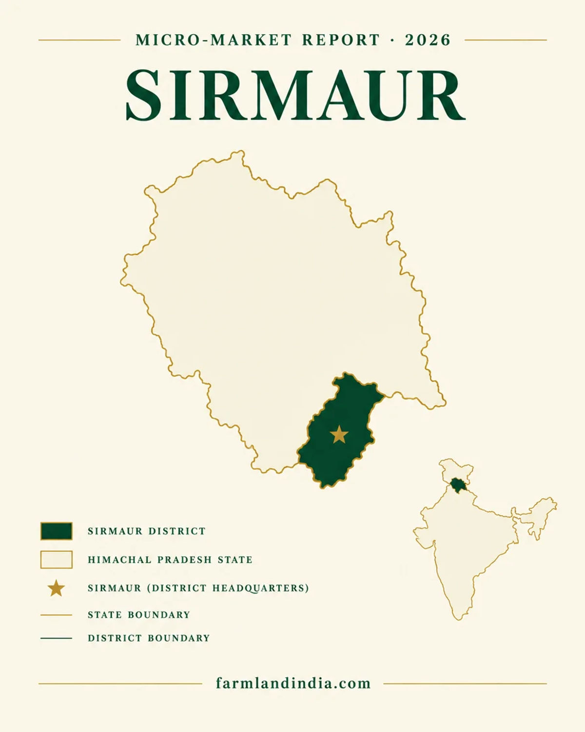
A south-east Himachal district with an industrial plain at Kala Amb and Paonta Sahib, tribal-status hill blocks in Trans-Giri, and Section 118, forest and dam checks before any advance.
2,825 sq km
Area (CGWB, 2013)
5.30 lakh
Population (Census 2011)
Over-exploited
Kala Amb valley groundwater (2011)
2030
Renukaji dam target
*Indicative range across districts and land types. Stamp duty, registration and conversion charges are additional. Local measurement units vary — every listing states the unit it is priced in. Not a valuation or an offer.
Himbhoomi — Himachal Pradesh Land Records PortalDistrict land record — Sirmaur
Rev. 2026 · Farmland India desk
State
Himachal Pradesh
Sub-divisions
The sources disagree. The district profile lists 7 tehsils (Nahan, Paonta Sahib, Rajgarh, Sangrah, Shillai, Pachhad, Dadahu) and 6 sub-tehsils (DIPS Sirmaur profile); the CGWB booklet of 2013 counts 6 tehsils and 4 sub-tehsils (CGWB, 2013). Ask the Deputy Commissioner's office for the notified list.
Key markets
Nahan · Paonta Sahib · Kala Amb · Rajgarh
Demand anchors
Two notified industrial areas, Kala Amb and Paonta Sahib (DIPS profile) · Paonta Sahib gurdwara pilgrimage (HP Tourism) · NH-07 four-laning and the Renukaji dam still pending
Rail and airport
No railway line in the district in the sources read. Nearest stations Ambala and Dehradun, nearest airports Chandigarh and Dehradun, per the HP Tourism page for Paonta Sahib
Size and population
2,825 sq km (CGWB booklet, 2013) · 5,29,855 people at the 2011 Census (Sirmaur district portal)
Pricing unit
₹ per acre or per sq m where a figure is quoted; no sourced price series. Take the area from the revenue record
Local units
Vary by village and revenue estate; we opened no source that defines them. Convert any quote to acres or square metres
Land records portal
Himbhoomi, the state record system (NIC mHimBhoomi page); the portal itself was not opened for this page
Land law is state law. These rules are maintained on the Himachal Pradesh page and apply to every district within it.
⚠ Under Section 118 of the Himachal Pradesh Tenancy and Land Reforms Act, 1972, a non-agriculturist cannot acquire land in the state without prior State Government permission (Section 118 text, Indian Kanoon). Stamp duty on permitted transfers was raised from 6% to 12% by an ordinance of 18 February 2025 (Legitquest copy).
Who can buy without permission? Only an agriculturist, which the Act defines as a person who cultivates land personally in the state (section 2(2), PRS copy of the Act). Out-of-state buyers do not qualify. Nor, according to The Tribune, October 2025, do Himachalis who hold no agricultural land; they need Revenue Department relaxation too.
Section 118 permission: the Act makes a transfer to a non-agriculturist invalid without it, and the section covers sale, gift, exchange, lease and mortgage with possession (Indian Kanoon). In Ajay Dabra v. Pyare Ram (31 January 2023) the Supreme Court held that land cannot pass to a non-agriculturist without prior State permission (LiveLaw, February 2023). The application goes to the Collector on Form LRXIV, with caps of 4 acres for farming, 500 sq m for a house and 300 sq m for a shop (Rule 38A, Rules of 1975). The rules allow the Collector 10 days and the State 10 days; The Tribune (October 2025) describes the process as lengthy, with several NOCs and some cases going to Cabinet, and gives no timeline.
The 12% duty: the Indian Stamp (Himachal Pradesh Amendment) Ordinance, 2025, dated 18 February 2025, sets duty at 12% of the higher of market value or consideration where the State grants permission under section 118(2)(h), regardless of gender (Legitquest copy). UNI reported in March 2025 that the rate had doubled from 6% as a bill was tabled (UNI, March 2025). Budgets drawn up before 2025 on a 6% basis are out of date.
A pending amendment: Bill 25 of 2025 would change Section 118, including a 3 plus 2 year use period and flats in RERA-registered projects up to 500 sq m (PRS bill text). The Assembly sent it to a select committee on 5 December 2025 (The Tribune, December 2025). We found no report that it has passed; until it does, the 1972 text applies.
NRI & OCI buyers: the RBI Master Direction under FEMA 1999 bars NRIs and OCIs from buying agricultural land, plantation land or a farm house (RBI Master Direction FED 12/2015-16). A Section 118 permission is a state matter and does not lift that bar.
The Himachal Pradesh state page applies to Sirmaur in full. The notes below restate its Section 118 position for this district and add what is specific here. They were read in October 2026 from the section text on Indian Kanoon, the Land Revenue Act on India Code and press reports. The district portal opened only in part, so nothing here rests on a Sirmaur revenue notification.
⚠ Section 118 of the Himachal Pradesh Tenancy and Land Reforms Act, 1972 makes a transfer of land to a non-agriculturist invalid without prior State Government permission (Indian Kanoon). An agriculturist is a person who cultivates land personally in the state (PRS copy of the Act). The application goes to the Collector, who is the Deputy Commissioner at Nahan, on Form LRXIV, with caps of 4 acres for farming, 500 sq m for a house and 300 sq m for a shop (Rule 38A; State of H.P. v. Vinod Gupta, 2023). In Ajay Dabra v. Pyare Ram (31 January 2023) the Supreme Court held that land cannot pass to a non-agriculturist without prior permission (LiveLaw, February 2023). Duty on a transfer permitted under section 118(2)(h) is 12% under the ordinance of 18 February 2025 (Legitquest copy). Bill 25 of 2025 would amend Section 118 but went to a select committee on 5 December 2025 (The Tribune, December 2025); we found no report that it has passed.
⚠ Records and mutation follow the Himachal Pradesh Land Revenue Act, 1954: sections 32 to 36 cover the record of rights and the periodical record kept by the patwari, section 35 requires acquisitions to be reported for entry in the mutation register, and the Deputy Commissioner is the Collector under section 7(2) (India Code copy, read through a text extraction). We could not read the land-ceiling provisions in the Act text available to us, so we give no limit; ask the Collector whether a ceiling applies to the holding you would reach.
⚠ The Trans-Giri area of Sirmaur is the home of the Hattee community. The state notified Scheduled Tribe status for the Hattees on 1 January 2024, covering 95 villages in 58 panchayats across the Shillai, Renukaji, Pachhad and Paonta Sahib segments, according to The Tribune, January 2024. That report does not mention land rights, and we found no source that applies tribal-area land rules to Sirmaur, so we state none. Ask the Collector in writing whether any restriction attaches to a Trans-Giri khasra before paying an advance.
⚠ Col Sher Jung National Park has a notified eco-sensitive zone that The Tribune reported (9 February 2025) extends up to 8.064 km around its boundary and covers 26 villages in the Nahan and Paonta Sahib forest divisions. The zone bars polluting industry, new sawmills and brick-kilns, tree-felling on government or revenue land and, within 1 km of the boundary, new commercial hotels, resorts and commercial construction; the Forest Department's master plan was still to be notified (The Tribune, February 2025). Forest land also needs central clearance before any diversion, and the state's 2019 report puts recorded forest at 66.52% of Himachal (FSI, 2019).
⚠ The Renukaji dam on the Giri is planned to submerge about 1,508 hectares across 41 villages in 20 gram panchayats, and The Tribune reported in June 2025 that land acquisition was complete and the final stage-II forest clearance for 909 hectares had been granted on 4 June 2025 (The Tribune, December 2024; The Tribune, June 2025). A parcel in the Dadahu-Giri belt should be checked against the submergence and project maps held by the Hydro Power Corporation and the Deputy Commissioner.
Read the Himachal Section 118 explainer for buyer eligibility, the permission route and NRI rules.
District overview
Sirmaur is the south-eastern district of Himachal Pradesh, in the outer Himalayas and the Shivalik range, and it borders Shimla and Solan within the state and Haryana and Uttarakhand outside it (Sirmaur district portal). The CGWB booklet gives 2,825 sq km and the 2011 Census 5,29,855 people, 89% of them rural (CGWB booklet, 2013). The Giri is the largest river, joining the Yamuna near Paonta Sahib, and the Tons forms the eastern edge. The district has two very different halves: the low Paonta valley and Kala Amb belt along the Haryana and Uttarakhand edge, and the hill blocks around Nahan, Rajgarh, Pachhad and Shillai.
Paonta Sahib sits on the Yamuna about 120 km from Chandigarh, 45 km from Dehradun and 45 km from Nahan (HP Tourism). The district has two notified industrial areas, Kala Amb with 69 plots and Paonta Sahib with 127, and National Highway 72 passes through it (DIPS Sirmaur profile).
We found no price series for Sirmaur. The district portal lists circle-rate documents for rural areas, but the ones on its circle-rate page are dated 2018-19 (Sirmaur district portal), and The Tribune reported in September 2025 that circle rates in several Himachal districts had not been revised for about five years (The Tribune, September 2025). Treat the portal files as a floor from an older year, not as a current value.
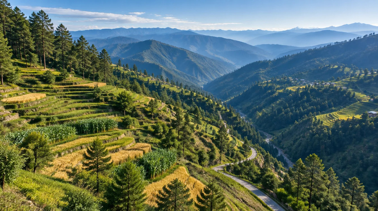
Farming is mixed: wheat on 25.2 thousand hectares and maize on 23.1 thousand, mostly rainfed, with ginger, peas, tomato, potato and stone fruit on the horticulture side (ICAR-CRIDA Sirmaur plan). Slope and rain matter more than soil in the hill blocks, and 66 roads were closed on a single day in August 2025 (The Tribune, August 2025).
Transaction costs
6–8%
General buyers (reported)
6% to ₹40 lakh, 8% above; women 4% to ₹1 crore, 8% above; Sept 2026 bill
12%
Section 118 transfers
ordinance of 18 February 2025, regardless of gender
2%
Registration fee
of the higher of market value or consideration, minimum ₹100 (2012 notification)
For a transfer under a Section 118 permission, duty is 12% of the higher of market value or consideration (ordinance text, Legitquest; UNI, March 2025). The 6% to 8% and 4% to 8% figures come from the Second Amendment Bill passed on 3 September 2026, as reported by ANI, September 2026 and Outlook Money, September 2026; neither report gives an effective date. The 2% registration fee comes from the Revenue Department notification of 12 January 2012; we found no later table. The state announced in May 2023 that physical stamp paper would be phased out after 31 March 2024 and replaced by e-stamps (The Tribune, May 2023). The Registration and Stamps offices were not consulted for this page, so check the rate table in force on the date of your deed. For Sirmaur we found no district-specific duty rate.
Know the belt
Official references only. No listing-site prices are used, and the only district rate files we found are dated 2018-19.
No sourced price series
Kala Amb and Paonta Sahib are the two notified industrial areas (DIPS profile). The CGWB booklet records heavy industrial draft in the Kala Amb valley, which it classed over-exploited in 2011 (CGWB, 2013). Industrial demand and groundwater limits both apply to land here.
Check: the groundwater category for the parcel and any permission needed to sink a borewell.
No sourced price series
Nahan is the district headquarters. The district portal lists rural circle-rate documents for Haripurdhar, Narag, Pajhota, Ronhat, Nohradhar, Kamrau, Dadhau, Pachhad, Renuka Ji and Shillai, all for 2018-19 (portal list). We read the titles, not the rates.
Check: the rate in force for the revenue estate on the date of the deed.
No sourced price series
The Hattee community received Scheduled Tribe status in January 2024 in these segments (The Tribune, January 2024). The report does not discuss land, so we draw no price or rule from it.
Check: any tribal-land restriction the Collector says applies.
No sourced price series
Listing-site asking prices for Sirmaur could not be traced to registered deals, so none are shown. Circle rates are a registration floor and, in the Sirmaur files we saw, an older one.
Check: registered sale deeds in the same revenue estate before negotiating.
Local land units in Sirmaur vary by village, and we opened no revenue manual that defines them. Himachal records give area in the jamabandi; convert every quote to acres or square metres before comparing two offers, and check the share of the khata being sold.
Connectivity
Distances are from the HP Tourism page for Paonta Sahib; we found no sourced distance for Nahan to Chandigarh or Delhi. Hill roads close in rain.
The practical question is the last leg from the highway to the parcel, so ask for the access road in the revenue record. In August 2025 officials warned that overloaded apple trucks on fragile rural roads raised the risk in the monsoon (The Tribune, August 2025). Section 118 rules for outside buyers: Himachal Section 118 explainer.
Growth catalysts
Status labels reflect sources read in October 2026. Government timelines are not guaranteed, and items marked pending have a single or an older source.
01Open or operating
04In progress or pending
Agriculture & terrain
A Shivalik district with an irrigated plain, rainfed hill farms and a short monsoon that does most of the damage.
The Paonta valley is a narrow tectonic valley with alluvial fill, and CGWB calls it the most productive aquifer in the district; the booklet put its stage of groundwater development at 26.66% in 2011, categorised safe, against 564.63% for the Kala Amb valley, categorised over-exploited (CGWB booklet, 2013, assessment of 2011). Industrial effluent is flagged as a pollution risk in the Paonta valley.
ICAR-CRIDA lists wheat on 25.2 thousand hectares and maize on 23.1 thousand, most of the maize rainfed, with ginger on 1.4 thousand hectares, peas, potato, tomato, peach, apple, plum and walnut (ICAR-CRIDA Sirmaur plan, plan of 2012, with dated data). Springs are the main water source in the hills, with low-yield fissured aquifers (CGWB).
Normal annual rainfall is 1,421 mm in the CRIDA plan and 1,405 mm in the CGWB booklet, about 90% of it in the monsoon. The Tribune reported damage of about ₹230 crore in the district between 20 June and 9 September 2025 and 66 roads closed on 15 August 2025 (The Tribune, September 2025; The Tribune, August 2025). A December 2023 report places Sirmaur in seismic Zone IV (The Tribune, December 2023).
CRIDA puts net sown area at 40.8 thousand hectares and cropping intensity at 185%, with 13.6 thousand hectares net irrigated, 55.5% of it by kuhls (hill channels) and 25.7% by canals; the district profile gives 48,682 hectares of forest and 58,560 of pasture for 2012-13 (ICAR-CRIDA; DIPS profile). Valley tubewells yield 200 to 3,220 litres a minute and springs are the hill source (CGWB). Ask for the water source before assuming irrigation.
Local units vary by village in Sirmaur and we opened no revenue manual that defines them. The state record is the jamabandi on Himbhoomi (NIC mHimBhoomi page); convert every quote to acres or square metres from it. Live mandi prices are on the national market portal, which we did not open for this page; crop income is modest next to land values, so price a parcel on location, access and permitted use.
At a glance
| District / belt | Price band* (per acre) | Evidence |
|---|---|---|
| Sirmaur — Nahan and hill blocks | No sourced price series | Portal circle-rate files are dated 2018-19; rates not read |
| Sirmaur — Kala Amb–Paonta belt | No sourced price series | No figure used on this page |
| Solan | No sourced price series | 2026-27 circle-rate notifications listed on the Solan portal; rates not read |
| Shimla | No sourced price series | See the Shimla page for its own evidence |
*Circle rates are registration floors, not market prices. See the Solan page for the industrial belt on the Chandigarh side and the Shimla page for the capital district.
Farmland India view
Five reasoned points, with an honest note that price evidence is thin and the big projects are still pending.
Kala Amb and Paonta Sahib are notified industrial areas with 69 and 127 plots (DIPS profile). Industrial land is a different transaction from farm land, and each still sits under Himachal's permission rules.
The town is about 120 km from Chandigarh and 45 km from Dehradun (HP Tourism). That reach is the main reason this district differs from the interior hill districts; we found no data on how it has moved land values.
The NH-07 four-lane is at the documents stage and only 7 km is four-lane (UNI, August 2026; The Tribune, July 2024). Price on the road as it is today.
Renukaji has forest clearance and a tunnel package at bidding stage (International Water Power, February 2026). It also submerges 1,508 hectares, so it is both a catalyst and a land-loss area.
With Section 118, tribal-status questions, an eco-sensitive zone and a dam footprint all parcel-specific, a buyer who documents each one is better placed than one relying on a broker summary. The return case is access and permitted use, not crop yield.
Confirm Section 118 status, eco-sensitive zone and dam-footprint position directly; these are not certified by Farmland India’s review.
STRAIGHT TALK
Read these before shortlisting in Sirmaur specifically.
A statewide requirement. The Tribune reported several NOCs per application and some cases going to Cabinet (October 2025); we found no sourced processing time.
New commercial hotels and construction are barred within 1 km of the boundary, and tree-felling on government and revenue land is prohibited across the zone (The Tribune, February 2025). Ask the Forest Department for the village list and master plan.
Renukaji would submerge about 1,508 hectares (The Tribune, January 2025). Check the parcel against the project maps and the compensation record.
Losses of about ₹230 crore were reported for 20 June to 9 September 2025 (The Tribune, September 2025). Check slope, drainage and neighbouring road cuts.
CGWB classed the valley over-exploited in 2011 at 564.63% development (CGWB). The data are old; check the current category and borewell permission.
Hattee Scheduled Tribe status was notified in January 2024 (The Tribune). We found no land rule attached to it, so ask the Collector what applies to a given khasra.
Circle-rate files on the portal are dated 2018-19 and statewide revisions were reported stalled in 2025 (The Tribune). Collect registered comparables before negotiating.
Who to contact
Section 118 applications go to the Deputy Commissioner at Nahan as Collector, on Form LRXIV (Rule 38A; Vinod Gupta, 2023), and the State Government decides. Mutation and record matters go to the Tehsildar or Naib Tehsildar of the tehsil, with the patwari keeping the village record (Land Revenue Act). Sale deeds are registered by the local Sub-Registrar. Forest questions, including the eco-sensitive zone, go to the Forest Department divisions at Nahan and Paonta Sahib (The Tribune). The Sirmaur district portal carries notices and circle-rate files. We could not open the Section 118 portal, Himbhoomi or the registration portal, so we do not link them; ask the Deputy Commissioner's office for the current application route.
DEVELOPER PROJECTS · TRUST SCORE
Developer projects carry the platform Trust Score and a reviewed document set.
Reviewed projects have completed Farmland India's document and site review. Individual land parcels are listed by their owners and are not reviewed to the same standard. Always complete your own legal due diligence.
KEEP EXPLORING
Micro-markets in Sirmaur
Other districts in Himachal Pradesh
Guides & research
COMMON QUESTIONS
Everything buyers, NRIs and investors ask before their first reviewed farmland purchase in Sirmaur.
Visit full wiki01 of 04
Only with prior State Government permission under Section 118 of the Himachal Pradesh Tenancy and Land Reforms Act, 1972, unless the buyer is an agriculturist, meaning a person who cultivates land personally in the state. The application goes to the Collector, who is the Deputy Commissioner at Nahan, on Form LRXIV, and the Supreme Court held in Ajay Dabra v. Pyare Ram (January 2023) that a transfer without prior permission cannot stand. Duty on a permitted transfer is 12% under the ordinance of 18 February 2025. Bill 25 of 2025 would amend Section 118 but went to a select committee in December 2025, and we found no report that it has passed.
02 of 04
We found no source that says so. The Tribune reported that Himachal notified Scheduled Tribe status for the Hattee community on 1 January 2024, covering 95 villages in 58 panchayats in the Shillai, Renukaji, Pachhad and Paonta Sahib segments, and the report does not mention land. Ask the Collector in writing whether any restriction attaches to a particular khasra before paying an advance.
03 of 04
We publish no price series for Sirmaur because listing-site asking prices could not be traced to registered deals. The Sirmaur portal lists rural circle-rate documents, but those on its circle-rate page are dated 2018-19 and we did not read the rates, and The Tribune reported in September 2025 that circle rates in several Himachal districts had not been revised for about five years. Circle rates are a registration floor, not a market price.
04 of 04
The Kala Amb to Paonta Sahib four-lane on NH-07 was at the documents stage in August 2026, with only 7 km near Paonta Sahib four-lane in July 2024. The Renukaji dam has stage-II forest clearance dated 4 June 2025 and a 2030 target, and would submerge about 1,508 hectares across 41 villages. A Nahan heliport was approved and at survey stage in December 2024.
Ready to look at what is available?
Browse reviewed listingsTransparency
Law and courts
Government
News
Further reading
Data-currency note: population and area follow the 2011 Census and the 2013 CGWB booklet; the CRIDA plan and groundwater assessment date from 2011 to 2013; infrastructure statuses were read in October 2026 and change quickly; the Renukaji cost and Nahan heliport reports are from December 2024 or earlier. The district portal opened only in part, and the Section 118, Himbhoomi and registration portals were not opened. This is a general guide, not legal advice. Report inaccuracies to wiki@farmlandindia.com.
For developers
Browse reviewed projects and individual land parcels across Sirmaur — or if you own land here, list it with platform review and reach serious buyers.
Farmland India ("the Platform"), operated by Bulk Procure Private Limited, is a digital marketplace for listing agricultural land, farmhouse and plotted development projects. The Platform is not a real estate broker, agent or intermediary under RERA or any other applicable law, and does not act for either party to a transaction.
Listings are submitted by developers, owners and their authorised representatives. Before publication, the Platform carries out a documentary review of the material supplied and records what was sighted. That review is limited to the documents made available to us at that time. It is not a title investigation, not a legal opinion, and not a warranty of title, approvals, or the accuracy of any information supplied by a lister. The Trust Score is an internal assessment produced from that review and is intended as a research aid, not as a guarantee of outcome.
Every buyer must carry out independent due diligence before any transaction — including verification of land records, encumbrance searches, approvals and regulatory compliance — through their own advocate and chartered accountant. Any legal or advisory professional introduced through the Platform is engaged directly by the user, on that professional's own terms; the Platform does not employ, supervise or accept responsibility for their work.
Nothing on the Platform is investment advice. Land values can fall as well as rise. The Platform is not liable for any loss, dispute or damage arising from a transaction between parties.