
District guide
Buying Land in Gadchiroli
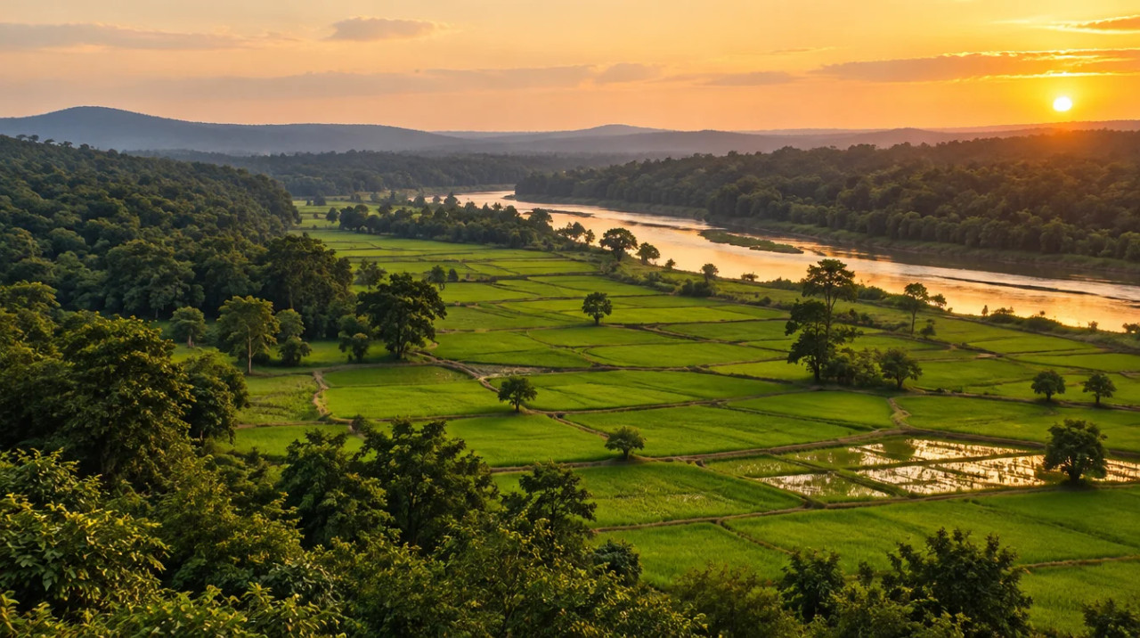
A forest-heavy tribal district of paddy farms on the Wainganga plain, with an approved expressway, an airport plan on hold, iron-ore mining and an estimated land price* that varies widely by belt.
14,412 sq km
Area (district portal)
38.70%
Scheduled Tribe share (Census 2011)
₹1–25 lakh per acre
Estimated land price*
94.241 km, acquisition approved Feb 2026
Bhandara–Gadchiroli expressway
*Indicative range across districts and land types. Stamp duty, registration and conversion charges are additional. Local measurement units vary — every listing states the unit it is priced in. Not a valuation or an offer.
District land record — Gadchiroli
Rev. 2026 · Farmland India desk
State
Maharashtra (Vidarbha); a tribal district, 38.70% Scheduled Tribe population in Census 2011 (Gadchiroli district portal profile)
Sub-divisions
The district portal lists 12 tehsils: Gadchiroli, Armori, Kurkheda, Dhanora, Chamorshi, Sironcha, Desaiganj (Wadsa), Korchi, Bhamragad, Mulchera, Aheri and Etapalli (Gadchiroli district portal profile), in six sub-divisions (Gadchiroli district portal, about the district)
Key markets
Gadchiroli town · Chamorshi · Armori · Desaiganj (Wadsa) · Kurkheda
Demand anchors
Bhandara–Gadchiroli expressway (land acquisition approved Feb 2026) · Chamorshi airport and industrial land (on hold Jun 2026) · iron-ore mining and steel expansion (reported Aug 2025)
Rail
We found no sourced rail-line figure or station list for the district; check Indian Railways
Size and population
14,412 sq km · 10,72,942 people (Census 2011) (Gadchiroli district portal profile); the ICAR-CRIDA plan gives 1,492 thousand hectares, so sources differ (ICAR-CRIDA Gadchiroli plan)
Estimated land price*
₹1–25 lakh per acre depending on the belt, with limited saleable stock in tribal and forest areas (indicative; see the note under the price table)
Pricing unit
₹/acre (farm land) · ₹/guntha or ₹/sq m for small plots
Local units
Acre = 40 gunthas = 43,560 sq ft; 1 guntha = 1,089 sq ft; 1 hectare = 2.47 acres. Local terms vary by tehsil, so convert any quote
Land records portal
Digital 7/12 and 8A extracts through the state land-records portal; the portal was not opened for this page
Land law is state law. These rules are maintained on the Maharashtra page and apply to every district within it.
Gadchiroli — land purchase legal rules
⚠ Maharashtra reserves agricultural land for agriculturists. Section 63 of the Tenancy Act voids a sale to anyone else unless an exception or a Collector’s permission applies, and in July 2026 the Revenue Minister repeated that only recognised farmers may buy. Several other statutes then decide whether a parcel can be split, converted or built on. Read the 7/12 before you read the price.
Who may buy agricultural land: Section 63 of the Maharashtra Tenancy and Agricultural Lands Act makes a sale, gift, exchange or lease of agricultural land invalid in favour of a person who is not an agriculturist. It also bites where an agriculturist buyer would end up holding more than two-thirds of the ceiling area (Indian Kanoon text of section 63). The Collector, or an officer the State authorises, can permit a transaction on conditions, but not where the buyer would farm the land and has other income of Rs 12,000 a year or more, according to the same text. In Gundaji Satwaji Shinde v. Ramchandra Bhikaji Joshi (Supreme Court, December 1978) the Court held that whether a buyer is an agriculturist is for the Mamlatdar, not the civil court (Manupat case guide). On 8 July 2026 the Revenue Minister told the Assembly that only recognised farmers may buy agricultural land and that buyers must show proof of farmer status; IANS named no new statute (IANS, July 2026).
Where the bar does not apply: Maharashtra Act I of 2016 inserted sub-section (1C), which switches off the bar for land inside a Municipal Corporation, subject to conditions: non-agricultural use within a fixed time, with the Collector able to extend by up to five years (Acts of 2016 and 2018, PRS). Section 63-1A separately lets a buyer, farmer or not, take land for bona fide industrial use without prior Collector permission (Indian Kanoon text of section 63-1A). The Maharashtra Tenancy and Agricultural Lands Laws (Amendment) Act, 2026, effective 15 April 2026, narrows that route to occupancy class-I land, replaces the old non-agricultural assessment and nazarana with a one-time conversion premium under section 47 of the Land Revenue Code, and caps the penalty for late notice at five times that premium (JSA, June 2026). JSA describes no change to the general bar in section 63(1).
Tenant-purchased land and wills: Land a tenant bought under the Act cannot be sold, gifted, mortgaged or leased without the Collector’s prior sanction. After ten years the sanction falls away if the seller pays nazarana of forty times the assessment, the buyer is an agriculturist and the buyer stays within the ceiling (Indian Kanoon text of section 43). The 2026 amendment deletes the nazarana (JSA, June 2026). A will does not get round the bar: in Vinodchandra Sakarlal Kapadia v. State of Gujarat (15 June 2020) the Supreme Court read “assignment” in section 43 to include a bequest to a non-agriculturist (LiveLaw, June 2020; Supreme Court judgment). That appeal came from Gujarat, which applies the same 1948 statute, and the Court disapproved an earlier ruling under the separate Vidarbha Act. Marathwada and Vidarbha run on parallel Acts that the 2026 amendment also touches.
Fragmentation and minimum plot size: The Maharashtra Prevention of Fragmentation and Consolidation of Holdings Act, 1947 restricts sales of land below a notified standard area. A notification of 8 August 2023 set it, outside municipal corporation and council limits, at about a quarter acre for bagayat (irrigated) land and half an acre for jirayat (dry-crop) land, which is roughly 10 and 20 gunthas on our arithmetic of 40 gunthas to the acre (Cyril Amarchand Mangaldas via Conventus Law). The 2024 amendment moved the regularisation window to 15 October 2024 at a premium of up to 5%. A further Act notified on 31 December 2025, deemed in force from 3 November 2025, deletes the proviso to section 8B and adds section 9(4): past transfers and partitions from 15 November 1965 to 15 October 2024 are regularised without premium where the land is used for bona fide non-agricultural purposes inside listed urban, planning-authority, cantonment and regional-plan zones (TeamLease RegTech; Bill text, PRS). The bill did not change the standard area or the general restrictions. In July 2025 the Revenue Minister said plots up to one guntha subdivided before 1 January 2025 would be treated as legal, and a committee was set up the following week (The Week, July 2025; The Week, July 2025). Plain farm land outside those zones is still bound by the standard area.
Non-agricultural conversion: The Maharashtra Land Revenue Code (Second Amendment) Act, 2025, notified on 31 December 2025, substituted section 42. The Collector’s permission is no longer needed to use agricultural land for a purpose that a draft or final Development Plan or Regional Plan allows; the planning authority’s development permission or building plan approval is enough, and sections 42A to 42D, 44 to 46 and the old assessment chapter were deleted (JSA, March 2026). The yearly non-agricultural assessment gives way to a one-time premium under section 47 on the Ready Reckoner value: 0.1% up to 1,000 sq m, 0.25% from 1,000 to 4,000 sq m and 0.5% above 4,000 sq m. A government resolution of 10 February 2026 implements the change (Khaitan & Co, February 2026). Neither note says the reform alters section 63, so our reading is that a non-farmer still cannot buy agricultural land first and convert it afterwards.
Ceiling on holdings: The Maharashtra Agricultural Lands (Ceiling on Holdings) Act, 1961 caps what one family unit may hold, from 18 acres of assured-irrigation land to 54 acres of other dry-crop land in a 2011 summary (Bombay Chartered Accountant Journal, April 2011). Section 63 uses two-thirds of that ceiling as the test for a buyer who is already a farmer.
Tribal land: Where the seller belongs to a Scheduled Tribe, the sale also falls under the Land Revenue Code and the Restoration of Lands to Scheduled Tribes Act, 1974 (section 63-1A text). Ask for the seller’s status in writing.
Land records: Digitally signed 7/12 (record of rights), 8A (khata) and ferfar (mutation) extracts now carry legal validity under rules made under the Maharashtra Land Measurement and Record Keeping Act, 2025, with a QR code and a 16-digit verification number, no Talathi stamp and a fee of Rs 15 each (Free Press Journal, December 2025). About 2.57 crore signed 7/12 records existed by June 2024, and e-Mojani 2.0 handles measurement (Elets, February 2025). Read the occupancy class, the holder’s name and the land-use entry before paying a token.
NRI and OCI buyers: The Reserve Bank’s Master Direction lets NRIs and OCIs buy immovable assets in India but excludes agricultural land, plantation land and a farmhouse, and its inheritance paragraphs carry no such exclusion (RBI Master Direction FED 12/2015-16, updated to September 2022). A farmhouse plot is therefore out of reach by purchase, wherever it sits in Maharashtra. Anyone relying on a later circular should read it directly. We did not open the 2023 standard-area notification, the text of section 63A or the current ceiling schedule, so have an advocate check all three against the survey number.
- Section 63 farmer-only bar
- NA reform Dec 2025
- Fragmentation Act 1947
- Ceiling Act 1961
- Digital 7/12 and 8A
- NRI agri: barred (FEMA)
- RR rates unchanged 2026-27
Gadchiroli — district-specific notes
The Maharashtra state page applies to Gadchiroli in full, and the district is described by its own portal as a tribal and undeveloped district. The notes below are specific to this district and are not repeated from the state page. Law was read from legal-database copies of Acts, law-firm notes and press reports; the Mahabhumi portal, the IGR rate pages and any Scheduled Area notification could not be opened, and the notes say so where it matters.
⚠ Maharashtra reserves agricultural land for agriculturists. Section 63 of the Tenancy and Agricultural Lands Act voids a sale to a non-agriculturist unless an exception or a Collector’s permission applies, and it also bites where an agriculturist buyer would end up above two-thirds of the ceiling area (Indian Kanoon text of section 63); on 8 July 2026 the Revenue Minister repeated that only recognised farmers may buy, and IANS named no new statute (IANS, July 2026). The state page reads Vidarbha as running on a parallel Act (our reading, CONFIRM), and the 2020 Supreme Court ruling on wills disapproved an earlier Vidarbha-Act decision (LiveLaw, June 2020). Treat the 7/12 and a written reading of the farmer-status rule as the first checks in Gadchiroli.
⚠ Tribal land is the first filter here. The Scheduled Tribe share is 38.70% (4,15,306 people) in the 2011 Census (Gadchiroli district portal profile). Where the seller belongs to a Scheduled Tribe, the sale also falls under the Land Revenue Code and the Restoration of Lands to Scheduled Tribes Act, 1974, and section 63-1A carries seller protections (Indian Kanoon text of section 63-1A). The district pages we opened do not say whether any tehsil or village is a notified Scheduled Area or covered by the Panchayats (Extension to Scheduled Areas) arrangements, and we did not open a notification. Ask the Collector’s office and the tribal development office, in writing, whether the recorded holder is a tribal member and whether the village is notified, before paying a deposit.
⚠ Forest dominates the district, and the sources disagree on how much. The district portal gives 12,897.12 sq km of forest, about 90% of the 14,412 sq km area on our arithmetic (Gadchiroli district portal profile); another portal page says about 76% (Gadchiroli district portal, about the district), The Week says about 70% (The Week, August 2025), and the ICAR-CRIDA plan gives 1,133 thousand hectares (ICAR-CRIDA Gadchiroli plan). A parcel recorded as forest land, or held under a forest-rights title, may not be saleable as farm land. Ask the Forest Department’s divisional office and the Tehsildar whether the survey number is revenue land, forest land or a forest-rights holding.
⚠ Mining is expanding. The Week reported in August 2025 that an iron-ore mine in the district was being expanded to 26 million tonnes a year of dispatchable capacity, with a 4.5 million tonne steel plant planned (The Week, August 2025). A June 2026 report says about 3,000 hectares in Chamorshi tehsil are being pursued for industrial projects and that the objection period was extended by 90 days (Swarajya, June 2026). Ask whether a parcel lies inside a lease, an industrial notification or a pipeline or road corridor.
⚠ The Prevention of Fragmentation Act, 1947 restricts sales of land below a notified standard area. A notification of 8 August 2023 set it, outside corporation and council limits, at about a quarter acre for bagayat (irrigated) land and half an acre for jirayat (dry-crop) land, roughly 10 and 20 gunthas on our arithmetic (Cyril Amarchand Mangaldas via Conventus Law); the notification itself was not opened, so CONFIRM. A further Act notified on 31 December 2025 regularises past transfers from 15 November 1965 to 15 October 2024 only for bona fide non-agricultural use in listed zones (TeamLease RegTech; Bill text, PRS), so it does not help a plain farm-land buyer.
⚠ Acquisition is contested. About 6,000 farmers marched in Gadchiroli on 5 June 2026 against airport land acquisition, proposed industrial projects in Chamorshi and mining expansion, and the state paused the airport acquisition pending a decision by the Chief Minister (Swarajya, June 2026). Treat acquisition status as a live, changing fact and ask for it in writing.
⚠ Using farm land for a house or farmhouse needs the conversion route. The Land Revenue Code Second Amendment, notified 31 December 2025, substituted section 42 and added a one-time section 47 premium of 0.1%, 0.25% or 0.5% of the ready-reckoner value by plot size, set by a GR of 10 February 2026 (JSA, March 2026; Khaitan and Co, February 2026). Both are law-firm reports, so CONFIRM against the Gazette before relying on them.
Read the full state-wise land laws guide for buyer eligibility, stamp duty and NRI rules.
- Tribal district
- Forest land
- Section 63-1A
- Mining and acquisition
District overview
Gadchiroli — a forest-heavy tribal district with an expressway, an airport plan and iron-ore mining
Gadchiroli district has 14,412 sq km and 10,72,942 people in the 2011 Census, of whom 38.70% are Scheduled Tribe, and it was created on 26 August 1982 out of Chandrapur (Gadchiroli district portal profile; Gadchiroli district portal, about the district). The Godavari forms its southern boundary, the Pranhita is formed near Chaprala village in Chamorshi taluka, and the Wainganga, Indravati and others drain it. The district portal calls paddy the main crop and bamboo and tendu leaves the best-known forest produce, and forest covers somewhere between about 70% and 90% of the area depending on the source.
We found no registered-deed series for farm land and no district ready-reckoner table. A reported compensation outlay for the Chamorshi airport is the only dated land-cost signal we found, and it covers one site (The Hitavada, May 2026). The estimated bands on this page, from about ₹1 lakh to ₹25 lakh per acre*, are wide and indicative: the Wainganga plain around Gadchiroli town, Chamorshi and Armori sits at the top, and the remote forest and tribal tehsils at the bottom.
Three state decisions drive the news. A land-acquisition approval of Rs 931.15 crore for the 94.241 km Bhandara–Gadchiroli expressway came in February 2026 (Swarajya, February 2026), the Chamorshi airport acquisition was paused in June 2026 after a farmers’ march (Swarajya, June 2026), and iron-ore mining and steel expansion were reported in August 2025 (The Week, August 2025).
- Gadchiroli town
- Chamorshi
- Armori
- Desaiganj
- Kurkheda
- Bhandara–Gadchiroli expressway

Transaction costs
Stamp duty & registration in Gadchiroli
5% + 1%
Municipal corporation and council areas
of market value in the Act text to May 2019; a further 1% from 8 Feb 2019 in notified areas
4%
Gram panchayat and other areas
of market value in the same Act text
1%
Registration fee
capped at Rs 30,000 in the same text
The figures above come from a reproduction of Article 25 of the Maharashtra Stamp Act, 1958 amended to May 2019 (Maharashtra Stamp Act text to May 2019), and the Rs 30,000 registration-fee cap is repeated in a May 2025 report (Free Press Journal, May 2025). The additional 1% for metro and infrastructure was still mentioned as current in April 2025 (Business Standard, April 2025). The grantee bears the duty unless the parties agree otherwise, and an understated value draws the shortfall plus a penalty of 2% a month, capped at four times the deficit (Maharashtra Stamp Act PDF, IGR). The IGR home page we opened gives no rate table (IGR Maharashtra), so the current schedule is unconfirmed; read it from the department or the Sub-Registrar before budgeting. The May 2025 cabinet waived the registration fee on partition documents for agricultural land, not on sale deeds, and a May 2026 report of an exemption on land purchases did not say which purchases it covers (Nation Press, May 2026). For tribal sellers the registration also depends on the permission and status checks on this page, so budget time for them, not only duty.
Know the belt
What is moving prices in Gadchiroli
Expressway, airport and mining news, plus wide indicative price bands marked *. No registered-deed series was found.
Gadchiroli town, Chamorshi and Armori (Wainganga plain)
Estimated land price*: ₹6–25 lakh per acre
This is where the expressway interchanges, the airport proposal and the industrial land pursuit all sit (Swarajya, February 2026; The Hitavada, May 2026; Swarajya, June 2026). We found no dated rate for farm land, so the band is a wide, rounded range by analogy with comparable Vidarbha districts and is not a deal price.
Check: acquisition notifications, forest status and the access road in the record.
Kurkheda, Desaiganj, Dhanora and Aheri
Estimated land price*: ₹2–10 lakh per acre
Paddy is the main crop in the plan, on mostly deep black soils (ICAR-CRIDA Gadchiroli plan). We found no dated rate here, so the band is a wide, indicative range.
Check: tribal-holder status, forest-rights entries and irrigation source.
Sironcha, Bhamragad, Etapalli, Korchi and Mulchera
Estimated land price*: ₹1–5 lakh per acre
These are remote, forest-heavy tehsils where legal status decides saleability more than price. We found no dated rate, so the band is a wide, indicative range for the few parcels that can be sold.
Check: whether the land is revenue land, tribal-held or forest, and whether road access is recorded.
Chamorshi airport site
Reported acquisition, now paused
The state approved Rs 104 crore to acquire about 311.81 hectares, of which 245.75 ha is private land, with Rs 76.99 crore for private-land compensation, in Chamorshi taluka (The Hitavada, May 2026). The acquisition was paused on 5 June 2026 (Swarajya, June 2026). The report’s own figures do not fully add up, so treat them as reported.
Check: whether a parcel is in the affected mouzas and the current status.
Ready Reckoner 2025-26 and 2026-27
Rural +3.36% (2025-26); unchanged (2026-27)
The state raised rural rates by 3.36% for 2025-26 (IANS via Investment Guru India, April 2026) and kept all rates unchanged for 2026-27 (The Hitavada, April 2026). We found no Gadchiroli table.
Check: the rate in force for the village on the deed date.
Units: acres, gunthas and hectares
Records and the Act texts use acres, gunthas and hectares: 1 acre = 40 gunthas = 43,560 sq ft, 1 guntha = 1,089 sq ft (The Week, July 2025) and 1 hectare = 2.47 acres. Local trade terms can differ between tehsils, so ask the seller for the 7/12 area and convert every quote to acres before comparing offers.
Connectivity
How Gadchiroli connects — road, rail and air
Only items with a source are listed; train services, bus links and flight schedules were not researched for this page.
By road
By rail
By air
The practical question is the last leg from the highway to the parcel; ask for the access road in the revenue record. Full rules for buyers: state-wise land laws.
Growth catalysts
Upcoming infrastructure & developments
Status labels reflect sources read in October 2026. Government-announced timelines are not guaranteed; items marked reported rest on a single outlet.
01Open or inaugurated
03In progress or pending
Agriculture & terrain
Soil, crops & water in Gadchiroli
A paddy-first district on mostly deep black soils, irrigated from wells, tanks and canals, with very large forest cover and tribal land.
🌾 Soil and crops
The ICAR-CRIDA plan (undated; crop data 2008-09) puts deep black soils on 72.3% of the area, medium-deep on 20.2% and shallow on 7.4%, with net sown area of 148 thousand hectares, cropping intensity 133.1% and paddy (149.6 thousand hectares in kharif) the main crop, followed by pigeon pea, soybean and rabi sorghum (ICAR-CRIDA Gadchiroli plan). The district portal also names bamboo and tendu leaves among forest produce (Gadchiroli district portal, about the district).
- Paddy
- Pigeon pea
- Soybean
- Bamboo
💧 Irrigation
The plan gives net irrigated area of 56.3 thousand hectares from canals, tanks, open wells and a few bore wells, but the table is garbled and its percentages overlap (ICAR-CRIDA Gadchiroli plan), so read it as a mix of sources and not a precise split. Rainfed area is 135.9 thousand hectares, so water access varies a lot by village.
- Tanks
- Open wells
- Canals
🌊 Rivers and forest
The Godavari, Pranhita, Wainganga, Indravati and several smaller rivers drain the district (Gadchiroli district portal profile; Gadchiroli district portal, about the district). Forest figures range from about 70% to 90% of the area by source, as the legal notes explain. Forest and river-bank parcels need a written status from the Forest Department.
- Godavari
- Pranhita
- Wainganga
- Forest
💧 Rainfall & groundwater
Average rainfall is 1,430.8 mm on the district portal (1,467.4 mm in 2023) and a normal of 1,428.5 mm in the plan (Gadchiroli district portal profile; ICAR-CRIDA Gadchiroli plan). The CGWB 2024 report lists Gadchiroli among districts with sporadic fluoride and nitrate readings (CGWB Maharashtra report, 2024); we found no district stage-of-extraction figure. Test the water of any parcel before buying.
📐 Measurement units
Records use acres, gunthas and hectares: 1 acre = 40 gunthas and 1 hectare = 2.47 acres (The Week, July 2025). Local terms vary by tehsil, so convert every quote before comparing offers. Price a parcel on legal status and access, not on crop income.
At a glance
Gadchiroli vs. nearby districts
| District / belt | Estimated land price* (per acre) | Basis |
|---|---|---|
| Gadchiroli — town, Chamorshi and Armori | ₹6–25 lakh* | Indicative estimate; wide band |
| Gadchiroli — Kurkheda, Desaiganj, Dhanora, Aheri | ₹2–10 lakh* | Indicative estimate; wide band |
| Gadchiroli — Sironcha, Bhamragad, Etapalli, Korchi, Mulchera | ₹1–5 lakh* | Indicative estimate; wide band |
| Chandrapur | Not estimated here | See the Chandrapur page |
| Gondia | Not estimated here | See the Gondia page |
| Nagpur | Not estimated here | See the Nagpur page |
*Indicative only, not a valuation or an offer; prices vary by plot, road access and title. Check the guideline or ready-reckoner rate with the Sub-Registrar. See the Chandrapur page, the Gondia page, the Bhandara page and the Nagpur page for nearby districts.
Farmland India view
Why investors look at Gadchiroli
Five reasoned points, with an honest note that this is a legally complex district where price evidence is thin and several projects are paused or at approval stage.
An expressway with acquisition funding
The 94.241 km Bhandara–Gadchiroli corridor has Rs 931.15 crore approved for land acquisition, but tendering waits for cabinet clearance (Swarajya, February 2026). Price on today’s roads.
A mining and steel economy
The Week reported mine expansion and steel plans with about 14,000 jobs so far (The Week, August 2025). Demand may follow near the road and industrial land, but leases and acquisition also take land out of the market.
An airport that is paused
The Chamorshi airport acquisition was paused on 5 June 2026 after a farmers’ march (Swarajya, June 2026). Do not price a parcel on an airport that may move or stall.
Low entry prices, high legal friction
Our indicative bands* are among the lowest in the state, but tribal-land rules, forest status and acquisition notices can make a cheap parcel unsaleable.
A paperwork-led market
Farmer-status, tribal-holder, forest-rights and acquisition status are all parcel-specific. The return case rests on clean title and permitted use, not on crop yield.
Confirm land-use, tribal-land and ready-reckoner status directly; these are not certified by Farmland India’s review.
STRAIGHT TALK
Risks & challenges in Gadchiroli
Read these before shortlisting in Gadchiroli specifically.
Tribal and forest land
Where the seller is a Scheduled Tribe member, section 63-1A and the 1974 Act apply (Indian Kanoon text of section 63-1A), and forest cover is between about 70% and 90% by source (Gadchiroli district portal profile; The Week, August 2025). Get written status.
Acquisition and protest
About 6,000 farmers marched on 5 June 2026 and the airport acquisition was paused (Swarajya, June 2026). Status can change within weeks.
Mining and leases
Mine expansion and about 3,000 hectares of industrial land in Chamorshi are in play (The Week, August 2025; Swarajya, June 2026). Ask whether a parcel is inside a lease or notification.
Stamp duty and rates
The Act text gives 5% plus 1% and 4%, with the schedule unconfirmed (Maharashtra Stamp Act text to May 2019). The state held Ready Reckoner rates for 2026-27 (The Hitavada, April 2026); no Gadchiroli table was found.
Announced is not delivered
The expressway has acquisition funding but no tender in the report we read, and the airport is paused (Swarajya, February 2026; Swarajya, June 2026). Price on today’s fundamentals.
Access, security and data gaps
Remote tehsils can lack recorded road access, and we found no sourced current security assessment, so check conditions locally. Area, forest share and tehsil sub-division figures vary by source, and the bands on this page are indicative estimates*, not deal prices.
Who to contact
Local revenue, planning & forest offices
Mutation and revenue-record matters go through the Tehsildar of the relevant tehsil under the District Collector, Gadchiroli; the district portal lists 12 tehsils in six sub-divisions (Gadchiroli district portal, about the district). Sale-deed registration is handled by the local Sub-Registrar, tribal-holder and Scheduled Area questions go to the Collector’s office and the tribal development office, and forest status goes to the Forest Department’s divisional office. We opened the district portal profile pages (Gadchiroli district portal profile) but not the Mahabhumi portal, the IGR rate pages or any Scheduled Area notification, so check them directly.
COMMON QUESTIONS
Frequently asked questions
Everything buyers, NRIs and investors ask before their first reviewed farmland purchase in Gadchiroli.
Visit full wiki01 of 04
What does farm land cost in Gadchiroli?
Our estimate is about ₹1 lakh to ₹25 lakh per acre*, depending on the belt: roughly ₹6–25 lakh around Gadchiroli town, Chamorshi and Armori, ₹2–10 lakh in Kurkheda, Desaiganj, Dhanora and Aheri, and ₹1–5 lakh in the remote tehsils, where few parcels can be sold. These are wide, rounded, indicative estimates, not a valuation or an offer. Check the Ready Reckoner rate with the Sub-Registrar.
02 of 04
Do tribal-land rules apply in Gadchiroli?
Often. The Scheduled Tribe share is 38.70% in the 2011 Census, and where the seller is a Scheduled Tribe member the sale also falls under the Land Revenue Code and the Restoration of Lands to Scheduled Tribes Act, 1974. We did not open a Scheduled Area notification, so ask the Collector’s office whether the holder is a tribal member and whether the village is notified.
03 of 04
What happened to the Gadchiroli airport land acquisition?
The state approved Rs 104 crore to acquire about 311.81 hectares in Chamorshi taluka, and after a march of about 6,000 farmers on 5 June 2026 it paused the acquisition until the Chief Minister decides. Confirm the current status with the Collector’s office before relying on the project.
04 of 04
How much of Gadchiroli is forest?
Sources differ: the district portal lists 12,897.12 sq km, about 90% of the area on our arithmetic, another portal page says about 76%, and The Week says about 70%. A parcel recorded as forest or held under a forest-rights title may not be saleable as farm land, so ask the Forest Department and the Tehsildar for written status.
Ready to look at what is available?
Browse reviewed listingsTransparency
Sources and references
Law and courts
- Maharashtra Tenancy and Agricultural Lands Act, 1948, section 63, Indian Kanoon text
- Section 63-1A, Indian Kanoon text
- Section 43, Indian Kanoon text
- Maharashtra Tenancy and Agricultural Lands Act, 1948 as amended in 2016 and 2018, PRS Legislative Research
- Vinodchandra Sakarlal Kapadia v. State of Gujarat, Supreme Court, 15 Jun 2020, LiveLaw report
- Gundaji Satwaji Shinde v. Ramchandra Bhikaji Joshi, Supreme Court, 5 Dec 1978, Manupat case guide
- Maharashtra Prevention of Fragmentation and Consolidation of Holdings (Amendment) Bill, 2025, PRS Legislative Research
- Maharashtra Stamp Act, 1958, text amended to May 2019
- Maharashtra Stamp Act, amended to 3 Jun 2022, IGR Maharashtra
Government
- Gadchiroli district portal, brief district profile
- Gadchiroli district portal, about the district
- District agriculture contingency plan, Gadchiroli, ICAR-CRIDA (undated; crop data 2008-09)
- Maharashtra state overview, State Disaster Management Authority
- Dynamic Ground Water Resources and Ground Water Quality of Maharashtra, 2024, Central Ground Water Board
- Foreign Exchange Management (Acquisition and Transfer of Immovable Property in India) Master Direction, RBI
- Inspector General of Registration and Controller of Stamps, Maharashtra (home page)
News
- Administrative approval of Rs 931.15 crore for Bhandara–Gadchiroli expressway land, Swarajya, 19 Feb 2026
- Maharashtra clears four expressway projects worth Rs 51,906 crore across Vidarbha, Swarajya, 15 May 2026
- State govt zeroes in on Chamorshi taluka for new airport in Gadchiroli, The Hitavada, 13 May 2026
- Gadchiroli airport land acquisition on hold after farmers’ protest, Swarajya, 7 Jun 2026
- From Naxal stronghold to steel hub: Gadchiroli, The Week, 10 Aug 2025
- Ready Reckoner rates 2026-27 unchanged, IANS via Investment Guru India, Apr 2026
- State opts for status quo in Ready Reckoner rates, The Hitavada, 1 Apr 2026
- Maharashtra hikes Ready Reckoner rates 3.9%, Business Standard, Apr 2025
- Registration fee waived for agricultural land partition documents, Free Press Journal, May 2025
- Maharashtra waives stamp duty on land buys, Nation Press, May 2026
- Only farmers can buy agricultural land in Maharashtra, IANS, 8 Jul 2026
Further reading
- Maharashtra Tenancy and Agricultural Lands Laws (Amendment) Act, 2026, JSA Prism, June 2026
- Land Revenue Code Second Amendment Act, 2025, JSA Prism, March 2026
- Land Revenue Code amendment, Khaitan and Co ERGO, 23 Feb 2026
- Recent amendments to the Fragmentation Act, Cyril Amarchand Mangaldas via Conventus Law
- Fragmentation Amendment Act, 2025, TeamLease RegTech
- Maharashtra land bill, legacy urban plots, King Stubb and Kasiva, Jan 2026
- Agricultural land laws and the 1961 Ceiling Act, Bombay Chartered Accountant Journal, Apr 2011
- Digital 7/12 extracts get full legal validity, Free Press Journal, Dec 2025
- Land records e-governance in Maharashtra, Elets, Feb 2025
- Plots up to one guntha, The Week, 9 Jul 2025
- Economic Survey of Maharashtra 2025-26
- Maharashtra state profile, Invest India
Data-currency note: the district portal gives area, population and tehsils, while crop, soil and irrigation data come from an undated ICAR-CRIDA plan with 2008-09 crop figures and a garbled irrigation table. Infrastructure and acquisition statuses were read in October 2026 and change quickly; Ready Reckoner items are reports, not notified schedules; estimated land prices are indicative and are not taken from any registered deed. Pages marked “not opened” are named only as places to check. This is a general guide, not legal advice. Report inaccuracies to wiki@farmlandindia.com.
For developers
Ready to explore Gadchiroli farmland?
Browse reviewed projects and individual land parcels across Gadchiroli — or if you own land here, list it with platform review and reach serious buyers.