
District guide
Buying Land in Lakhisarai
Land in Lakhisarai, Bihar: Kiul rail junction, Mokama–Munger highway, bypass road and June 2026 MVR rules explained for buyers.
About 1,301 sq km
Area (CGWB)
About 1,095 to 1,170 mm
Normal annual rainfall
About 82 km, Rs 4,447 crore
Mokama–Munger highway
54 km, about Rs 962 crore
Kiul–Jhajha third line
*Indicative range across districts and land types. Stamp duty, registration and conversion charges are additional. Local measurement units vary — every listing states the unit it is priced in. Not a valuation or an offer.
District land record — Lakhisarai
Rev. 2026 · Farmland India desk
State
Bihar
Blocks
Six blocks: Barahiya, Halsi, Lakhisarai, Pipariya, Ramgarh Chowk and Surajgarha (CGWB)
Key markets
Lakhisarai town · Barahiya · Kiul · Surajgarha · Halsi · Ramgarh Chowk · Pipariya
Demand anchors
Mokama–Munger four-lane highway · Kiul–Jhajha third rail line · Barahiya bypass road · Ganga and Kiul river plains
Rail
Kiul Junction and Lakhisarai Junction on the Howrah–Delhi main line
Size and population
About 1,301 sq km (CGWB) and about 10 lakh people at the 2011 Census (Census of India)
Pricing unit
Asking prices are usually quoted per kattha or decimal; no sourced price series is shown
Local units
Kattha (कट्ठा), bigha (बीघा) and decimal (डिसमिल) are used in deeds and talk; this page converts to acres and sq yd only where a source does
Land law is state law. These rules are maintained on the Bihar page and apply to every district within it.
Lakhisarai — land purchase legal rules
Bihar does not reserve agricultural land for farmers the way Gujarat or Maharashtra do, so an Indian resident who is not a cultivator can usually buy farmland here. The limits that bite are different: a family land ceiling, a conversion permission before any non-farm use, an unfinished statewide resurvey that is rewriting old records, and the usual NRI bar under FEMA. Most buyer problems in Bihar come from the records, not from the law.
Who can buy agricultural land? We found no provision in Bihar’s tenancy or ceiling laws that limits farmland purchases to agriculturists. What the Bihar Land Reforms (Fixation of Ceiling Area and Acquisition of Surplus Land) Act, 1961 controls is how much a family may hold, and section 16 bars any acquisition by transfer, exchange, lease, mortgage or settlement that would take the buyer’s family above its ceiling. Inheritance, bequest and gift are outside that bar.
Ceiling limits: Section 4 of the 1961 Act sets the ceiling for a family of up to five by land class: 15 acres for land irrigated by government works and double-cropped, 18 acres for land on private tubewells or lift irrigation, 25 acres for one-season irrigated land, 30 acres for other land including orchards, 37.5 acres for diara or chaur land and 45 acres for hilly, sandy or perennially submerged land. Each extra family member adds one-tenth of the ceiling, up to one and a half times the limit. A “family” is a person, spouse and minor children, and companies, trusts and institutions count as persons.
Conversion to non-farm use: The Bihar Agriculture Land (Conversion for Non-Agriculture Purposes) Act, 2010 requires prior permission from the Sub-Divisional Officer before agricultural land is used for anything else. The fee is 10% of market value as set by the Collector under the Stamp Act, the SDO must decide within 90 days, and converting without permission draws a penalty of half the fee on top of the fee. The Act does not apply inside municipal areas or areas notified as urban, commercial or industrial through a master plan, where building and layout rules take over instead.
Mutation and the Jamabandi: A registered deed is not the end of the job. The buyer has to apply for mutation, called Dakhil Kharij, so that the Jamabandi (register II) moves to the buyer’s name and rent receipts are issued to the buyer. Both steps run online through Bihar Bhumi, and errors in the digitised Jamabandi are corrected through the Parimarjan portal. Sellers whose Jamabandi carries a wrong name, area or plot number should fix it before registry, not after.
The special land survey: Bihar is resurveying land under the Bihar Special Survey and Settlement Act, 2011, which will produce a new Khatiyan (record of rights) and maps for each village. The deadline was moved to December 2026 in March 2025 (PTI via ThePrint), and the revenue minister was reported in March 2026 to have set December 2027 for completion (Prabhat Khabar, March 2026). Buyers in a village under survey should check whether the seller filed the self-declaration and whether any claim or objection is pending on the plot.
Government, Bhoodan and estate land: A large share of disputes involves land that was never the seller’s to sell: government land recorded as gair mazarua, Bhoodan land, or land of former estates. The revenue department reported that 2,56,664.88 acres of the 6,48,593.14 acres donated under Bhoodan had been distributed, and that about 15,358 acres of the former Bettiah Raj estate were set to be taken over (Deccan Herald). Check the khata category in the Khatiyan before paying any token money.
Scheduled Areas and tribal land: Bihar is not among the ten states with notified Fifth Schedule Areas (PIB). The Chotanagpur and Santhal Parganas tenancy restrictions on tribal land went with those regions to Jharkhand in 2000, so buyers moving between the two states should not assume the same rules apply.
Planned township zones: Bihar has finalised areas for 11 greenfield satellite townships and in April 2026 the Urban Development Department barred sale, purchase and construction in seven of them, including the Pataliputra Township around Patna (Prabhat Khabar, April 2026). The ban on sales was lifted in August 2026, though a landowner inside the Pataliputra township area must first inform the government before selling, and a cabinet decision reported on 29 October 2026 removed the restriction in the satellite townships, with construction to follow the development control rules (Prabhat Khabar, 9 August 2026; Prabhat Khabar, 29 October 2026). Zoning under these plans now decides what a plot can be used for.
Documents to ask for: Before paying an advance, collect the current Jamabandi page and the latest rent receipt (lagan rasid), the Khatiyan (record of rights) from the last settled survey and, where it exists, the new survey entry, the Bhu Naksha map sheet with the plot number marked, the seller’s chain of registered deeds (kewala) for at least the last 30 years, the mutation order that put the land in the seller’s name, and a land possession certificate (LPC) from the circle office. Match the khata, khesra (plot) number, area and boundaries across every document. Our Bhu Naksha guide and mutation status guide show how to pull these online.
NRI and OCI buyers: Under the RBI’s Master Direction on acquisition of immovable property, NRIs and OCIs may buy immovable property in India other than agricultural land, plantation property or a farm house. They can inherit such land. Our NRI guide covers the options in detail.
- No farmer-only rule found
- Ceiling Act 1961
- Conversion Act 2010 (SDO)
- Dakhil Kharij mutation
- Special survey to 2027 (reported)
- NRI agri: barred (RBI)
- Records via Bihar Bhumi
Lakhisarai — district-specific notes
The Bihar state page applies to Lakhisarai in full: the ceiling law, the 2010 conversion rule, mutation through Bihar Bhumi and the NRI bar. These five points are specific to the district.
⚠ Lakhisarai lies on the south bank of the Ganga, with the Kiul and Harohar rivers crossing it (CGWB). The northern blocks near the Ganga and the Kiul are flat alluvial plain where flooding and waterlogging are the first things to check. The south-east is hard rock country with quartzite, phyllite and granite gneiss, where plots are rockier and wells are less certain.
⚠ Two big transport projects touch the district. The four-lane Mokama–Munger section of the Buxar–Bhagalpur high-speed corridor was approved by the Union Cabinet on 10 September 2025 (Business Standard), and a third rail line between Kiul and Jhajha was reported approved in 2026 (Construction World). Land taken for either project is acquired through the notification route, so ask the circle office whether a plot lies in a notified survey number before paying anything.
⚠ The statewide minimum value register (MVR) revision applies in Lakhisarai. Prabhat Khabar reported that from 19 June 2026 MVR doubled in urban and peripheral areas and rose 1.6 times in rural areas, with stamp duty rising from 6% to 7% in rural areas (Prabhat Khabar, 18 June 2026). Read the Bihar stamp duty guide and the MVR rate guide.
⚠ Groundwater quality needs a test: the ICAR-CRIDA plan notes fluoride at 0.6 to 7.07 ppm in parts of the district (ICAR-CRIDA). If you plan a farmhouse, orchard or dairy, test the borewell water before you pay.
⚠ NRIs and OCIs cannot buy agricultural land in India under FEMA; they may buy non-agricultural land after conversion, or inherit. See Can NRIs buy agricultural land in India. Companies and family offices should read the ceiling rules on the Bihar state page first.
Read the full Bihar land buying guide for the ceiling, conversion, survey and NRI rules.
- Ganga and Kiul floodplain
- Hill and rocky land in the south-east
- MVR revised June 2026
- Highway and rail acquisition
- Fluoride in groundwater
District overview
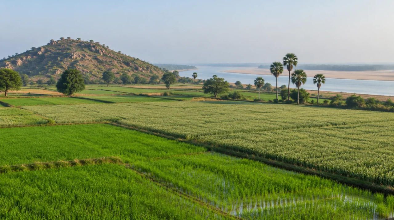
Lakhisarai — a Ganga-side rice and wheat district on the Howrah–Delhi rail line
Lakhisarai is a small district of about 1,301 sq km in central Bihar, with six blocks and about 10 lakh people at the 2011 Census (CGWB; Census of India). It sits between Patna and Munger on the Howrah–Delhi main line, and Kiul Junction, a major rail junction, lies inside it.
The land is mostly alluvial plain used for paddy, wheat, maize and pulses, with a cropping intensity of about 166% in the ICAR-CRIDA plan (ICAR-CRIDA). The south-east edges rise into low hills and rocky ground. That mix gives buyers two very different land types within a short drive: fertile river plain near the Kiul and Ganga and drier, rockier land towards Jamui.
Who buys here: local farming families, small traders from Lakhisarai and Barahiya, government and railway employees who want a plot or farm near their posting, and people who left for Patna, Kolkata or Delhi and want land at home. Large investors are fewer than in Patna or Gaya districts, so prices tend to move with local road and rail news.
The land market follows the Mokama–Munger corridor, the Kiul–Jhajha rail expansion and the road bypass at Barahiya. The sections below give the status of each project and the date of the source.
Before you pay for any plot, match the seller’s name to the Jamabandi (जमाबंदी), the latest rent receipt (lagan), the Khata and Khesra numbers and the Bhu-Naksha sheet, and confirm that mutation (दाखिल-खारिज) is complete at the circle office (anchal). Our guides cover the Bihar Bhumi Jamabandi lookup, the Bhu-Naksha plot map and mutation status.
- Kiul Junction
- Mokama–Munger highway
- Kiul and Harohar rivers
- Rice and wheat
- Ganga plain
- Hill edge

Transaction costs
Stamp duty & registration in Lakhisarai
7% · 9%
Stamp duty from 19 June 2026: rural · urban
up from 6% and 8%; reported by Prabhat Khabar
2x · 1.6x
MVR in urban and peripheral · rural areas
from 19 June 2026
+5% a year
Further MVR rise each financial year
full revision every three years
Lakhisarai follows the state rates. Prabhat Khabar reported on 18 June 2026 that the MVR was raised from 19 June, doubling in urban and peripheral areas and rising 1.6 times in rural areas, with a further 5% rise each year and a full revision every three years; general stamp duty went from 6% to 7% (Prabhat Khabar, 18 June 2026). A separate Prabhat Khabar report from the Thakurganj sub-registry office in Kishanganj gave 7% for rural and 9% for urban areas, matching the extra 2% for municipal areas. We did not find a Lakhisarai-specific notice, so confirm the urban and rural class of your mouza at the sub-registrar office. The registration fee was not restated in the 2026 reports.
Know the belt
What is moving prices in Lakhisarai
Three pockets drive most enquiries. Their character, and what to check, are below.
Lakhisarai town and the Kiul junction belt
District headquarters · Lakhisarai Junction · Kiul Junction
Lakhisarai town and Kiul are the rail and trading centres of the district, on the Howrah–Delhi main line. Kiul is one end of the 54 km third-line project approved in 2026 (Construction World). The June 2026 urban and peripheral MVR rule applies to land around both towns. Demand is for small residential, godown and farm plots.
Check: whether the plot is inside the municipal or peripheral belt, drainage on low land and any railway land boundary.
Barahiya and the Mokama corridor
Barahiya · Mokama–Munger highway · Barahiya bypass
Barahiya is the western gateway to the district and lies on the Mokama–Munger four-lane route (Construction World). A separate 10 km greenfield bypass between BNM College Ghat in Barahiya and Maranchi has been fast-tracked, with Rs 23.21 crore sanctioned for a first phase of 4.7 km (Projects Today, 16 January 2026). The Ganga floodplain sits close by, so elevation matters.
Check: the plot’s distance from the notified alignment, the flood level of the last monsoon and whether the road is a public road in the record.
Surajgarha, Halsi and the southern blocks
Farm plots · rocky land · hill edge
The southern blocks are farming land with rice, wheat and maize, and rockier ground towards the hills (CGWB). Plots here are cheaper to hold but harder to irrigate where the rock is shallow. Demand is mostly local, from farm families and traders.
Check: a borewell depth record from neighbours, the land class in the Jamabandi and road access in the monsoon.
Asking prices
Asking prices are quoted per kattha or decimal and vary sharply between the town, the highway villages and the river villages. We do not publish a district price series because we found no named source. Compare any ask against the MVR and registered deeds for similar plots in the same mouza, and be wary of a premium that rests only on highway or rail news.
Connectivity
How Lakhisarai connects — road, rail and air
Lakhisarai sits on the main rail line and the Buxar–Bhagalpur road corridor.
🚗 By road
✈️ By air
🚆 By rail
Always test a travel-time claim yourself, in the monsoon as well as in dry weather.
Growth catalysts
Upcoming infrastructure & developments
Status labels reflect sources read in November 2026. Government timelines are not guarantees.
00Open
03Catalysts
Agriculture & terrain
Soil, crops & water in Lakhisarai
A rice, wheat and maize plain with canal and borewell irrigation and a fluoride watch.
Crops
The ICAR-CRIDA plan lists rice on about 27,300 ha, wheat on about 18,200 ha, maize on about 8,100 ha and pulses (chickpea and lentil) on about 16,100 ha, with cropping intensity of 166% (ICAR-CRIDA). Gram, masoor and vegetables also feature in the CGWB profile.
- Kharif: rice, maize
- Rabi: wheat, lentil, chickpea
- Vegetables near towns
Rain and irrigation
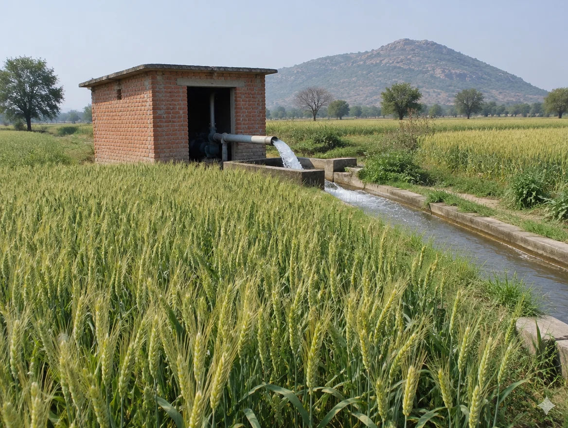
The two sources differ on normal rainfall: ICAR-CRIDA gives about 1,095 mm and CGWB about 1,170 mm, of which about 85% falls in the monsoon (ICAR-CRIDA; CGWB). Net irrigated area is about 42,100 ha, with canals supplying about 18% and tubewells a large share.
- Net irrigated area: about 42,100 ha
- Canals: about 18%
- Tubewells and borewells: the largest source
Soils
ICAR-CRIDA records clayey soil on about 42% and fine sandy loam on about 41% of the district (ICAR-CRIDA). Clay holds water and can waterlog in a wet year; sandy loam drains well but needs more irrigation.
Groundwater
CGWB placed all six blocks in the “safe” category, with a stage of groundwater development of 41.9% on data as on 31 March 2009 (CGWB). The figure is old, so use it as a rough guide and test water quality, since fluoride is noted in parts of the district.
At a glance
Lakhisarai vs. nearby districts
| District | Land and water | What links it to Lakhisarai |
|---|---|---|
| Munger | East neighbour, on the same highway | Linked by the Mokama–Munger corridor and the main rail line |
| Jamui | South neighbour with hill and forest land | Rail link via Jhajha; compare rocky versus plain land |
| Sheikhpura | West neighbour, smaller market | Shares the main line and road access to Patna side |
| Begusarai | North across the Ganga | Industrial belt; reached by Ganga bridges, not directly by road |
Lakhisarai is smaller and quieter than Patna or Munger, but it sits on the same rail and highway corridors. That gives it connectivity without the premium of a city market.
Farmland India view
Why investors look at Lakhisarai
Five reasoned points for Lakhisarai, each tied to a source on this page.
Highway news moves prices before work does
The Mokama–Munger cabinet approval is a real decision, but the sources give no completion date (Business Standard). Buyers who pay a premium before acquisition notices are issued carry the timing risk.
Kiul is a rail story
The third line is a railway capacity project (Construction World). It matters more for the junction towns and freight than for distant farm plots.
Test groundwater before building
Fluoride is noted in parts of the district, and CGWB data is from 2009 (ICAR-CRIDA).
Rates have just moved
MVR rose from 19 June 2026 and stamp duty went to 7% for rural land, so registration costs are higher than in older deeds (Prabhat Khabar).
Plain versus hill land
The plain near the Ganga and Kiul is fertile but flood-exposed; the south-east is rockier and cheaper to hold. Decide which use you want before you search.
Confirm Jamabandi, mutation, zoning and acquisition status directly — these are not certified by Farmland India’s review.
STRAIGHT TALK
Risks & challenges in Lakhisarai
District-specific risks. Read the state page for the general Bihar risks on ceiling, conversion and records.
Flood and waterlogging
The Ganga, Kiul and Harohar cross the district (CGWB), and ICAR-CRIDA lists flood and waterlogging beyond two days as contingencies (ICAR-CRIDA). Visit in the monsoon and ask neighbours about the last three years.
Acquisition for highway and rail
Land on the Mokama–Munger route may be notified for acquisition. Ask for the notified survey numbers from the circle office before paying.
Fluoride in water
ICAR-CRIDA notes fluoride up to 7.07 ppm in parts of the district (ICAR-CRIDA). Test the water before building a home or dairy.
Rate shock at registration
MVR doubled in urban and peripheral areas from 19 June 2026 (Prabhat Khabar). Budget stamp duty on the higher of the deed value and the MVR.
Old or conflicting data
The CGWB booklet gives two population totals and two stage figures in different sections, and its data is from 2009 to 2013. Use it as a guide and not as a final number.
Mutation gaps and shared plots
Many holdings are divided among heirs without partition. Ask for a registered partition deed and a mutation order before paying.
Rocky or hill-edge land
In the south-east, shallow rock can make borewells fail or cost more. Ask neighbours for depth and yield before buying farm land.
Non-resident buyers
NRIs cannot buy farm land in India; do not accept a workaround in a relative’s name, which can create legal and tax trouble.
Who to contact
Local revenue & planning offices
Start with the Lakhisarai District Collectorate (Lakhisarai district site) for the District Magistrate and the Land Acquisition Officer, then the Circle Office (anchal) of the block, the sub-registrar office, and the NHAI and Road Construction Department offices for acquisition notices. Mutation status is on Bihar Bhumi. For rules on conversion, see the Bihar Agriculture Land (Conversion for Non-Agricultural Purposes) Act, 2010.
KEEP EXPLORING
Explore more areas
Other districts in Bihar
- Araria
- Arwal
- Aurangabad
- Banka
- Begusarai
- Bhagalpur
- Bhojpur
- Buxar
- Darbhanga
- East Champaran
- Gaya Ji (gaya)
- Gopalganj
- Jamui
- Jehanabad
- Kaimur (bhabua)
- Katihar
- Khagaria
- Kishanganj
- Madhepura
- Madhubani
- Munger
- Muzaffarpur
- Nalanda
- Nawada
- Patna
- Purnia
- Rohtas
- Saharsa
- Samastipur
- Saran
- Sheikhpura
- Sheohar
- Sitamarhi
- Siwan
- Supaul
- Vaishali
- West Champaran
COMMON QUESTIONS
Frequently asked questions
Everything buyers, NRIs and investors ask before their first reviewed farmland purchase in Lakhisarai.
Visit full wiki01 of 04
Is the Mokama–Munger highway built
Not yet in the sources we read. The Union Cabinet approved the 82 km four-lane section on 10 September 2025 at Rs 4,447 crore, and the reports give no completion date.
02 of 04
Does the Kiul–Jhajha third line affect Lakhisarai land
Kiul is in Lakhisarai district and is one end of the 54 km line approved in 2026. Rail projects use railway land first, so the effect on private farm land may be limited, but check the notified plot list.
03 of 04
What changed in stamp duty in 2026
Prabhat Khabar reported that from 19 June 2026 MVR doubled in urban and peripheral areas and rose 1.6 times in rural areas, with rural stamp duty up from 6% to 7%.
04 of 04
Can an NRI buy farm land in Lakhisarai
No. Under FEMA, NRIs and OCIs cannot buy agricultural land, plantation land or a farm house in India. They may buy non-agricultural land and can inherit.
Transparency
Sources and references
Official and legal
- CGWB: Ground Water Information Booklet, Lakhisarai district
- ICAR-CRIDA: Agriculture Contingency Plan for Lakhisarai district
- Census of India
- Bihar Bhumi
- Bihar Agriculture Land (Conversion) Act, 2010
News and projects
- Business Standard: Cabinet clears Bihar projects, 10 Sep 2025
- Construction World: Mokama–Munger highway
- Construction World: Kiul–Jhajha third line, 1 Jun 2026
- Projects Today: Barahiya bypass, 16 Jan 2026
- Indian Masterminds: Kiul Bailey bridge, 5 Jul 2025
- Indian Masterminds: Raxaul–Haldia Expressway
- Prabhat Khabar: MVR revision, 18 Jun 2026
Data-currency note: sources were read in November 2026. Project status, the MVR and land rules change often; check the linked source and the relevant office before relying on any figure.
For developers
Ready to explore Lakhisarai farmland?
Browse reviewed projects and individual land parcels across Lakhisarai — or if you own land here, list it with platform review and reach serious buyers.