
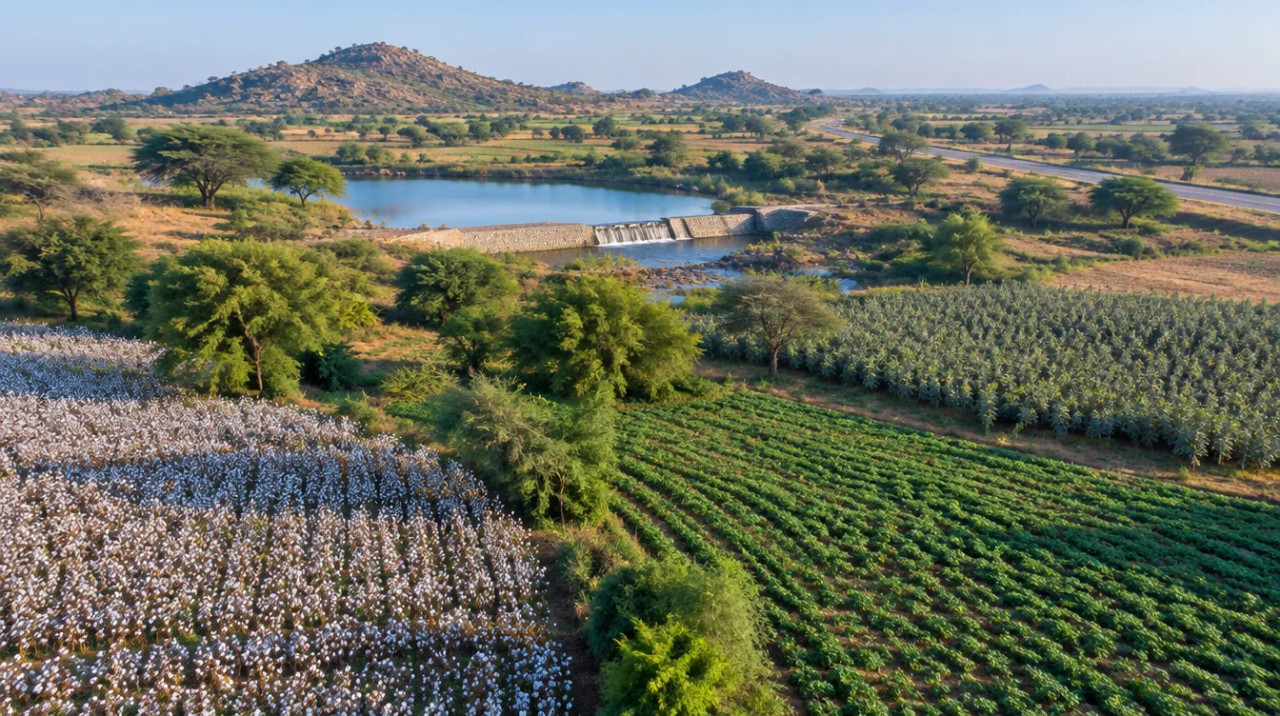
District guide
Buying Land in Jamnagar
A Gulf of Kutch district in Saurashtra: farmer-status rule, draft marine eco-sensitive zone, notified SEZ survey numbers and corridors still at planning stage.
5,846 sq km
Area
13.89 lakh
Population (Census 2011)
7
Talukas (district portal)
316 km, DPR stage (Nov 2024)
Jamnagar–Bharuch expressway
*Indicative range across districts and land types. Stamp duty, registration and conversion charges are additional. Local measurement units vary — every listing states the unit it is priced in. Not a valuation or an offer.
District land record — Jamnagar
Rev. 2026 · Farmland India desk
State
Gujarat
Sub-divisions
7 talukas: Jamnagar City, Jamnagar Rural, Kalavad, Dhrol, Jodiya, Lalpur, Jamjodhpur; 421 villages (Jamnagar district portal, October 2026)
Key markets
Jamnagar city · Dhrol · Jodiya · Kalavad · Lalpur · Jamjodhpur
Demand anchors
Oil refining, oil mills and brass industry listed on the district portal · Amritsar–Jamnagar corridor and a proposed Jamnagar–Bharuch expressway · a notified multi-product special economic zone
Rail
Western Railway line; doubling work on the Jamnagar line was reported in July 2026 (DeshGujarat, July 2026, headline seen; article not opened)
Size and population
5,846 sq km · 13,89,283 people, Census 2011 (Jamnagar district portal, October 2026)
Pricing unit
₹/guntha or ₹/acre; vigha quotes vary by region
Local units
Guntha = 1,089 sq ft · 40 gunthas = 1 acre · Vigha varies by region
Land records portal
AnyROR (did not open for us; check records there)
Land law is state law. These rules are maintained on the Gujarat page and apply to every district within it.
Jamnagar — land purchase legal rules
Agricultural land in Gujarat can generally be bought only by an agriculturist, and farmer status is checked before a sale entry is certified. The other main checks are tenure (old or new), NA permission, the fragmentation limit and whether the area is notified under the Disturbed Areas Act.
Who can buy agricultural land? Section 63 of the Gujarat Tenancy and Agricultural Lands Act, 1948 is headed “Transfers to non-agriculturist barred”, and section 2(2) defines an agriculturist as a person who cultivates land personally. A commentary on the Supreme Court appeal Vinodchandra Sakarlal Kapadia v State of Gujarat (Civil Appeal 2573 of 2020) reports that the Gujarat High Court read section 63 to bar a transfer by an agriculturist to a non-agriculturist without the Collector’s permission, including by will (Mondaq, April 2021). Farmer status is checked from revenue records back to a cut-off of 6 April 1995, under Revenue Department circulars of 13 September 2024, and a self-declaration form goes with a sale entry or an NA application (SCC Online, September 2024). We read section 63 through these summaries, not its full text; confirm with a Gujarat revenue lawyer.
Will non-farmers be allowed to buy? A committee chaired by C. L. Meena studied the tenancy laws and its suggestions on non-farmer purchase were being assessed in November 2024, with no decision announced (Gujarat Samachar, November 2024; Gujarat Samachar, November 2024). We found no enacted change by October 2026, so the section 63 rule above is the one to plan on.
Ceiling limits: the Gujarat Agricultural Lands Ceiling Act, 1960 (Gujarat Act 27 of 1961, amendments compiled by PRS Legislative Research) bars a person from holding land above the ceiling area. Land of a spouse and minor children is grouped with the holder, a family of more than five may hold one-fifth of the ceiling area for each extra member up to twice the ceiling, and each major son counts as a separate person; in desert, hill and drought-prone areas the dry-crop ceiling is raised by 12.5% but cannot pass 21.85 hectares (54 acres). These points come from a legal-database copy of the Act that we do not link, because the India Code page did not open here; the class-wise acreage in Schedule I was not in the text we read, so we show no per-class figure.
Tenure, premium and NA permission: section 43 of the Tenancy Act is headed “Restriction on transfers of land purchased or sold under this Act”, which is the basis of what the press calls new tenure land, and the Collector’s office grants permission and collects a premium under it (Surat Collectorate). A government notification of 8 February 2024 lets a tenant who has farmed land for more than 15 years move it from new tenure to old tenure without a conversion fee, but the premium for NA use is still payable (LiveLaw, April 2025). NA (non-agricultural) permission is granted under section 65 of the Gujarat Land Revenue Code, 1879, and is deemed granted if the Collector does not decide within three months (same source); applications have been online since a December 2018 circular (SCC Online, September 2024). Press reports put the NA premium at about 35 to 40 per cent of land value (Gujarat Samachar, March 2024); we found no official schedule. The 2008 resolution on NA procedure also lists distance limits from railways, airports and Air Force installations (900 m) and from the sea high-tide line (500 m) (Revenue Department resolution, July 2008), which later circulars may have changed.
Fragmentation (tukda) limit: the Assembly passed the Gujarat Prevention of Fragmentation and Consolidation of Holdings (Amendment) Bill on 11 September 2026. As reported, it sets a uniform standard area of 10 gunthas (1,012 sq m) for rural land under a new section 5(4), leaves out municipal and urban development authority areas, and regularises violations from 1948 to 31 March 2026 without penalty; before this, buyers paid 10% of jantri value (DeshGujarat, September 2026). We did not see the Act text or any filing deadline.
Industrial and institutional exceptions: sections 63AA and 63AAA allow land bought for industrial, education or health use to be resold on payment of a share of jantri value that falls with the holding period, from 100% at three to five years to 25% beyond ten years (Gujarat Bill 23 of 2020, PRS Legislative Research). We have the Bill, not the enacted Act. A charity that bought in breach before 30 June 2015 may apply for conversion within a period the State notifies (Gujarat Bill 1 of 2024, PRS Legislative Research).
Disturbed Areas Act, 1991: where the State has notified an area under section 3, a transfer of land or buildings there needs the Collector’s prior sanction after an inquiry into free consent and fair value, and a transfer without it is void under section 5; contravention carries imprisonment of three to five years under section 6D (Gujarat Act 12 of 1991, PRS Legislative Research). A 2026 amendment renames these “specified areas”, adds a Monitoring and Advisory Committee and extends the Collector’s checks (Bill 18 of 2026; DeshGujarat, March 2026); the government notified the amendment in July 2026, with the effective date to be notified separately (DeshGujarat, July 2026). As a due-diligence step, ask the Collector or Sub-Registrar whether the survey number lies in a notified area; we hold no list of notified areas.
Land Grabbing Act, 2020 and tribal land: the Gujarat Land Grabbing (Prohibition) Act, 2020 works through district committees, and in December 2024 a Gujarat High Court bench issued guidelines for those committees (LiveLaw, December 2024). Land held by Scheduled Tribe occupants is separately restricted under section 73AA of the Land Revenue Code, which the 2020 Bill cross-refers to (PRS Legislative Research); we did not open the Code, so check the occupant’s status in the 7/12.
NRI & OCI buyers: regulation 3 of the Foreign Exchange Management (Acquisition and Transfer of Immovable Property in India) Regulations, 2018 lets NRIs and OCIs buy land other than agricultural land, a farm house or plantation property (Reserve Bank of India, 2018 regulations). Residential and commercial land is open to them. The same section 63 rule applies to a resident non-farmer.
- Agriculturists only (s.63)
- Ceiling Act 1960
- NA via s.65
- Fragmentation: 10 gunthas
- Disturbed Areas Act
- NRI agri: barred (RBI 2018)
- 7/12 via AnyROR
Jamnagar — district-specific notes
The Gujarat state page applies to Jamnagar in full. The notes below are specific to this district and are not repeated from the state page. Law was read from Act texts on India Code and PRS, a Ministry of Environment draft notification and press reports; the Revenue Department home page, AnyROR and gARVI did not open for us, so where a note rests on press or commentary it says so.
⚠ Part of the Gulf of Kutch coast in Jamnagar district lies inside a draft eco-sensitive zone. A Ministry of Environment and Forests draft notification of 29 February 2012 proposed a 326.26 sq km zone around the Marine National Park and Marine Sanctuary, of which 208.58 sq km is landward, covering villages in the then Dwarka, Kalyanpur, Khambhaliya, Jodiya and Jamnagar talukas. It proposed to prohibit commercial mining, quarrying, saw mills and new polluting industries, and to regulate tree felling, hotels and resorts and road widening, while leaving ongoing agriculture and horticulture permitted (MoEFCC draft notification S.O. 353(E), 29 Feb 2012). That is a 14-year-old draft written when the district was larger (ten talukas, including Dwarka and Kalyanpur), and we found no final notification, so ask the Forest Department which villages and survey numbers the current zone covers.
⚠ The Commerce Ministry notified an additional 88.02 hectares to a multi-product special economic zone at Jamnagar on 1 May 2025, taking the notified area to 1,377.4622 hectares, and the survey numbers are listed in the Gazette notification, not in the press report (India Shipping News, May 2025). Check a parcel's survey number against that notification before paying a deposit on land near the industrial belt.
⚠ We found no Jamnagar-specific rule on buying coastal or border-area land. The Revenue Department's resolution of 1 July 2008 lists a 500 m limit from the sea high-tide line and 900 m limits from railways, airports and Air Force installations for non-agricultural permission (Revenue Department GR, 1 Jul 2008); it may have been superseded, and no Coastal Regulation Zone map was opened. Ask the Collector in writing whether the parcel falls in any such band.
⚠ The state-wide tests still decide who can buy. Section 63 of the Gujarat Tenancy and Agricultural Lands Act, 1948 bars transfer to a non-agriculturist, and the Act defines an agriculturist as a person who cultivates land personally (India Code). Farmer status is checked back to 6 April 1995 under circulars of 13 September 2024 (SCC Online, September 2024). Ask also whether the survey number lies in an area notified under the Disturbed Areas Act, 1991; we obtained no list of notified areas.
Read the full Gujarat land buying guide for buyer eligibility, stamp duty and NRI rules.
- Tenancy Act s 63
- Draft marine eco-sensitive zone
- Notified SEZ survey numbers
- NA permission
District overview
Jamnagar — an industrial Saurashtra district on the Gulf of Kutch
Jamnagar is a Saurashtra district of 5,846 sq km with 13,89,283 people at Census 2011, seven talukas and 421 villages (Jamnagar district portal, October 2026). The portal places it on the Gulf of Kutch, with Devbhumi Dwarka, Rajkot and Porbandar as neighbours. Older documents describe a larger, ten-taluka district of 14,125 sq km (CGWB district brochure, November 2013), so district totals in those papers are not comparable with today's portal figures.
We publish no per-acre price band for Jamnagar. No district or village jantri schedule opened for us, and listing-site asking prices could not be traced to registered deals. The only state-wide reference is the report that jantri rates were doubled from 15 April 2023 (DeshGujarat, February 2023); a revised draft was still pending in November 2024 (The Secretariat, November 2024).
The portal lists groundnut, cotton, wheat, bajra and castor as the main crops, and oil refining, oil mills and the brass industry as the main industries; it names eight rivers (Und, Vartu, Aji, Ruparel, Rangmati, Nagmati, Fulzar and Venu) (same portal page). Rainfall figures disagree: the portal gives an average of 1,100 mm for 2012–2016, while the CGWB brochure gives 573 mm from a 1951–1980 record and the ICAR-CRIDA plan 638 mm (ICAR-CRIDA Jamnagar plan). Treat rainfall as variable and check borewell depth on the parcel.
- Jamnagar city
- Dhrol
- Jodiya
- Kalavad
- Lalpur
- Jamjodhpur
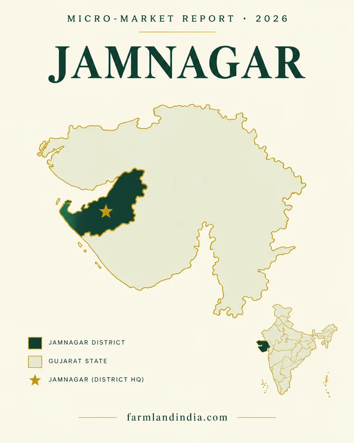
Transaction costs
Stamp duty & registration in Jamnagar
4.9%
Stamp duty on conveyance
34
Not found
Registration fee
26
Doubled
Jantri rates from 15 Apr 2023
30
The Comptroller and Auditor General's audit for the year ended 31 March 2018 states stamp duty on a conveyance deed at 4.9 per cent of the greater of consideration and market value, and gives no registration-fee rate for conveyances (CAG Report 3 of 2019). Jantri rates were reported doubled from 15 April 2023 (DeshGujarat, February 2023), and the Registration Department's summary says deeds are registered online through gARVI 2.0 in 294 Sub-Registrar offices (Registration System of Gujarat, IGR summary). We could not open the registration portal, and no Jamnagar jantri schedule opened, so ask the Sub-Registrar for the duty, fee and jantri on your parcel.
Know the belt
What is moving land prices in Jamnagar
State-level references only: no district jantri schedule opened and no listing-site prices are used.
Jantri: state-level only
Doubled from 15 Apr 2023 (reported)
DeshGujarat reported in February 2023 that jantri rates would double from 15 April 2023 after about 12 years (DeshGujarat, February 2023). A revised draft for agricultural land was pending in November 2024 (The Secretariat, November 2024). We have no Jamnagar village figures.
Check: the jantri for the village and survey number on the sale-deed date.
Industrial belt and SEZ
Notified area 1,377.4622 ha (1 May 2025)
The Commerce Ministry's May 2025 notification added 88.02 hectares to a multi-product special economic zone at Jamnagar (India Shipping News, May 2025). The report gives no land price and no taluka.
Check: whether the survey number appears in the Gazette notification.
Gulf of Kutch coast
Draft eco-sensitive zone 326.26 sq km (2012)
The 2012 draft proposed to bar new polluting industries and regulate hotels and road widening in a zone around the Marine National Park (MoEFCC draft, February 2012). No final notification was found.
Check: the zone status of coastal villages with the Forest Department.
Asking prices
No sourced price series
Listing-site asking prices for Jamnagar could not be traced to registered deals, so none are shown. Jantri is a registration floor, not what a seller will accept.
Check: registered sale deeds in the same revenue village before negotiating.
Units: guntha and vigha
Gujarat land is measured in gunthas: 10 gunthas is 1,012 sq m, so a guntha is about 101 sq m or 1,089 sq ft, and 40 gunthas make an acre (DeshGujarat, September 2026 for the 10-guntha figure). The vigha varies by region and we found no official conversion, so convert every quote to gunthas or acres and check the 7/12 extract for the area actually being sold.
Connectivity
How Jamnagar connects — road, rail and air
Distances to Rajkot, Ahmedabad and Mumbai are not given because no official or news source was found. Journey times vary with traffic and road works.
By road
By air
By rail & metro
The practical question is the last leg from the highway to the parcel; ask for the access road in the village map and the 7/12 extract. Gujarat rules for buyers from outside the state: Gujarat agricultural land rules.
Growth catalysts
Upcoming infrastructure & developments
Status labels reflect sources read in October 2026. Government-announced timelines are not guaranteed; items marked confirm have a single or an older source.
01Open or inaugurated
04In progress or pending
Agriculture & terrain
Soil, crops & water in Jamnagar
Black-soil Saurashtra plain with a saline coastal edge, groundnut and cotton on open wells and borewells, and canal water arriving through SAUNI.
🌾 Black-soil plains (inland talukas)
The ICAR-CRIDA contingency plan (older, pre-2013 district; crop data 2004–2009) gives medium to shallow black soils on 59.0% of the area and mixed red-black and coastal alluvial soils on 34.1%, with groundnut on about 399,000 hectares, cotton 144,000, wheat 54,000, cumin 34,000, castor 12,500 and pearl millet 12,100, from a net sown area of 820,000 hectares and a cropping intensity of 122.5% (ICAR-CRIDA Jamnagar plan). The portal lists groundnut, cotton, wheat, bajra and castor today (district portal).
- Groundnut
- Cotton
- Wheat
- Castor
🌊 Coastal alluvial belt and salinity
The CGWB brochure (November 2013, pre-2013 boundaries) says coastal alluvial soils in parts of Kalyanpur, Khambhalia, Jamnagar and Jodiya are mostly saline and alkaline, and that electrical conductivity exceeded 3,000 µS/cm at 12 villages, fluoride 1.5 mg/l at 6 villages and nitrate 50 mg/l at 9 villages in May 2012 samples (CGWB brochure). Ask for a water test on any coastal parcel.
- Coastal alluvium
- Saline soils
- Water quality
💧 Rivers and canal water
The portal names eight rivers: Und, Vartu, Aji, Ruparel, Rangmati, Nagmati, Fulzar and Venu (district portal). SAUNI Link-3 ends at Venu-1 dam in the district (MoJS SAUNI report), and the Narmada main canal is reported complete at 458.32 km (DeshGujarat, March 2025). Canal water reaches only the villages in a command area.
- Und
- Aji
- Venu
- SAUNI
💧 Water & rainfall
Normal rainfall is 573 mm in the CGWB brochure and 638 mm in the ICAR-CRIDA plan, while the portal gives an average of 1,100 mm for 2012–2016; we show all three because they do not agree. For the pre-2013 district, CGWB put groundwater development at 64.21% as on March 2011 with all ten talukas "safe", and pre-monsoon depth to water in 2012–13 ranged from 1.74 m at Salaya to 38.41 m at Lalpur (CGWB brochure). ICAR-CRIDA lists 58,287 open wells irrigating 67,000 hectares and 70,112 borewells irrigating 77,000 hectares, against 17.2% from canals (ICAR-CRIDA plan). Across Gujarat, CGWB puts 2024 extraction at 54.21% with 22 of 252 units over-exploited, and gives no district-wise stage (CGWB, Gujarat 2024). Check borewell depth and yield on the parcel.
📐 Measurement units
Gujarat land units: guntha about 1,089 sq ft (101 sq m); 40 gunthas = 1 acre; vigha varies by region. Convert every quote to gunthas or acres before comparing two offers. Live mandi prices are on Agmarknet, which we did not open for this page; crop income is modest next to land values near the industrial belt, so price a parcel on location, permitted use and water, not on groundnut or cotton yield.
At a glance
Jamnagar vs. its neighbours
| District / belt | Price band* (per acre) | Evidence |
|---|---|---|
| Jamnagar — all talukas | No sourced price series | No district jantri schedule opened; state jantri reported doubled from 15 Apr 2023 |
| Devbhumi Dwarka | No sourced price series | No figure used on this page |
| Rajkot | No sourced price series | No figure used on this page |
| Porbandar | No sourced price series | No figure used on this page |
*No per-acre figure for Jamnagar or its neighbours is traceable to registered deals, so none is shown. See the Devbhumi Dwarka page for the coast to the west, the Rajkot page for the nearest large market and the Porbandar page for the southern neighbour.
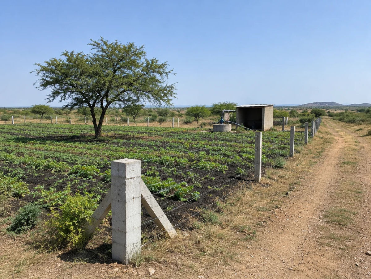
Farmland India view
Why investors look at Jamnagar
Five reasoned points, with an honest note that price evidence is thin and several corridors are still proposals.
An industrial base next to farmland
The portal lists oil refining, oil mills and brass as the district's industries, and a special economic zone of 1,377 hectares is notified (India Shipping News, May 2025). Industry sets land demand more than crops do, but it also puts survey-number checks first.
Roads on paper, one of them existing
The Malia–Jamnagar stretch is an existing four-lane road, while the Jamnagar–Bharuch expressway was at consultant stage in November 2024. A buyer should price on today's roads.
A coast that needs paperwork
The draft marine eco-sensitive zone, the 2008 distance limits and saline soils all make coastal parcels parcel-specific. Documented land is easier to resell than land bought on a broker summary.
A farmer-status market
Section 63 limits who may buy farmland, so the buyer pool is smaller than the number of listings suggests. A farmer buyer, or a buyer using an exception, moves faster.
No price evidence to lean on
We found no sourced price series and no district jantri schedule. This desk treats any per-acre claim without a registered deed as an opinion.
Confirm farmer status, NA permission, zone status and jantri directly; these are not certified by Farmland India’s review.
STRAIGHT TALK
Risks & challenges in Jamnagar
Read these before shortlisting in Jamnagar specifically.
Farmer-status rule
Section 63 of the Tenancy Act bars transfer to a non-agriculturist, and farmer status is checked back to 6 April 1995. A proposal to let non-farmers buy was under review in November 2024 and we found nothing enacted.
Draft marine eco-sensitive zone
A 2012 draft proposed a 326.26 sq km zone with limits on mining, new polluting industry and hotels. No final notification was found, so ask which villages are covered.
Notified SEZ survey numbers
The special economic zone notification lists survey numbers in the Gazette. Check the parcel against it before paying a deposit.
Saline soil and water quality
Coastal alluvial soils are mostly saline and alkaline per CGWB, and 12 villages exceeded 3,000 µS/cm in May 2012. Ask for a water test.
Fragmentation limit
The rural standard area was set at 10 gunthas (1,012 sq m) by an amendment passed on 11 September 2026; we have not seen the Act text. Check that the area sold is not a fragment.
Announced is not delivered
The Jamnagar–Bharuch expressway had no published project report in November 2024, and the rail doubling has no date in the headline we saw. Price on today's fundamentals.
No sourced price series
We use no listing-site prices for Jamnagar, and no district jantri schedule opened. Collect registered comparables before negotiating.
Who to contact
Local revenue, planning & forest offices
Mutation and revenue-record matters go through the Mamlatdar of the relevant taluka (Jamnagar City, Jamnagar Rural, Kalavad, Dhrol, Jodiya, Lalpur, Jamjodhpur), as listed on the Jamnagar district portal; the Collector and District Magistrate heads the district office (portal home). Non-agricultural permission and new-tenure questions go to the Collector, and sale-deed registration to the local Sub-Registrar. Records are on AnyROR and deeds are registered through gARVI; the Revenue Department's 2008 resolution on non-agricultural permission is here. We could not open AnyROR, gARVI or the Revenue Department home page, and the district portal's tehsil page refused our fetch, so check the offices directly and ask which Prant (sub-division) office covers your taluka.
COMMON QUESTIONS
Frequently asked questions
Everything buyers, NRIs and investors ask before their first reviewed farmland purchase in Jamnagar.
Visit full wiki01 of 04
What does agricultural land cost in Jamnagar?
We publish no per-acre band for Jamnagar because no district jantri schedule opened for us and listing-site asking prices could not be traced to registered deals. The only state-wide reference is the report that jantri rates were doubled from 15 April 2023 (DeshGujarat, February 2023). Jantri is a registration floor, not a market price, so collect registered sale deeds from the same village.
02 of 04
Who can buy agricultural land in Jamnagar?
Section 63 of the Gujarat Tenancy and Agricultural Lands Act, 1948 bars transfer to a non-agriculturist, and an agriculturist is a person who cultivates land personally (India Code). Farmer status is checked back to 6 April 1995 under circulars of 13 September 2024 (SCC Online, September 2024). We found no enacted change by October 2026.
03 of 04
Does the Gulf of Kutch coast limit buying in Jamnagar?
A February 2012 draft notification proposed a 326.26 sq km eco-sensitive zone around the Marine National Park, with limits on mining, new polluting industry and hotels (Ministry of Environment, Forests and Climate Change). We found no final notification and no Jamnagar-specific purchase rule, so ask the Forest Department and the Collector about the survey number.
04 of 04
Which infrastructure affects Jamnagar?
The Malia–Jamnagar stretch of the Amritsar–Jamnagar corridor is an existing four-lane road (tracker, July 2024), the Jamnagar–Bharuch expressway was at consultant stage in November 2024, and the special economic zone was enlarged to 1,377.46 hectares in May 2025. Doubling work on the Jamnagar rail line was reported in July 2026.
Transparency
Sources and references
Law and courts
- Gujarat Tenancy and Agricultural Lands Act, 1948 (headings and s 2(2)), India Code
- An agriculturist is debarred from bequeathing agricultural land to a non-agriculturist, Mondaq, 29 Apr 2021
- Balancing reform and responsibility: rethinking land conversion policies, LiveLaw, 1 Apr 2025
- Gujarat Agricultural Lands Ceiling Act, 1960 (Act 27 of 1961), PRS Legislative Research copy
- Gujarat Disturbed Areas Act, 1991 (PRS Legislative Research copy)
- Disturbed Areas Act amendment Bill 18 of 2026, PRS Legislative Research
- Shashikant Vasudevbhai Patel v State of Gujarat, Gujarat High Court, 10 Sep 2018
- Foreign Exchange Management (Acquisition and Transfer of Immovable Property in India) Regulations, 2018, Reserve Bank of India
- Draft notification S.O. 353(E), eco-sensitive zone around Marine National Park and Sanctuary, Gulf of Kutch, MoEFCC, 29 Feb 2012
Government
- Jamnagar district at a glance (talukas, area, population, crops, rivers), Jamnagar district portal
- Jamnagar district portal home page
- Ground water information booklet, Jamnagar district, Central Ground Water Board, Nov 2013 (pre-2013 boundaries)
- District agriculture contingency plan, Jamnagar, ICAR-CRIDA (older district; crop data 2004-09)
- Dynamic Ground Water Resources of Gujarat 2024, Central Ground Water Board
- Revenue Department resolution on non-agricultural permission, 1 Jul 2008
- Stamp duty and registration fees, Report 3 of 2019 (Revenue Sector), Comptroller and Auditor General
- Registration System of Gujarat, Inspector General of Registration summary
- Report on best practices: SAUNI Gujarat, Ministry of Jal Shakti
- AnyROR land records portal (did not open for this page)
- gARVI registration portal (did not open for this page)
News
- Centre notifies additional 88.02 hectares for multi-product SEZ in Jamnagar, India Shipping News, 8 May 2025
- Amritsar-Jamnagar Economic Corridor: information and status, The Metro Rail Guy, 6 Jul 2024
- Jamnagar-Bharuch Expressway: information and status, The Metro Rail Guy, 6 Nov 2024
- Western Railway revises terminal stations for key trains due to Jamnagar line doubling work, DeshGujarat, 29 Jul 2026 (headline only)
- Soon Ahmedabad pilgrims can visit Dwarka and return same day by Vande Bharat Express, DeshGujarat, 25 Jun 2026 (headline only)
- Jantri rate hike to be effective from April 15, DeshGujarat, 11 Feb 2023
- Gujarat to revise minimum rates for agricultural land, The Secretariat, 13 Nov 2024
- Gujarat farmer verification process streamlined, SCC Online, 25 Sep 2024
- Gujarat assessing non-farmers access to agricultural land, Gujarat Samachar, 12 Nov 2024
- Gujarat Assembly passes tukda dhara amendment bill, DeshGujarat, 11 Sep 2026
- Gujarat govt notifies Disturbed Areas Act amendment, DeshGujarat, 15 Jul 2026
- 69,800 km Narmada canals done, DeshGujarat, 8 Mar 2025
Further reading
- Major changes likely in Gujarat tenancy and agricultural land laws, Gujarat Samachar, 9 Mar 2024
- Gujarat High Court guidelines on misuse of the Land Grabbing Act, LiveLaw, 11 Dec 2024
- Gujarat Town Planning and Urban Development Act, 1976, India Code (not opened)
- Gujarat cabinet approves 17 new talukas, PTI via The Week, 24 Sep 2025
- Gujarat govt approves creation of new district Vav-Tharad, AIR News, 1 Jan 2025
- Gujarat faces growing groundwater crisis, Gujarat Samachar, 28 Sep 2026
- Castor crop cultivation in Gujarat 2021-22, Directorate of Economics and Statistics
- District industrial profile of Jamnagar, MSME Development Institute (undated; older district)
Data-currency note: area, population and taluka count are district-portal figures; soil, crop and groundwater tables come from CGWB and ICAR-CRIDA papers of 2011 to 2013 that describe the older, larger district; infrastructure statuses were read in October 2026 and change quickly; two corridor entries rest on tracker pages of 2024. Pages marked "did not open" are named only as places to check. This is a general guide, not legal advice. Report inaccuracies to wiki@farmlandindia.com.
For developers
Ready to explore Jamnagar farmland?
Browse reviewed projects and individual land parcels across Jamnagar — or if you own land here, list it with platform review and reach serious buyers.