
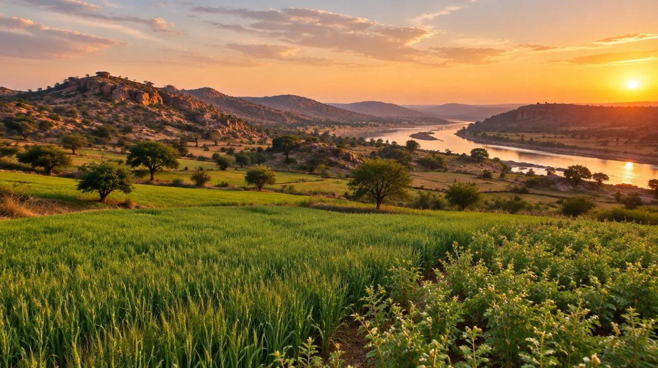
District guide
Buying Land in Chhatarpur
A Bundelkhand district with Khajuraho, rain-fed farm land and the Ken–Betwa dam: tribal-land, forest and acquisition checks come before price.
17.63 lakh
Population (district portal)
13
Tehsils (district portal)
₹2–30 lakh/acre
Estimated land price*
₹49,000 crore
Ken–Betwa link project
*Indicative range across districts and land types. Stamp duty, registration and conversion charges are additional. Local measurement units vary — every listing states the unit it is priced in. Not a valuation or an offer.
District land record — Chhatarpur
Rev. 2026 · Farmland India desk
State
Madhya Pradesh
Sub-divisions
The district portal gives 13 tehsils and 7 sub-divisions without naming them (Chhatarpur district portal). The MSME profile (2010-11 data) lists 11 tehsils: Chhatarpur, Nowgaon, Rajnagar, Bijawar, Lovkushnagar, Gaurihar, Badamalhera, Buxwaha, Maharajpur, Chandala and Ghuwara (MSME district profile). CONFIRM the current list with the Collector’s office.
Key markets
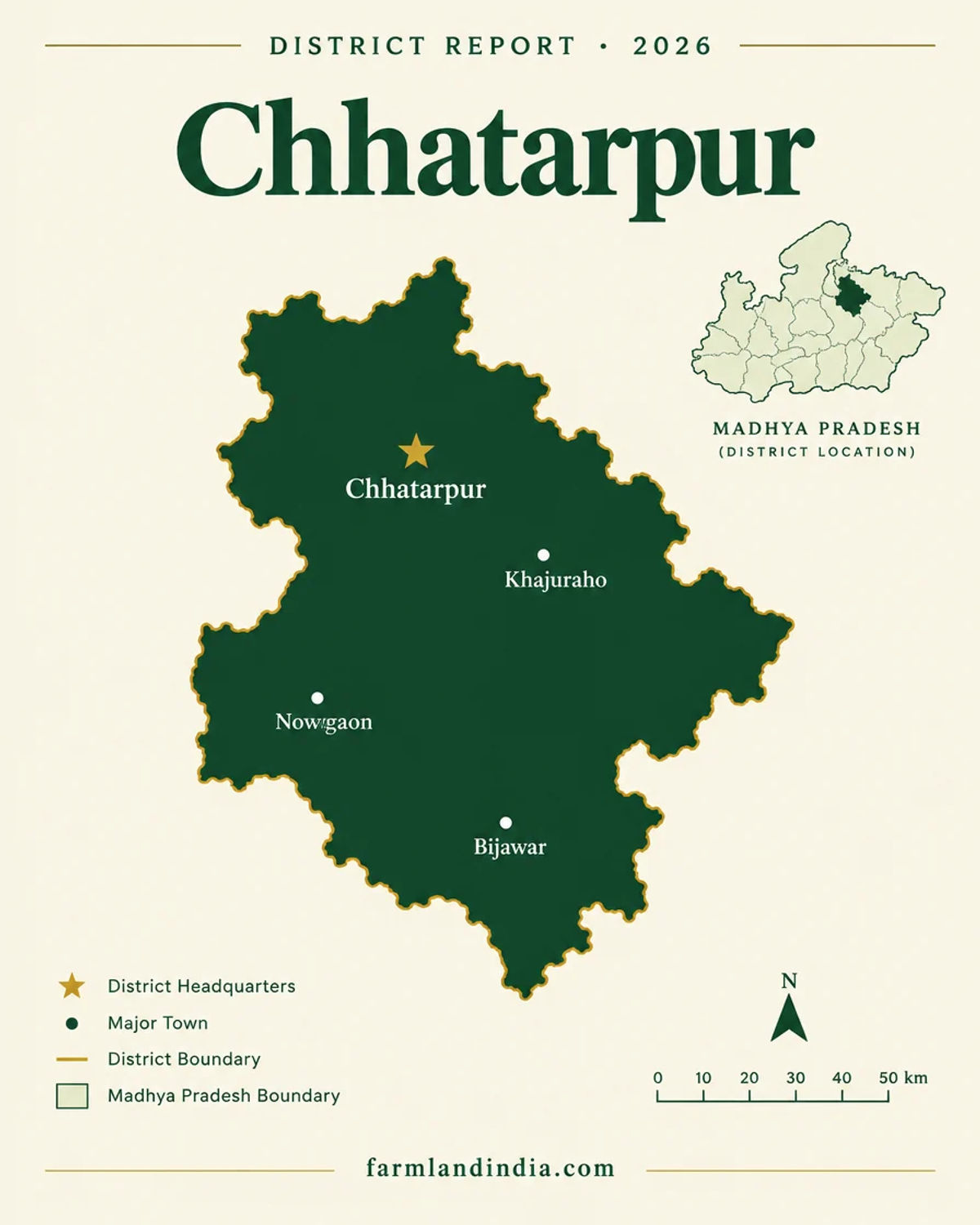
Chhatarpur city · Khajuraho and Rajnagar · Nowgaon · Bijawar · Buxwaha · Laundi (Lovkushnagar)
Demand anchors
Khajuraho heritage tourism · Banaras–Khajuraho Vande Bharat (Nov 2025) · Ken–Betwa link project (Daudhan dam) · Panna Tiger Reserve edge
Rail
Chhatarpur and Khajuraho, with rake points approved at both in a 2022 plan (India Infra Hub, April 2022); the MSME profile gives about 50 km of rail line
Size and population
17,62,857 people and 1,210 villages on the district portal (Chhatarpur district portal); area 10,863 sq km on the portal but 8,687 sq km in the MSME profile and CRIDA plan, so CONFIRM
Pricing unit
₹/acre · Estimated land price*: ₹2–30 lakh per acre depending on the micro-area (indicative, see price section)
Local units
Records use survey numbers and hectares; sellers also quote acres and village units whose size can differ by tehsil, so convert to hectares (1 ha is about 2.47 acres)
Land records portal
MP Bhulekh (not opened for this page; check records there)
Land law is state law. These rules are maintained on the Madhya Pradesh page and apply to every district within it.
Chhatarpur — land purchase legal rules
⚠ Madhya Pradesh does not run on a single rule for farmland. Tribal land, land above the holding ceiling, diverted land and ordinary farmland each follow a different track, and the Collector’s office sits at the centre of the first. Work out which track a parcel is on before looking at the price.
Which office decides what: A member of a tribe that the Code treats as aboriginal needs written permission from a revenue officer of at least Collector rank to sell land outside a notified area, and in a notified area the bar on sale to a non-tribal is absolute (section 165(6); Supreme Court, April 2025). The Supreme Court accepted in April 2025 that an Additional Collector can grant that permission under a valid work-allocation order (Lawyer E-News, April 2025). Sale deeds are registered through the Registration Department, which launched the Sampada 2.0 online registration system in October 2024 (The Statesman, October 2024).
Section 165 and tribal land: The April 2025 judgment concerned 6.29 hectares in Ratlam district outside the notified tehsils; the sale went through because the Additional Collector had given written permission, the price was above market value and a 10-year bar on changing the land’s use was attached under section 165(6-ee) (Supreme Court, April 2025). The High Court had earlier upheld the same sale and noted the Patwari’s report, the sellers’ need to fund a marriage and settle loans, and the land they kept (High Court, October 2023). Permission is a gate, not a formality: a sale with no permission is exposed. Under section 170B a transfer made by fraud can be reverted to the tribal owner or heirs, and the Supreme Court in March 2019 held that a civil court could not revisit a Collector’s 1985 section 170B order that had survived a writ petition (Supreme Court, March 2019).
Wills and indirect transfers: In February 2025 the High Court held that “transfer” in section 165(6) is not confined to sale and covers a Will of tribal land in favour of a non-tribal, so Collector permission was needed there too (High Court, February 2025). A buyer cannot assume that an inheritance document or a power of attorney avoids the permission step. There is a narrow carve-out: in October 2024 the High Court, relying on an older Division Bench ruling, held that sections 165(6) and 170 do not apply to Nazul land in an urban area, and sent the question of whether a given parcel was Nazul or Abadi back to the Additional Commissioner (High Court, October 2024).
Diversion and the Code: Turning farmland to another use is a diversion. A June 2022 High Court order refers to land “diverted under section 172” to non-agricultural purposes, and the Supreme Court has described section 59 as allowing reassessment of land revenue on a change of use, with a premium that the Sub-Divisional Officer may impose (High Court, June 2022; Supreme Court, August 2008). We could not read the current text of sections 172 and 190, so this page does not describe their procedure or fees, and a seller’s diversion order should be read in full, not taken on trust.
Ceiling on holdings: The Madhya Pradesh Ceiling on Agricultural Holdings Act, 1960 caps how much one holder or family may hold and provides for acquiring surplus land. In the 2021 case the Supreme Court quoted section 7(b) as allowing a family of five or fewer 54 acres, and set aside surplus declarations where a pending suit had not been disclosed (Supreme Court, January 2021). A legal-database copy of the Act lists three tiers for a family of five or fewer: 18 acres of two-crop irrigated land, 27 acres of one-crop irrigated land and 54 acres of dry land, and says land cannot be transferred before the final ceiling order without the Collector’s written permission, unless the holder is within the ceiling (legal database text of the 1960 Act). Treat those figures as the Act’s text as published there, and have a lawyer check the current schedule before buying a large holding.
Who may buy: None of the court orders or Act texts we opened bars a buyer simply for not being a farmer; the limits that turned up were the tribal-land permission in section 165(6) and the ceiling on holdings. We found no state notice listing other buyer conditions, so confirm with the Registration Department and the Collector’s office that none applies to the district you are looking at.
Registration and stamping: The Indian Stamp (Madhya Pradesh Second Amendment) Act, 2025 was published on 17 December 2025 and changes how short-stamped documents are handled, including a penalty of 1% of the deficient portion per month (TeamLease RegTech, December 2025). Duty rates are covered in the stamp duty section below.
Land records: Madhya Pradesh land records (khasra and the B-1 extract) are issued through the state’s MP Bhulekh portal. We could not open that portal for this page and found no independent description of its current fields or fees, so ask the seller for a fresh extract and compare the survey number, area and recorded owner with the sale deed.
NRI and OCI buyers: The Reserve Bank’s Master Direction under FEMA 1999 excludes agricultural land, plantation land and a farm house from what NRIs and OCIs may buy, in Madhya Pradesh as elsewhere (RBI Master Direction FED 12/2015-16, updated to September 2022). They can buy other immovable assets such as residential or commercial sites, and inheritance is treated separately in the Direction. Benami-law exposure was not checked against the Act text for this page, so take legal advice before using a nominee.
- Land Revenue Code 1959
- Section 165(6) tribal land
- Ceiling Act 1960
- Wills need permission
- NRI agri: barred (FEMA)
- Sampada 2.0
Chhatarpur — district-specific notes
The Madhya Pradesh state page applies to Chhatarpur in full. The notes below are specific to this district and are not repeated from the state page. Law was read from Supreme Court and High Court orders and a legal-database copy of the Ceiling Act; the Land Revenue Code text and the Bhulekh portal could not be opened, and the notes say so where it matters.
⚠ Tribal land is the first check in Madhya Pradesh. Under section 165(6) of the Madhya Pradesh Land Revenue Code, 1959 a member of a tribe the Code treats as aboriginal needs written permission from a revenue officer of at least Collector rank to sell to a non-tribal outside notified areas, and inside notified areas the bar is absolute (Supreme Court, April 2025). Under section 170B a transfer made by fraud can be reverted to the tribal owner or heirs (Supreme Court, March 2019), and a Will of tribal land to a non-tribal also needs the section 165(6) permission (High Court, February 2025). We found no source listing notified tribal tehsils or villages for Chhatarpur; ask the Collector’s office in writing whether the owner is a tribal holder and whether the village lies in a notified area.
⚠ A farmhouse or any other non-agricultural use means diversion of the land. A June 2022 High Court order refers to land “diverted under section 172” of the Code, and the Supreme Court has described section 59 as allowing reassessment of land revenue on a change of use, with a premium the Sub-Divisional Officer may impose (High Court, June 2022; Supreme Court, August 2008). We could not read the current text of sections 172 and 190, so this page does not describe their procedure or fees; ask the Sub-Divisional Officer (Revenue) for the diversion order itself and read it in full.
⚠ The Madhya Pradesh Ceiling on Agricultural Holdings Act, 1960 caps what a family may hold. In January 2021 the Supreme Court quoted section 7(b) as allowing a family of five or fewer 54 acres (Supreme Court, January 2021), and a legal-database copy of the Act lists 18 acres of two-crop irrigated land, 27 acres of one-crop irrigated land and 54 acres of dry land, with Collector permission needed to transfer land before the final ceiling order (legal database text of the 1960 Act). CONFIRM the current schedule with a lawyer before assembling a large holding in Chhatarpur.
⚠ Forest, tiger-reserve and project-acquisition land are the district-specific traps. The Daudhan dam of the Ken–Betwa link project is being built across the Ken in Chhatarpur district near the Panna Tiger Reserve; about 9,000 hectares of rural and forest land will be submerged, including 4,141 hectares in the reserve core and 1,314 in its buffer, and about 1,913 families in 10 villages are affected (Outlook India, April 2026). Down To Earth reported in 2016 that 5,258 hectares of forest would be diverted (Down To Earth, September 2016). Land in or near these villages may be under acquisition, so ask the Collector for acquisition notices on the khasra. The MSME profile also records forest and mineral extraction (granite, rock phosphate, diaspore, dolomite, sand) (MSME profile), so check lease status, and the 2024 state assessment lists Chhatarpur for uranium above 30 ppb in groundwater (CGWB, Madhya Pradesh 2024).
Read the state-wise land laws guide and the Madhya Pradesh page for buyer eligibility, stamp duty and NRI rules.
- Land Revenue Code 1959
- Section 165(6) tribal land
- Panna Tiger Reserve edge
- Ken–Betwa acquisition
District overview
Chhatarpur — a Bundelkhand district with Khajuraho and the Ken–Betwa dam
Chhatarpur is a Bundelkhand district in the north-east of Madhya Pradesh, and the district portal gives 17,62,857 people, 1,210 villages, 13 tehsils and 7 sub-divisions (Chhatarpur district portal). Area is disputed between sources: 10,863 sq km on the portal against 8,687 sq km in the MSME profile (MSME profile). The Ken and Dhasen drain it, with the Ken covering about 70% of the catchment. The portal lists the Khajuraho temples among its tourist sites (district portal, about the district).
The estimated farm-land price* for Chhatarpur runs from about ₹2 lakh to ₹30 lakh per acre. The upper end applies to land near Chhatarpur city and the Khajuraho and Rajnagar tourism belt, the middle to ordinary rain-fed farm land across Nowgaon, Buxwaha and Maharajpur, and the lower end to land near the Daudhan reservoir and forest edge in Bijawar. One reported compensation case is a useful anchor: a villager at Palkoha in Bijawar tehsil said he received ₹15 lakh for three acres, about ₹5 lakh an acre (Outlook India, April 2026). *Indicative only, not a valuation or an offer; prices vary by plot, road access and title. Check the guideline or ready-reckoner rate with the Sub-Registrar.
Farming is rain-fed and winter-crop led. The ICAR-CRIDA plan shows 2008-09 areas of 133.8 thousand hectares of wheat and 89.2 of chickpea, only 157.0 thousand hectares irrigated out of a net sown 319.9, and 77.2% of irrigation from open wells (ICAR-CRIDA plan). Water, not soil, limits farm value.
- Khajuraho
- Chhatarpur
- Bijawar
- Nowgaon
- Ken–Betwa link
- Bundelkhand
Transaction costs
Stamp duty & registration in Chhatarpur
7.5%
Stamp duty (reported)
state-wide figure, reported; Registration Department page not opened
3%
Registration fee (reported)
on the same base; CONFIRM with the Sub-Registrar
~10.5%
Combined, reported arithmetic
earlier report gave 9.5% to 12.5%
Dainik Jagran English reported on 27 March 2026 stamp duty of 7.5% and a registration charge of 3% on the higher of market value or transaction value (Dainik Jagran English, March 2026). Its 25 March piece said a guideline-rate rise would raise duty and fees in proportion and that no fresh taxes would be levied (Dainik Jagran English, March 2026); an earlier piece put the combined range at 9.5% to 12.5%. These are state-wide figures as reported, and we could not open the Registration Department’s own fee page, so ask the Chhatarpur Sub-Registrar for the current schedule for agricultural land before you budget. Since 17 December 2025 a short-stamped document attracts a penalty of 1% of the shortfall per month (TeamLease RegTech, December 2025). Registration is online through Sampada 2.0, which also shows guideline rates by location (The Statesman, October 2024). We found no Chhatarpur-specific guideline-rate report.
Know the belt
What is moving prices in Chhatarpur
No district-level guideline report was found, so this section gives our indicative price bands*, one compensation anchor and the water and units points.
Estimated land price*: city and tourism belt
₹10–30 lakh per acre* (Chhatarpur, Khajuraho, Rajnagar)
Land near Chhatarpur city and the Khajuraho temple belt, where tourism and the Vande Bharat service add non-farm demand. The band is wide because we hold no registered-deed series; it is set by analogy and rounded. *Indicative only, not a valuation or an offer; prices vary by plot, road access and title. Check the guideline or ready-reckoner rate with the Sub-Registrar.
Check: heritage-zone rules near protected monuments, diversion status and access.
Estimated land price*: rain-fed farm land
₹3–10 lakh per acre* (Nowgaon, Buxwaha, Maharajpur, Gaurihar)
Rain-fed land growing wheat and chickpea. The ICAR-CRIDA plan records 162.9 thousand hectares rainfed against 157.0 irrigated and a cropping intensity of 127% (ICAR-CRIDA plan). *Indicative only, not a valuation or an offer; prices vary by plot, road access and title. Check the guideline or ready-reckoner rate with the Sub-Registrar.
Check: well yield and the fluoride and uranium notes in the risks section.
Estimated land price*: dam and forest edge
₹2–7 lakh per acre* (Bijawar, Daudhan side)
Land near the Daudhan reservoir and the Panna Tiger Reserve. A Palkoha resident reported ₹15 lakh for three acres on top of ₹12.5 lakh, and protesters say compensation lists left some villagers out (Outlook India, April 2026). Compensation is not a market price. *Indicative only, not a valuation or an offer; prices vary by plot, road access and title. Check the guideline or ready-reckoner rate with the Sub-Registrar.
Check: acquisition status, forest status and buffer-zone rules before any deposit.
Compensation anchor
~₹5 lakh per acre (one reported case)
The only price-like figure we found for the district comes from one resident quoted in a news report on the Ken–Betwa project (Outlook India, April 2026). It is one person’s account, not a rate notified by the state.
Check: the award or notification itself, not a quote in a report.
Units: hectare, acre and village units
Madhya Pradesh revenue records identify land by survey number (khasra) and area, and court orders in the state describe holdings in hectares (Supreme Court, April 2025). Sellers and brokers also quote acres and village units whose size can differ by district and tehsil. Convert every quote to hectares or acres (one hectare is about 2.47 acres, our arithmetic) and match it to the khasra area; we did not open a revenue manual for local unit definitions.
Connectivity
How Chhatarpur connects — road, rail and air
Distances to Jhansi, Delhi and other cities are not given because no official or news source was found. Journey times vary with traffic and road works.
By road
By air
By rail
Road lengths are 2010-11 figures from an MSME profile and are not current; the practical test is a drive from the nearest highway to the parcel, so ask for the access road in the revenue record. Full Madhya Pradesh rules are in the state-wise land laws guide.
Growth catalysts
Upcoming infrastructure & developments
Status labels reflect sources read in October 2026. Items marked CONFIRM have a single or an older source.
01Open or inaugurated
02In progress or pending
Agriculture & terrain
Soil, crops & water in Chhatarpur
A rain-fed Bundelkhand district of wheat and chickpea on shallow soils, where wells, the Ken and a new dam shape water access.
🌾 Rain-fed plains (Chhatarpur, Nowgaon, Buxwaha, Maharajpur)
The ICAR-CRIDA plan puts the district in the Bundelkhand zone, with soil depth split into deep 30.2%, medium 30.8% and shallow 38.8%, and 2008-09 areas of wheat 133.8 thousand hectares, chickpea 89.2, blackgram 34.8, sesame 33.0 and soybean 25.7 (ICAR-CRIDA plan). Net sown area is 319.9 thousand hectares at 127% cropping intensity. Those crop figures are dated.
- Wheat
- Chickpea
- Blackgram
- Sesame
🏞 Ken and Dhasen basins
The MSME profile places the district in the Yamuna sub-basin of the Ganga basin, with the Ken draining 69.99% of the catchment and the Dhasen 30.10% (MSME profile). The Ken now carries the Daudhan dam works, which will change local water access.
- Ken
- Dhasen
- Daudhan
⛏ Forest and minerals
The CRIDA plan lists 214.0 thousand hectares of forest out of 863.0 thousand, and the MSME profile records diaspore, rock phosphate, granite, dolomite and sand output for 2010-11 (ICAR-CRIDA plan; MSME profile). Lease and forest status decide use near hills and reserve edges.
- Forest
- Granite
- Rock phosphate
💧 Water & rainfall
The ICAR-CRIDA plan gives normal annual rainfall of 1,095.1 mm, mostly June to September, and irrigation of 157.0 thousand hectares, 77.2% from open wells and only 5.06% from canals (ICAR-CRIDA plan). It reports 7 blocks safe and 1 semi-critical (Laundi) with high fluoride there, though the table is undated. The 2024 state assessment lists Chhatarpur for uranium above 30 ppb (CGWB, Madhya Pradesh 2024). Test water before a farmhouse plan.
📐 Measurement units
Madhya Pradesh records use survey numbers and hectares; sellers also quote acres and village units whose size can differ by tehsil. Convert every quote to hectares or acres before comparing two offers (one hectare is about 2.47 acres). Live mandi prices are on Agmarknet (not opened for this page); price a parcel on water, access and permitted use, since dry-farming income is modest.
At a glance
Chhatarpur vs. its neighbours
| District / belt | Price band* (per acre) | Evidence |
|---|---|---|
| Chhatarpur — city and tourism belt* | ₹10–30 lakh* | Indicative estimate; not a valuation |
| Chhatarpur — rain-fed farm land* | ₹3–10 lakh* | Indicative estimate; not a valuation |
| Chhatarpur — dam and forest edge* | ₹2–7 lakh* | Indicative estimate; one compensation anchor reported |
| Katni — rural farm land* | ₹4–12 lakh* | Indicative estimate; see the Katni page |
| Narsinghpur — irrigated Narmada belt* | ₹12–30 lakh* | Indicative estimate; see the Narsinghpur page |
*Indicative only, not a valuation or an offer; prices vary by plot, road access and title. Check the guideline or ready-reckoner rate with the Sub-Registrar. See the Katni page for the limestone district and the Narsinghpur page for the Narmada valley.
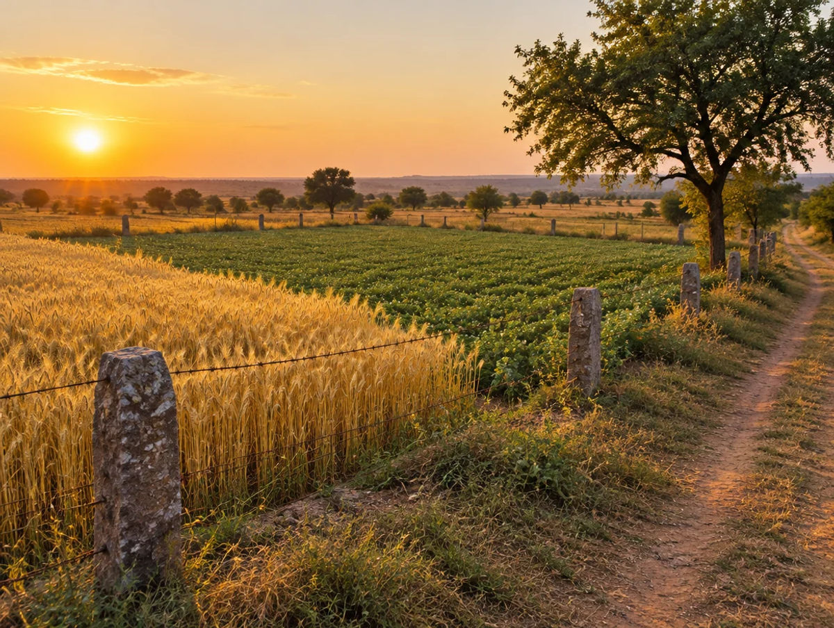
Farmland India view
Why investors look at Chhatarpur
Five reasoned points, with an honest note that the price evidence is thin and the dam brings acquisition risk as well as water.
Khajuraho brings visitors
The Khajuraho temples are listed among the district’s tourist sites (district portal), and a Vande Bharat service now links Khajuraho with Varanasi (The Hitavada, November 2025). Tourism is a non-farm demand base for land near the town.
A large irrigation project nearby
The Ken–Betwa link project aims to irrigate over 8.11 lakh hectares in Madhya Pradesh (The Statesman, December 2024). That could ease water stress in a rain-fed district, though benefits by tehsil are not sourced.
Low entry prices on our estimates
Our indicative bands* start at about ₹2 lakh an acre for dam and forest-edge land and ₹3 lakh for rain-fed farm land. Low prices come with water, title and acquisition risk, so cheap is not the same as good value.
A rail link is running
The Banaras–Khajuraho Vande Bharat was flagged off in November 2025 (The Hitavada, November 2025), and rake points were approved at Chhatarpur and Khajuraho in 2022 (India Infra Hub, April 2022).
A market that rewards paperwork
Tribal-land, ceiling, diversion, forest and acquisition checks are all parcel-specific. A buyer who documents each one is better placed than one relying on a broker summary. The return case is water, access and permitted use.
Confirm tribal-land, ceiling, diversion, forest and acquisition status directly; these are not certified by Farmland India’s review.
STRAIGHT TALK
Risks & challenges in Chhatarpur
Read these before shortlisting in Chhatarpur specifically.
Acquisition and submergence
Daudhan dam works will submerge about 9,000 hectares and affect 10 villages, with compensation disputes reported in 2026. Ask the Collector for acquisition notices on the khasra.
Panna Tiger Reserve edge
Parts of the reserve core and buffer are being submerged. Get written forest status and buffer-zone rules for any parcel near the reserve.
Tribal-land permission
Section 165(6) permission is needed for a sale by a tribal holder to a non-tribal outside notified areas, and the bar is absolute inside them. We found no list of notified Chhatarpur villages, so ask the Collector in writing.
Water scarcity and quality
Most irrigation is from open wells and the plan lists high fluoride at Laundi; the 2024 state assessment lists uranium above 30 ppb in Chhatarpur. Test water and check well depth.
Ceiling and diversion paper
The Ceiling Act figures come from a legal-database copy and diversion procedure was not read. Ask for the diversion order and any ceiling proceedings in full.
Conflicting area and tehsil data
The portal gives 10,863 sq km and 13 tehsils, the MSME profile 8,687 sq km and 11 tehsils. Match the parcel to the current tehsil in the revenue record.
Estimated prices are indicative
The price bands* are estimates by analogy plus one compensation quote, not registered-deed series. Collect registered comparables in the same revenue estate before negotiating.
Who to contact
Local revenue, planning & forest offices
Mutation and revenue-record matters go through the Tehsildar of the relevant tehsil; the portal says there are 13 tehsils and 7 sub-divisions but its home page does not name them (Chhatarpur district portal). The Sub-Divisional Officer (Revenue) handles diversion, the Collector’s office handles tribal-land permission, ceiling matters and acquisition notices, and sale-deed registration is done at the Sub-Registrar’s office, with online registration through Sampada 2.0. We could not open MP Bhulekh or the Registration Department pages, so check them directly.
KEEP EXPLORING
Explore more areas
Other districts in Madhya Pradesh
- Agar Malwa
- Alirajpur
- Anuppur
- Ashok Nagar
- Balaghat
- Barwani
- Betul
- Bhind
- Bhopal
- Burhanpur
- Chhindwara
- Damoh
- Datia
- Dewas
- Dhar
- Dindori
- Guna
- Gwalior
- Harda
- Hoshangabad
- Indore
- Jabalpur
- Jhabua
- Katni
- KhandwaAgricultural Land • 1 listing
- Khargone
- Mandla
- Mandsaur
- Mauganj
- Morena
- Narsinghpur
- Neemuch
- Niwari
- Pandhurna
- Panna
- Raisen
- Rajgarh
- Ratlam
- Rewa
- Sagar
- Satna
- Sehore
- Seoni
- Shahdol
- Shajapur
- Sheopur
- Shivpuri
- Sidhi
- Singrauli
- Tikamgarh
- Ujjain
- Umaria
- Vidisha
COMMON QUESTIONS
Frequently asked questions
Everything buyers, NRIs and investors ask before their first reviewed farmland purchase in Chhatarpur.
Visit full wiki01 of 04
What does farm land cost in Chhatarpur?
We estimate* roughly ₹10–30 lakh per acre near Chhatarpur city and the Khajuraho belt, ₹3–10 lakh for rain-fed farm land, and ₹2–7 lakh near the Daudhan reservoir and forest edge. These are indicative estimates, not a valuation or an offer; prices vary by plot, road access and title. One resident reported ₹15 lakh for three acres as compensation, about ₹5 lakh an acre (Outlook India, April 2026).
02 of 04
Does the Ken-Betwa project affect land in Chhatarpur?
Yes. The Daudhan dam is being built across the Ken in Chhatarpur district near the Panna Tiger Reserve, with about 9,000 hectares to be submerged and 1,913 families in 10 villages affected (Outlook India, April 2026). Ask the Collector for acquisition notices on the khasra before buying near the reservoir.
03 of 04
What stamp duty applies to land in Chhatarpur?
Dainik Jagran English reported in March 2026 stamp duty of 7.5% and a registration fee of 3% state-wide, about 10.5% combined. We could not open the Registration Department page, so confirm with the Sub-Registrar. We found no Chhatarpur-specific guideline-rate report.
04 of 04
Which infrastructure affects Chhatarpur?
The Banaras–Khajuraho Vande Bharat was flagged off in November 2025 (The Hitavada), the Ken–Betwa link project foundation was laid in December 2024 (The Statesman), and Khajuraho station redevelopment was announced in 2022 with no later status found.
Ready to look at what is available?
Browse reviewed listingsTransparency
Sources and references
Law and courts
- State of Madhya Pradesh v. Dinesh Kumar, 2025 INSC 470, Supreme Court, 8 Apr 2025 (section 165(6))
- Pooran Singh v. Dhaniram, Civil Appeal 3122 of 2019, Supreme Court, 14 Mar 2019 (section 170B)
- Second Appeal 2837 of 2022, Madhya Pradesh High Court (Jabalpur), 17 Feb 2025 (Will of tribal land)
- Garvit Khandelwal v. State of Madhya Pradesh, Writ Appeal 200 of 2021, High Court (Indore), 15 Jun 2022 (diverted land)
- Civil Appeals 7732-7733 of 2004, Supreme Court, 26 Aug 2008 (section 59, reassessment and premium)
- Bajranga v. State of Madhya Pradesh, Civil Appeal 6209 of 2010, Supreme Court, 19 Jan 2021 (Ceiling Act, section 7)
- Madhya Pradesh Ceiling on Agricultural Holdings Act, 1960 (sections 5 and 7), legal database copy
Government
- Chhatarpur district portal, home page (tehsils, sub-divisions, area, population)
- About the district (area, tourist sites), Chhatarpur district portal
- Brief industrial profile, Chhatarpur, MSME Development Institute (2010-11 data)
- District agriculture contingency plan, Chhatarpur, ICAR-CRIDA (crop data 2008-09)
- Master Direction FED 12/2015-16 on immovable assets under FEMA 1999, Reserve Bank of India (updated to 1 Sep 2022)
- Dynamic Ground Water Resources of Madhya Pradesh, 2024, Central Ground Water Board
- Madhya Pradesh state profile, State Level Bankers Committee
News
- PM to inaugurate Rs 49,000 crore Ken-Betwa project, The Statesman, 25 Dec 2024
- Bundelkhand diary: villagers demand compensation as Ken-Betwa project advances, Outlook India, 30 Apr 2026
- Ken-Betwa project gets wildlife board approval, Down To Earth, 21 Sep 2016
- State gets another Vande Bharat, The Hitavada, 9 Nov 2025
- Indian Railways set to roll out Vande Bharat trains to Khajuraho, India Infra Hub, 18 Apr 2022
- Madhya Pradesh guideline rate hike proposed for 2026-27, stamp duty and registration charges, Dainik Jagran English, 27 Mar 2026
- Bhopal: guideline rate hike proposed, Dainik Jagran English, 25 Mar 2026
- Indian Stamp (Madhya Pradesh Second Amendment) Act, 2025, TeamLease RegTech, Dec 2025
- MP CM launches online portal for e-registry (Sampada 2.0), The Statesman, Oct 2024
Further reading
- Madhya Pradesh state profile, State Level Bankers Committee
- Formation of new districts, The Hitavada, 2 Sep 2024
- Master Direction on immovable assets under FEMA 1999, Reserve Bank of India
- Madhya Pradesh Ceiling on Agricultural Holdings Act, 1960, legal database
- Indian Stamp (MP Second Amendment) Act 2025, TeamLease RegTech
- Sampada 2.0 launch, The Statesman, Oct 2024
- Bhopal guideline-rate proposal, Dainik Jagran English, 25 Mar 2026
- Dynamic Ground Water Resources of Madhya Pradesh 2024, CGWB
Data-currency note: area and tehsil counts differ between the portal and a 2010-11 profile; crop and groundwater data are dated 2008-09 or undated; road and rail lengths are 2010-11; infrastructure statuses were read in October 2026 and change quickly. Pages marked “not opened” are named only as places to check. Price bands marked with an asterisk are indicative estimates, not valuations. This is a general guide, not legal advice. Report inaccuracies to wiki@farmlandindia.com.
For developers
Ready to explore Chhatarpur farmland?
Browse reviewed projects and individual land parcels across Chhatarpur — or if you own land here, list it with platform review and reach serious buyers.