
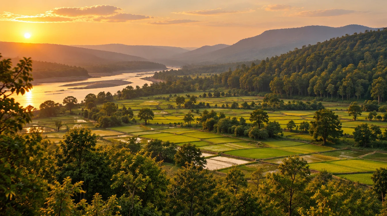
District guide
Buying Land in Mandla
A fully Scheduled Narmada and forest district around the Kanha Tiger Reserve: tribal-land permission, buffer and corridor checks, thin official data and indicative land-price bands only.
5,800 sq km
Area (district portal)
10.55 lakh
Population (portal; year not stated)
₹1.5–18 lakh per acre
Estimated land price*
1,134.31 sq km
Kanha buffer (NTCA)
*Indicative range across districts and land types. Stamp duty, registration and conversion charges are additional. Local measurement units vary — every listing states the unit it is priced in. Not a valuation or an offer.
District land record — Mandla
Rev. 2026 · Farmland India desk
State
Madhya Pradesh
Sub-divisions
6 tehsils and 9 development blocks on the district portal, which does not list their names; the ICAR-CRIDA plan also counts nine blocks and names none (ICAR-CRIDA contingency plan, Mandla, 2013), so tehsil names are not sourced here (Mandla portal). Mandla is part of Jabalpur division
Key markets
Mandla town · Narmada valley farm villages · Kanha buffer villages
Demand anchors
Kanha Tiger Reserve (Mandla and Balaghat, NTCA brief note, Kanha) · Jabalpur 97 km by the portal’s airport figure · NH 45 and NH 543 widening works reported in November 2022 (India Infra Hub, November 2022) · Narmada Pragati Path in planning (Free Press Journal, August 2026)
Rail
No station named at Mandla; the portal gives Jabalpur as the closest station (Mandla portal, how to reach)
Size and population
5,800 sq km and 10,54,905 people on the portal home page, which does not state the Census year (Mandla portal home page)
Estimated land price*
₹1.5–18 lakh per acre* (wide band: forest-edge and Kanha buffer villages to land on the Jabalpur road). *Indicative only, not a valuation or an offer; prices vary by plot, road access and title. Check the guideline or ready-reckoner rate with the Sub-Registrar.
Pricing unit
₹/acre (farm land) · records in hectares
Local units
Area is recorded in hectares; local units vary by district and tehsil, so convert every quote to acres or hectares (1 hectare is about 2.47 acres)
Land records portal
MP Bhulekh (not opened for this page; ask the seller for a fresh khasra and B-1 extract)
Land law is state law. These rules are maintained on the Madhya Pradesh page and apply to every district within it.
Mandla — land purchase legal rules
⚠ Madhya Pradesh does not run on a single rule for farmland. Tribal land, land above the holding ceiling, diverted land and ordinary farmland each follow a different track, and the Collector’s office sits at the centre of the first. Work out which track a parcel is on before looking at the price.
Which office decides what: A member of a tribe that the Code treats as aboriginal needs written permission from a revenue officer of at least Collector rank to sell land outside a notified area, and in a notified area the bar on sale to a non-tribal is absolute (section 165(6); Supreme Court, April 2025). The Supreme Court accepted in April 2025 that an Additional Collector can grant that permission under a valid work-allocation order (Lawyer E-News, April 2025). Sale deeds are registered through the Registration Department, which launched the Sampada 2.0 online registration system in October 2024 (The Statesman, October 2024).
Section 165 and tribal land: The April 2025 judgment concerned 6.29 hectares in Ratlam district outside the notified tehsils; the sale went through because the Additional Collector had given written permission, the price was above market value and a 10-year bar on changing the land’s use was attached under section 165(6-ee) (Supreme Court, April 2025). The High Court had earlier upheld the same sale and noted the Patwari’s report, the sellers’ need to fund a marriage and settle loans, and the land they kept (High Court, October 2023). Permission is a gate, not a formality: a sale with no permission is exposed. Under section 170B a transfer made by fraud can be reverted to the tribal owner or heirs, and the Supreme Court in March 2019 held that a civil court could not revisit a Collector’s 1985 section 170B order that had survived a writ petition (Supreme Court, March 2019).
Wills and indirect transfers: In February 2025 the High Court held that “transfer” in section 165(6) is not confined to sale and covers a Will of tribal land in favour of a non-tribal, so Collector permission was needed there too (High Court, February 2025). A buyer cannot assume that an inheritance document or a power of attorney avoids the permission step. There is a narrow carve-out: in October 2024 the High Court, relying on an older Division Bench ruling, held that sections 165(6) and 170 do not apply to Nazul land in an urban area, and sent the question of whether a given parcel was Nazul or Abadi back to the Additional Commissioner (High Court, October 2024).
Diversion and the Code: Turning farmland to another use is a diversion. A June 2022 High Court order refers to land “diverted under section 172” to non-agricultural purposes, and the Supreme Court has described section 59 as allowing reassessment of land revenue on a change of use, with a premium that the Sub-Divisional Officer may impose (High Court, June 2022; Supreme Court, August 2008). We could not read the current text of sections 172 and 190, so this page does not describe their procedure or fees, and a seller’s diversion order should be read in full, not taken on trust.
Ceiling on holdings: The Madhya Pradesh Ceiling on Agricultural Holdings Act, 1960 caps how much one holder or family may hold and provides for acquiring surplus land. In the 2021 case the Supreme Court quoted section 7(b) as allowing a family of five or fewer 54 acres, and set aside surplus declarations where a pending suit had not been disclosed (Supreme Court, January 2021). A legal-database copy of the Act lists three tiers for a family of five or fewer: 18 acres of two-crop irrigated land, 27 acres of one-crop irrigated land and 54 acres of dry land, and says land cannot be transferred before the final ceiling order without the Collector’s written permission, unless the holder is within the ceiling (legal database text of the 1960 Act). Treat those figures as the Act’s text as published there, and have a lawyer check the current schedule before buying a large holding.
Who may buy: None of the court orders or Act texts we opened bars a buyer simply for not being a farmer; the limits that turned up were the tribal-land permission in section 165(6) and the ceiling on holdings. We found no state notice listing other buyer conditions, so confirm with the Registration Department and the Collector’s office that none applies to the district you are looking at.
Registration and stamping: The Indian Stamp (Madhya Pradesh Second Amendment) Act, 2025 was published on 17 December 2025 and changes how short-stamped documents are handled, including a penalty of 1% of the deficient portion per month (TeamLease RegTech, December 2025). Duty rates are covered in the stamp duty section below.
Land records: Madhya Pradesh land records (khasra and the B-1 extract) are issued through the state’s MP Bhulekh portal. We could not open that portal for this page and found no independent description of its current fields or fees, so ask the seller for a fresh extract and compare the survey number, area and recorded owner with the sale deed.
NRI and OCI buyers: The Reserve Bank’s Master Direction under FEMA 1999 excludes agricultural land, plantation land and a farm house from what NRIs and OCIs may buy, in Madhya Pradesh as elsewhere (RBI Master Direction FED 12/2015-16, updated to September 2022). They can buy other immovable assets such as residential or commercial sites, and inheritance is treated separately in the Direction. Benami-law exposure was not checked against the Act text for this page, so take legal advice before using a nominee.
- Land Revenue Code 1959
- Section 165(6) tribal land
- Ceiling Act 1960
- Wills need permission
- NRI agri: barred (FEMA)
- Sampada 2.0
Mandla — district-specific notes
The Madhya Pradesh state page applies to Mandla in full. The notes below are specific to this district and are not repeated from the state page. Law was read from court orders, a legal-database copy of the Scheduled Areas Order, the Ministry of Panchayati Raj table and the National Tiger Conservation Authority note; the Land Revenue Code, India Code and the MP Bhulekh portal could not be opened.
⚠ The whole of Mandla district is a Scheduled Area. The legal-database copy of the Scheduled Areas Order, 2003 (G.S.R. 114(E), 20 February 2003) lists “Mandla district” with no tehsil qualifier (Scheduled Areas Order, 2003 (legal-database copy)), and the Ministry of Panchayati Raj table lists it as fully covered (Ministry of Panchayati Raj). We have not checked either against the gazette. Inside a notified area the bar on sale of tribal land to a non-tribal is absolute, so a non-tribal buyer should expect the usable supply to be land already held by non-tribals.
⚠ Sale of land held by a member of a tribe that the Land Revenue Code treats as aboriginal needs written permission from a revenue officer of at least Collector rank outside a notified area, and inside a notified area the bar on sale to a non-tribal is absolute (section 165(6); Supreme Court, April 2025). A Will of tribal land in favour of a non-tribal needs the same permission (High Court, February 2025), and a transfer made by fraud can be reverted under section 170B (Supreme Court, March 2019). Ask the Collector’s office who the recorded holder is. We read no Mandla-specific order.
⚠ Part of Mandla lies in the Kanha Tiger Reserve. The National Tiger Conservation Authority’s brief note covers Mandla and Balaghat districts and gives 917.43 sq km of core and 1,134.31 sq km of buffer, 2,074.31 sq km in all; the same page gives conflicting figures for the national park (940 sq km in the text, 22.57 sq km in a table). It says about 45 villages stood in the old park area, 32 forest villages have been voluntarily relocated outside the core, and that Madhya Pradesh is preparing a generic plan for the Kanha–Pench corridor (NTCA brief note, Kanha). We did not open the notification maps, so ask the Forest Department in writing whether a parcel is in the core, the buffer, the corridor or an eco-sensitive belt.
⚠ Turning farm land to another use is a diversion. A 2022 High Court order refers to land "diverted under section 172", and the Supreme Court has described section 59 as allowing reassessment on a change of use with a premium (High Court, June 2022; Supreme Court, August 2008). We could not read the current text of sections 172 and 190, so read any diversion order in full. The Ceiling on Agricultural Holdings Act, 1960 caps holdings: the Supreme Court quoted section 7(b) as 54 acres for a family of five or fewer in 2021 (Supreme Court, January 2021), and a legal-database copy lists 18, 27 and 54 acre tiers and bars transfer before the final ceiling order without the Collector’s written permission (legal-database text). Treat the tiers as CONFIRM and ask a Madhya Pradesh lawyer for the current schedule before assembling a large holding.
⚠ None of the court orders or Act texts opened for the Madhya Pradesh state page bars a buyer for not being a farmer; the limits found were the tribal-land permission and the holding ceiling. NRIs and OCIs cannot buy agricultural land, plantation land or a farm house under the RBI Master Direction (RBI Master Direction FED 12/2015-16, updated to September 2022).
Read the state-wise land laws guide for buyer eligibility, stamp duty and NRI rules, and the Madhya Pradesh state page for the corridor overview.
- Whole district Scheduled Area
- Section 165(6) tribal land
- Kanha Tiger Reserve
- Ceiling Act 1960
District overview
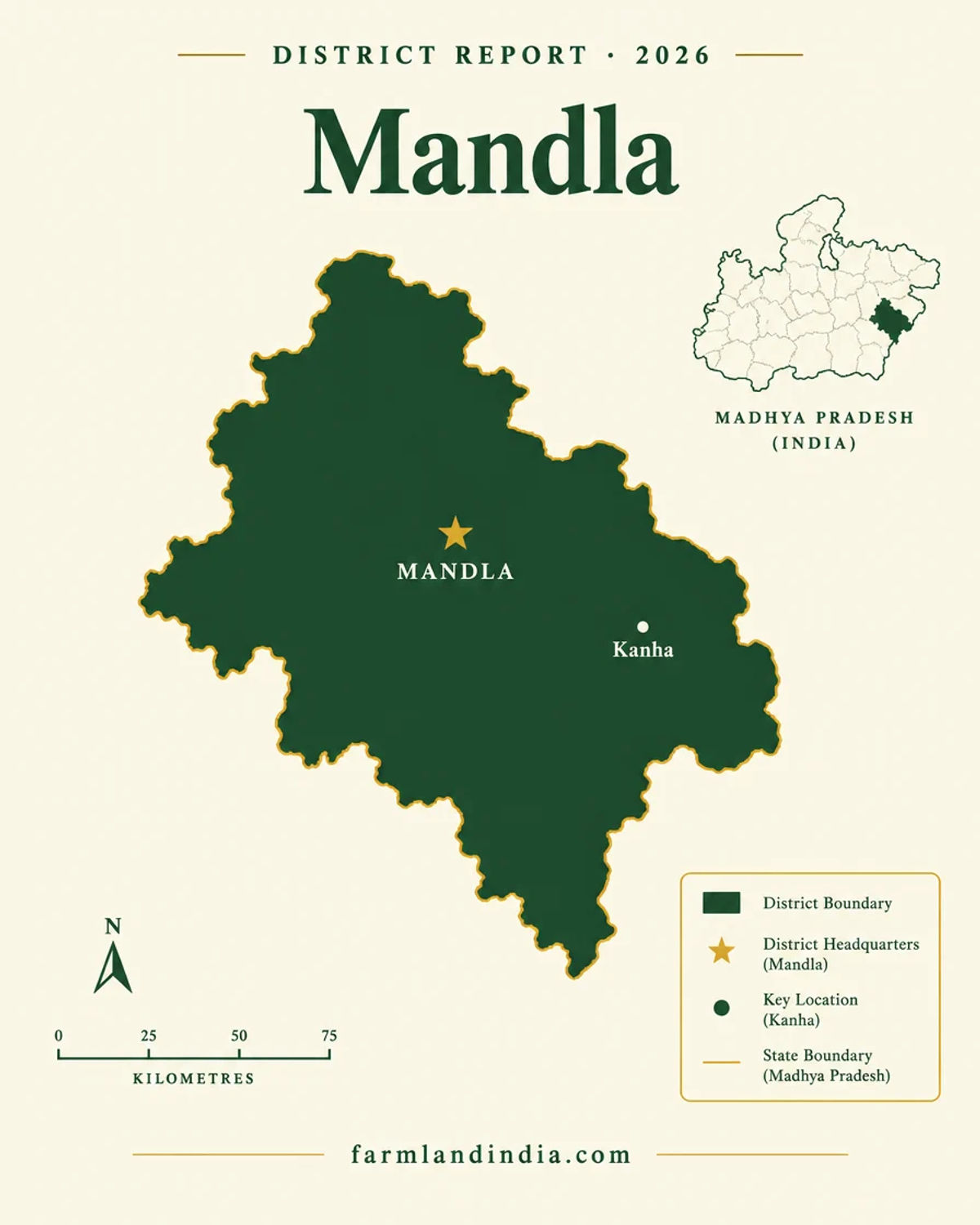
Mandla — a fully Scheduled Narmada and forest district around the Kanha Tiger Reserve, with thin official data
Mandla is a Mahakoshal district in Jabalpur division, with six tehsils and nine development blocks on the district portal, which describes the Narmada as surrounding the district on three sides and names Kanha National Park as its main attraction (Mandla portal). The portal home page gives 5,800 sq km and 10,54,905 people without a Census year (Mandla portal home page). We could not open the CGWB district booklet, so there is no sourced soil, crop, rainfall or block-wise groundwater data for Mandla on this page.
We found no official per-acre figure for Mandla. The estimated bands on this page, marked with an asterisk, are our indicative ranges derived by analogy with Jabalpur, Seoni and Betul-side farm land and kept wide: forest-edge and buffer villages sit well below land on the Jabalpur road. The statewide guideline-rate reports we could source do not cover Mandla (Free Press Journal, March 2023; Dainik Jagran English, 25 March 2026). A guideline rate is a registration floor, not a market price.
The portal gives Jabalpur as the nearest airport, 97 km away, and the closest railway station, with regular buses on the Jabalpur–Mandla road (Mandla portal, how to reach). The one project we could tie to Mandla is the Narmada Pragati Path: Free Press Journal reported in August 2026 a roughly 906 km, ₹31,000 crore expressway, at planning stage, whose route description names Mandla between Shahpura and Narsinghpur (Free Press Journal, August 2026). The 11 districts are not named, so treat Mandla as on the route description and not as confirmed.
- Mandla
- Narmada
- Kanha Tiger Reserve
- Scheduled Area
Transaction costs
Stamp duty & registration in Mandla
7.5%
Stamp duty, as reported
of market value or transaction value, whichever is higher; press report, department page not opened
3%
Registration fee, as reported
on the same base; press report, department page not opened
~10.5%
Combined, reported arithmetic
an earlier report put the range at 9.5% to 12.5%; confirm with the Sub-Registrar
Dainik Jagran English reported on 27 March 2026 stamp duty of 7.5% and a registration charge of 3% on the higher of market value or transaction value (Dainik Jagran English, March 2026). Its 25 March piece said a guideline-rate rise would raise duty and fees in proportion (Dainik Jagran English, 25 March 2026). We could not open the Registration Department’s own fee page, so treat these as reported figures and ask the Sub-Registrar for the current schedule for agricultural land. Since 17 December 2025 a short-stamped document attracts a penalty of 1% of the shortfall per month (TeamLease RegTech, December 2025). Registration can be done online through Sampada 2.0, which also shows guideline rates by location (The Statesman, October 2024). No Mandla-specific schedule was found.
Know the belt
What is moving prices in Mandla
No official per-acre series was found. The cards below carry estimated bands (asterisk) and say what to check. *Indicative only, not a valuation or an offer; prices vary by plot, road access and title. Check the guideline or ready-reckoner rate with the Sub-Registrar.
Mandla town and the Jabalpur road
Estimated ₹6–18 lakh per acre*
The portal gives Jabalpur as the nearest airport (97 km) and closest station, with regular buses between Jabalpur and Mandla (Mandla portal, how to reach). Proximity to Jabalpur carries this band; no road project for this stretch was found. The band is derived by analogy with the Kundam and Bargi fringe of Jabalpur district.
Check: whether the seller is tribal, whether the village is notified, and the access road in the record.
Narmada valley farm villages
Estimated ₹3–10 lakh per acre*
The portal says the Narmada surrounds the district on three sides (Mandla portal). River-side land can carry irrigation and flood risk together. We found no sourced crop, rainfall or groundwater data for Mandla, so the band is by analogy with comparable Mahakoshal river-valley land.
Check: flood history, irrigation source and the Scheduled status of the village.
Forest-edge and Kanha buffer villages
Estimated ₹1.5–8 lakh per acre*
The Kanha buffer is 1,134.31 sq km and an active corridor links Kanha and Pench (NTCA brief note, Kanha). Restrictions on use, wildlife conflict and long distances hold the estimate down,. We found no sourced tourism premium, so the band stays wide.
Check: core, buffer, corridor and eco-sensitive status in writing before any advance.
Guideline rates
No Mandla figure found
Statewide, rates were revised at about 18,000 locations from 1 April 2023 (Free Press Journal, March 2023). The 2026-27 proposal reported for Bhopal does not cover this district (Dainik Jagran English, 25 March 2026).
Check: the rate for the village on the Sampada 2.0 portal or at the Sub-Registrar on the day of registration.
Units: acres, hectares and local terms
Land in Madhya Pradesh is recorded by survey number, with area in hectares in court orders and acres in the Ceiling Act figures; one hectare is about 2.47 acres (our arithmetic). Local units vary by district and tehsil and no revenue manual was opened for them, so convert every quote to acres or hectares and ask the Patwari what the khasra records before comparing two offers.
Connectivity
How Mandla connects — road, rail and air
Distances come from the district portal’s own how-to-reach page; no independent drive times were checked.
By road
By air
By rail & metro
The practical question is the last leg from the highway to the parcel, so ask for the access road in the revenue record. Full rules: Madhya Pradesh land laws.
Growth catalysts
Upcoming infrastructure & developments
Status labels reflect sources read in October 2026. Government-announced timelines are not guaranteed; both pending items rest on one source each.
01Open or operating
05In progress or pending
Agriculture & terrain
Soil, crops & water in Mandla
A Narmada-surrounded forest district: the portal, not a groundwater booklet, is the only source we could open for soil, crop and water.
🌊 Narmada on three sides
The portal says Mandla is surrounded by the Narmada on three sides (Mandla portal). River frontage can mean water and flood exposure together, and we found no sourced flood record for Mandla, so ask the seller for flood history on low parcels.
- Narmada
- River frontage
🐅 Kanha and the forest belt
The portal names Kanha National Park as the main attraction (Mandla portal), and the NTCA note gives the reserve 917.43 sq km of core and 1,134.31 sq km of buffer across Mandla and Balaghat (NTCA brief note, Kanha). The Forest Department’s buffer-zone notification of 5 October 2010 covers 1,134.31 sq km across Mandla (Khatia, Sijhora and Motinala ranges) and Balaghat (Khapa, Garhi and Samnapur ranges) (Madhya Pradesh Forest Department, Kanha buffer notification, 2010). Forest status and buffer status decide what can be done here, so legal status matters more than soil.
- Kanha
- Core and buffer
- Corridor
- Forest edge
📊 Crops and irrigation (2008-09 plan data)
The ICAR-CRIDA plan gives rice as the main crop at 115.1 thousand hectares (2008-09), then minor millets (kodo-kutki) 39.7, wheat 29.4, maize 18.5, peas 16.8, mustard 16.2 and lentil 14.8 thousand hectares; net irrigated area is 20.4 thousand hectares against 214.3 thousand hectares net sown, about 9.5%, and canals supply about 78% of it (ICAR-CRIDA contingency plan, Mandla, 2013). Shallow soils cover about 55.7% of the area. The figures are 15 years old, so ask for current khasra crop entries.
- Rice
- Kodo-kutki
- Wheat
- ~9.5% irrigated
💧 Water & rainfall
The same plan gives normal annual rainfall of 1,445.1 mm, of which 1,289.3 mm falls in the south-west monsoon, with onset in the second week of June (ICAR-CRIDA contingency plan, Mandla, 2013). It also reports groundwater quality problems (fluoride and salinity) across most of its nine blocks without naming them; that is 2013-era text, so CONFIRM the current block category with the Central Ground Water Board. For a borewell-dependent parcel, test the well. The state-level 2024 assessment is a Madhya Pradesh average of 58.40% extraction and does not describe Mandla (CGWB, GWRA-2024).
📐 Measurement units
Land in Madhya Pradesh is recorded by survey number, with area in hectares in court orders and acres in the Ceiling Act figures; one hectare is about 2.47 acres (our arithmetic). Local units vary by district and tehsil and no revenue manual was opened for them, so convert every quote to acres or hectares and ask the Patwari what the khasra records before comparing two offers. Live mandi prices are on the state and national mandi portals (not opened for this page); price a parcel on location, legal status and permitted use, not on crop income.
At a glance
Mandla vs. its neighbours
| District / belt | Estimated land price* (per acre) | Evidence |
|---|---|---|
| Mandla: town and Jabalpur road | ₹6–18 lakh* | Estimated by analogy; no guideline figure found |
| Mandla: Narmada valley farm villages | ₹3–10 lakh* | Estimated; flood and Scheduled checks |
| Mandla: forest-edge and Kanha buffer villages | ₹1.5–8 lakh* | Estimated; buffer and corridor checks |
| Jabalpur: Kundam and Bargi fringe | ₹5–20 lakh* | Estimated; see the Jabalpur page |
| Seoni: Lakhnadon, Kurai and Ghansor forest-edge tehsils | ₹3–10 lakh* | Estimated; see the Seoni page |
| Dindori — town and highway side* | ₹4–12 lakh* | Indicative estimate; see the Dindori page |
*Indicative only, not a valuation or an offer; prices vary by plot, road access and title. Check the guideline or ready-reckoner rate with the Sub-Registrar. See the Jabalpur page for the division headquarters and nearest airport, and the Seoni page for the neighbouring Satpura district with scheduled tehsils and a tiger reserve, and the Dindori page for the neighbour that an NH 543 bypass and widening (reported November 2022) links to Mandla.
Farmland India view
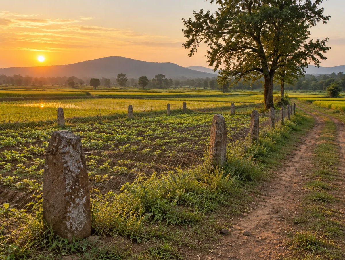
Why investors look at Mandla
Five reasoned points, with an honest note that the price evidence is thin and a fully Scheduled, tiger-reserve district limits both sellers and use.
Jabalpur is the market
The portal gives Jabalpur as the nearest airport and station, 97 km away. Land on that road is the most liquid in the district, which is why its band is the highest.
Kanha shapes everything nearby
A 1,134.31 sq km buffer and an active Kanha–Pench corridor mean use restrictions near the reserve. Some buyers see tourism upside; we found no sourced premium.
Low entry prices, high legal friction
The estimated bands are low, but the whole district is a Scheduled Area, so the pool of land a non-tribal can buy is narrower than the price suggests.
Narmada frontage
The Narmada surrounds the district on three sides. Water access is an asset, flood exposure is the cost, and neither is quantified in any source we opened.
Honest data gaps
No district groundwater, crop or rainfall data was read for Mandla. A buyer should ask for a borewell test and local registered comparables before relying on any band here.
Confirm tribal-land status, notified-area status, buffer status and diversion directly; these are not certified by Farmland India’s review. *Indicative only, not a valuation or an offer; prices vary by plot, road access and title. Check the guideline or ready-reckoner rate with the Sub-Registrar.
STRAIGHT TALK
Risks & challenges in Mandla
Read these before shortlisting in Mandla specifically.
Whole district is a Scheduled Area
Mandla is listed as a whole district in the legal-database copy of the 2003 Order and as fully covered in the Panchayati Raj table. Sale of tribal land to a non-tribal is barred inside notified areas.
Kanha Tiger Reserve buffer and corridor
The buffer is 1,134.31 sq km and a Kanha–Pench corridor plan is being prepared. Ask the Forest Department about core, buffer, corridor and eco-sensitive status in writing.
Tribal-land permission
A sale without Collector-rank written permission is exposed (Supreme Court, April 2025), and a Will needs the same permission (High Court, February 2025).
Diversion and premium
Change of use can bring reassessment and a premium (Supreme Court, August 2008). We could not read the current procedure under sections 172 and 190.
Ceiling-surplus land
Holdings above the ceiling can be declared surplus (Supreme Court, January 2021). Ask whether proceedings were ever opened on the seller’s family.
River-side flood exposure
The Narmada surrounds the district on three sides. Ask for flood history on any low parcel.
A reported, not official, duty rate
The 7.5% duty and 3% fee come from a March 2026 press report. Ask the Sub-Registrar for the current schedule.
Estimated, not registered, prices*
The land-price bands here are indicative estimates, not registered deals. Collect registered comparables from the same revenue estate before negotiating.
Announced is not delivered
The Narmada Pragati Path has a revised project report in preparation and no confirmed alignment in Mandla. Price on today’s access.
Nuclear project and acquisition
A two-unit, 1,400 MW nuclear project at Chutka has reported land acquisition done and local opposition (Patrika, October 2025). Ask the Collector for acquisition and displacement notices on any khasra.
Dated farm data and poor groundwater quality
The crop and irrigation figures are from a 2008-09 plan, only about 9.5% of net sown area was irrigated, and the plan reports fluoride and salinity problems in groundwater. Test water and ask for current crop entries.
Who to contact
Local revenue, planning & forest offices
Mutation and revenue-record matters go through the Tehsildar of the relevant tehsil and the village Patwari. Permission to sell tribal-held land comes from a revenue officer of Collector rank or above, and the Supreme Court accepted in 2025 that an Additional Collector can act under a work-allocation order (Supreme Court, April 2025). Because the whole district is a Scheduled Area, the District Collector’s office is the first call for any sale involving tribal-held land; the Mandla district portal lists six tehsils but does not name them. Tiger-reserve, buffer and forest questions go to the Forest Department. Sale deeds are registered with the Sub-Registrar under the Registration Department, also online through Sampada 2.0 (The Statesman, October 2024). We could not open the MP Bhulekh, Registration Department or India Code pages, so check them directly.
KEEP EXPLORING
Explore more areas
Other districts in Madhya Pradesh
- Agar Malwa
- Alirajpur
- Anuppur
- Ashok Nagar
- Balaghat
- Barwani
- Betul
- Bhind
- Bhopal
- Burhanpur
- Chhatarpur
- Chhindwara
- Damoh
- Datia
- Dewas
- Dhar
- Dindori
- Guna
- Gwalior
- Harda
- Hoshangabad
- Indore
- Jabalpur
- Jhabua
- Katni
- KhandwaAgricultural Land • 1 listing
- Khargone
- Mandsaur
- Mauganj
- Morena
- Narsinghpur
- Neemuch
- Niwari
- Pandhurna
- Panna
- Raisen
- Rajgarh
- Ratlam
- Rewa
- Sagar
- Satna
- Sehore
- Seoni
- Shahdol
- Shajapur
- Sheopur
- Shivpuri
- Sidhi
- Singrauli
- Tikamgarh
- Ujjain
- Umaria
- Vidisha
COMMON QUESTIONS
Frequently asked questions
Everything buyers, NRIs and investors ask before their first reviewed farmland purchase in Mandla.
Visit full wiki01 of 04
Can an outsider buy agricultural land in Mandla?
The whole district is listed as a Scheduled Area in a legal-database copy of the 2003 Order and in the Panchayati Raj table, and inside a notified area the bar on sale of tribal land to a non-tribal is absolute (section 165(6); Supreme Court, April 2025). Non-tribal-held land is not caught by that bar, but we read no Mandla-specific order. NRIs and OCIs cannot buy agricultural land under the RBI Master Direction.
02 of 04
What does agricultural land cost in Mandla?
We found no official per-acre figure. Our indicative estimate* is about ₹6–18 lakh per acre for land in Mandla town and on the Jabalpur road, ₹3–10 lakh for Narmada valley farm villages, and ₹1.5–8 lakh for forest-edge and Kanha buffer villages, with wide margins. *Indicative only, not a valuation or an offer; prices vary by plot, road access and title. Check the guideline or ready-reckoner rate with the Sub-Registrar.
03 of 04
What stamp duty applies to land in Mandla?
Dainik Jagran English reported in March 2026 stamp duty of 7.5% and a registration charge of 3%, about 10.5% together, on the higher of market value or transaction value. We could not open the Registration Department page, so confirm the rate with the Sub-Registrar. A short-stamped deed attracts a penalty of 1% a month on the shortfall (TeamLease RegTech, December 2025).
04 of 04
How does the Kanha Tiger Reserve affect land in Mandla?
The National Tiger Conservation Authority's brief note covers Mandla and Balaghat, with 917.43 sq km of core and 1,134.31 sq km of buffer, and says a generic plan for the Kanha–Pench corridor is being prepared. We did not open notification maps, so ask the Forest Department in writing whether a parcel is in the core, buffer, corridor or an eco-sensitive belt.
Ready to look at what is available?
Browse reviewed listingsTransparency
Sources and references
Law and courts
- State of Madhya Pradesh v. Dinesh Kumar, 2025 INSC 470, Supreme Court, 8 Apr 2025: tribal land sale outside a notified area, section 165(6)
- Second Appeal 2837 of 2022, MP High Court (Jabalpur), 17 Feb 2025: a Will of tribal land to a non-tribal and section 165(6)
- Pooran Singh v. Dhaniram, Civil Appeal 3122 of 2019, Supreme Court, 14 Mar 2019: section 170B and tribal land sold to a non-tribal
- Garvit Khandelwal v. State of Madhya Pradesh, Writ Appeal 200 of 2021, MP High Court (Indore), 15 Jun 2022: record corrections on diverted land
- Civil Appeals 7732-7733 of 2004, Supreme Court, 26 Aug 2008: reassessment and premium on diversion, section 59
- Bajranga v. State of Madhya Pradesh, Civil Appeal 6209 of 2010, Supreme Court, 19 Jan 2021: Ceiling on Agricultural Holdings Act, 1960
- The Scheduled Areas (States of Chhattisgarh, Jharkhand and Madhya Pradesh) Order, 2003, G.S.R. 114(E), 20 Feb 2003, Indian Kanoon copy
Government
- Master Direction FED 12/2015-16 on immovable assets under FEMA 1999, Reserve Bank of India, updated to 1 Sep 2022
- Madhya Pradesh state profile (area, districts, population), State Level Bankers Committee Madhya Pradesh
- Dynamic Ground Water Resources of Madhya Pradesh, assessment 2024, Central Ground Water Board
- State-wise details of notified Fifth Schedule Areas, Ministry of Panchayati Raj
- Brief note on Kanha Tiger Reserve, National Tiger Conservation Authority
- Mandla district portal home page
- About Mandla district, Mandla district portal
- How to reach Mandla, Mandla district portal
- Contingency plan for Mandla district, ICAR-CRIDA (2013)
- Kanha Tiger Reserve buffer zone notification, Madhya Pradesh Forest Department (5 Oct 2010)
News
- Madhya Pradesh guideline rate hike proposed for 2026-27, stamp duty and registration charges, Dainik Jagran English, 27 Mar 2026
- Bhopal: 12% guideline rate hike proposed, Dainik Jagran English, 25 Mar 2026
- Land costlier in 18,000 locations, new collector guidelines from 1 April 2023, Free Press Journal, 27 Mar 2023
- MP CM launches online portal for e-registry (Sampada 2.0), The Statesman, Oct 2024
- Indian Stamp (Madhya Pradesh Second Amendment) Act, 2025, notified 17 Dec 2025, TeamLease RegTech
- Madhya Pradesh plans Narmada Pragati Path to link Gujarat and Chhattisgarh, Free Press Journal, 2 Aug 2026
- Five NH projects in Mandla and Dindori, India Infra Hub, 10 Nov 2022
- Six-lane expressway to boost connectivity, The Hitavada, 13 Aug 2026
- Chutka nuclear power project land acquisition, Patrika, Oct 2025
- Narmada Expressway route, Patrika, 18 Nov 2024
Further reading
- Ramendra Singh v. State of Madhya Pradesh, Supreme Court, 23 Jan 1984: family and ceiling area, sections 2(gg), 6 and 7
- Madhya Pradesh Ceiling on Agricultural Holdings Act, 1960 (section 5 and section 7 text), Legitquest legal database
- Indian Stamp (Madhya Pradesh Amendment) Act, 2022 (Act 17 of 2022), Legitquest legal database
- No bar on tribal land sale outside notified area, Supreme Court, Lawyer E-News, 11 Apr 2025
- Collector guideline rate hike at 621 locations in Bhopal district, Free Press Journal, 22 Feb 2026
- Centre asks MP to give land for Narmada Expressway project, Business Standard (PTI), 7 Feb 2018
Data-currency note: the district portal gives no Census year for its population; the ICAR-CRIDA crop, soil, rainfall and irrigation figures are from 2008-09 and 2013 and name no tehsils; the Kanha buffer figure is from a 2010 notification; highway, corridor and nuclear-project items are news reports from 2022 to 2026 with completion not confirmed; the Scheduled Areas text is a legal-database copy of the 2003 Order; infrastructure statuses were read in October 2026 and change quickly; the stamp duty is a press-reported figure. Land-price bands marked with an asterisk are indicative estimates, not valuations. The MP Bhulekh portal, the Registration Department site and India Code could not be opened, so nothing is attributed to a reading of them. This is a general guide, not legal advice. Report inaccuracies to wiki@farmlandindia.com.
For developers
Ready to explore Mandla farmland?
Browse reviewed projects and individual land parcels across Mandla — or if you own land here, list it with platform review and reach serious buyers.