
District guide
Buying Land in Churu
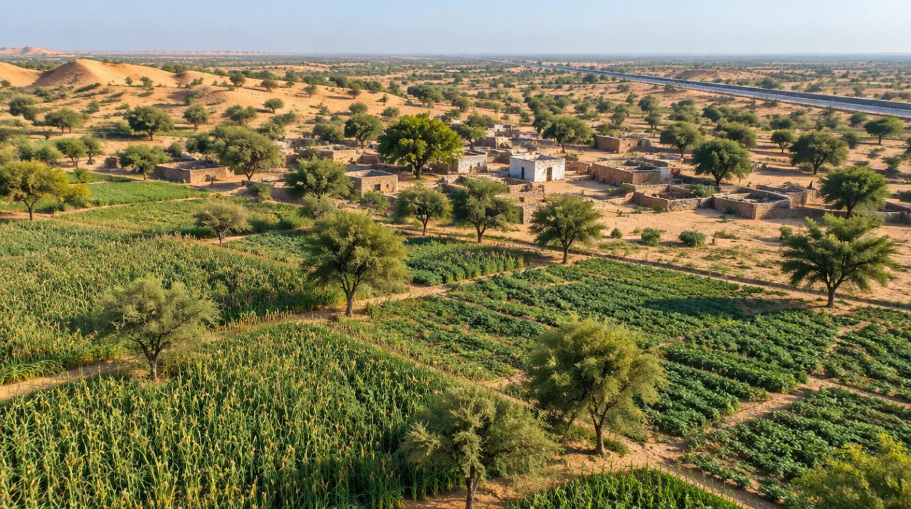
A dry-belt Rajasthan district of sand dunes, gram and bajra: rail lines doubled in 2026, a blackbuck sanctuary at Sujangarh and groundwater close to fully used.
20.41 lakh
Population (Census 2011)
328 mm
Normal rainfall (industrial profile)
92.59%
Stage of groundwater development (2013)
46 km + 58 km
Rail doubling commissioned (Aug 2026)
*Indicative range across districts and land types. Stamp duty, registration and conversion charges are additional. Local measurement units vary — every listing states the unit it is priced in. Not a valuation or an offer.
Apna Khata — Rajasthan Land Records PortalDistrict land record — Churu
Rev. 2026 · Farmland India desk
State
Rajasthan
Sub-divisions
6 tehsils (Churu, Ratangarh, Taranagar, Rajgarh, Sardarshahar, Sujangarh) and 6 sub-divisions (DIPR, data to 2010-11); the CGWB booklet of 2017 lists 7 tehsils, adding Bidasar (CGWB, 2017). The district portal did not open, so check the current list with the Collector.
Key markets
Churu · Ratangarh · Sujangarh · Sardarshahar · Rajgarh · Taranagar
Demand anchors
Churu–Ratangarh and Churu–Sadulpur rail doubling commissioned (August 2026) · Tal Chhapar blackbuck sanctuary at Sujangarh · stone and marble leases
Rail
Churu junction lines to Ratangarh (46 km) and Sadulpur (58 km), both doubled (North Western Railway, Indian Infrastructure, August 2026); 394 km of rail line in the district in 2010-11 (DIPR)
Size and population
13,859 sq km (13,85,898 hectares) in the industrial profile, while the CGWB booklet gives 16,830 sq km, so the area is to confirm · 20,41,172 people at Census 2011 (DIPR)
Pricing unit
₹/acre or ₹/hectare (farmland) · ₹/sq yd or sq m (plots)
Local units
Local land units vary by tehsil; ask the patwari for the conversion and the area in acres or hectares
Land records portal
Revenue Department land-records portal (Apna Khata); not opened for this page. Sale deeds register through ePanjiyan
Land law is state law. These rules are maintained on the Rajasthan page and apply to every district within it.
Churu — land purchase legal rules
In the Ceiling Act and the part of the Tenancy Act we read, no clause limits the purchase of agricultural land to farmers. The limits that do appear sit elsewhere: who may sell (Section 42), how much one family may hold, and how the land may be used once bought.
Who can buy agricultural land? We found no farmer-only clause in the Rajasthan Imposition of Ceiling on Agricultural Holding Act, 1973 or in the first 100,000 characters (of about 108,700) of the Tenancy Act, 1955, apart from the Section 42 bar described below. Clause (a) of Section 42 was omitted with effect from 11 November 1992. Whether any residency or farmer test applies to a particular parcel should be checked with the Sub-Registrar before an advance is paid.
Ceiling limits still apply: Section 4(1) of the Ceiling Act sets, for a family of up to five members, 18 acres of land under assured irrigation that can grow two crops a year and 27 acres where it can grow one crop. Unirrigated land is capped by zone: 48 acres in the fertile zone, 54 in the semi-fertile zone, 125 in the semi-desert zone and 175 in the desert zone (the hilly-zone figure is unclear in the printed text). The ceiling rises by one-fifth for each member beyond five, up to twice the base. Section 17(1) bars acquiring land that takes a holding past the ceiling, and Section 17(2) requires declarations from buyer and seller before the transfer document is registered. The India Code text records amendments up to 2020, so the current schedule needs checking.
SC/ST khatedar land, Section 42 of the Tenancy Act: under clause (b), a sale, gift or bequest of khatedari rights by a Scheduled Caste member to a person outside that community, or by a Scheduled Tribe member to a person outside that tribe, is void; clause (bb) adds the Saharia tribe (Tenancy Act). In State of Rajasthan v. Aanjaney Organic Herbal Pvt. Ltd., Civil Appeals 6741-6742 of 2012, the Supreme Court held on 20 September 2012 that a sale by an SC member to a company was void (Supreme Court, September 2012). In February 2025 the Rajasthan High Court held again that a non-SC/ST buyer cannot acquire khatedari rights by adverse possession (LiveLaw, February 2025). The seller's community should be read from the jamabandi before any money moves.
Conversion for non-agricultural use, Section 90A: Section 90A of the Rajasthan Land Revenue Act, 1956 requires permission before agricultural land is put to non-agricultural use, building included. The State Government decides after an inquiry, the holder pays urban assessment or a premium, and use without permission exposes the holder to ejectment under Section 91 or to a penalty (Indian Kanoon text of Section 90A; the India Code copy could not be opened). The Rajasthan High Court noted in February 2022 that the government may regularise unauthorised conversions (LiveLaw, February 2022). For rural land, the 2007 conversion rules name the deciding officer by use and size: the Tehsildar for a residential unit up to 2,500 sq m, the Sub-Divisional Officer, Collector or State Government for larger plots. A complete application is to be decided within 90 days, and the converted land used within five years (Rules 9(3) and 14(1), Revenue Department rules, 2019 compilation). Later amendments to the rules were not read.
NRI & OCI buyers: The Reserve Bank's Master Direction under FEMA 1999 lets NRIs and OCIs buy immovable property other than agricultural land, plantation property or a farm house, in Rajasthan as elsewhere (RBI Master Direction, updated to 1 September 2022). The inheritance clauses carry no such exclusion, and residential or commercial plots are not on the excluded list.
- No farmer-only bar found
- Ceiling: 18–175 acres by class
- Tenancy Act §42
- Sec 90A conversion
- NRI agri: barred (FEMA)
- Land records portal
Churu — district-specific notes
The Rajasthan state page applies to Churu in full. The notes below are specific to this district. Law was read from India Code, a Supreme Court judgment, a Rajasthan High Court report and the Revenue Department's conversion rules; where an official page did not open, the note says so.
⚠ Tal Chhapar Wildlife Sanctuary lies at Sujangarh. In a suo motu petition the Rajasthan High Court barred any reduction of the sanctuary's area, directed that objections to the draft eco-sensitive zone notification (No. 3409/2021, dated 14 September 2021) be decided quickly and the proposal sent to the Centre, and struck down the 2019 re-notification of a 2.7 km road through the sanctuary (LiveLaw, September 2022). We found no final zone notification, so ask the Forest Department whether a parcel near Sujangarh falls inside any zone.
⚠ Stone and marble leases exist in the district: the industrial profile lists 129 masonry-stone, 56 marble, 25 sandstone and 10 brick-earth leases in 2010-11 (DIPR). A parcel beside a lease can carry blasting, dust or access-road issues; ask the Mines and Geology office for the lease status of neighbouring plots.
⚠ The district lies in the dry belt, and the CGWB booklet says there is practically no scope left for further groundwater development (CGWB, 2017). Rajgarh and Sujangarh blocks were over-exploited in the 2013 data in that booklet. Check whether any borewell restriction applies to a parcel before relying on a new tubewell; we found no Churu-specific order.
⚠ Section 42 of the Rajasthan Tenancy Act applies in Churu as elsewhere: a sale, gift or bequest of khatedari rights by a Scheduled Caste member to a person outside that community, or by a Scheduled Tribe member to a person outside that tribe, is void (Tenancy Act, 1955). The Supreme Court applied the bar to a company buyer in 2012 (Supreme Court, September 2012). Read the seller's community from the jamabandi before any advance.
⚠ Ceiling limits apply to the buyer's total holding. Section 4(1) of the Ceiling Act, 1973 sets 18 acres of assured-irrigation land (two crops), 27 acres (one crop) and, for unirrigated land, 48 to 175 acres by zone; sections 17(1) and 17(2) bar going over the ceiling and require buyer and seller declarations at registration. We did not find the zone classification for individual Churu villages, so ask the Tehsildar for it in writing.
⚠ Non-agricultural use needs conversion under section 90A of the Land Revenue Act (Indian Kanoon text; the India Code copy could not be opened). For rural land the 2007 conversion rules name the deciding officer by use and size, set a 90-day decision period and a five-year window to use the land (Revenue Department rules, 2019 compilation). Later amendments to the rules were not read.
Read the full Rajasthan land buying guide for buyer eligibility, stamp duty and NRI rules.
- Tenancy Act §42
- Ceiling Act 1973
- Sec 90A conversion
- Tal Chhapar sanctuary (draft ESZ)
- Dry-belt groundwater
District overview
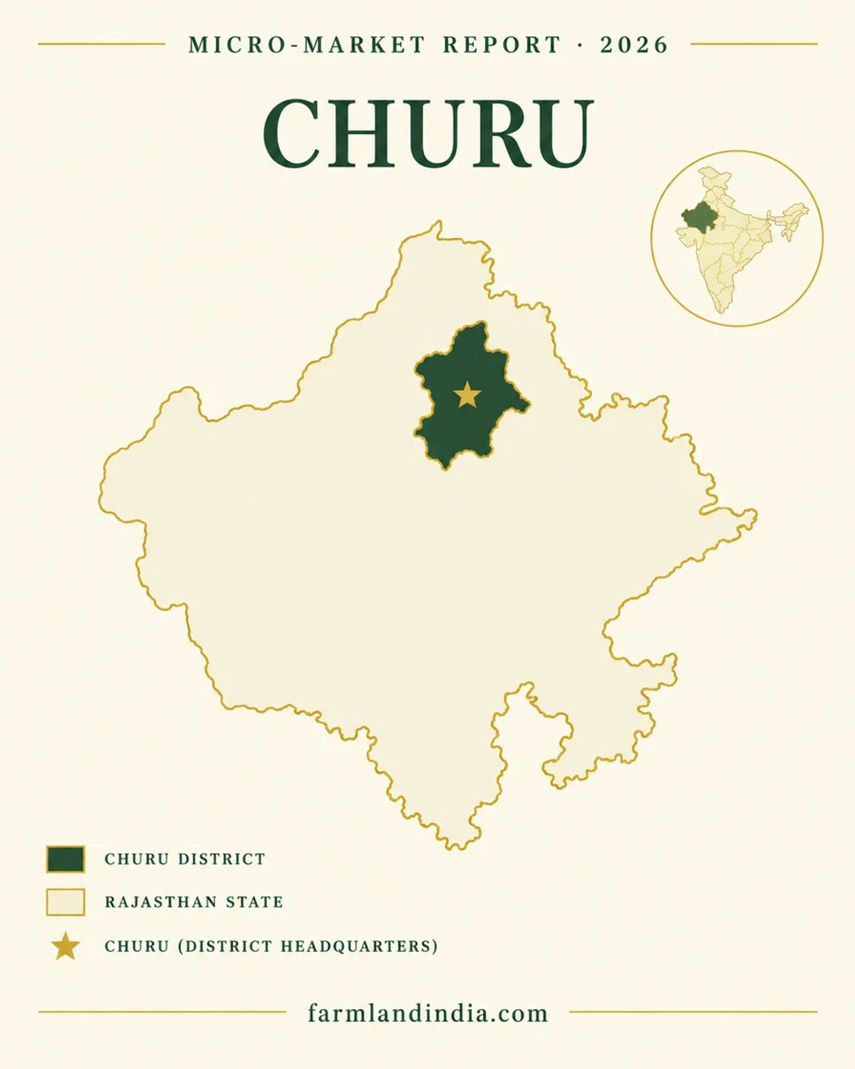
Churu — a dry-belt district with doubled rail lines and a blackbuck sanctuary
Churu is a north Rajasthan district of 20,41,172 people at Census 2011 and, in the industrial profile, 13,859 sq km, though the CGWB booklet gives 16,830 sq km (DIPR; CGWB, 2017). The profile lists six tehsils, 912 revenue villages and ten urban bodies, and notes that Agra–Bikaner National Highway 11 (old numbering) passes through and that the nearest airport is Jaipur, 206 km away. In August 2026 Indian Infrastructure reported that the North Western Railway had commissioned doubling of the 46 km Churu–Ratangarh and 58 km Churu–Sadulpur lines (Indian Infrastructure, August 2026).
We publish no per-acre price band for Churu. No district DLC schedule, registered-deal series or news price report was found, so the page uses state-wide official references only. DLC rates were revised about 10% in April 2026 and by 5% to 49% in listed areas from 3 August 2026 (Patrika, August 2026); the district effect was not reported.
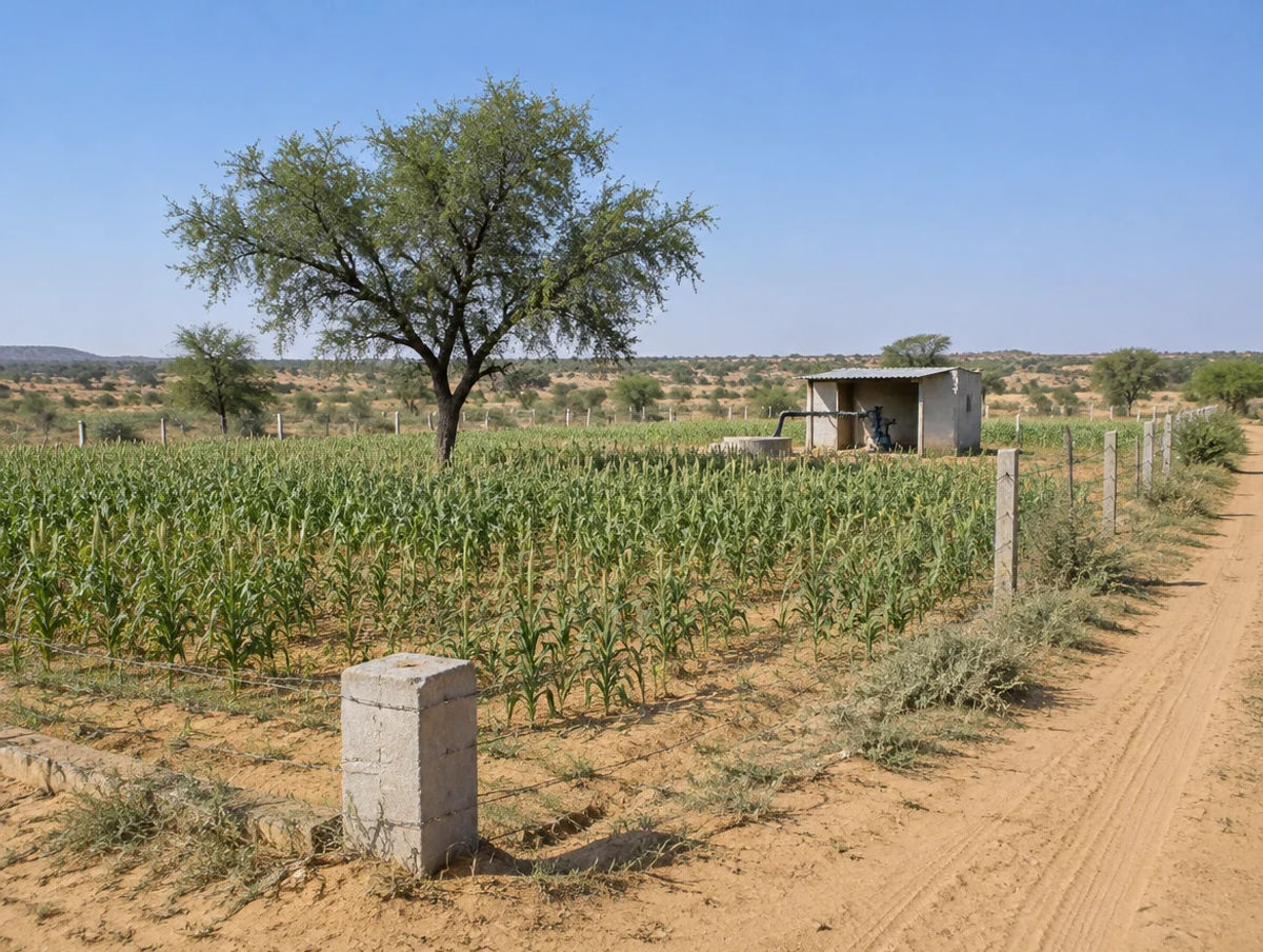
Churu is a dry farming district. Normal rainfall is 328 mm with no perennial river, and wells and ponds are the main water sources (DIPR). The CGWB booklet records gram, bajra and pulses as the main crops in 2013-14 and tubewells as the main irrigation source (CGWB, 2017). Water and soil salinity matter as much as the rail line.
- Churu
- Ratangarh
- Sujangarh
- Sardarshahar
- Rail doubling
- Tal Chhapar
Transaction costs
Stamp duty & registration in Churu
Up to 20%
Surcharge on stamp duty
cow-protection surcharge, s. 3-B Stamp Act 1998; cap raised from 10% in 2018; notified rate to confirm
DLC
Valuation basis
Patrika reported in August 2026 that duty and fee follow DLC rates
Not traced
Base duty and registration fee
no official page or news report found for sale-deed rates
The surcharge cap was raised from 10% to 20% by the Rajasthan Stamp (Amendment) Bill, 2018 (PRS, Bill 18 of 2018; The Tribune, September 2018). The rate notified today is not confirmed, and the base stamp duty and registration fee for a sale deed could not be traced, so none is quoted. Deeds are registered through the Registration and Stamps Department's ePanjiyan system (NeGD listing). Patrika reported that DLC rates rose about 10% in April 2026 and by 5% to 49% in listed areas from 3 August 2026 (Patrika, August 2026, a Hindi-language report); in December 2024 irrigated agricultural land in rural areas rose by up to 50% and agricultural registration moved to hectares (Patrika, December 2024). Since July 2024, Rule 57 of the Stamp Rules lets the registering officer inspect the land and value open land and structures separately (TeamLease RegTech, July 2024). Take the current schedule for Churu from the Registration and Stamps office.
Know the belt
What is moving prices in Churu
State-wide DLC movement and a dry-belt farming profile; no district rate schedule or asking-price series was found.
DLC revisions, statewide
April 2026 about +10%; 5% to 49% in listed areas from 3 Aug 2026
Patrika reported the April 2026 revision and the 3 August 2026 schedule (Patrika, August 2026, a Hindi-language report). In December 2024 irrigated rural agricultural land rose by up to 50% (Patrika, December 2024). No Churu village-wise figure was found.
Check: the village's DLC rate on the sale-deed date at the Sub-Registrar.
Rail doubling
Churu–Ratangarh 46 km, Churu–Sadulpur 58 km
Indian Infrastructure reported on 11 August 2026 that both doublings were commissioned, at estimated costs of ₹422 crore and ₹468 crore (Indian Infrastructure, August 2026). The report gives no opening date and no land-price effect.
Check: station access and the road to the parcel, not the rail line alone.
Stone and marble leases
Masonry stone, marble, sandstone
The industrial profile counts 129 masonry-stone and 56 marble leases in 2010-11, with masonry stone at about 27.6 lakh tonnes (DIPR). The data is 15 years old.
Check: current lease status beside the parcel with the Mines and Geology office.
Asking prices
No sourced price series
Listing-site asking prices for Churu could not be traced to registered deals, so none are shown. The DLC rate is the only official reference and it is not what a seller will accept.
Check: registered sale deeds in the same revenue village before negotiating.
Units: acre and hectare
Revenue records and sellers may use local land units that differ by tehsil and village, so we do not define them here. Convert every quote to acres or hectares, and note that agricultural sale registration moved to hectares in December 2024 (Patrika, December 2024). Ask the patwari to confirm the area in the jamabandi against the area on offer.
Connectivity
How Churu connects — road, rail and air
Road distances to Jaipur, Bikaner or Delhi are not given beyond the one airport distance in the industrial profile. Journey times vary with traffic and road works.
By road
By rail & metro
The practical question is the last leg from the highway or station to the parcel; ask for the access road in the revenue record. Full Rajasthan rules for buyers from outside the state: Rajasthan agricultural land rules.
Growth catalysts
Upcoming infrastructure & developments
Status labels reflect sources read in October 2026. Government-announced timelines are not guaranteed; items marked confirm have a single or an older source.
02Open or inaugurated
00In progress or pending
Agriculture & terrain
Soil, crops & water in Churu
A dry-belt district of sand dunes and calcareous soils, where tubewells carry irrigation and groundwater is close to fully used.
🌾 Crops
The CGWB booklet gives 2013-14 areas of gram 387,681 hectares, bajra 326,230, pulses 253,926, wheat 33,368 and oilseeds 32,252 (CGWB, 2017). State-level crop areas for 2023-24 are in the Rajasthan statistics book (Directorate of Economics and Statistics).
- Gram
- Bajra
- Pulses
- Wheat
🏜 Soils
The booklet describes sand dunes in the north, desert soils (calcareous sands) in the south, a narrow belt of red desert soils around Sardarshahar and Ratangarh, and saline soils in low interdunal areas (CGWB, 2017). Salinity affects what a parcel can grow, so ask for a soil test.
- Sand dunes
- Calcareous sands
- Saline pockets
💧 Irrigation sources
Net irrigated area was 106,732 hectares in 2013-14: tubewells 64,949, other wells 34,449 and canals 7,334 (CGWB, 2017). Canal command is small, so ask whether a parcel has any canal water right.
- Tubewells
- Wells
- Canals
💧 Water & rainfall
The industrial profile gives normal rainfall of 328 mm and no perennial river (DIPR); the CGWB booklet's own text and table disagree (269.6 mm and 369.6 mm), so we use the profile. The booklet puts the stage of groundwater development at 92.59% on 31 March 2013, with Rajgarh at 374.96% and Sujangarh at 131.73% (over-exploited), Churu at 87.97% and Ratangarh at 74.40% (semi-critical) and Sardarshahar at 39.79% (safe); Taranagar had no data (CGWB, 2017). Its text and table are not consistent, so check the current block category. The 2024 state report lists sporadic salinity, fluoride, nitrate and uranium exceedances in Churu (CGWB, 2024), and puts the state at 149.86% extraction. Check borewell yield and water quality on site.
📐 Measurement units
Local land units vary by tehsil, so convert every quote to acres or hectares before comparing two offers. Mandi prices for gram and bajra are published on Agmarknet; the portal was not opened for this review, so no mandi price is quoted. Crop income is modest next to land values, so price a parcel on its location, permitted use and water, not on yield.
At a glance
Churu vs. nearby districts
| District / belt | Price band* (per acre) | Evidence |
|---|---|---|
| Churu — DLC | No sourced price series | State-wide DLC revisions only (Patrika, Aug 2026); no district schedule found |
| Bikaner | No sourced price series | No figure used on this page |
| Sikar | No sourced price series | No figure used on this page |
| Jhunjhunu | No sourced price series | No figure used on this page |
*DLC rates are valuation floors for duty, not market prices. See the Bikaner page and the Sikar page for nearby districts.
Farmland India view
Why investors look at Churu
Five reasoned points, with an honest note that the price evidence is thin and several catalysts are still pending.
Rail capacity added
Both the Churu–Ratangarh and Churu–Sadulpur lines were reported doubled and commissioned in August 2026. That is delivered infrastructure, though no traffic or land-price effect has been reported.
A dry-belt market priced on water
Normal rainfall is 328 mm and groundwater is close to fully used. Land with a proven borewell and clean water is a different asset from land without.
Wildlife and lease overlays reward paperwork
A blackbuck sanctuary with a draft eco-sensitive zone and 200-plus stone and marble leases mean forest, lease and conversion status should be documented parcel by parcel.
Large holdings may meet the ceiling
Unirrigated desert-zone limits are among the highest in the state, but irrigated land carries 18 or 27 acres; check the family's total holding and zone class.
Official rates moving, price evidence thin
DLC rates were revised in April and August 2026. No registered-deal series exists on this page, so negotiate on registered comparables.
Confirm khatedar class, Section 90A conversion and DLC status directly; these are not certified by Farmland India’s review.
STRAIGHT TALK
Risks & challenges in Churu
Read these before shortlisting in Churu specifically.
Sanctuary and zone status
Tal Chhapar has a draft eco-sensitive zone notification of September 2021 that a High Court order of 2022 directed to be processed. Ask for the khasra's status in writing.
Dry-belt groundwater
The 2013 block data shows Rajgarh and Sujangarh over-exploited, and the booklet says there is no scope for further development. Check borewell depth, yield and quality.
Salinity and water quality
Saline soils sit in interdunal lows and CGWB 2024 lists sporadic salinity, fluoride, nitrate and uranium exceedances. Test soil and water before paying a deposit.
Lease land
Stone and marble leases are numerous; check neighbouring leases and access roads.
Section 42 exposure
A sale of khatedari land by an SC or ST member to someone outside that community is void. Establish the seller's community from the jamabandi before any advance.
Fast-moving DLC rates
DLC rates were revised in April 2026 and again from 3 August 2026. A valuation agreed in spring may not match the schedule in force at registration.
No sourced price series
We use no listing-site prices for Churu, and DLC rates are only a valuation basis. Collect registered comparables before negotiating.
Who to contact
Local revenue, registration & forest offices
Conversion of rural agricultural land is decided by the Tehsildar, Sub-Divisional Officer, Collector or State Government, depending on use and plot size (Rule 9, Revenue Department rules, 2019 compilation). Mutation and jamabandi matters go through the Tehsildar of the relevant tehsil, and the District Collector's office coordinates revenue administration. Sale-deed registration is handled by the Sub-Registrar office under the ePanjiyan system, which feeds the eDharti land records for agricultural deeds (NeGD listing). The Forest Department's divisional office can confirm whether a khasra lies near the Tal Chhapar sanctuary, and the Mines and Geology office holds lease records. The Revenue Department portal, the ePanjiyan site and the Churu district portal were not opened for this review, so take office locations and jurisdiction maps from the department directly.
KEEP EXPLORING
Explore more areas
Other districts in Rajasthan
- AlwarFarmhouse Estate • 12 listings
- Balotra
- Banswara
- Baran
- Barmer
- Beawar
- Bharatpur
- Bhilwara
- Bikaner
- BundiAgricultural Land • 1 listing
- Chittorgarh
- DausaFarmhouse Estate • 2 listings
- Deeg
- Dholpur
- Didwana-Kuchaman
- Dungarpur
- Ganganagar
- Hanumangarh
- JaipurFarmhouse Estate • 2 listings
- Jaisalmer
- Jalor
- Jhalawar
- Jhunjhunu
- Jodhpur
- Karauli
- Khairthal-Tijara
- Kota
- Kotputli-BehrorFarmhouse Estate • 1 listing
- Nagaur
- Pali
- Phalodi
- Pratapgarh
- Rajsamand
- Salumbar
- Sawai Madhopur
- Sikar
- Sirohi
- Tonk
- Udaipur
Guides & research
- Stamp Duty Calculator Rajasthan: DLC Land Table (2026)Wiki · P11 Taxation, Stamp Duty & Registration
- DLC Rate Jodhpur: Lookup Table and Method (2026)Wiki · P11 Taxation, Stamp Duty & Registration
- DLC Rate Jaipur: Lookup Table and Method (2026)Wiki · P11 Taxation, Stamp Duty & Registration
- Acre to Bigha in Rajasthan: Pucca, Kachcha (2026)Wiki · P01 Land Measurement Units
- Stamp Duty Rajasthan: Land Registry Charges (2026)Wiki · P11 Taxation, Stamp Duty & Registration
- DLC Rate Lookup Rajasthan: Check Circle Rate (2026)Wiki · P02 Land Records & Documentation
- Girdawari Rajasthan: Crop Record Guide (2026)Wiki · P02 Land Records & Documentation
- Mutation Status Rajasthan: Check Online (2026)Wiki · P02 Land Records & Documentation
COMMON QUESTIONS
Frequently asked questions
Everything buyers, NRIs and investors ask before their first reviewed farmland purchase in Churu.
Visit full wiki01 of 04
What does agricultural land cost in Churu?
We publish no per-acre band for Churu because no district DLC schedule, registered-deal series or news price report could be traced. The official references are state-wide: DLC rates rose about 10% in April 2026 and by 5% to 49% in listed areas from 3 August 2026 (Patrika, August 2026). DLC rates are valuation floors for duty, not market prices.
02 of 04
Can anyone buy agricultural land in Churu?
In the Ceiling Act and the part of the Tenancy Act we read, no clause limits purchase to farmers. The limits that bind are Section 42 (sales by SC and ST khatedars to outsiders are void), the holding ceiling and conversion under Section 90A. NRIs and OCIs may not buy agricultural land under the RBI Master Direction. Confirm with the Sub-Registrar.
03 of 04
What stamp duty applies to land in Churu?
The base stamp duty and registration fee for a sale deed could not be traced to an official page or news report, so we quote none. A cow-protection surcharge of up to 20% on duty exists under Section 3-B of the Rajasthan Stamp Act, 1998, and Patrika reported in August 2026 that duty follows DLC rates. Take the current schedule from the Sub-Registrar.
04 of 04
Which infrastructure affects Churu?
Indian Infrastructure reported on 11 August 2026 that the 46 km Churu–Ratangarh and 58 km Churu–Sadulpur rail doublings were commissioned. We found no expressway or highway project named for Churu in the sources read.
Ready to look at what is available?
Browse reviewed listingsTransparency
Sources and references
Law and courts
- Rajasthan Imposition of Ceiling on Agricultural Holding Act, 1973 (ss. 4, 6, 17), India Code
- Rajasthan Tenancy Act, 1955 (s. 42), India Code
- State of Rajasthan v. Aanjaney Organic Herbal Pvt. Ltd., Civil Appeals 6741-6742 of 2012, Supreme Court, 20 Sep 2012
- Anandi Lal v. Dalip Prajapat, Rajasthan High Court, reported by LiveLaw, 14 Feb 2025
- Section 90A, Rajasthan Land Revenue Act, 1956, Indian Kanoon
- Bhanwar Singh v. State of Rajasthan, Rajasthan High Court, reported by LiveLaw, Feb 2022
- Rajasthan Stamp (Amendment) Bill, 2018 (Bill 18 of 2018), s. 3-B surcharge, PRS Legislative Research
- Rajasthan HC prohibits reduction of area of Tal Chappar Sanctuary, LiveLaw, 10 Sep 2022
Government
- Rajasthan Land Revenue (Conversion of Agricultural Land for Non-Agricultural Purposes in Rural Areas) Rules, 2007, Revenue Department, 2019 compilation
- Master Direction FED 12/2015-16 on immovable assets under FEMA 1999, Reserve Bank of India, updated to 1 Sep 2022
- Ground water brochure, Churu district, Central Ground Water Board, 2017
- Dynamic Ground Water Resources and Ground Water Quality of Rajasthan, 2024, Central Ground Water Board
- District Industrial Profile of Churu, MSME-Development Institute (data to 2010-11)
- Agricultural Statistics of Rajasthan 2023-24, Directorate of Economics and Statistics
- Rajasthan Monsoon Report 2025, India Meteorological Department, Jaipur
- Geographic profile of Rajasthan, Resident Commissioner, Government of Rajasthan (undated)
- ePanjiyan and eDharti listing, India Stack Local, National e-Governance Division
News
- Rajasthan government scraps new districts and divisions, Scroll, 29 Dec 2024
- Government annuls 9 districts and 3 divisions, Sentinel Assam, 29 Dec 2024
- Rajasthan raises stamp duty surcharge from 10 to 20 for cow protection, The Tribune, 7 Sep 2018
- DLC rates raised by up to 50 percent in Rajasthan, Patrika, 3 Dec 2024
- Construction-cost rates and small agricultural plots in peri-urban DLC valuation, Patrika, 19 Nov 2025
- New DLC rates in force from 3 Aug 2026, Patrika (Hindi-language report), 4 Aug 2026
- Churu-Ratangarh, Churu-Sadulpur rail doubling projects commissioned in Rajasthan, Indian Infrastructure, 11 Aug 2026
Further reading
- Lok Sabha Unstarred Question 3083 on groundwater categorisation, 18 Dec 2025
- Rajasthan Stamp (Amendment) Rules 2024, Rule 57, TeamLease RegTech, 10 Jul 2024
- Press note, Rajasthan Budget 2026-27, Finance Department
- Rajasthan Budget Analysis 2026-27, PRS Legislative Research
- Master Direction FED 12/2015-16 on immovable assets under FEMA 1999, Reserve Bank of India, updated to 1 Sep 2022
- Rajasthan Monsoon Report 2025, India Meteorological Department, Jaipur
- Geographic profile of Rajasthan, Resident Commissioner, Government of Rajasthan (undated)
- Agricultural Statistics of Rajasthan 2023-24, Directorate of Economics and Statistics
Data-currency note: sources were read in October 2026. Population, tehsils and rainfall come from a District Industrial Profile with data to 2010-11 (Census 2011 population); groundwater, crop and irrigation data come from a 2017 CGWB booklet with 2013 and 2013-14 tables whose text and tables disagree in places. The district area differs between the two (13,859 and 16,830 sq km). The district portal, the Apna Khata and ePanjiyan portals, the Revenue Department site, Agmarknet and the India Code text of the Land Revenue Act and the Stamp Act could not be opened, so nothing here is attributed to a reading of them. Base stamp duty and the registration fee are not quoted. DLC rates, court orders and project timelines change often. General information, not legal advice. Report inaccuracies to wiki@farmlandindia.com.
For developers
Ready to explore Churu farmland?
Browse reviewed projects and individual land parcels across Churu — or if you own land here, list it with platform review and reach serious buyers.