

Owner listed
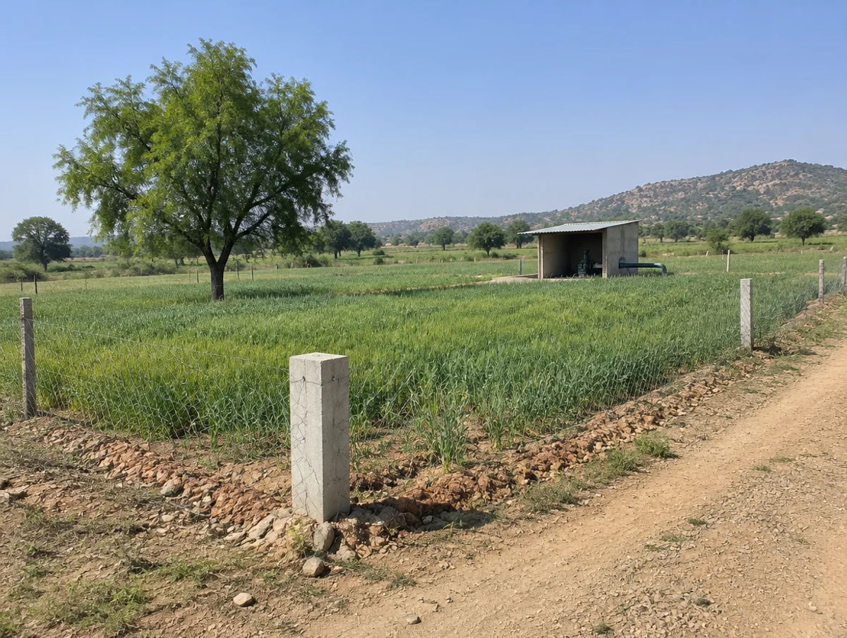
Aroha Farms Purushottampura
Kotputli-Behror, Rajasthan
₹13.75L4.63 AcreView
District guide
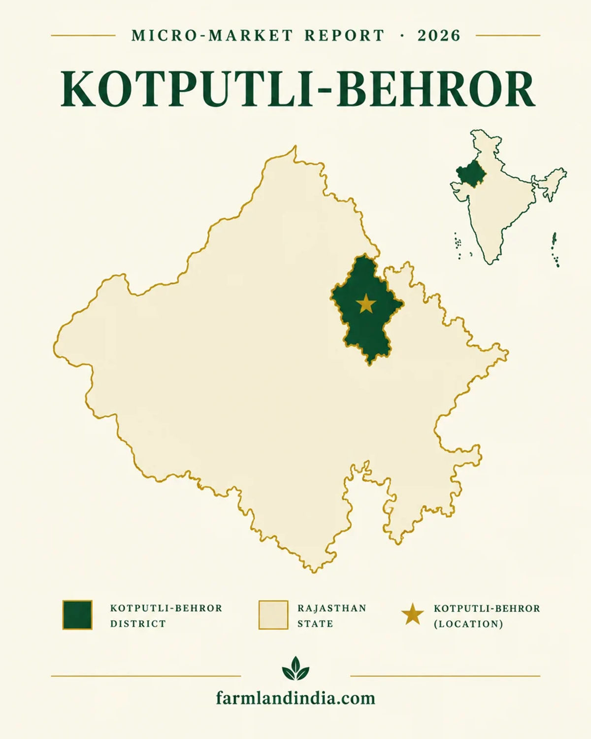
A 2023 district on the Delhi–Jaipur highway belt: Neemrana's industrial zone, irrigated mustard-bajra farmland, over-exploited aquifers and a rail link still on paper.
2,881 sq km
Reporting area (2023-24)
57.3%
Net sown area (2023-24)
90.3%
Net irrigated, share of net sown
8
Tehsils (reported)
District land record — Kotputli-Behror
Rev. 2026 · Farmland India desk
State
Rajasthan (district created in 2023 from parts of Jaipur and Alwar; kept in the December 2024 decision) (Patrika, August 2023; Scroll, December 2024)
Sub-divisions
7 sub-divisions and 8 tehsils in a compilation of the 2023 notification: Behror, Bansur, Neemrana, Mandhan, Narayanpur, Kotputli, Viratnagar, Pavta (Rajras, reported; notification not opened)
Key markets
Neemrana · Behror · Kotputli · Bansur · Shahjahanpur · Viratnagar
Demand anchors
Neemrana Japanese industrial zone and RIICO areas on the Delhi–Jaipur highway · Ambala–Kotputli NH-152D · RRTS extension via Neemrana and Behror proposed, no schedule
Rail
No rail line or station checked for this page; Namo Bharat (RRTS) extension through Neemrana and Behror proposed (IANS, May 2026)
Size and population
2,881 sq km reporting area (288,103 ha, 2023-24) (Directorate of Economics and Statistics); no Census total for the district as now bounded was found on a page we could open
Pricing unit
₹/hectare or ₹/acre (farmland) · ₹/sq m (plots, DLC)
Local units
Village units differ by tehsil; agricultural registration is in hectares since the December 2024 DLC revision (Patrika, December 2024)
Land records portal
Revenue Department land-records portal (Apna Khata) not opened for this page; sale deeds register through ePanjiyan (NeGD listing)
Land law is state law. These rules are maintained on the Rajasthan page and apply to every district within it.
In the Ceiling Act and the part of the Tenancy Act we read, no clause limits the purchase of agricultural land to farmers. The limits that do appear sit elsewhere: who may sell (Section 42), how much one family may hold, and how the land may be used once bought.
Who can buy agricultural land? We found no farmer-only clause in the Rajasthan Imposition of Ceiling on Agricultural Holding Act, 1973 or in the first 100,000 characters (of about 108,700) of the Tenancy Act, 1955, apart from the Section 42 bar described below. Clause (a) of Section 42 was omitted with effect from 11 November 1992. Whether any residency or farmer test applies to a particular parcel should be checked with the Sub-Registrar before an advance is paid.
Ceiling limits still apply: Section 4(1) of the Ceiling Act sets, for a family of up to five members, 18 acres of land under assured irrigation that can grow two crops a year and 27 acres where it can grow one crop. Unirrigated land is capped by zone: 48 acres in the fertile zone, 54 in the semi-fertile zone, 125 in the semi-desert zone and 175 in the desert zone (the hilly-zone figure is unclear in the printed text). The ceiling rises by one-fifth for each member beyond five, up to twice the base. Section 17(1) bars acquiring land that takes a holding past the ceiling, and Section 17(2) requires declarations from buyer and seller before the transfer document is registered. The India Code text records amendments up to 2020, so the current schedule needs checking.
SC/ST khatedar land, Section 42 of the Tenancy Act: under clause (b), a sale, gift or bequest of khatedari rights by a Scheduled Caste member to a person outside that community, or by a Scheduled Tribe member to a person outside that tribe, is void; clause (bb) adds the Saharia tribe (Tenancy Act). In State of Rajasthan v. Aanjaney Organic Herbal Pvt. Ltd., Civil Appeals 6741-6742 of 2012, the Supreme Court held on 20 September 2012 that a sale by an SC member to a company was void (Supreme Court, September 2012). In February 2025 the Rajasthan High Court held again that a non-SC/ST buyer cannot acquire khatedari rights by adverse possession (LiveLaw, February 2025). The seller's community should be read from the jamabandi before any money moves.
Conversion for non-agricultural use, Section 90A: Section 90A of the Rajasthan Land Revenue Act, 1956 requires permission before agricultural land is put to non-agricultural use, building included. The State Government decides after an inquiry, the holder pays urban assessment or a premium, and use without permission exposes the holder to ejectment under Section 91 or to a penalty (Indian Kanoon text of Section 90A; the India Code copy could not be opened). The Rajasthan High Court noted in February 2022 that the government may regularise unauthorised conversions (LiveLaw, February 2022). For rural land, the 2007 conversion rules name the deciding officer by use and size: the Tehsildar for a residential unit up to 2,500 sq m, the Sub-Divisional Officer, Collector or State Government for larger plots. A complete application is to be decided within 90 days, and the converted land used within five years (Rules 9(3) and 14(1), Revenue Department rules, 2019 compilation). Later amendments to the rules were not read.
NRI & OCI buyers: The Reserve Bank's Master Direction under FEMA 1999 lets NRIs and OCIs buy immovable property other than agricultural land, plantation property or a farm house, in Rajasthan as elsewhere (RBI Master Direction, updated to 1 September 2022). The inheritance clauses carry no such exclusion, and residential or commercial plots are not on the excluded list.
The Rajasthan state page applies to Kotputli-Behror in full. The notes below restate the points that matter most here and add what is specific to this district. Law was read from Act texts on India Code, Supreme Court and High Court judgments and a Revenue Department rules compilation; where an official page did not open, the note says so.
⚠ Kotputli-Behror is a 2023 district. Patrika reported in August 2023 that it took three sub-divisions from Jaipur (from the Kotputli and Viratnagar seats) and four from Alwar (from the Behror and Bansur seats), with the Neemrana industrial area leaving Alwar (Patrika, August 2023; the report is in Hindi and gives counts, not names). Scroll lists the district among those kept on 28 December 2024, which left Rajasthan with 41 districts (Scroll, December 2024). Deeds, jamabandi extracts and approvals dated before 2023 name Jaipur or Alwar, so ask which tehsil record and which Sub-Registrar office a village now falls under.
⚠ Section 42(b) of the Rajasthan Tenancy Act, 1955 makes void a sale, gift or bequest of khatedari rights by a Scheduled Caste member to a person outside that community, or by a Scheduled Tribe member to a person outside that tribe (Tenancy Act). The Supreme Court applied the bar to a company buyer on 20 September 2012 (Supreme Court, September 2012), and the Rajasthan High Court held in February 2025 that adverse possession gives a non-SC/ST buyer no khatedari rights (LiveLaw, February 2025). Read the seller's community from the jamabandi before any advance.
⚠ Putting agricultural land to any other use needs permission under Section 90A of the Rajasthan Land Revenue Act, 1956 (Indian Kanoon text of Section 90A; the India Code copy could not be opened). For rural land the 2007 conversion rules name the deciding officer by use and size, set a 90-day decision period and require the converted land to be used within five years (Revenue Department rules, 2019 compilation); later amendments were not read, and the Rajasthan High Court noted in February 2022 that the government may regularise unauthorised conversions (LiveLaw, February 2022).
⚠ Land inside a RIICO industrial area is a different asset from farmland. In the RIICO auctions that closed on 30 September 2026, Business Standard reported plots on an initial 33-year allotment with two optional 33-year renewals (Business Standard, October 2026); that coverage does not list Neemrana or Behror, so the terms for a particular plot have to be read from its allotment letter.
⚠ Section 4(1) of the Rajasthan Imposition of Ceiling on Agricultural Holding Act, 1973 caps a family of up to five at 18 acres of land under assured irrigation that can grow two crops a year and 27 acres where it can grow one crop; unirrigated land is capped by zone from 48 acres in the fertile zone to 175 acres in the desert zone, and the ceiling rises by one-fifth for each member beyond five, up to twice the base. Section 17(1) bars acquiring land that takes a holding past the ceiling, and Section 17(2) requires declarations from buyer and seller before the deed is registered (Ceiling Act, 1973). The India Code text records amendments up to 2020, so the current schedule needs checking. Because 90.28% of the district's net sown area is irrigated (Directorate of Economics and Statistics, 2023-24), the irrigated-land tiers are the likelier limits; the class recorded against a khasra decides which tier applies.
⚠ The Directorate of Economics and Statistics classifies 39,967 hectares, 13.87% of the district's reporting area, as forest in 2023-24 (Directorate of Economics and Statistics). That is a revenue classification, not a parcel map. We did not research Aravalli-specific court orders or eco-sensitive-zone notifications for this district, so ask the Tehsildar and the Forest Department for the khasra's status in writing before paying a deposit.
Read the full Rajasthan land buying guide for buyer eligibility, stamp duty and NRI rules.
District overview
Kotputli-Behror was created in 2023 from parts of Jaipur and Alwar (Patrika, August 2023). The Directorate of Economics and Statistics gives it a reporting area of 288,103 hectares, about 2,881 sq km, of which 57.33% is net sown (Agricultural Statistics of Rajasthan 2023-24). Patrika counted 7 municipal bodies, 7 panchayat samitis and 205 gram panchayats in the new district. A compilation of the 2023 notification lists 7 sub-divisions and 8 tehsils: Behror, Bansur, Neemrana, Mandhan, Narayanpur, Kotputli, Viratnagar and Pavta (Rajras). We could not open the notification, and no Census total for the district as now bounded turned up on a page we could open.
We publish no per-acre price band for Kotputli-Behror. No official or news series for the district turned up, and the statewide DLC revisions Patrika reported do not name it (Patrika, August 2026). The documented demand driver is industry. Business Standard described Neemrana in July 2022 as a hub for Japanese firms on the Delhi–Jaipur highway, with more than 50 companies and over ₹6,000 crore invested (Business Standard, July 2022). The MSME-DI profile of Alwar, written before the split, lists RIICO areas at Neemrana (the Japanese zone at 1,166.33 acres and EPIP at 210.51), Behror (280.81 acres), Shahjahanpur (203.09) and Sotanala (151.91), with plot data as on 31 March 2012 (MSME-DI Alwar profile).
Away from the industrial areas this is mustard, bajra and wheat country. In 2023-24 bajra took 42.87% of cropped area, mustard 33.94% and wheat 13.69%, and 90.28% of net sown land was irrigated, almost all of it from electric tubewells (Directorate of Economics and Statistics). Water is the constraint: the CGWB booklets for the parent districts put the Behror, Neemrana, Bansur and Kotputli blocks in the over-exploited category in March 2009 (CGWB Alwar; CGWB Jaipur).
Transaction costs
Up to 20%
Surcharge on stamp duty
Cow-protection surcharge, Section 3-B, Stamp Act 1998; cap raised from 10% in 2018
DLC
Valuation basis
Patrika reported in August 2026 that duty and fee follow DLC rates
Not traced
Base duty and fee
Sale-deed rates could not be traced to an official page or a news report
The surcharge cap was raised from 10% to 20% by the Rajasthan Stamp (Amendment) Bill, 2018 (PRS, Bill 18 of 2018; The Tribune, September 2018). The rate notified today is not confirmed, and the base stamp duty and registration fee for a sale deed could not be traced, so none is quoted. Deeds are registered through the Registration and Stamps Department's ePanjiyan system (NeGD listing). The Patrika reports on DLC revisions name Jaipur localities but not Kotputli-Behror, so we have no district schedule. In December 2024 Patrika reported that irrigated agricultural land in rural areas rose by up to 50% and that agricultural registration moved to hectares (Patrika, December 2024). Patrika gave one example in December 2024: on a ₹50 lakh transaction in an area where the DLC rate rose 15%, the extra cost was ₹66,000 in a man's name and ₹56,250 in a woman's (Patrika, December 2024). Since July 2024, Rule 57 of the Stamp Rules lets the registering officer inspect the land and value open land and structures separately (TeamLease RegTech, July 2024). Take the schedule in force from the Sub-Registrar's office.
Know the belt
Statewide rate news, a documented industrial base and 2023-24 farm statistics. No listing-site prices are used.
About 10% (Apr 2026); 5% to 49% in listed areas (3 Aug 2026)
Patrika reported that DLC rates rose about 10% in April 2026 and by 5% to 49% in listed areas from 3 August 2026 (Patrika, August 2026; the report is in Hindi). The report names Jaipur localities and satellite towns, not Kotputli-Behror. In December 2024 the 300-metre highway rule was removed, so commercial rates apply only to structures directly on a highway and not to farmland up to 300 metres away (Patrika, December 2024).
Check: the rate for the village on the sale-deed date; we have not seen a Kotputli-Behror schedule.
50+ Japanese firms, ₹6,000 crore+ (Jul 2022)
Business Standard reported the investment totals for the Neemrana zone in July 2022 (Business Standard). The 2012 MSME-DI profile lists principal industries at Neemrana (biscuits, yarn, terry towels, sanitary ware), Shahjahanpur (refrigerators, terry towels) and Behror (lubricants, decorative laminates, industrial alcohol), and shows Behror's 259 plots fully allotted and Shahjahanpur's 188 of 190 (MSME-DI Alwar profile). Those counts are 14 years old.
Check: whether a plot lies inside a RIICO area, in a private layout or on farmland.
57.33% net sown; 90.28% of it irrigated
Net sown area was 165,162 hectares in 2023-24 and 85.66% of it was sown more than once (Directorate of Economics and Statistics). Irrigation depends on tubewells, which the next section sets against groundwater data.
Check: the khasra's irrigation class, which also decides which ceiling tier applies.
No sourced price series
Listing-site asking prices for Kotputli-Behror could not be traced to registered deals, so none are shown. The DLC rate is the only official reference and it is a floor for registration, not what a seller will accept.
Check: registered sale deeds in the same revenue estate before negotiating.
Land in the villages is quoted in local units that differ between tehsils, so a quoted area means little until it is converted. Since the December 2024 DLC revision agricultural land is registered in hectares (Patrika, December 2024). Ask the patwari for the conversion in writing and for the share of the khata being sold; we did not open a revenue manual for local unit definitions.
Connectivity
Drive times and distances from Delhi or Jaipur are given only where a dated report states them. Journey times vary with traffic and road works.
The practical question is the last leg from the highway to the parcel; ask for the access road in the revenue record. Rules for buyers from outside the state: Rajasthan agricultural land rules.
Growth catalysts
Status labels reflect sources read in October 2026. Announced timelines are not guaranteed; items marked proposed or planning have no construction schedule.
03Open or inaugurated
02In progress or pending
Agriculture & terrain
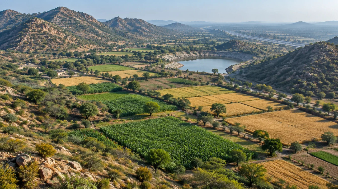
A mustard-bajra-wheat district at the Aravalli edge, irrigated almost entirely from tubewells in blocks that were over-exploited in 2009.
The Directorate of Economics and Statistics gives a 2023-24 reporting area of 288,103 hectares, with 165,162 hectares net sown (57.33%) and 85.66% of that sown more than once. Bajra covered 42.87% of cropped area, mustard 33.94% and wheat 13.69%, with barley at 0.87% and gram at 0.73% (Agricultural Statistics of Rajasthan 2023-24). No district soil survey was found, so soil type is not described.
Forest land is 39,967 hectares (13.87% of reporting area), barren and uncultivable land 27,011 hectares and permanent pastures 12,488 hectares (Directorate of Economics and Statistics). These are revenue classes for the whole district. Whether a ridge or hill parcel carries a restriction has to be read khasra by khasra.
Gross irrigated area was 165,256 hectares in 2023-24: 162,573 from electric tubewells, 2,683 from open wells and none from canals. Net irrigated area was 90.28% of net sown area (Directorate of Economics and Statistics). With no canal command, the borewell is the farm's water.
CGWB's 2024 assessment gives no block-level figures; its state figure is 149.86% extraction, with 214 of 302 units over-exploited (CGWB, 2024). The block figures we found are for 31 March 2009 in the parent-district booklets, on the old boundaries: stage of groundwater development of 250% in Behror, 173% in Neemrana and 168% in Bansur (CGWB Alwar booklet) and 200.27% in Kotputli (CGWB Jaipur booklet), all over-exploited; Viratnagar has no categorisation there. The Alwar booklet reports excess fluoride in Neemrana, salinity of 2,000 to 3,000 µS/cm in parts of Neemrana and Behror, and nitrate above 45 mg/L in parts of Neemrana. IMD recorded 730.9 mm of June to September 2025 rain in Alwar against a normal of 545.9 mm, and 918.5 mm in Jaipur against 524.3 mm (IMD Jaipur, 2025).
Local units differ between tehsils, so convert every quote to hectares or acres before comparing two offers. We did not check mandi prices for this page and quote no crop price. A parcel's value here turns on location, access and permitted use, which the revenue record does not capture.
At a glance
| District / belt | Net sown area, 2023-24 | Evidence |
|---|---|---|
| Kotputli-Behror | 165,162 ha (57.33% of reporting area) | Directorate of Economics and Statistics, 2023-24; 90.28% of net sown area irrigated |
| Khairthal-Tijara | 132,413 ha (67.39%) | Same publication; 97.95% irrigated |
| Alwar | 239,963 ha | Same publication, the district as left after the 2023 split |
| Jaipur Gramin | 410,891 ha | Listed separately in the 2023-24 publication; the district was annulled on 28 Dec 2024 (Scroll) |
Statistics are for farm land use only. No price band is shown for any district because none could be traced to an official or news series. See the Khairthal-Tijara page for the other district split from Alwar, the Alwar page for the parent district and the Jaipur page for the other.
Farmland India view
Five reasoned points, with an honest note that the price evidence is thin and the rail catalyst is still proposed.
Neemrana sits on the Delhi–Jaipur highway and hosts a Japanese industrial zone with more than 50 companies reported in July 2022. That is the clearest documented demand driver here, and it attaches to RIICO land and to access roads, not automatically to farmland.
By the state's own statistics 90.28% of net sown land is irrigated and 85.66% is cropped twice. The yield case rests on tubewells in blocks that were over-exploited in 2009, so water is a cost to price in.
The Namo Bharat extension through Neemrana and Behror was agreed in principle in May 2026 with no schedule. This desk reads it as optionality, not as a basis for paying a premium.
DLC rates rose about 10% in April 2026 and by 5% to 49% in listed areas from 3 August 2026. The reports do not name this district, so the village-level rate has to be checked.
A 2023 boundary change, the Section 42 bar, the holding ceiling and Section 90A conversion are all parcel-specific. A buyer who documents each one is better placed than one relying on a broker summary.
Confirm khatedar class, Section 90A status and the Sub-Registrar office directly; these are not certified by Farmland India's review.
STRAIGHT TALK
Read these before shortlisting in Kotputli-Behror specifically.
All the blocks with figures in the parent-district booklets were over-exploited in March 2009, from 168% in Bansur to 250% in Behror, and the 2024 state figure is 149.86%. Check borewell depth, yield and water quality before assuming irrigation or a farmhouse supply.
A sale of khatedari land by an SC or ST member to someone outside that community is void under Section 42, and the text we read offers no permission route. The Supreme Court applied the bar to a company buyer in 2012. Establish the seller's community before any advance.
Farmland cannot be built on without Section 90A permission, and RIICO plots are allotted on lease. A parcel marketed as industrial may be neither; ask for the conversion order or the allotment letter.
13.87% of the district's reporting area is classed as forest, and we did not research Aravalli orders for this page. Ask for the khasra's forest status in writing.
The district dates from 2023 and was drawn from two parents. Papers older than that name Jaipur or Alwar, and the tehsil list we found is a secondary compilation. Check which office holds a village's records.
DLC rates were revised in April 2026 and again on 3 August 2026, and the reports do not give a Kotputli-Behror schedule. A valuation agreed in spring may not match the rate in force at registration.
The RRTS extension has no reported schedule, the ERCP link was at DPR and appraisal stage in December 2025, and we found no sourced price series. Price a parcel on today's roads and today's water.
Who to contact
The Tehsildars of the tehsils listed in the compilation (Behror, Bansur, Neemrana, Mandhan, Narayanpur, Kotputli, Viratnagar and Pavta) hold the revenue records for their areas (Rajras). Conversion of rural agricultural land is decided by the Tehsildar, Sub-Divisional Officer, Collector or State Government depending on use and size (Rule 9, Revenue Department rules, 2019 compilation). Sale-deed registration is handled by the Sub-Registrar through ePanjiyan, which feeds the eDharti land records for agricultural deeds (NeGD listing). The District Collector's office sits at the district level. The district portal opened but its page text carried no usable district profile, and the Apna Khata and ePanjiyan portals were not opened, so take office locations and jurisdiction maps from the departments directly.
DEVELOPER PROJECTS · TRUST SCORE
Developer projects carry the platform Trust Score and a reviewed document set.
Reviewed projects have completed Farmland India's document and site review. Individual land parcels are listed by their owners and are not reviewed to the same standard. Always complete your own legal due diligence.
KEEP EXPLORING
Other districts in Rajasthan
Guides & research
COMMON QUESTIONS
Everything buyers, NRIs and investors ask before their first reviewed farmland purchase in Kotputli-Behror.
Visit full wiki01 of 04
We publish no per-acre band for Kotputli-Behror because no official or news price series for the district turned up and listing-site asking prices could not be traced to registered deals. The only official reference is the DLC rate, which Patrika reported rising about 10% in April 2026 and by 5% to 49% in listed areas from 3 August 2026; those reports do not name this district. Industrial plots in RIICO areas are allotted on lease, which Business Standard reported as an initial 33 years in the September 2026 auctions.
02 of 04
A compilation of the 2023 notification lists 7 sub-divisions and 8 tehsils: Behror, Bansur, Neemrana, Mandhan, Narayanpur, Kotputli, Viratnagar and Pavta. Patrika's August 2023 report counts 7 municipal bodies, 7 panchayat samitis and 205 gram panchayats. We could not open the notification, so ask the Collector's office or the Tehsildar for the current list and for the district under which a village's records sit.
03 of 04
We found no farmer-only clause in the Ceiling Act, 1973 or in the part of the Tenancy Act, 1955 that we read (first 100,000 of about 108,700 characters). The limits that do appear are the Section 42 bar on sales by SC and ST khatedars to outsiders, the holding ceiling in Section 4 of the Ceiling Act and the Section 90A permission needed to use farmland for anything else. NRIs and OCIs cannot buy agricultural land, plantation property or a farm house under the RBI Master Direction. Ask the Sub-Registrar whether any further test applies to the parcel in Kotputli-Behror.
04 of 04
The block figures we found are old and on the pre-2023 boundaries: CGWB booklets put Behror at 250%, Neemrana at 173%, Bansur at 168% and Kotputli at 200.27% stage of groundwater development in March 2009, all over-exploited. CGWB's 2024 state assessment gives 149.86% extraction with 214 of 302 units over-exploited but no block table. Check borewell depth, yield and water quality on the parcel.
Ready to look at what is available?
Browse reviewed listingsTransparency
Law and courts
Government
News
Further reading
Data-currency note: sources were read in October 2026. Tehsil lists come from a secondary compilation, not the notification. Farm figures are the Directorate's 2023-24 district data; groundwater block figures are March 2009 values from the parent-district booklets and predate the 2023 boundaries; industrial plot counts are as on 31 March 2012. The Apna Khata and ePanjiyan portals, the Revenue Department site and the India Code text of the Land Revenue Act and the Stamp Act could not be opened, so nothing here is attributed to a reading of them. Section 90A is cited through a statute copy and court reports. DLC rates, court orders and project timelines change often. This is a general guide, not legal advice. Report inaccuracies to wiki@farmlandindia.com.
For developers
Browse reviewed projects and individual land parcels across Kotputli-Behror — or if you own land here, list it with platform review and reach serious buyers.
Farmland India ("the Platform"), operated by Bulk Procure Private Limited, is a digital marketplace for listing agricultural land, farmhouse and plotted development projects. The Platform is not a real estate broker, agent or intermediary under RERA or any other applicable law, and does not act for either party to a transaction.
Listings are submitted by developers, owners and their authorised representatives. Before publication, the Platform carries out a documentary review of the material supplied and records what was sighted. That review is limited to the documents made available to us at that time. It is not a title investigation, not a legal opinion, and not a warranty of title, approvals, or the accuracy of any information supplied by a lister. The Trust Score is an internal assessment produced from that review and is intended as a research aid, not as a guarantee of outcome.
Every buyer must carry out independent due diligence before any transaction — including verification of land records, encumbrance searches, approvals and regulatory compliance — through their own advocate and chartered accountant. Any legal or advisory professional introduced through the Platform is engaged directly by the user, on that professional's own terms; the Platform does not employ, supervise or accept responsibility for their work.
Nothing on the Platform is investment advice. Land values can fall as well as rise. The Platform is not liable for any loss, dispute or damage arising from a transaction between parties.