
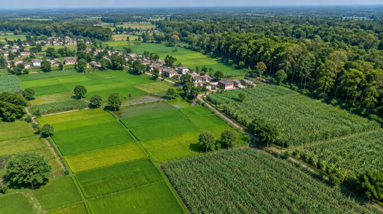
District guide
Buying Land in Pilibhit
A Terai district on the Nepal edge with canal-fed cane, rice and wheat land, a tiger reserve whose eco-zone is still a proposal, and no sourced price series.
3,499 sq km
Area (CGWB profile)
730 sq km
Tiger reserve (WII)
20,31,007
Population (portal, 2011)
4
Sugar factories (portal)
District land record — Pilibhit
Rev. 2026 · Farmland India desk
State
Uttar Pradesh
Division
Bareilly
Tehsils
Five on the district portal; three (Pilibhit, Bisalpur, Puranpur) in the CGWB profile: confirm
Blocks
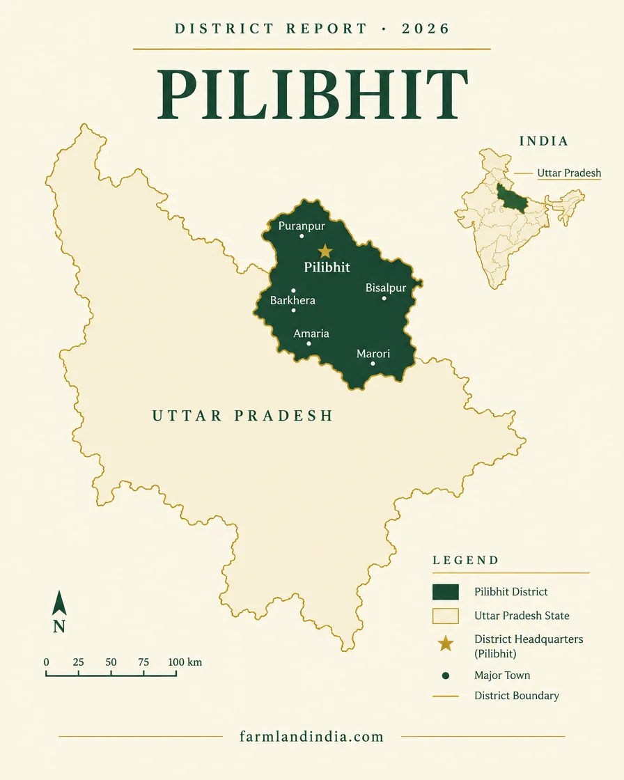
7 (Amaria, Barkhera, Bilsanda, Bisalpur, Lalauri Khera, Marori, Puranpur) per CGWB
Area
3,499 sq km (CGWB); the MSME profile gives 378,384 hectares
Population (Census 2011)
20,31,007 (district portal); the MSME profile tabulates 20,37,225
Tiger reserve
Pilibhit Tiger Reserve, 730 sq km (602 core, 127 buffer; WII)
Delhi and Lucknow
Not sourced; check the live route
Nearest airport
Not sourced; check distance and flight schedules
Land records portal
UP Bhulekh / IGRS UP
Land law is state law. These rules are maintained on the Uttar Pradesh page and apply to every district within it.
Pilibhit — land purchase legal rules
⚠ Two checks come before any advance in Uttar Pradesh: the Revenue Code limit of 5.0586 hectares (about 12.5 acres) on what one person can acquire by purchase or gift, and the registry position in the DNGIR villages near Noida, where a purchase halt was reported in January 2024 and no later word was found. UP Revenue Code 2006, section 89; Sakshi Post, January 2024.
Who can buy agricultural land? The Revenue Code sections we read set a size limit (section 89) and special rules for land held by Scheduled Caste and Scheduled Tribe members (sections 98 and 99). None asks the buyer to be a farmer or to live in the state (UP Revenue Code 2006, IGRS UP). We did not read the whole tenure chapter, so ask the Sub-Registrar whether anything further applies. The Code repealed the Zamindari Abolition and Land Reforms Act 1950 when it was enforced on 18 December 2015 (SCC Online, February 2016).
Holding limit: section 89(2) of the Code bars a purchase or gift that would take the buyer's total holding in Uttar Pradesh above 5.0586 hectares, about 12.5 acres on our conversion (UP Revenue Code 2006). Under the earlier Act the Supreme Court read a company as a person for this limit and let the excess vest in the State (Oswal Fats and Oils, April 2010). The separate 1960 Ceiling Act caps total holdings; the India Code text gives 7.30 hectares of irrigated land for a family of five or fewer, with additions for larger families, and the text mixes acres and hectares, so the current schedule needs checking (India Code).
DNGIR villages: the Dadri-Noida-Ghaziabad Investment Region covers 84 notified villages, 63 in Bulandshahr and 21 in Gautam Buddh Nagar, notified in October 2024 (Swarajya, July 2026). In January 2024 a Noida Authority letter to the Stamp Department halted purchase and sale in the proposed villages, with registration of agricultural land needing the Authority's consent (Sakshi Post, January 2024). Two July 2026 reports on acquisition by mutual consent do not mention the halt (Millennium Post, July 2026), so ask the Noida Authority or the District Magistrate's office whether it still applies to a given village.
Scheduled Caste and Scheduled Tribe land: a Scheduled Caste bhumidhar needs the Collector's previous written permission to transfer land to a non-Scheduled Caste buyer (section 98), and a Scheduled Tribe bhumidhar may not transfer to a non-Scheduled Tribe buyer (section 99) (UP Revenue Code 2006). The Allahabad High Court described a transfer without the permission as void in Omwati v District Collector, Pilibhit, November 2022.
NRI & OCI buyers: the Reserve Bank's Master Direction under FEMA 1999 excludes agricultural land, plantation land and a farm house from what NRIs and OCIs may buy or receive as a gift (paragraphs 3.1.1 and 3.1.2). Inheritance is covered separately in paragraphs 3.1.3 and 3.1.4, without that exclusion (Reserve Bank of India Master Direction FED 12/2015-16).
- Revenue Code 2006
- Purchase limit: 5.0586 ha
- DNGIR: 84 villages
- SC land: Collector permission
- NRI agri: barred (FEMA)
- Ceiling Act 1960
Pilibhit — district-specific notes
The full Uttar Pradesh legal framework above (inherited from the state record) applies to Pilibhit in full, including the ceiling, SC/ST-land and NRI rules. The notes below are specific to this district and are not repeated from the state page.
⚠ Pilibhit Tiger Reserve covers 730 sq km (602 core, 127 buffer). It became a wildlife sanctuary in February 2014 and a tiger reserve in June 2014, and the Wildlife Institute of India page records that the reserve has sent a proposal for an eco-sensitive zone to the government, with none declared (WII management-evaluation page). Check parcels near the forest edge in writing with the Divisional Forest Officer for forest boundary, buffer and any pending zone status, not from a broker map.
⚠ The same page describes the reserve as a crucial part of the Tarai Elephant Reserve, notified on 29 December 2022 (WII management-evaluation page). A farmhouse, resort or fencing plan close to forest land may attract wildlife-related conditions that do not apply to ordinary farmland, so ask for the permission trail before paying an advance.
⚠ The standard Uttar Pradesh rules apply. Section 89(2) of the Revenue Code bars a purchase that takes a buyer above 5.0586 ha, about 12.5 acres, in the state (UP Revenue Code text, IGRS UP), and a Scheduled Caste bhumidhar needs the Collector's prior written permission to transfer to a non-SC buyer (section 98); the Allahabad High Court treated a breach as void in a case against the Collector of Pilibhit (SCC Online, November 2022). Farmhouse or resort use also needs the land recorded as non-agricultural under section 80 of the Code. Ordinance No. 14 of 2026 treats a building, development or layout approval inside a notified development-authority or industrial-authority area as the section 80(2) declaration of non-agricultural use, with the entry recorded in the revenue records within 15 days (PRS, Ordinance 14 of 2026); the cabinet cleared it in March 2026 (Free Press Journal, March 2026), and a compliance bulletin reports it notified as an Act on 13 August 2026 (TeamLease RegTech, August 2026). Outside such areas the section 80 route through the Sub-Divisional Officer applies, with a 45 working-day decision period (UP Revenue Code text, India Code). Which regime covers your village is a question for the tehsil.
- Pilibhit Tiger Reserve
- Tarai Elephant Reserve
- Terai Arc
District overview
Pilibhit — Terai farmland, sugar and a tiger reserve
Pilibhit is a Terai district of 3,499 sq km in the CGWB profile (the MSME profile gives 378,384 hectares), with 20,31,007 people at the 2011 Census. The district portal lists five tehsils and seven blocks, 78,478 hectares of forest, and four sugar factories at Majhola, Puranpur, Bisalpur and Pilibhit. The Sharda canal is the main canal, and total canal length in the district is 938 km. The CGWB profile lists three tehsils, so confirm which tehsil covers a parcel.
For a land buyer, Pilibhit is a farming and nature district. The portal calls sugarcane the main crop, and the ICAR-CRIDA plan (2008-09) shows rice on 154,810 hectares, wheat on 155,015 and sugarcane on 52,083. Pilibhit Tiger Reserve is the district's best-known asset: the WII page reports 25 tigers in 2014 and 65 in 2018 (WII management-evaluation page). That gives the northern part a wildlife-tourism story, but we found no sourced evidence of land prices responding to it.
We found no sourced road distances to Delhi, Lucknow or Bareilly, so the earlier figures were removed; drive the route before committing. The MSME profile counts 132 km of rail line and 40 km of national highway in the district (MSME district industrial profile). Buyers should read the Uttar Pradesh state page first for who can buy and how much.
- Pilibhit Tiger Reserve
- Terai Arc
- Sharda Canal
- Puranpur
- Bisalpur
- Amaria
- Kalinagar
Market & connectivity
What is moving prices in Pilibhit
Sourced figures with the source of each named. Where no source exists, the page says so.
No sourced price series
We found no official or news price series for Pilibhit farmland. Earlier drafts used one seller expectation from a listing site, which could not be traced to a registered deed, so no figure appears here. Gather registered sale deeds for the village and compare them with its circle rate.
What we left out
Most listing-site entries for the district said call for price or were quoted in local units of unknown size, and one started at an unlocated Rs 1.5 crore per acre with no village shown. None are used. Ask any seller who quotes such a number for the village and khasra number.
Listing-site figures
Quotes that do not state their size in acres or square metres are not comparable. Ask the seller to show the area on the khatauni, and match it to a registered deed before comparing anything.
Units and records
Pilibhit quotes are often given in local units whose size differs from one listing to the next. Ask for the area in acres or square metres from the khatauni.
Sugar-mill economy
The district portal lists four sugar factories (Majhola, Puranpur, Bisalpur and Pilibhit), and the MSME profile counts six sugar-related units (MSME district industrial profile). Cane payments tie farm income to the mills, so check farm income against local mandi data, not assumptions.
Stamp duty and circle rates
Stamp duty and registration are set out on the Uttar Pradesh state page. District magistrates set circle rates each year (PTI via The Week, March 2025); we did not open a Pilibhit schedule, so check the village rate on IGRS UP.
Connectivity
How Pilibhit connects — road, rail and air
Pilibhit has 132 km of rail line and 40 km of national highway in the MSME profile. We found no sourced road distances. Journey times vary with traffic and road works.
🚗 By road
✈️ By air
🚆 By rail
🌲 The forest edge is the product
For hospitality or farmhouse buyers, access to the forest-edge villages matters more than any headline distance, so drive the last 20 km before choosing a parcel. The Sharda canal is the district's main canal (district portal).
Growth catalysts
Upcoming infrastructure & developments
Status labels maintained by the Farmland India research desk. Announced timelines are not guaranteed.
Shamli–Gorakhpur link expressway
Earlier text cited a press report on a roughly 700 km Shamli–Gorakhpur link through Bareilly district. We did not open it and found no confirmed project, so it carries no weight here.
Eco-sensitive zone for the tiger reserve
The WII page says the reserve has sent a proposal for an eco-sensitive zone to the government, and none is declared (WII management-evaluation page). If declared it would set rules for land use near the boundary, so watch for the notification before buying close to the forest.
Tarai Elephant Reserve
Notified on 29 December 2022, with Pilibhit Tiger Reserve described as a crucial part of it (WII management-evaluation page). It signals continued conservation priority in the Terai belt, and may affect land use near forest corridors.
Bareilly Airport (nearby)
Earlier text described a civil enclave at Bareilly. We did not open a source for its services or schedules, so check live routes before relying on it.
Agriculture & terrain
Soil, crops & water in Pilibhit
A canal-fed Terai plain where rice, wheat and sugarcane dominate, groundwater is shallow and the forest edge sets the terms.
🌾 Cropped area
The CGWB district profile gives a net sown area of 240,085 hectares and a gross irrigated area of 63% of the cropped area; the ICAR-CRIDA plan (2008-09) gives 239,014 hectares and a cropping intensity of 167.56%, with rice, wheat and sugarcane on 154,810, 155,015 and 52,083 hectares. The portal says sugarcane is the main crop. Confirm crop mix with the district agriculture office.
- Sugarcane
- Rice
- Wheat
💧 Water and rainfall
Normal rainfall is 1,242 mm in the ICAR-CRIDA plan (1,085.4 mm in the June to September monsoon) and about 1,256 mm in the CGWB profile. Groundwater is shallow: pre-monsoon depth was 3.30 to 5.63 m below ground in June 2012, development is 63.24%, and all seven blocks are classed safe. The same profile reports iron above 2 mg per litre, so test borewell water. Bore wells supply 81.21% of irrigation and canals 18.41% (ICAR-CRIDA).
- Shallow water table
- Sharda canal
- Iron in Tarai
🌲 Forest and wildlife
The district portal gives 78,478 hectares of forest and the MSME district industrial profile 78,639, with its land-use table giving 80,009. Pilibhit Tiger Reserve covers 730 sq km. ICAR-CRIDA lists floods and drought as occasional hazards. Land near the forest edge is wildlife country first and farmland second, with the legal and access questions that follow.
- Terai Arc
- Sharda
- Ghaghara
🌾 Mandi price reference
Wholesale prices for Pilibhit markets are published daily by the national agricultural market portal, Agmarknet; we did not open it for this page, and the secondary price aggregator used earlier has been dropped. Farm income supports the land, but price a parcel on location, access and legal status, not on yield alone.
🔎 Government sources to check
Other offices to check: ICAR for crop science, CGWB for groundwater category, IMD for rainfall normals, the Census of India for population tables, UP Bhulekh for khatauni and mutation records and IGRS UP for circle rates and registration. We did not open these portals for this page.
At a glance
Pilibhit vs. nearby belts
| District / belt | Price band* (per acre) | Evidence |
|---|---|---|
| Pilibhit — farmland | No sourced price series | No official or news series found |
| Pilibhit — plots | No sourced price series | No official or news series found |
| Circle rate | Not opened | Check the village rate on IGRS UP |
| Hapur | No sourced price series | See the state page; listing-site bands were removed |
*No sourced land price exists for Pilibhit on this page. The table lists the evidence gaps plainly instead of showing a figure.
Farmland India view
Why investors look at Pilibhit
Three reasons this desk includes Pilibhit, with a plain note that price evidence is missing.
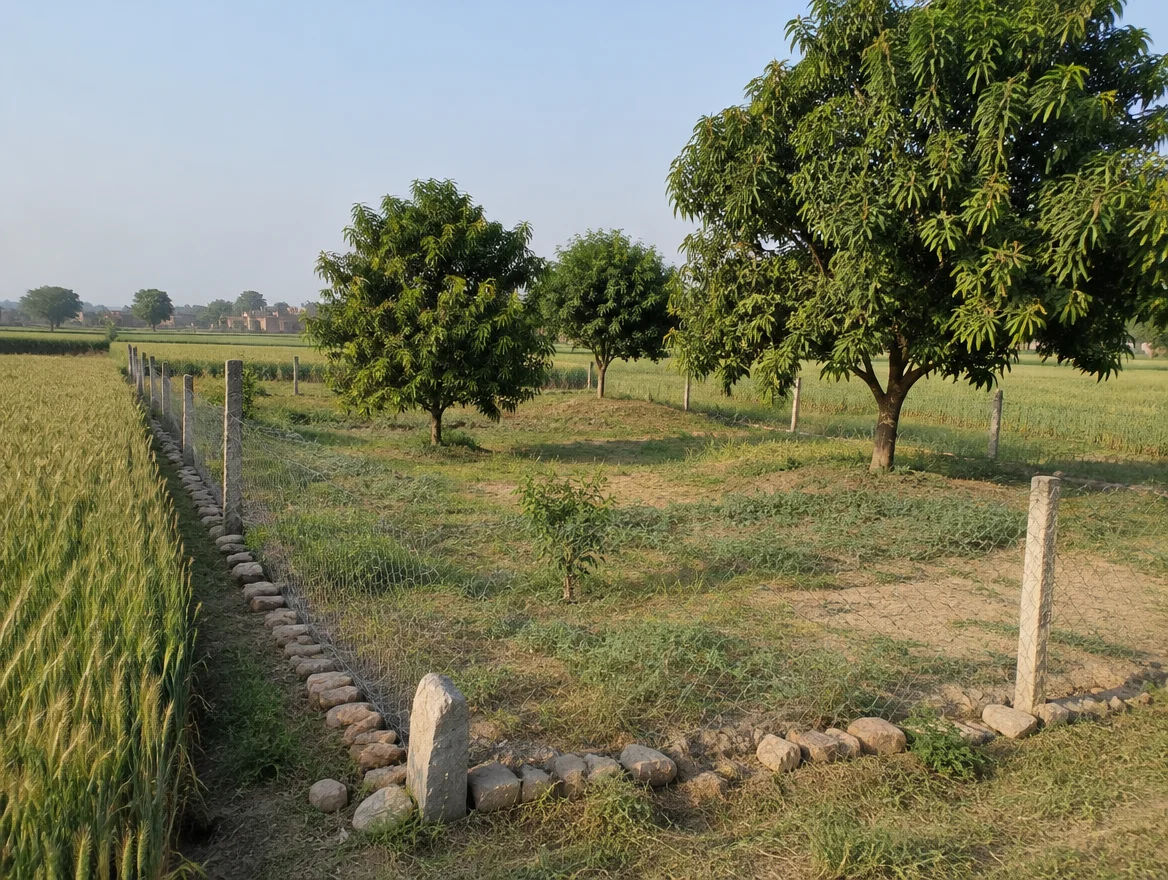
A genuine wildlife and Terai landscape
Pilibhit Tiger Reserve (25 tigers in 2014 and 65 in 2018 per the WII page) gives the northern belt a conservation identity few UP districts have, which suits eco-stay thinking only if forest-edge rules allow it.
No price comparison possible
We found no sourced price series, so this page claims no price advantage over any other district. Collect registered deeds before forming a view.
Farming with canal and shallow groundwater
Irrigation reaches about 63% of the cropped area (CGWB), and four sugar factories (district portal) provide a local cane market. That supports farm-led and agri-business use more than speculation.
Confirm forest-boundary, eco-sensitive-zone and purchase-limit status directly; Farmland India’s listing review does not certify them.
Before you shortlist a parcel, read the Uttar Pradesh agricultural land rules guide.
STRAIGHT TALK
Risks & challenges in Pilibhit
Read alongside the Uttar Pradesh state-wide risks — these are specific to Pilibhit.
Forest-edge and eco-sensitive-zone uncertainty
An eco-sensitive-zone proposal is pending and the boundary rules were not read. Do not assume permission to build or fence near forest land.
No sourced price evidence
We found no sourced price series. Treat any Pilibhit price quote as unproven until backed by registered deeds.
Conflicting district figures
Area is 3,499 sq km (CGWB) or about 3,784 sq km (MSME), tehsils are five or three, and population is 20,31,007 or 20,37,225 across sources. Use these as orders of magnitude.
Iron in groundwater
The CGWB profile reports iron above 2 mg per litre. Test borewell water before planning drinking or drip use.
Cane and mill dependence
Four sugar factories anchor local farm income, and payment delays or policy changes affect cane growers. Check current payment status with local farmers.
No confirmed new corridor
We found no confirmed new corridor for Pilibhit. Price on today's access, not on a promised highway.
Standard UP due diligence still applies
The 12.5-acre (5.0586 ha) purchase limit under section 89(2), khatauni review, SC/ST transfer rules and the NRI bar apply exactly as elsewhere in the state; see the state page.
Who to contact
Local revenue & registration offices
Mutation applications route through the Tehsildar and SDM of the relevant tehsil; the district portal lists five tehsils and the CGWB profile three, so confirm which covers the village. Forest-boundary and buffer-zone questions go to the Divisional Forest Officer for the Pilibhit Tiger Reserve. A land-use declaration under section 80 goes through the Sub-Divisional Officer. Sale-deed registration is handled by the local Sub-Registrar, and records are on UP Bhulekh and IGRS UP, neither of which we opened for this page. SC/ST-land permissions route through the Collector as set out on the state page.
KEEP EXPLORING
Explore more areas
Other districts in Uttar Pradesh
- Agra
- Aligarh
- Allahabad
- Ambedkar Nagar
- Amethi
- Auraiya
- Azamgarh
- Bagpat
- Bahraich
- Ballia
- Balrampur
- Banda
- Barabanki
- Bareilly
- Basti
- Bijnor
- Budaun
- Bulandshahr
- Chandauli
- Chitrakoot
- Deoria
- Etah
- Etawah
- Faizabad
- Farrukhabad
- Fatehpur
- Firozabad
- Gautam Buddha NagarResidential (R-Zone) • 1 listing
- Ghaziabad
- Ghazipur
- Gonda
- Gorakhpur
- Hamirpur
- HapurResidential Plotted • 2 listings
- Hardoi
- Hathras
- Jalaun
- Jaunpur
- Jhansi
- Jyotiba Phule Nagar
- Kannauj
- Kanpur Dehat
- Kanpur Nagar
- Kasganj
- Kaushambi
- Kheri
- Kushinagar
- Lalitpur
- Lucknow
- Maharajganj
- Mahoba
- Mainpuri
- MathuraAgricultural Land • 1 listing
- Mau
- Meerut
- Mirzapur
- Moradabad
- Muzaffarnagar
- Pratapgarh
- Raebareli
- Rampur
- SaharanpurPremium Estate • 1 listing
- Sambhal
- Sant Kabir Nagar
- Sant Ravidas Nagar
- Shahjahanpur
- Shamli
- Shrawasti
- Siddharthnagar
- Sitapur
- Sonbhadra
- Sultanpur
- Unnao
- Varanasi
Guides & research
- Bhu Naksha UP: Check Village Land Map Online (2026 Guide)Wiki · P02 Land Records & Documentation
- Khatauni Nakal UP: Get a Copy Online or at the Tehsil (2026 Guide)Wiki · P02 Land Records & Documentation
- Khasra Khatauni UP: How to Check and Read It Online (2026 Guide)Wiki · P02 Land Records & Documentation
- IGRS UP Encumbrance Certificate: Apply, Track and Download (2026 Guide)Wiki · P02 Land Records & Documentation
- Dakhil Kharij Status UP: Check Mutation Online (2026 Guide)Wiki · P02 Land Records & Documentation
- Circle Rate Uttar Pradesh: Check Land Rates Online (2026 Guide)Wiki · P02 Land Records & Documentation
- Property Tax for Land in Uttar Pradesh: Check and Pay Online (2026 Guide)Wiki · P02 Land Records & Documentation
- Bigha in Uttar Pradesh: District-wise VariationsWiki · P01 Land Measurement Units
COMMON QUESTIONS
Frequently asked questions
Everything buyers, NRIs and investors ask before their first reviewed farmland purchase in Pilibhit.
Visit full wiki01 of 04
What does land cost in Pilibhit?
We publish no per-acre figure, because listing-site asking prices could not be traced to registered deeds and we found no official or news series. District magistrates revise circle rates each year (PTI via The Week, March 2025); check the village rate on IGRS UP and collect registered sale deeds for the same village.
02 of 04
Is Pilibhit Tiger Reserve land restricted?
The reserve covers 730 sq km (602 core, 127 buffer), and the Wildlife Institute of India page says a proposal for an eco-sensitive zone has been sent to the government and none is declared. Confirm forest-boundary and zone status with the Divisional Forest Officer before buying near the forest.
03 of 04
What do farmers grow in Pilibhit?
The district portal calls sugarcane the main crop. ICAR-CRIDA's plan (2008-09) shows rice on 154,810 hectares, wheat on 155,015 and sugarcane on 52,083, and the portal lists four sugar factories.
04 of 04
Is groundwater a problem in Pilibhit?
The CGWB profile (2012-13 data) puts groundwater development at 63.24% with all seven blocks safe and pre-monsoon depths of 3.30 to 5.63 m. It also reports iron above 2 mg per litre, so test borewell water.
Ready to look at what is available?
Browse reviewed listingsTransparency
Sources and references
Law and courts
- Uttar Pradesh Revenue Code 2006, section 80 (non-agricultural use), India Code
- Uttar Pradesh Revenue Code 2006, text hosted by IGRS UP (sections 89(2) and 98)
- The Uttar Pradesh Revenue Code (Fourth Amendment) Ordinance 2026, Ordinance 14 of 2026, PRS Legislative Research
- Omwati v District Collector, Pilibhit, Allahabad High Court (SCC Online, 19 Nov 2022)
- Master Direction FED 12/2015-16 on immovable assets under FEMA, Reserve Bank of India, updated 1 Sep 2022
Government
- Pilibhit district portal: about the district
- District Industrial Profile of Pilibhit, Ministry of MSME (area, population, rail, roads, forest, sugar mills)
- District agriculture contingency plan, Pilibhit, ICAR-CRIDA (2008-09 crop data, rainfall, soils)
- District groundwater profile, Pilibhit, Central Ground Water Board (2012-13 data)
- Pilibhit Tiger Reserve, Management Effectiveness Evaluation, Wildlife Institute of India
News
- UP Cabinet clears ordinance on land use conversion, Free Press Journal, 23 Mar 2026
- Uttar Pradesh Revenue Code (Amendment) Act 2026, TeamLease RegTech, Aug 2026
- UP land rates revision, PTI via The Week, 10 Mar 2025
Further reading
- UP Revenue Code 2006 full text, India Code
- Section 80 amendment ordinance, May 2026
- CGWB Uttar Pradesh groundwater assessment 2024 (state-level)
- Dudhwa Tiger Reserve brief, NTCA (neighbouring reserve)
- District Industrial Profile, Pilibhit
- Contingency plan, Pilibhit, ICAR-CRIDA
- Pilibhit Tiger Reserve evaluation page, WII
- UP Revenue Code text, IGRS UP
Internal guides
Data-currency note: census figures reflect 2011, the CGWB profile rests on 2012-13 observations and a 2009 estimate, and ICAR-CRIDA crop areas are for 2008-09. Sources differ on area, tehsil count and population. No listing-site prices are used, and this is a general guide, not legal advice. Report inaccuracies to wiki@farmlandindia.com.
For developers
Ready to explore Pilibhit farmland?
Browse reviewed projects and individual land parcels across Pilibhit — or if you own land here, list it with platform review and reach serious buyers.